A little about WEATHER
We’re still in Puerto Vallarta waiting for the right weather window to open up for the jump to the Marquesas. I attended a Puddle Jump weather seminar put on by Mike from PV Sailing and learned a lot. It’s looking like this year the jump window (prime time to depart from Mexico) will open up later than normal–around the 3rd week of March. We’ve been experiencing El Nino trends since 2012 where a band of warm sea surface temperatures develops in the central and east-central equatorial Pacific. This affects surface pressure in the southern hemisphere and sometimes means lighter trade winds in the south pacific.
We had hoped to leave around March 15, but will stick around until the weather gods give the go-ahead. It all has to do with the Pacific high stabilizing and moving into place so we can sail along the 1015 millibar barometric pressure line. When this happens, then you wait for a cold front to come down the outside of the Baja peninsula that will give you the push needed to reach the trades, which typically takes 4 good running days. If you leave at the wrong time, there will be too little wind and, unless you motor, you’ll be going nowhere fast.
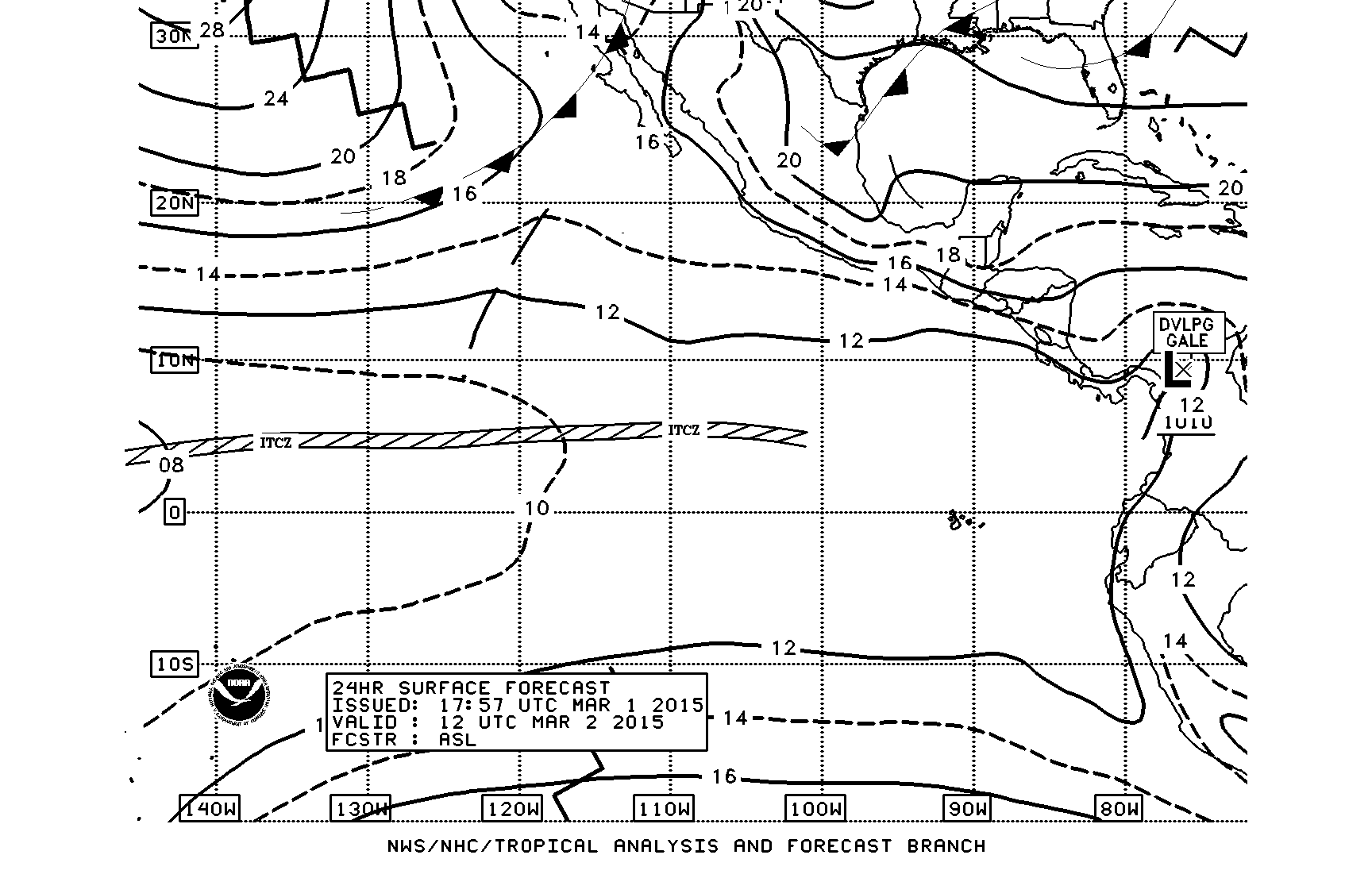
So we’re keeping a close eye on the weather trends. The images shown below are part of what we look at. These are NOAA charts for a region of the Eastern Pacific and can be downloaded from the internet when land based, or from single sideband when at sea. The top one shows barometric pressure lines and the ITCZ (inter-tropical convergence zone ie doldrums) for today, March 1, 2015. Puerto Vallarta is at 20.7N, 105.3W, and we want to cross the equator near the 125 degree longitude line. The diagram shows a large part of the pacific sitting at a pressure of 12 (1012 millibar), meaning there would be very light winds.
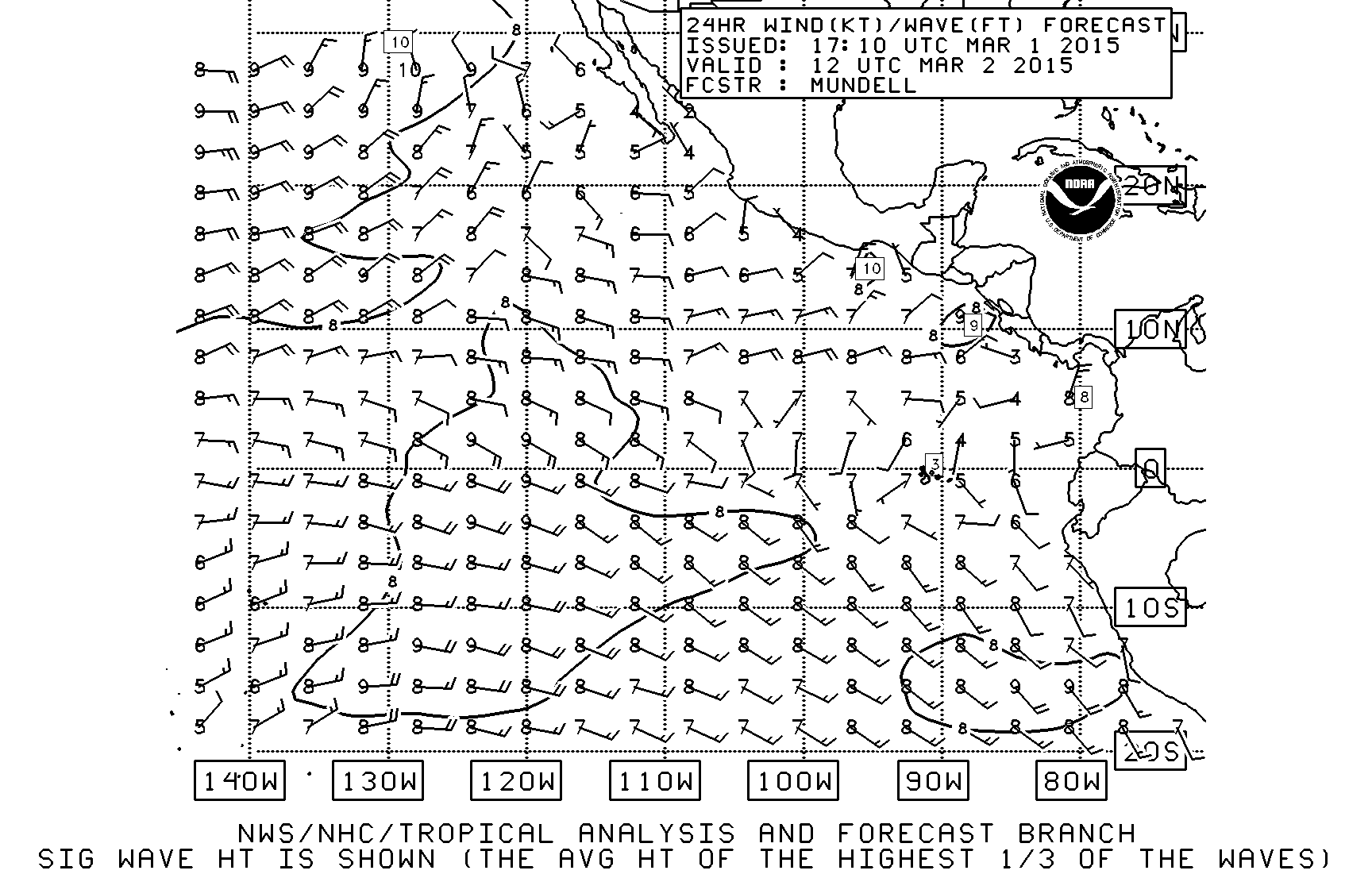
The next diagram shows wind and wave height for the same region. The wind barbs point in the direction of the wind, and show the wind strength (each full barb represents 10 knots of wind, and half barbs are 5 knots, so the one in the top left is 20 knots, and the 3rd one down is 25 knots). The numbers next to the wind barbs represent average wave height (mostly 7-8 feet in the diagram). If you compare the 2 diagrams, you will notice that the higher wind occurs near the higher pressure gradients–in the upper left.
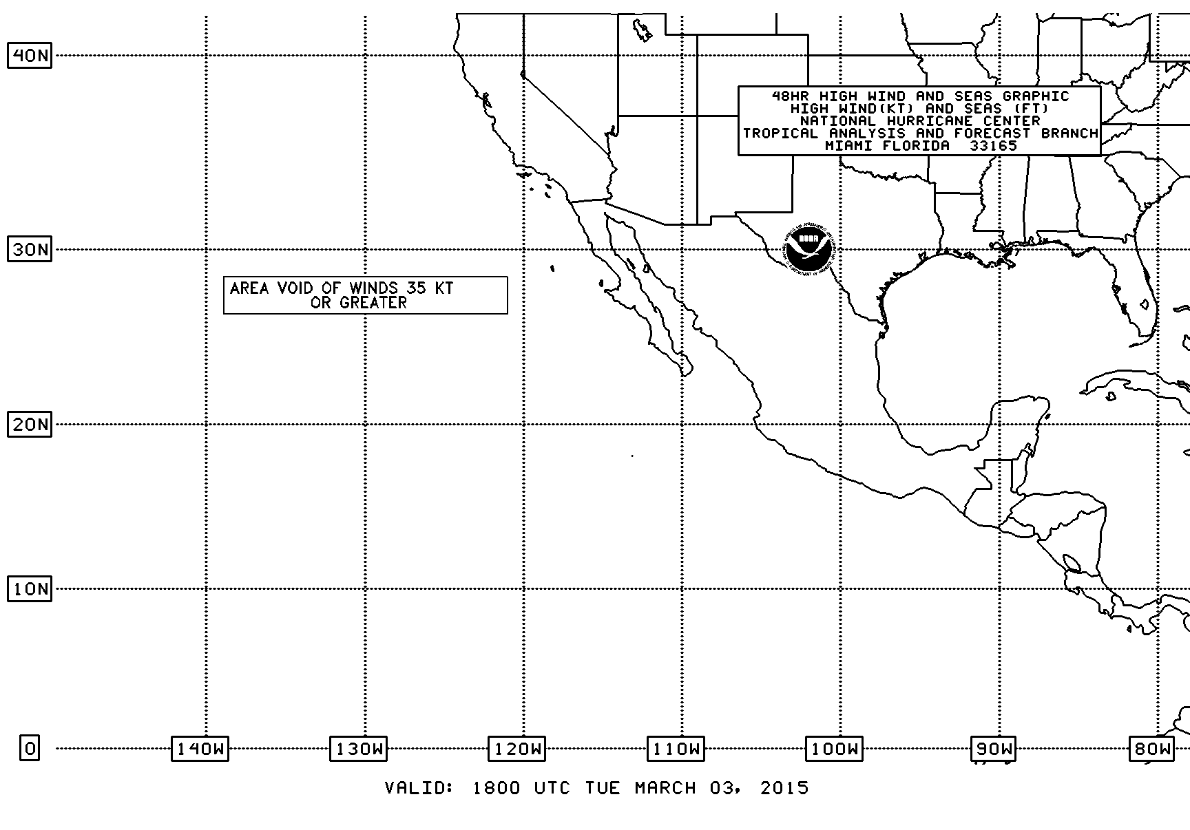
The diagram below indicates areas that are predicted to exceed 35 kt winds. It’s something we will look at every day during the crossing and we want it to look exactly like below–area void of high winds!