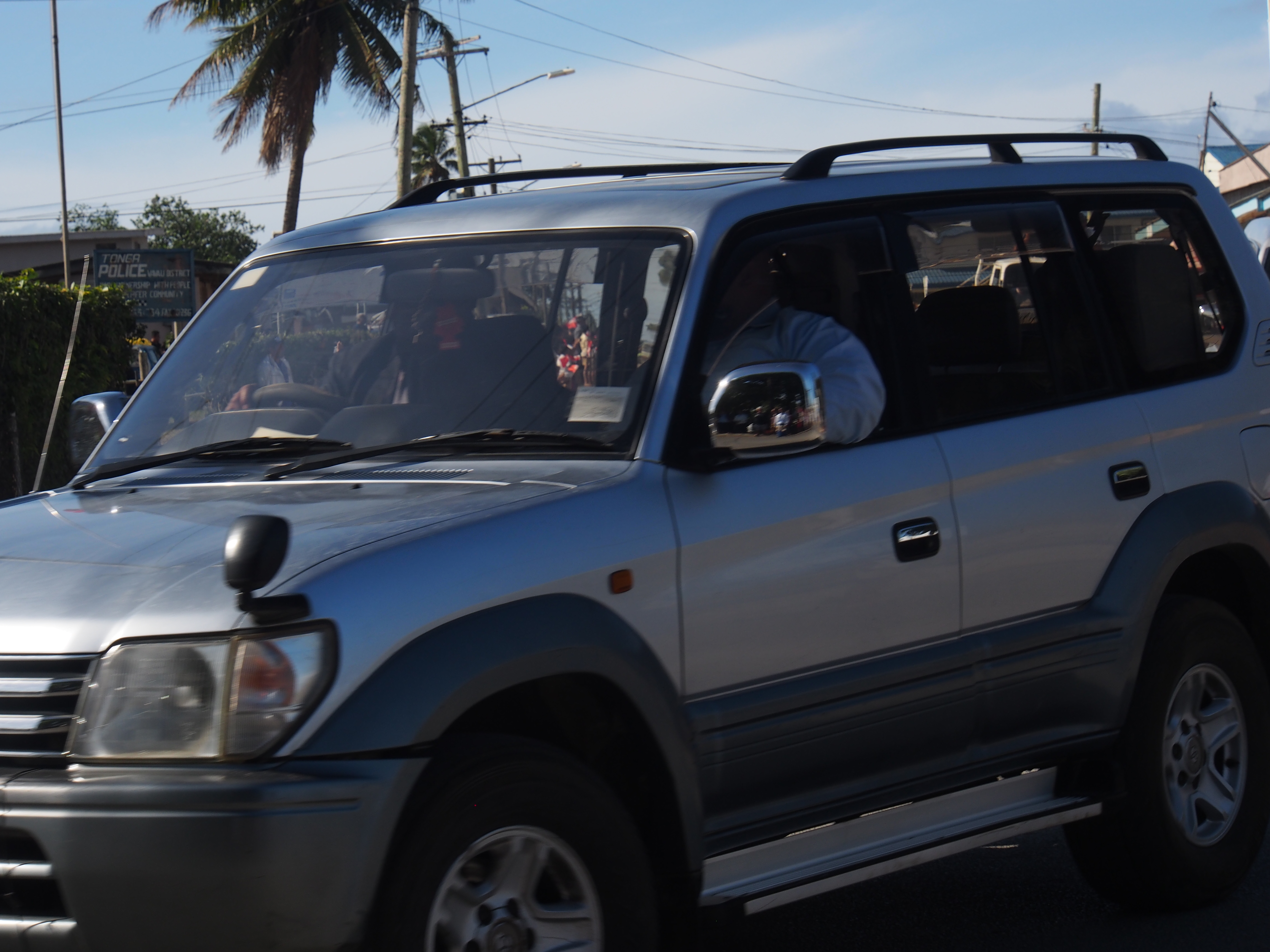
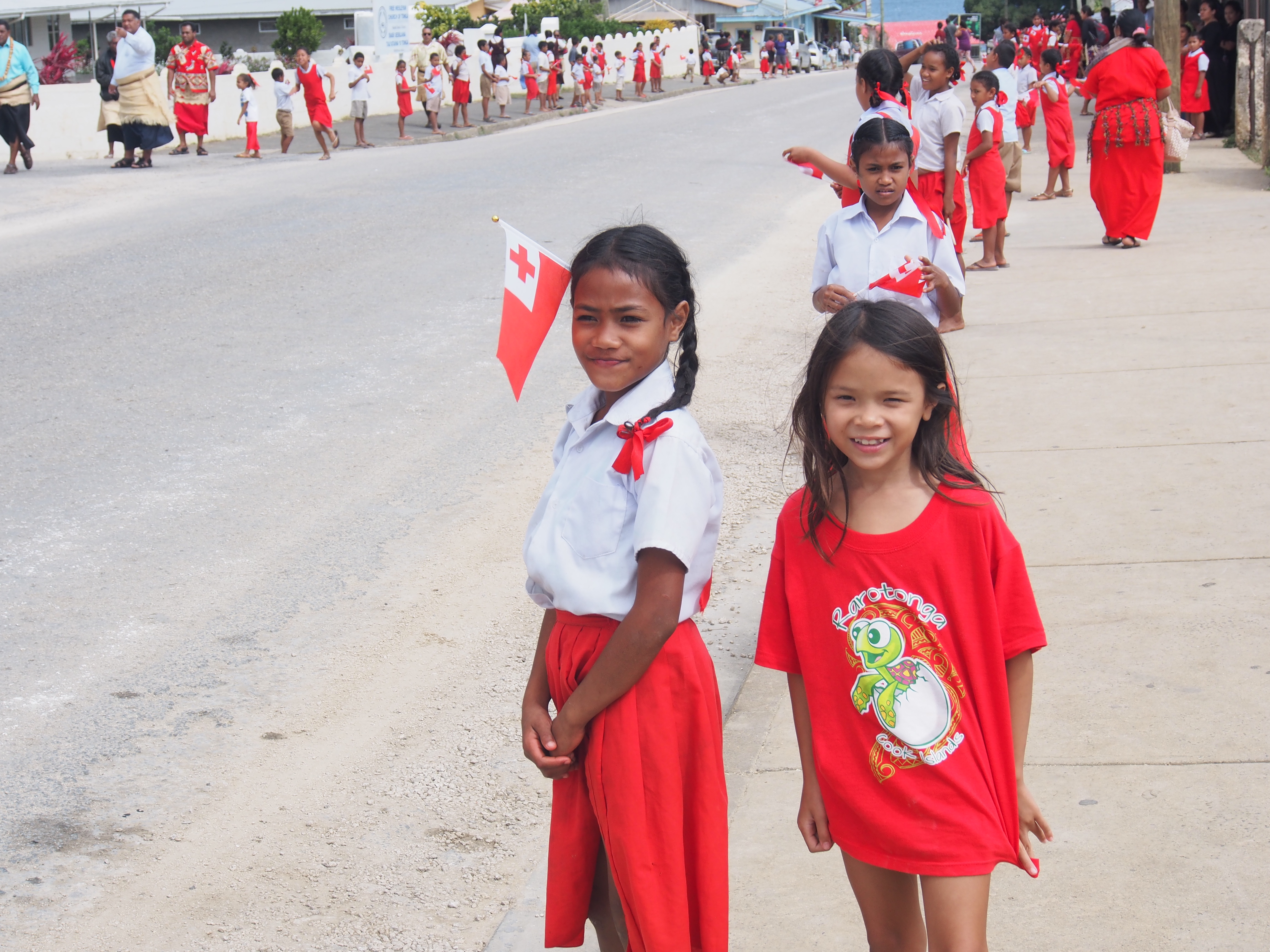
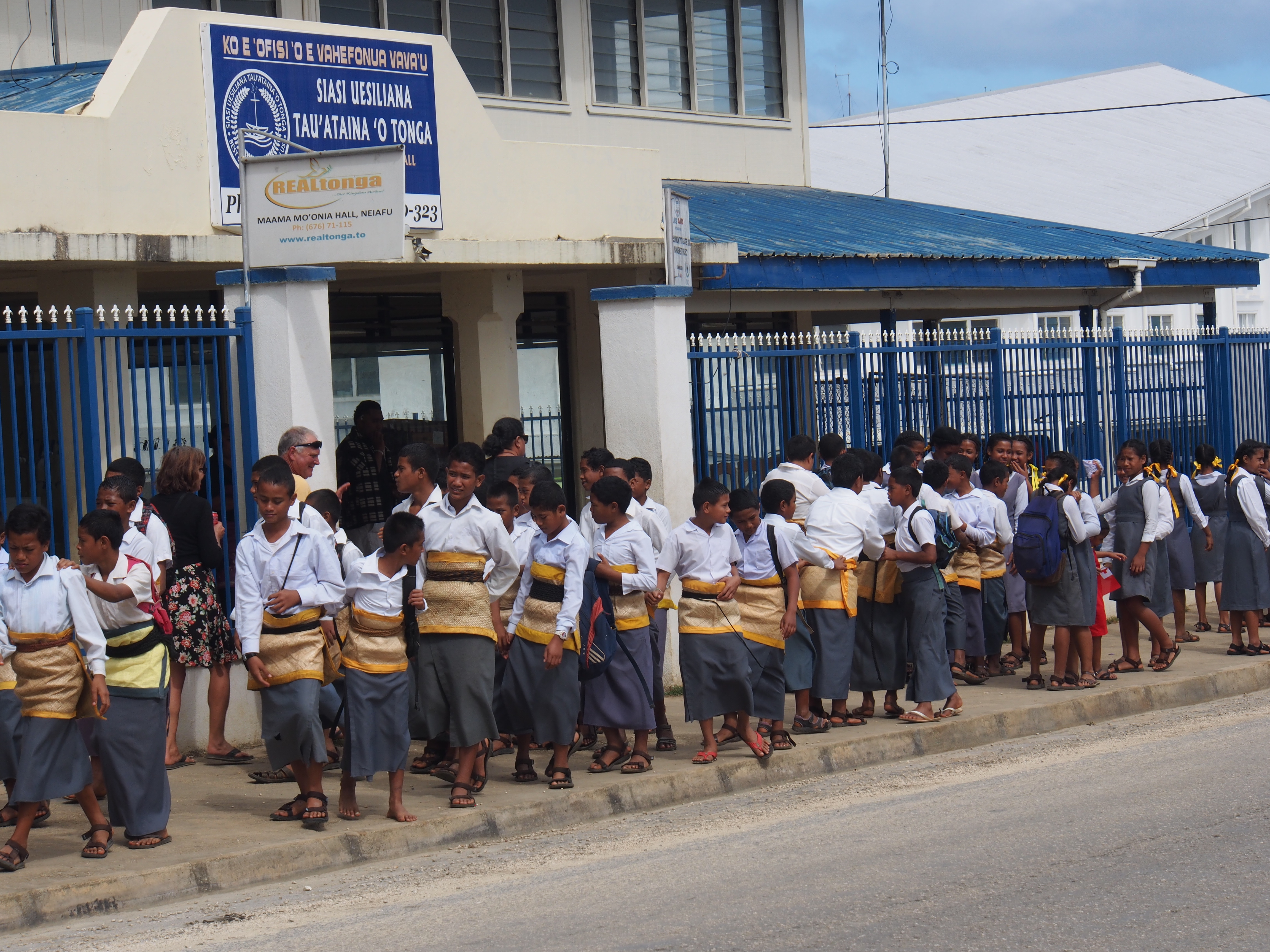
After a few days back in Neiafu to provision, do laundry and banking, and upload pics for the blog, we set out again to explore more of the outer islands. While in Neiafu, we also helped welcome the king to Vava’u as we joined hundreds of school children lining the road to the airport. We had a 2-second view of him as his motorcade drove by on the way to his palace. He was recently coronated and took over the crown from his brother who passed away over a year ago.
King Tupou VI in passenger side (near-side in white shirt)School kids lining street waiting for the kingSchool kids lining street waiting for the king
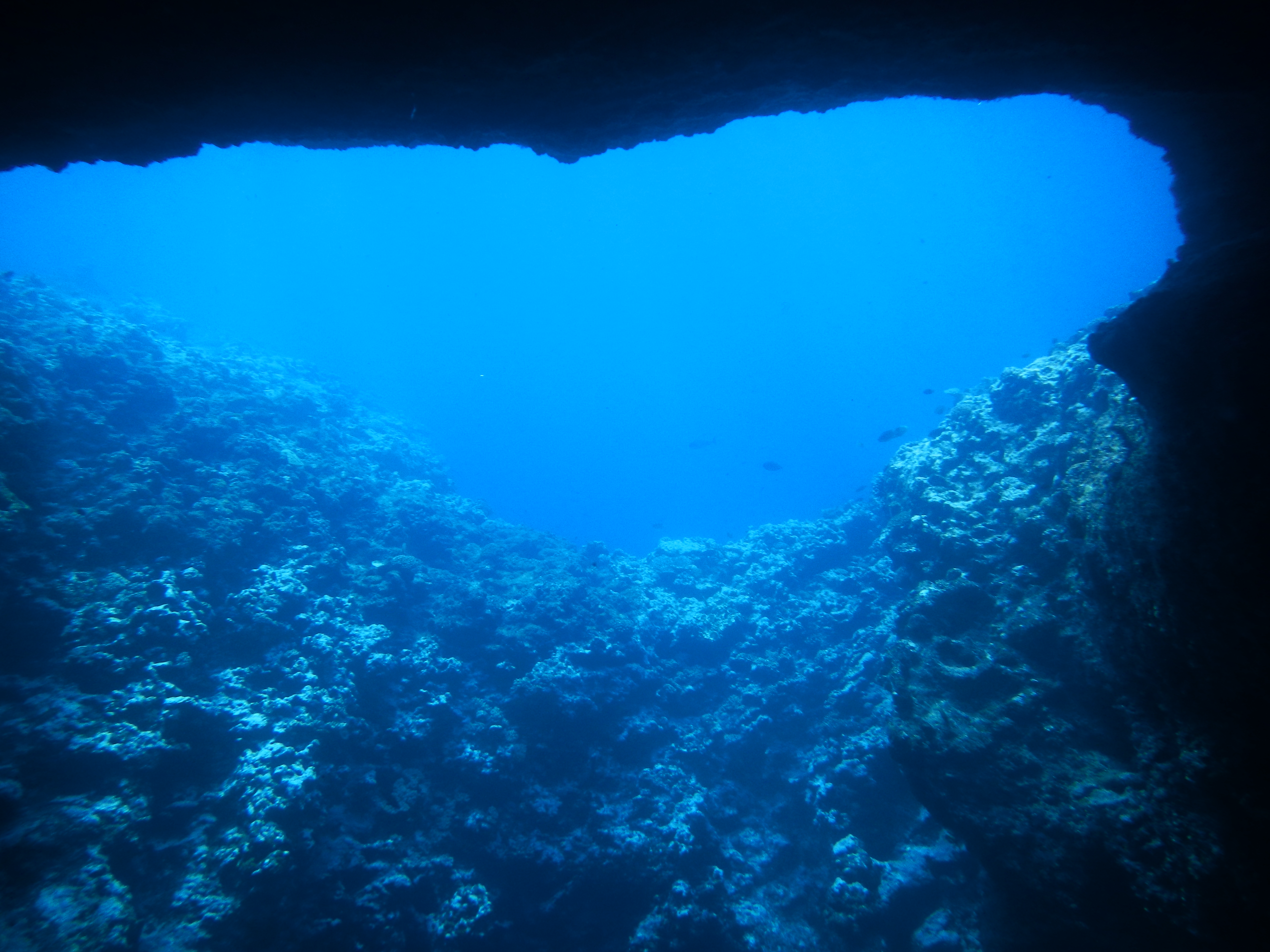
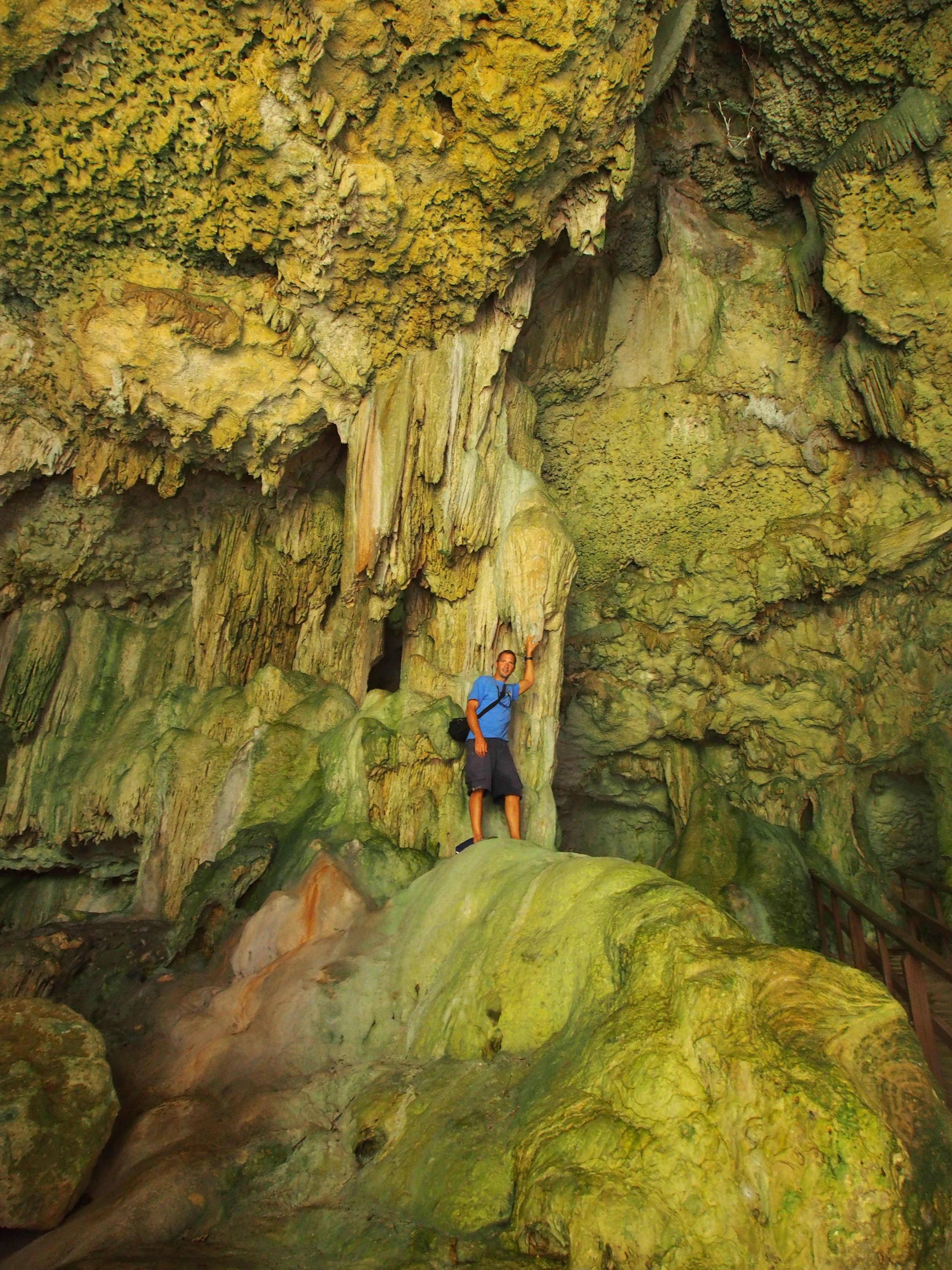
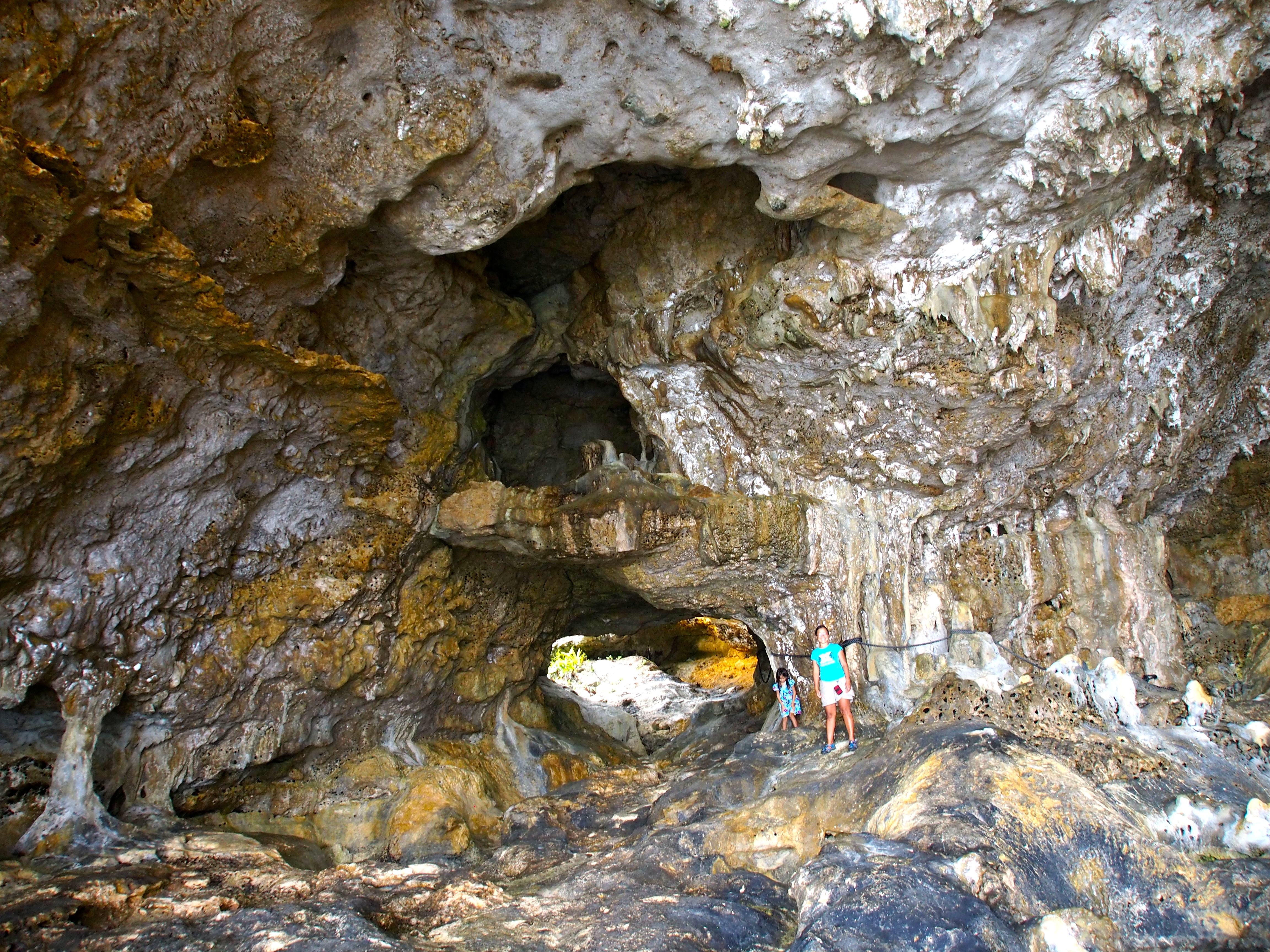
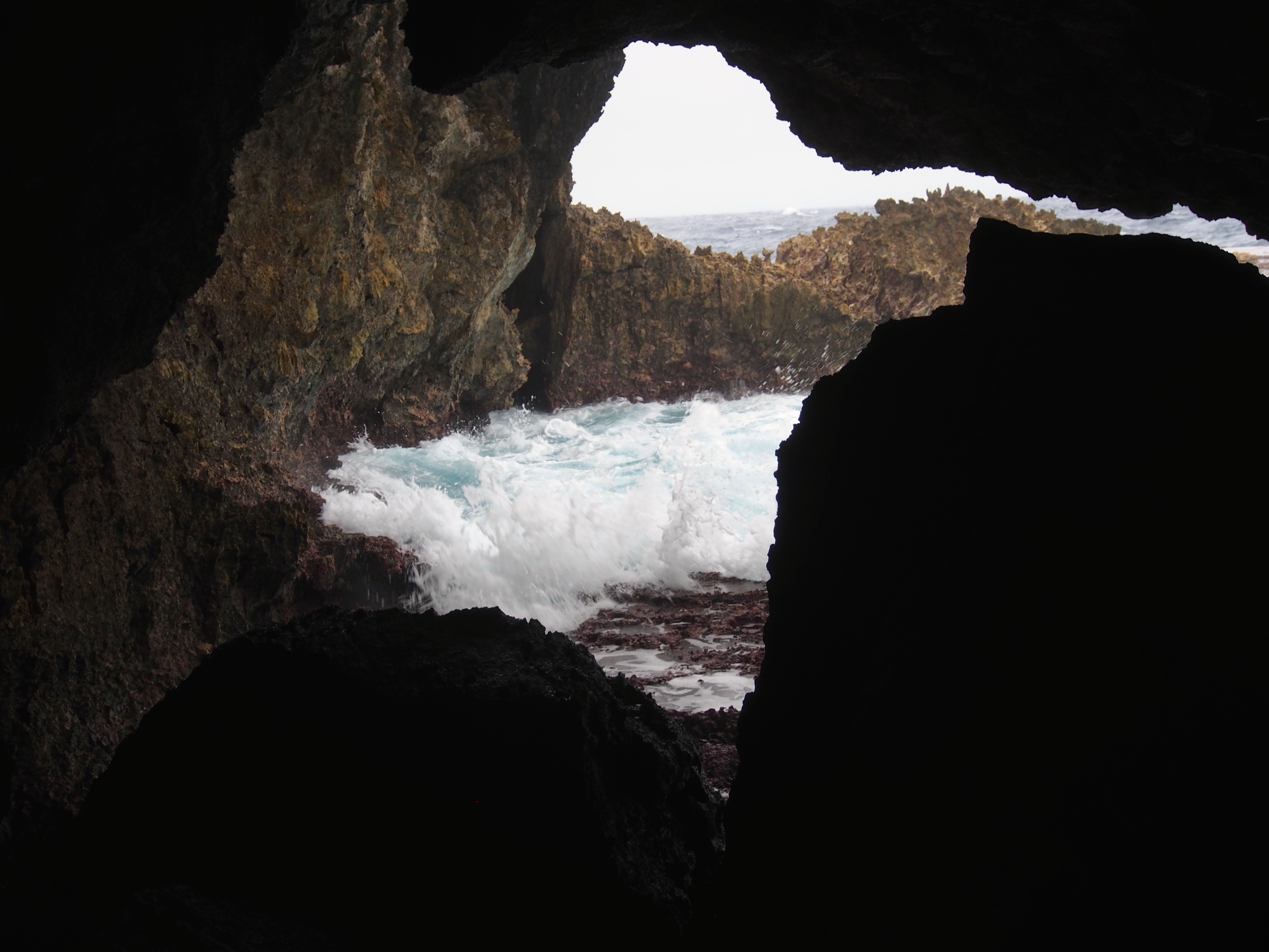
Mariner’s Cave
The saying is that everyone visits Swallow’s Cave, but only the brave go to Mariner’s Cave. We hopped on SV Bob The Cat and motored a short distance from Port Maurelle to the west side of Nuapapu island. At medium tide, the entrance to the top of the cave opening is about 4’ under water. Since David and Malene were there before, they knew exactly where the opening was and “parked” their catamaran nearby. The adults and some of the older kids jumped in the water and prepared to dive down into the cave. The first time through is scary since you cannot see the inside of the cave. To enter, you take a deep breath and swim 4’ under water for about 10’, then come back up to the surface. It’s sort of like diving under our boat on one side and coming up on the other side. The inside of the cave is slightly smaller than Swallow’s Cave, and the only light comes from under water where the opening is. After swimming in and out a few times, we realized it was too difficult for Jacintha and she was happy to stay aboard the catamaran and play with Matthias, Lucas, and Ivan. There’s a second entrance to the cave that some people can free-dive to. It’s about 50’ down, so we didn’t even consider trying! We motored back to the anchorage and had a pizza party dinner aboard Apropos. Karen and Malene baked 6 pizzas for a hungry crew of 4 kids and 4 adults!
Looking out at the underwater opening to Mariner’s Cave from insideLooking into the cave opening from outsideDarkness inside the cave
Back to Port Maurelle
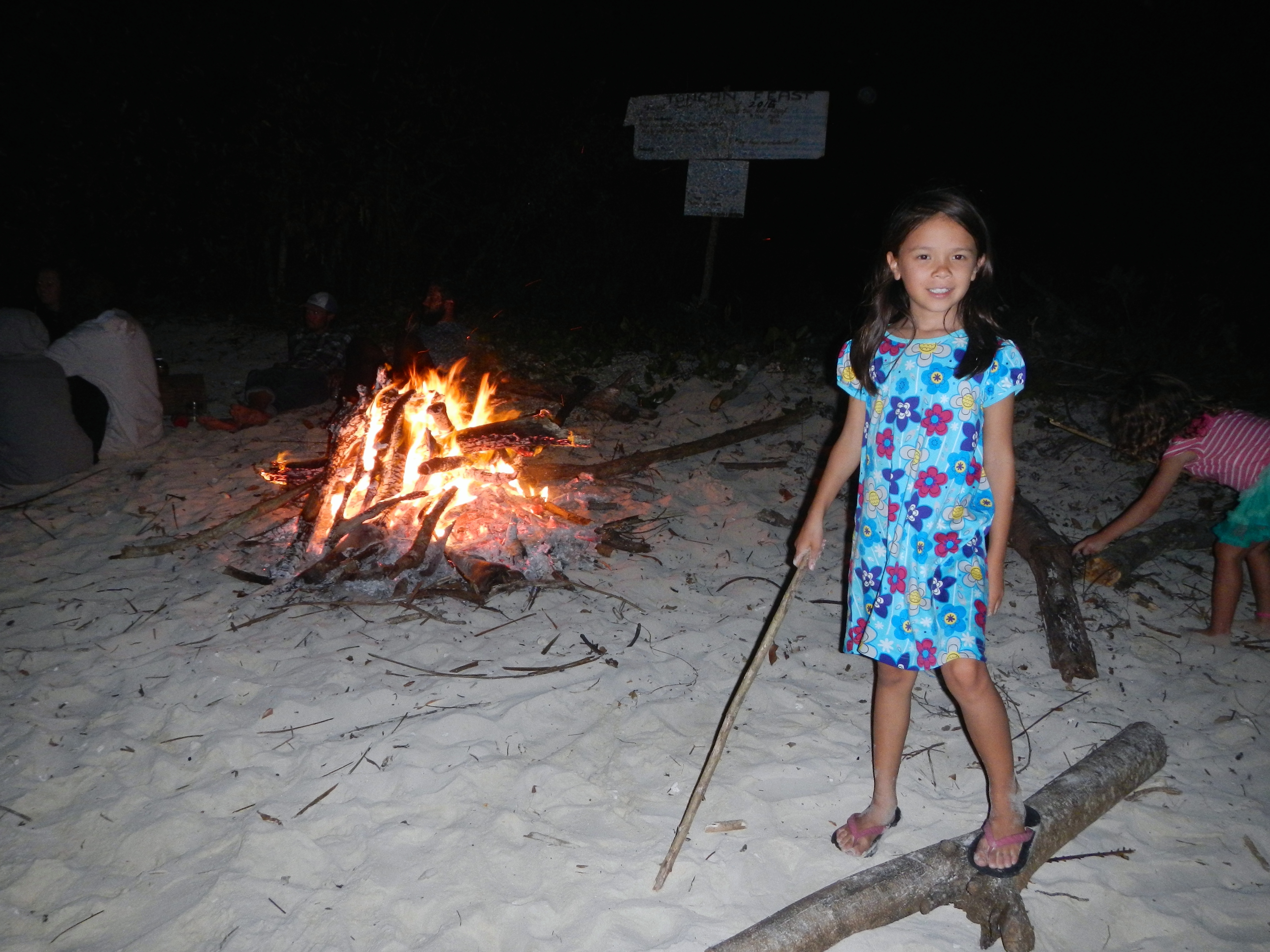
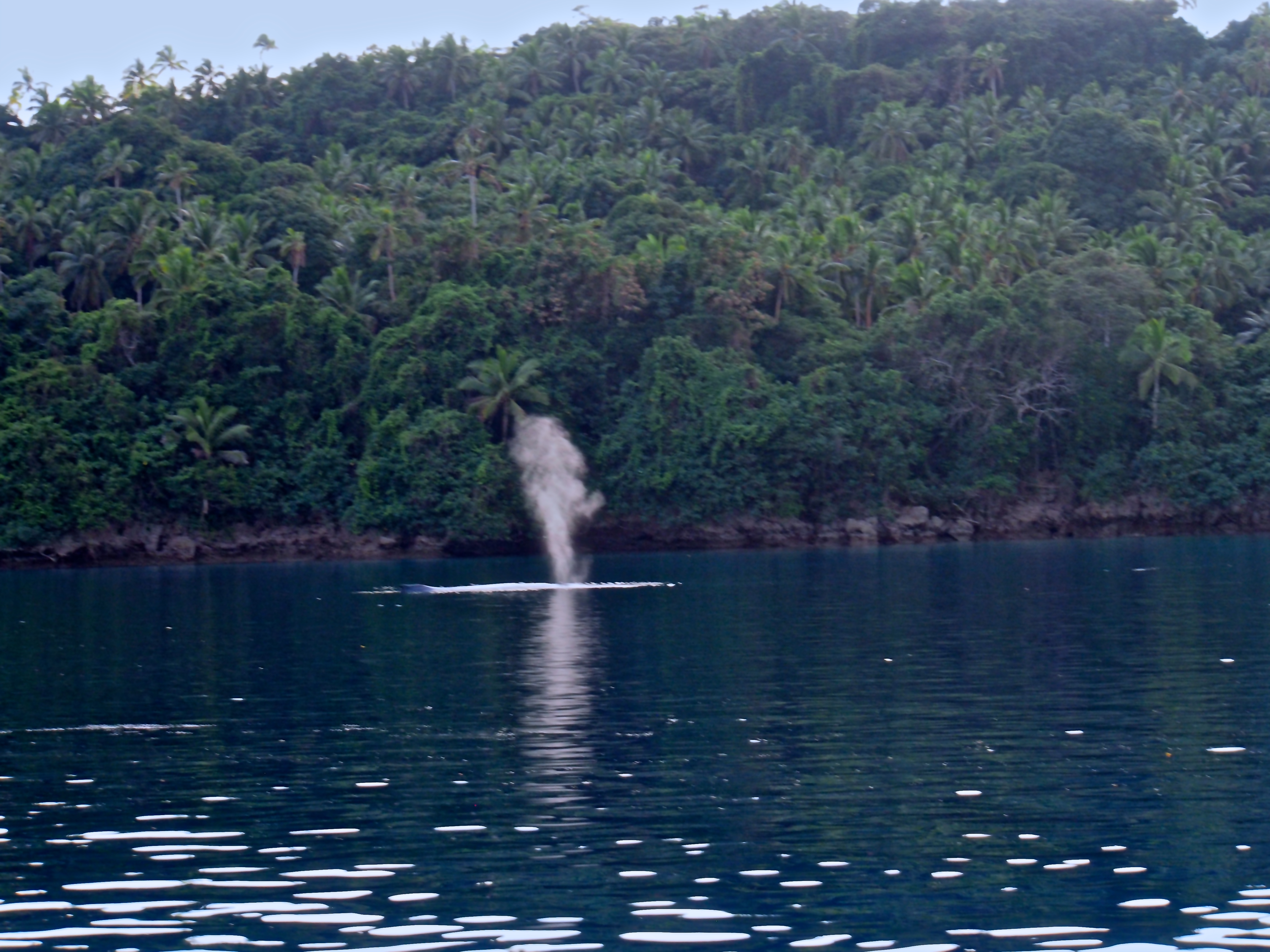
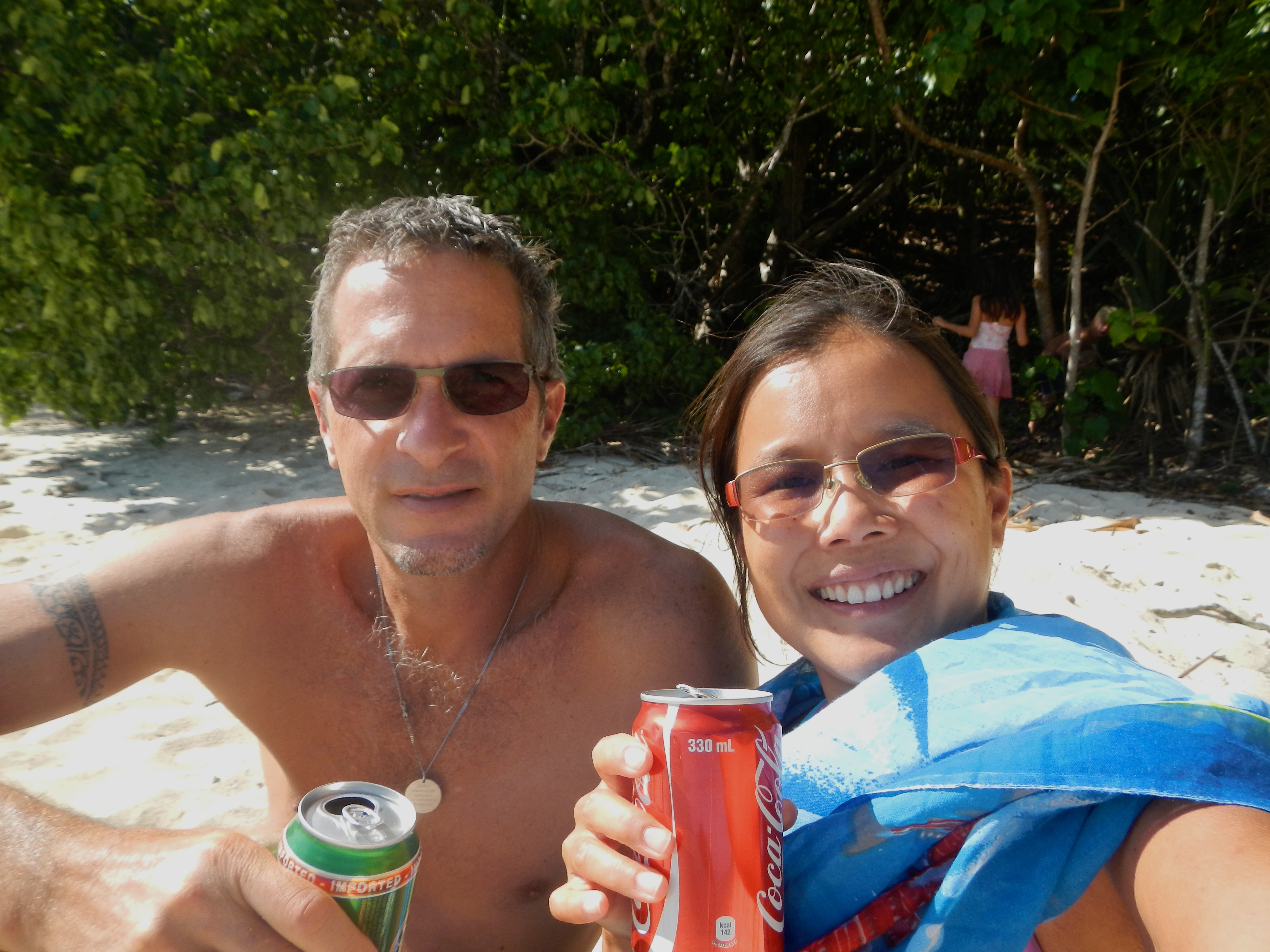
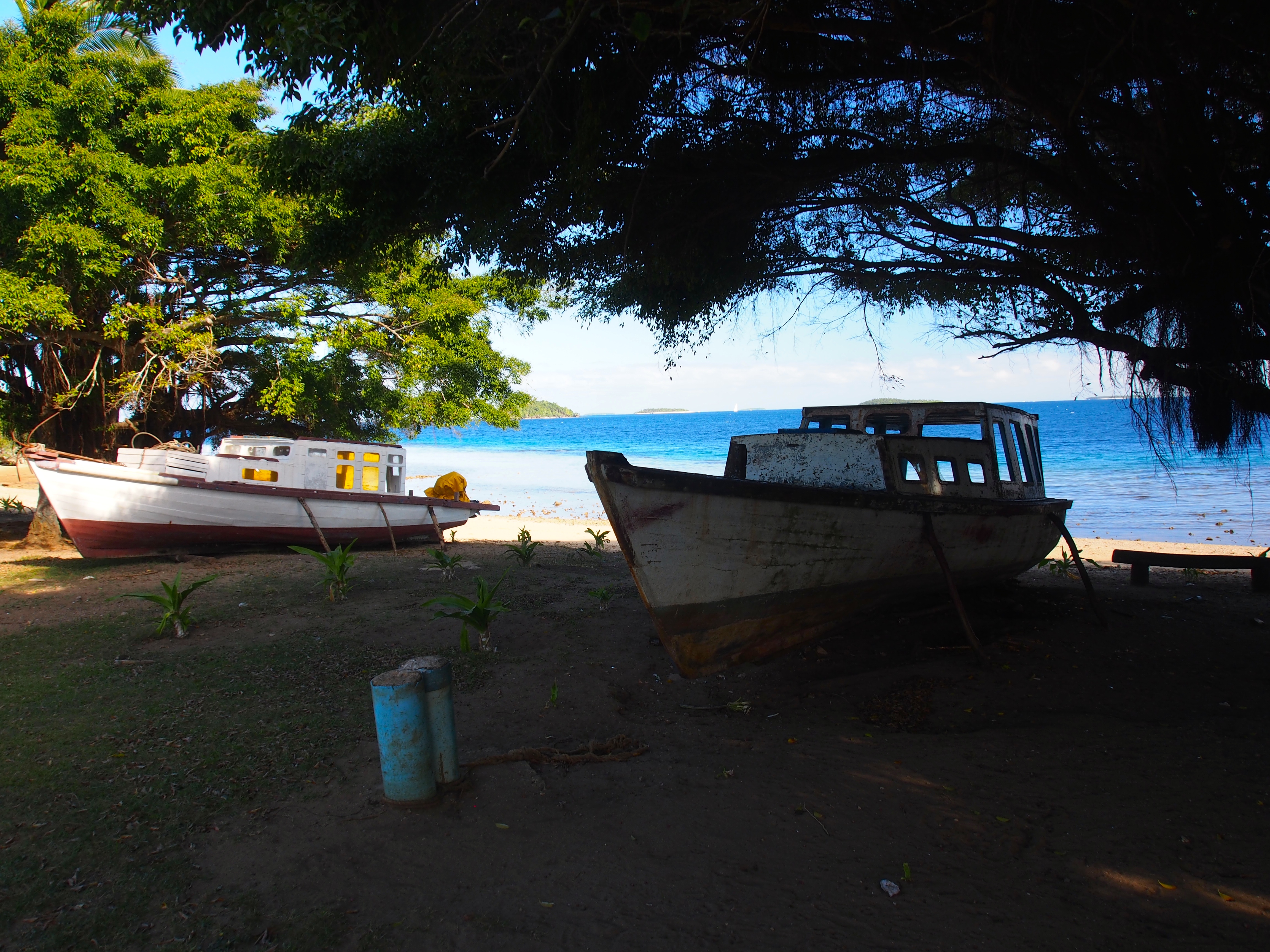
Port Maurelle is one of our favorite anchorages in the Vava’u group. Since the south-easterly trade winds were up all week, we returned there as it’s sheltered and has good holding. We also reconnected with familiar boats like Bob The Cat, Panthera, Fannie Fisher, and Javelot. It’s great for Jacintha too since she has friends on Javelot and Bob The Cat. She comes and goes via dinghy to other kid boats anchored next to us kodu.ut.ee. With about 10 boats in the anchorage, we had a fun beach bonfire one night complete with jumbo marshmellows we bought at Costco in Mexico. A female humpback whale and her calf swam into the anchorage one morning and gave us a nice show.
Bonfire on beachHumpback spout in Port Maurelle
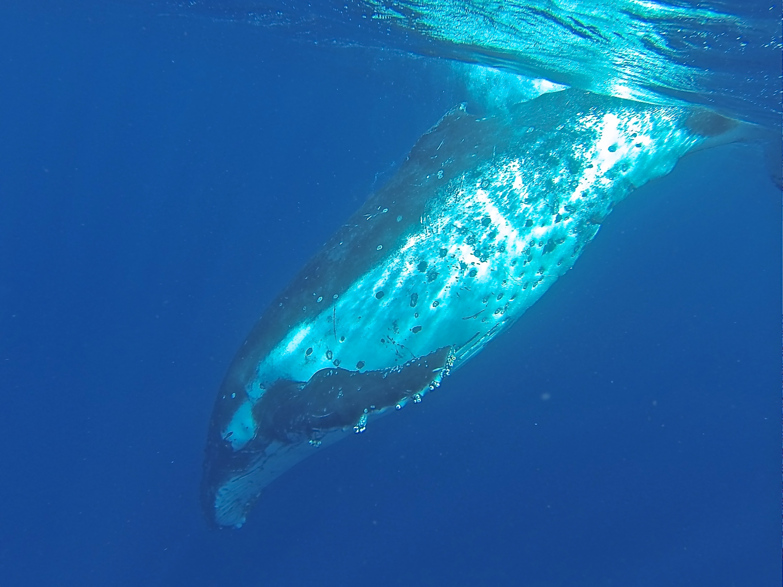
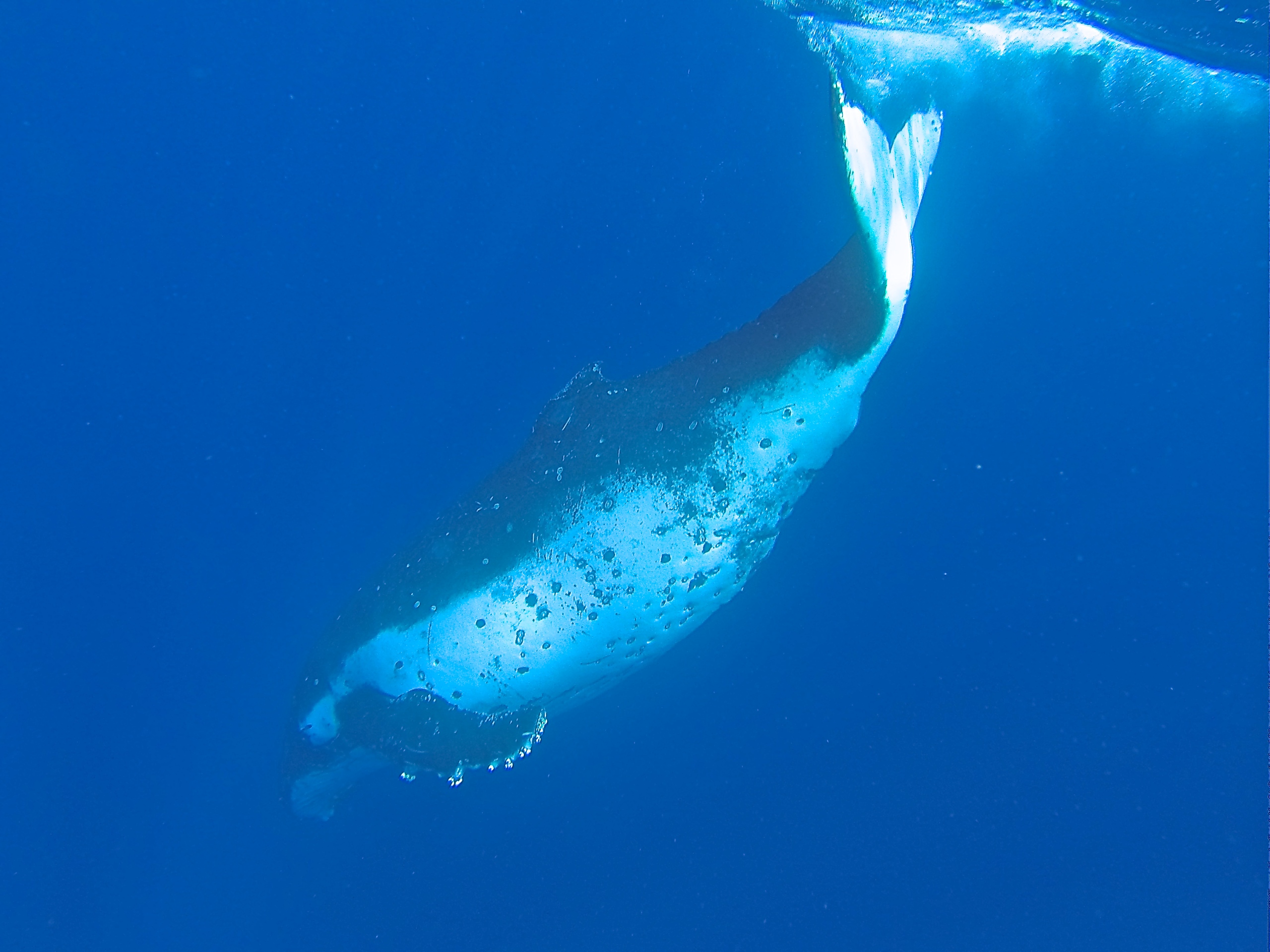
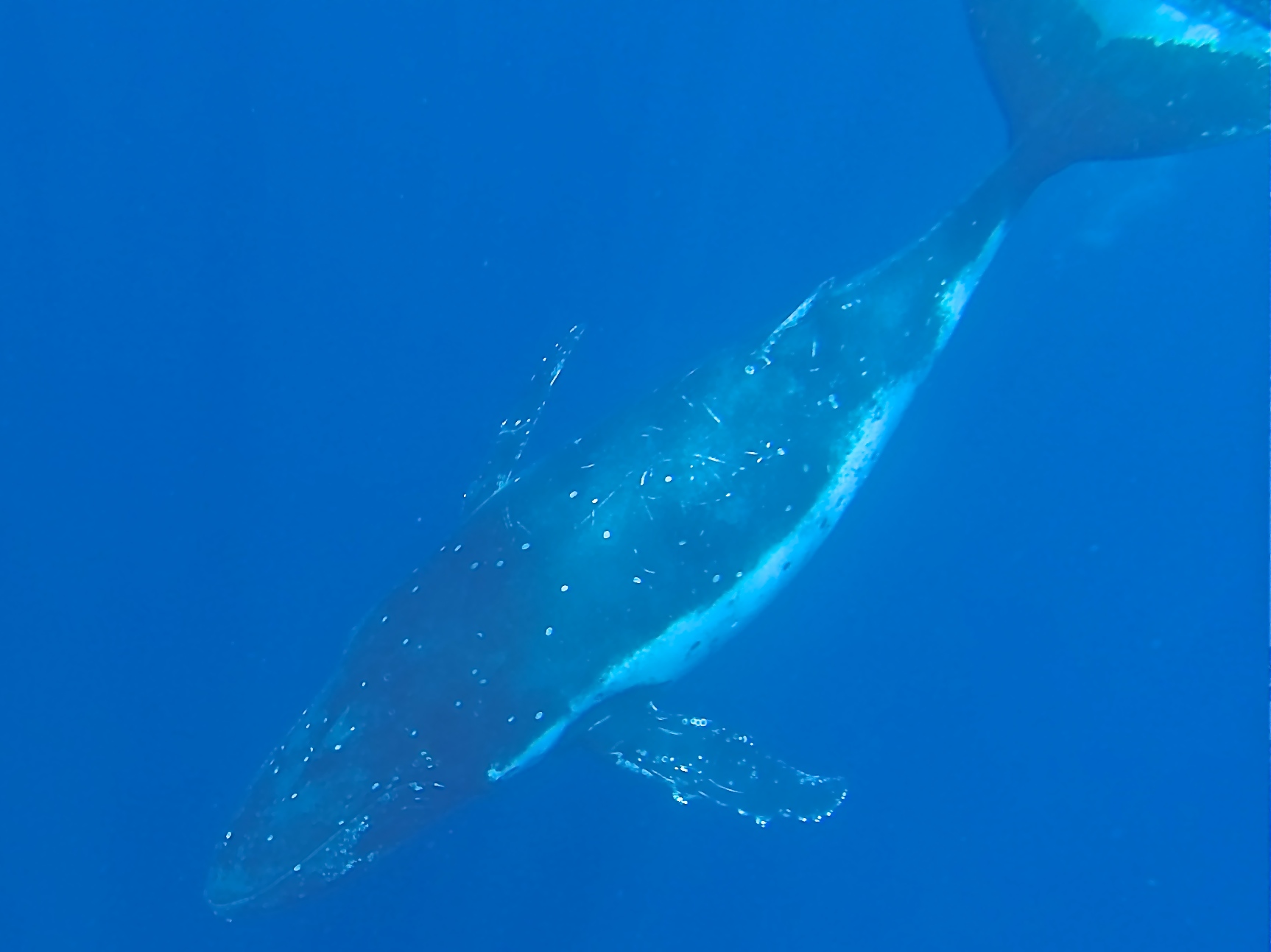
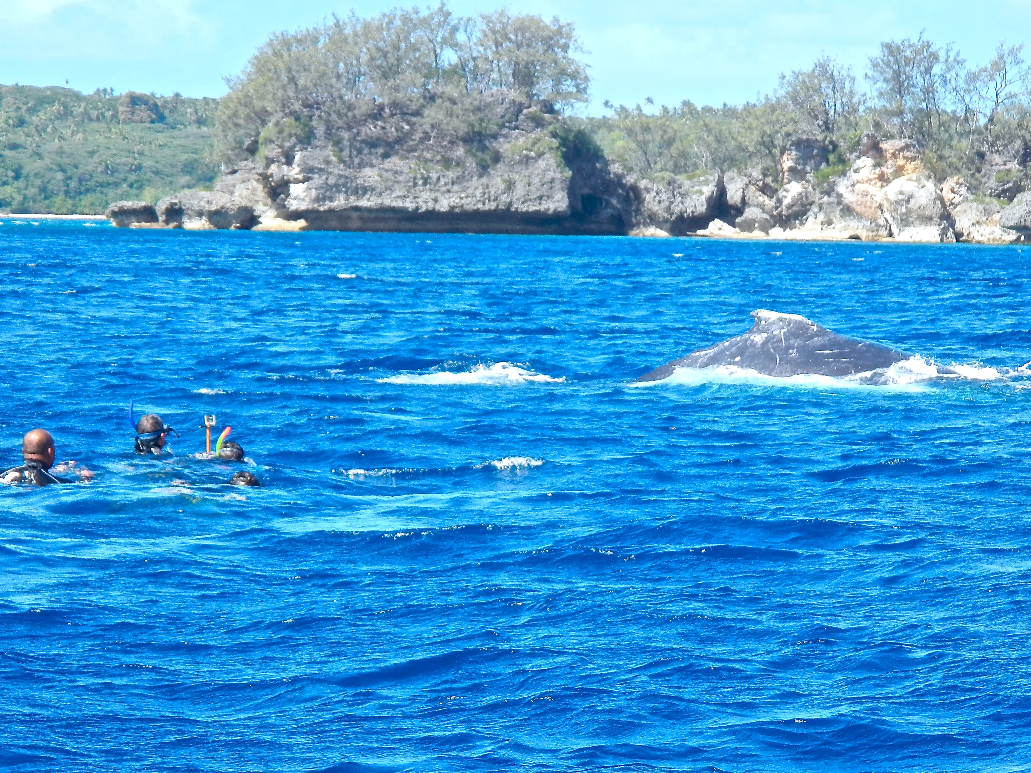
Swimming with Whales
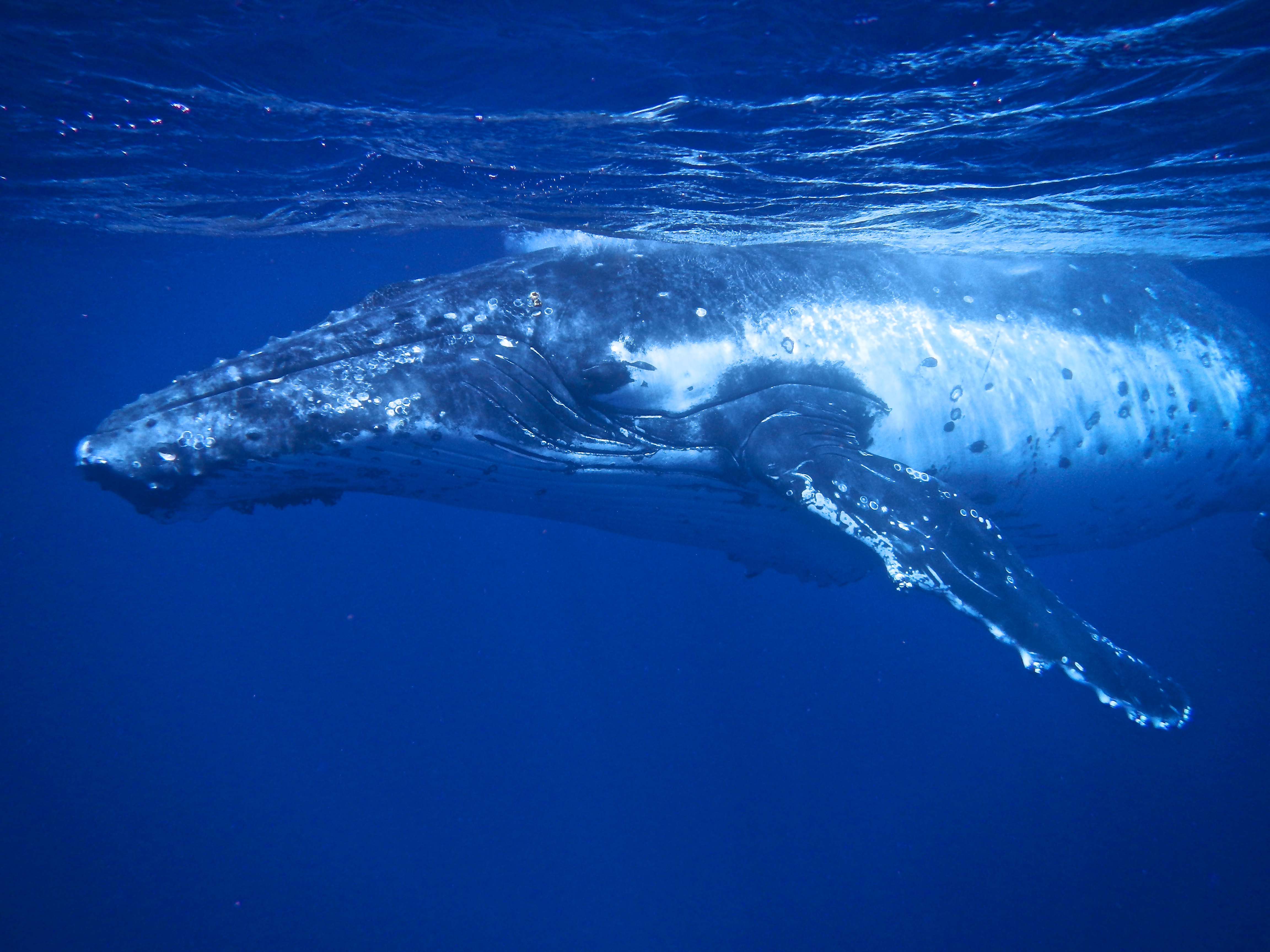
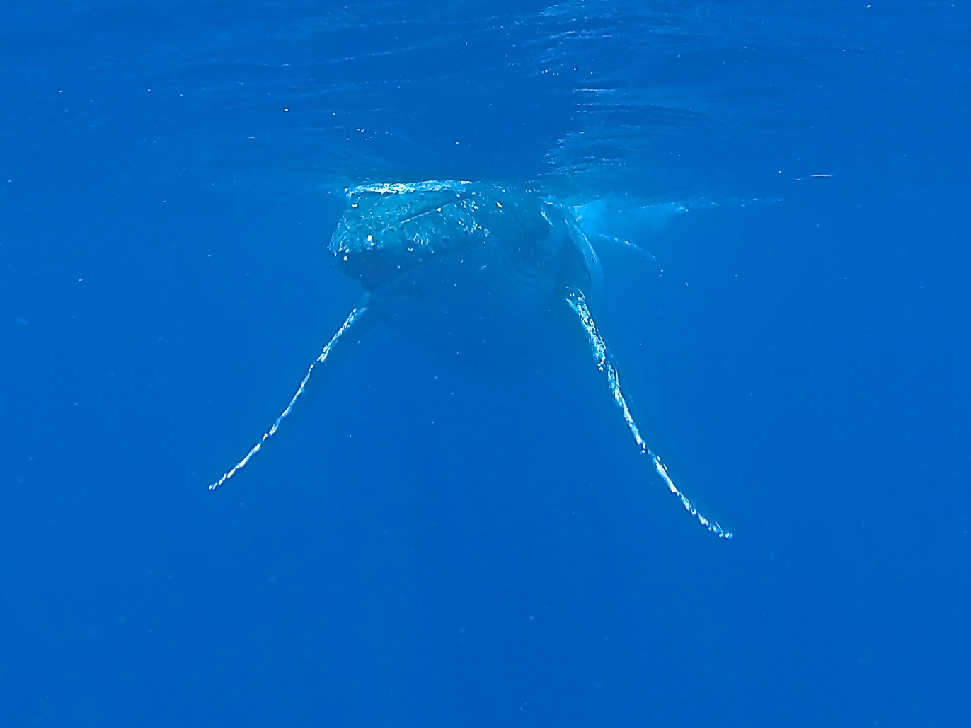
There are only a few places in the world that allow swimming with whales, and Tonga is one of them. Since we already swam with the whale sharks in La Paz, the sea lions near Isla La Partida, black-tipped and lemon sharks in Rangiroa, and stingrays in Bora Bora, we figured we may as well try swimming with humpback whales.
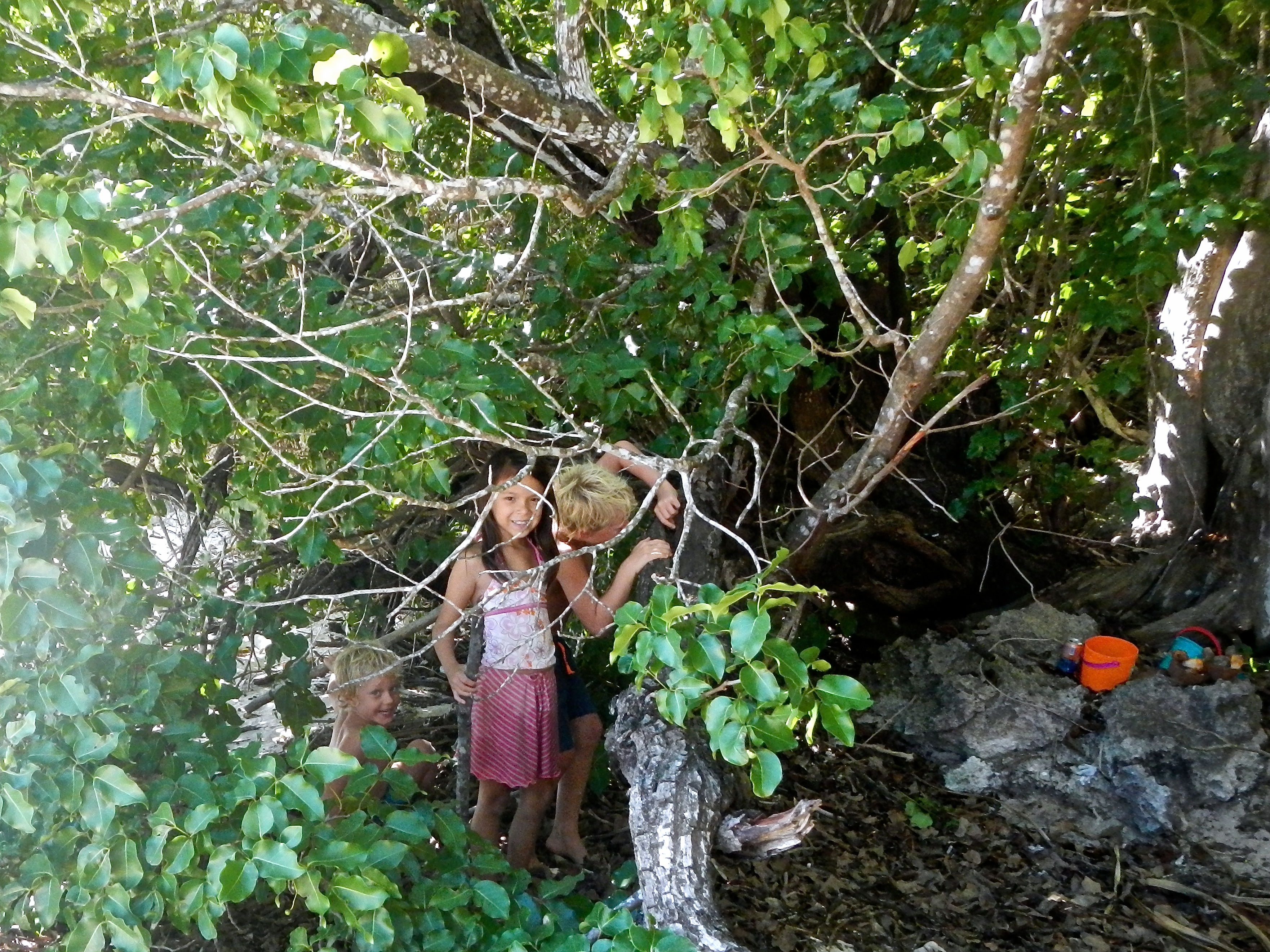
First we spent a nice relaxing afternoon on the small uninhabited island of Taunga, anchorage #23. David and Malene kiteboarded on the windy side of the island, the 3 kids gathered sand dollars and built a hut, and Karen and I relaxed on the wind-free, leeward side of the island. We then headed back to Port Maurelle, 3 miles away, where the whale boat would pick us up in the morning.
Relaxing on a quiet island beachJacintha playing with Matthias and LukeDavid and Malene Kiteboarding
To legally swim with whales, you must go with a certified guide and there are several in Tonga.
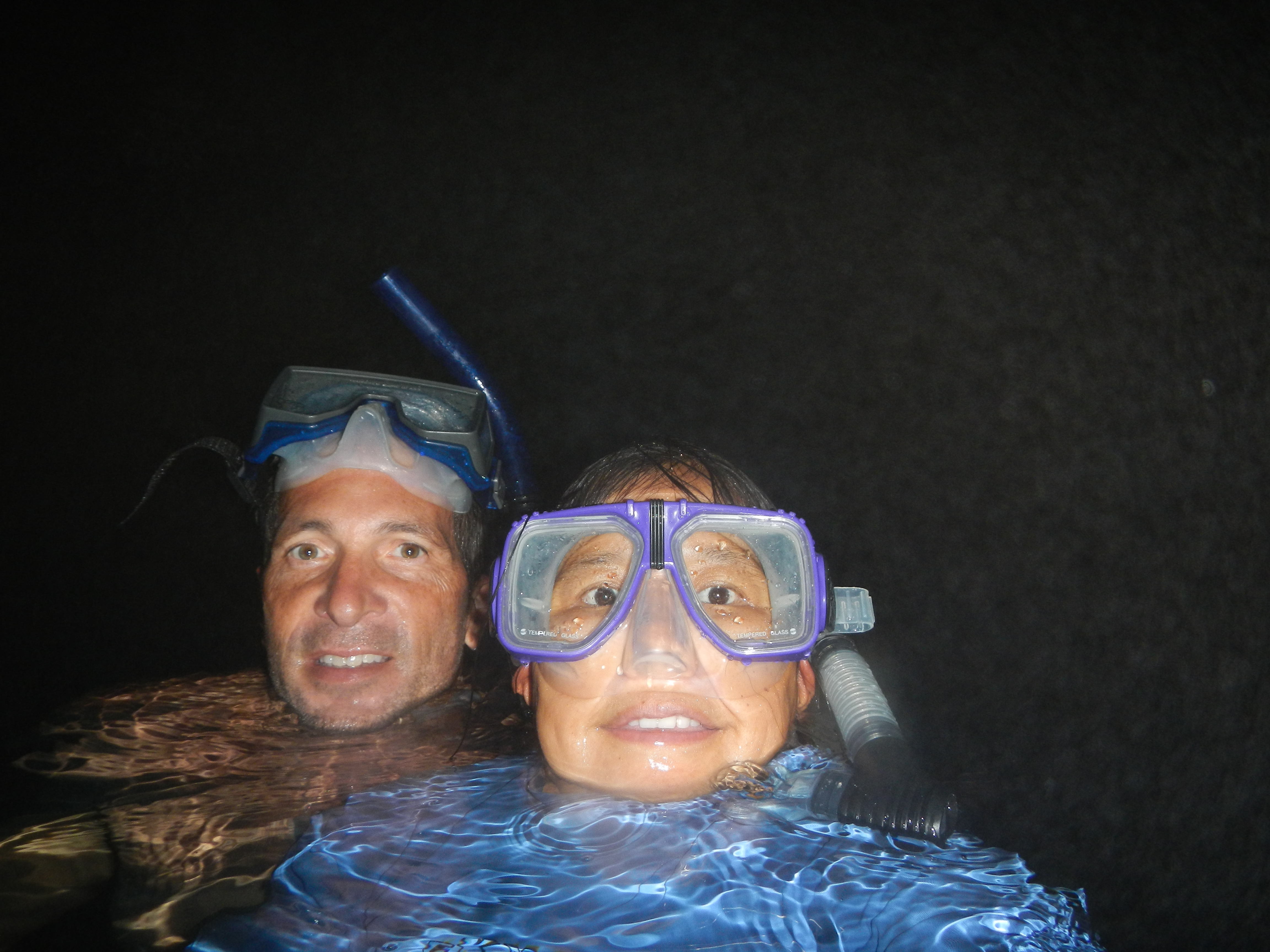
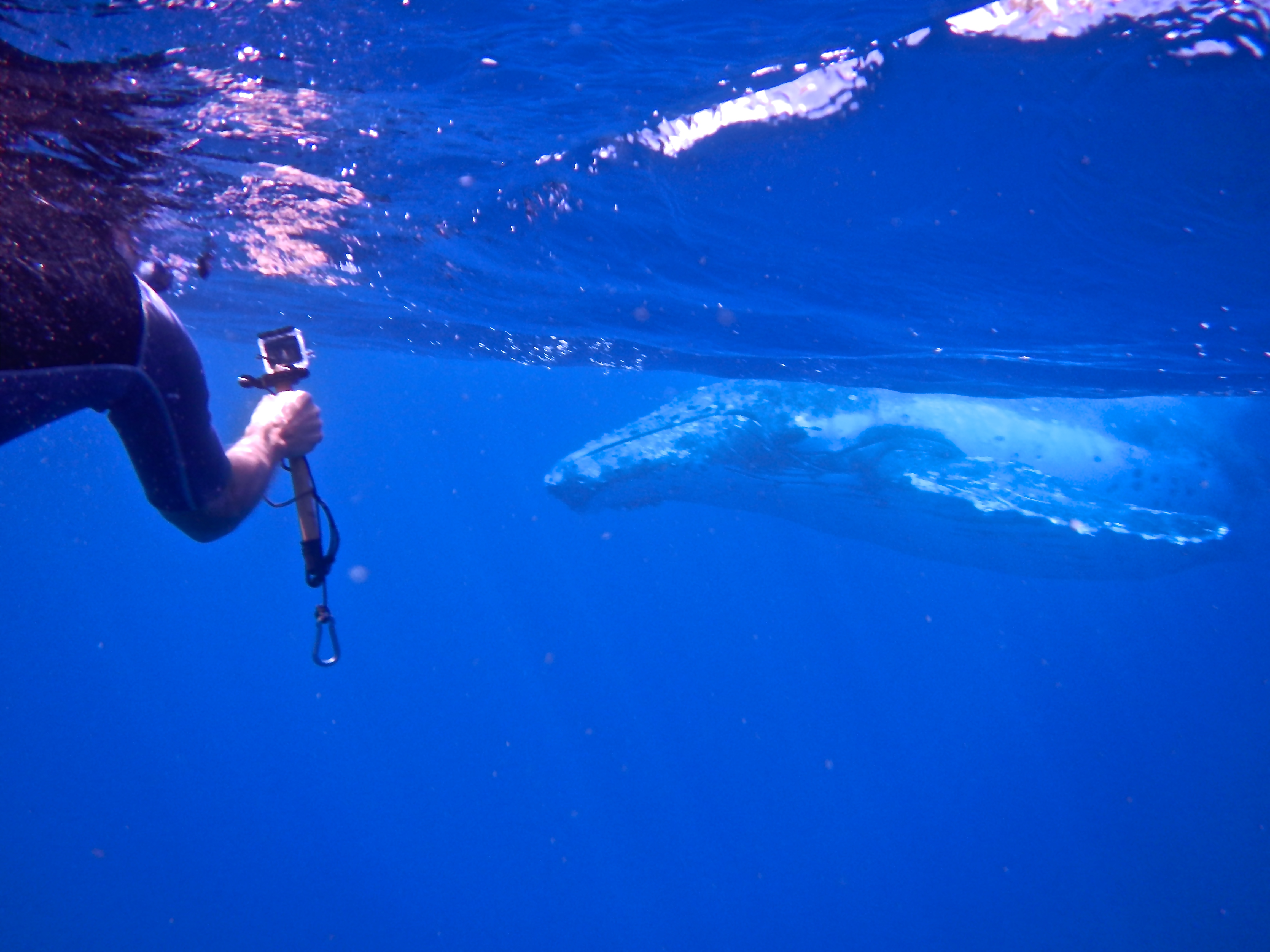
The whale boat came by our anchorage at 8am to pick us up, then sped away to some of their favorite whale sites. We spotted a few whales in the distance, but they disappeared before we reached them. After about 3 hours of searching, we finally got in the water near a pair of humpbacks but didn’t see them underwater before they dove off. This area was not protected from the wind so the waves made it difficult to snorkel without sucking in water. Soon after, we spotted a female with a young calf, and jumped in the water again, but didn’t get close enough before they swam away. I was starting to wonder if this whale swimming tour was going to be worth it ($1000 Tongan or $500US for the 3 of us). Finally, we spotted a juvenile male humpback surfacing about every 4 minutes. This is a sign that they are sleeping and half their brain is turned off, so they surface about every 4 minutes to breathe, then dive back down. We jumped back in the water and swam to where he last surfaced. The water was very clear so you could see him rising from about 50’. As he got closer to the surface, you realized just how big he was. He stayed on the surface for 5-10 seconds before slowing turning around to go back down. With a few strokes of his powerful tail, he got smaller and smaller until he disappeared into the abyss. We stayed around for 4 or 5 cycles during which time we rotated swimmers (a guide can only take 4 swimmers in the water at a time and there were 6 on the boat). It was an amazing experience and we got some good underwater photos and videos.
Up close to a juvenile male humpback whaleJuvenile Humpback swimming towards usDivingWhale tail waveHumpback Whale swimming below usIn the water with the whale guide on leftShooting video and pics with a GoProWatching a whale surfacing to take a breath
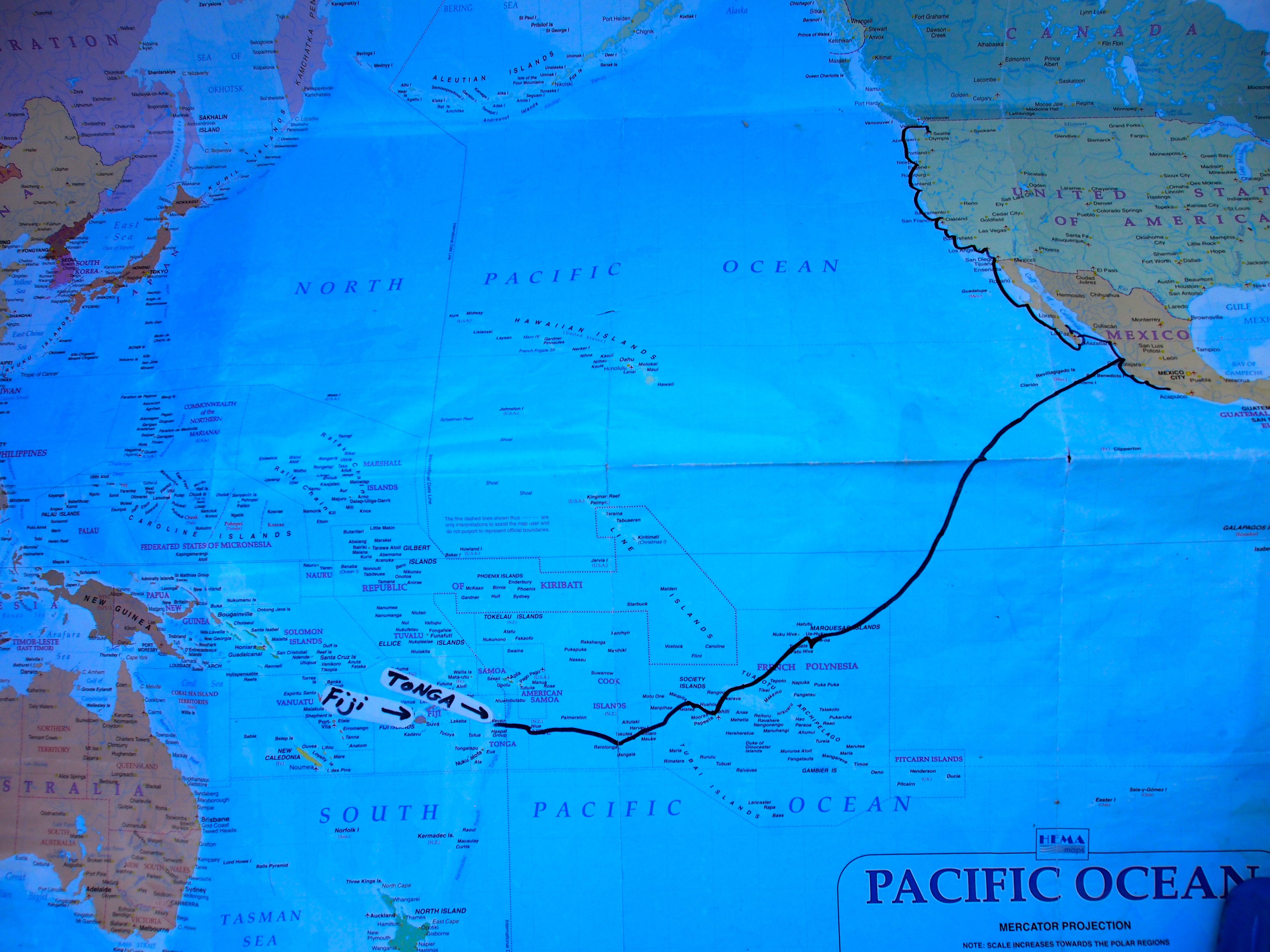
Sailing from Seattle to Australia in one year is a lot of sailing! We’re nearing the 10,000 mile mark and still have almost 3,000 miles to go to reach Sydney. Since arriving in the Marquesas with the Pacific Puddle Jump fleet in April, we have sailed ahead west on a faster pace than most boats, our timeline dictated by Karen’s leave of absence from work expiring at the end of September. Not wanting to rush through Tonga and Fiji, which are some of the best cruising grounds in the South Pacific, we decided to change the “plan”.
The new plan is to keep Apropos in Fiji during the cyclone season (November through April) and fly back to Seattle in mid-September. Fiji is at 17 deg 40 min latitude south, and 177 deg 20 min longitude east, right in the middle of the cyclone belt. But Vuda Point marina, on the SW side of Viti Levu island in Fiji, has cyclone pits—long trenches that are dug in the ground for lowering the keel into with tires stacked up along the sides to keep the boat upright. We researched it and contacted friends from Seattle who kept their boat there, and it sounds like a good option. They have strict rules about removing things from the deck (canvas, sails, solar panels—basically anything that can blow away) so that if a cyclone does pass by, flying projectiles will be kept to a minimum. Having the boat out of the water has its pluses and minuses, but as far as surviving a storm, its the best option. Of course, all bets are off if hit directly by a category 5 cyclone.
Although there is some risk in doing this, we believe it’s the best option and will allow us to spend a few more weeks in Tonga and a whole month cruising in Fiji. Our boat insurance company has also approved the new plan, which has me returning to Fiji in April and sailing the boat back to Seattle via Hawaii. I’ll have 2 crew positions open if anyone is interested (more on that later)!
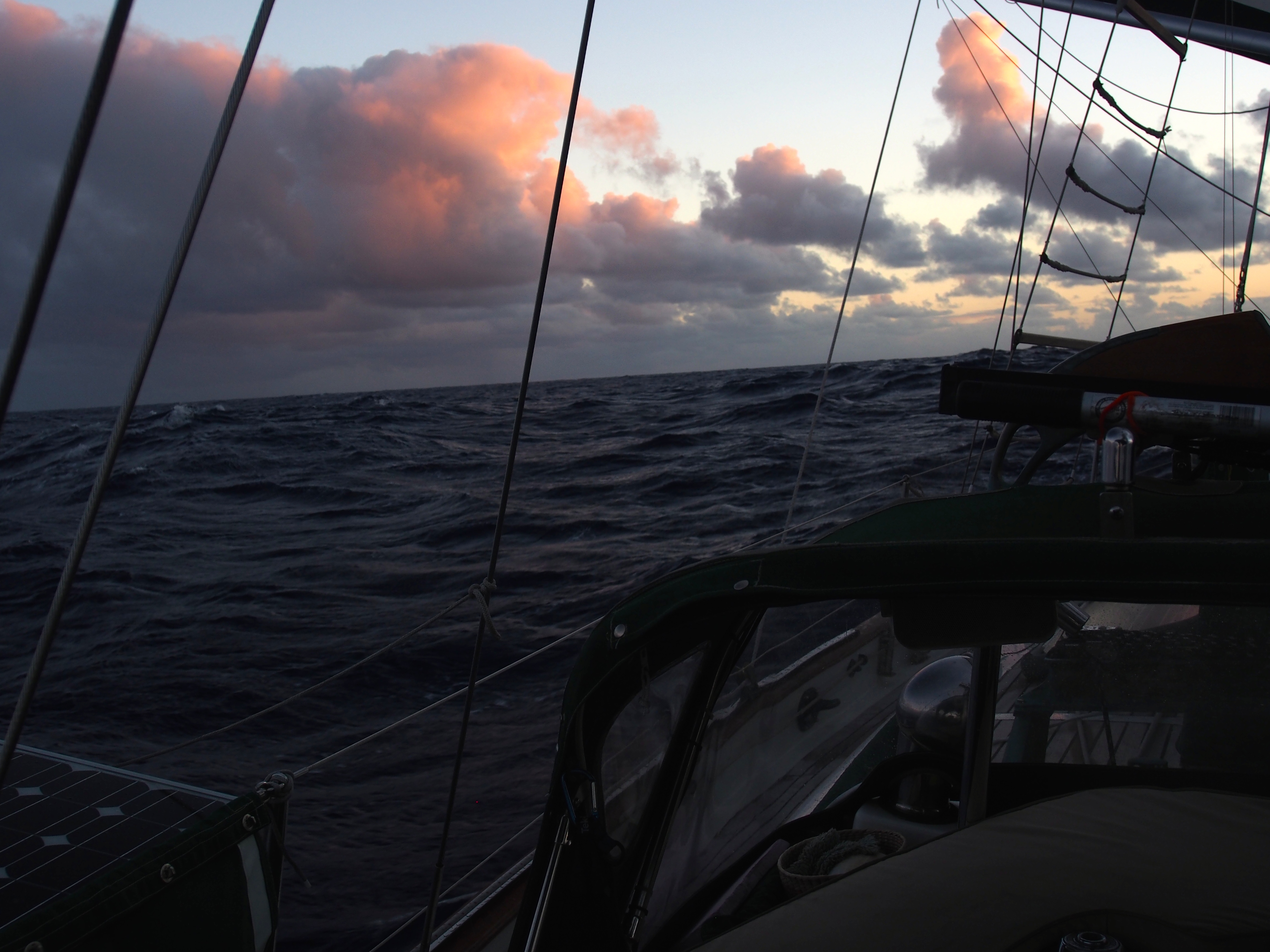
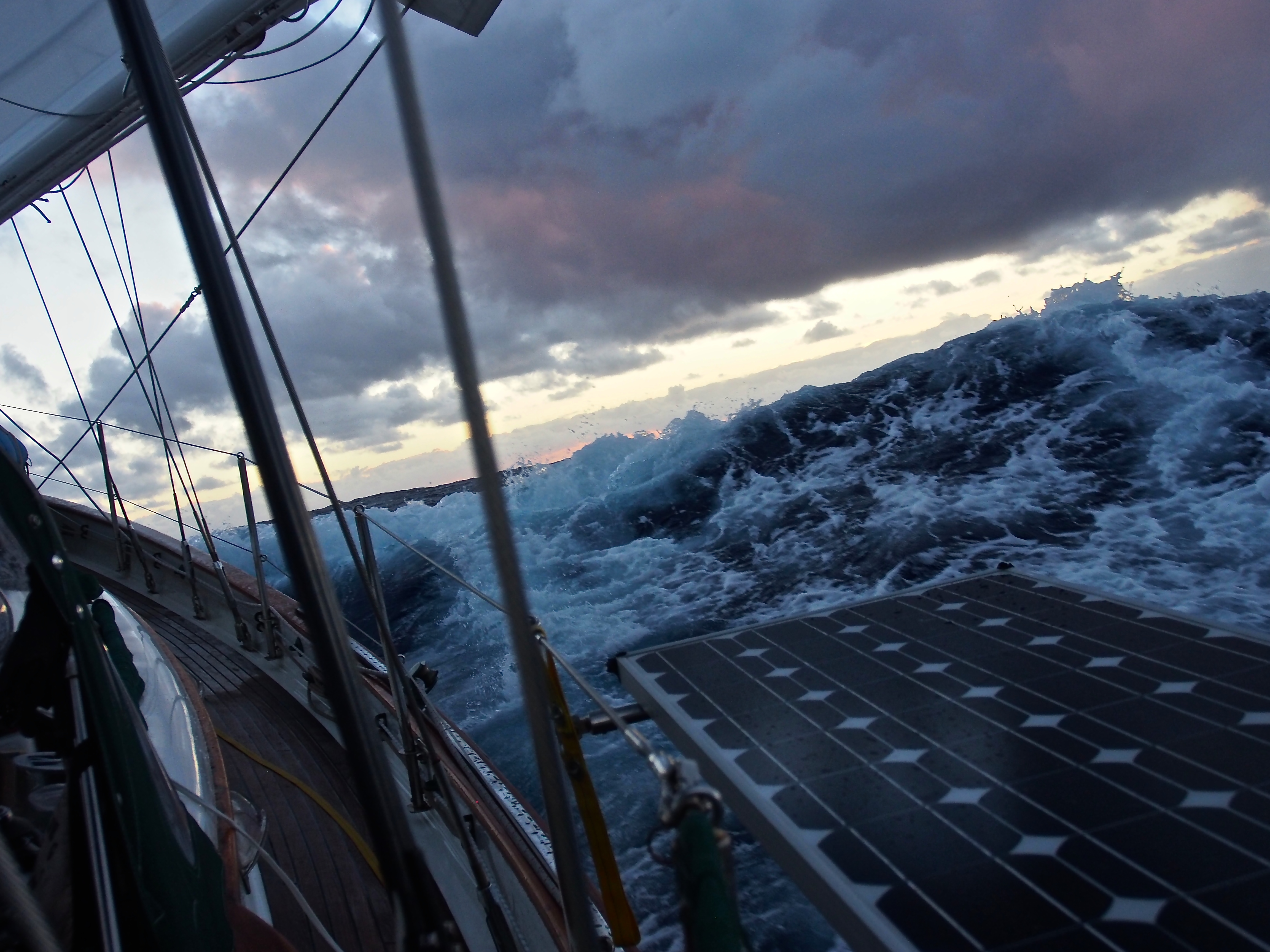
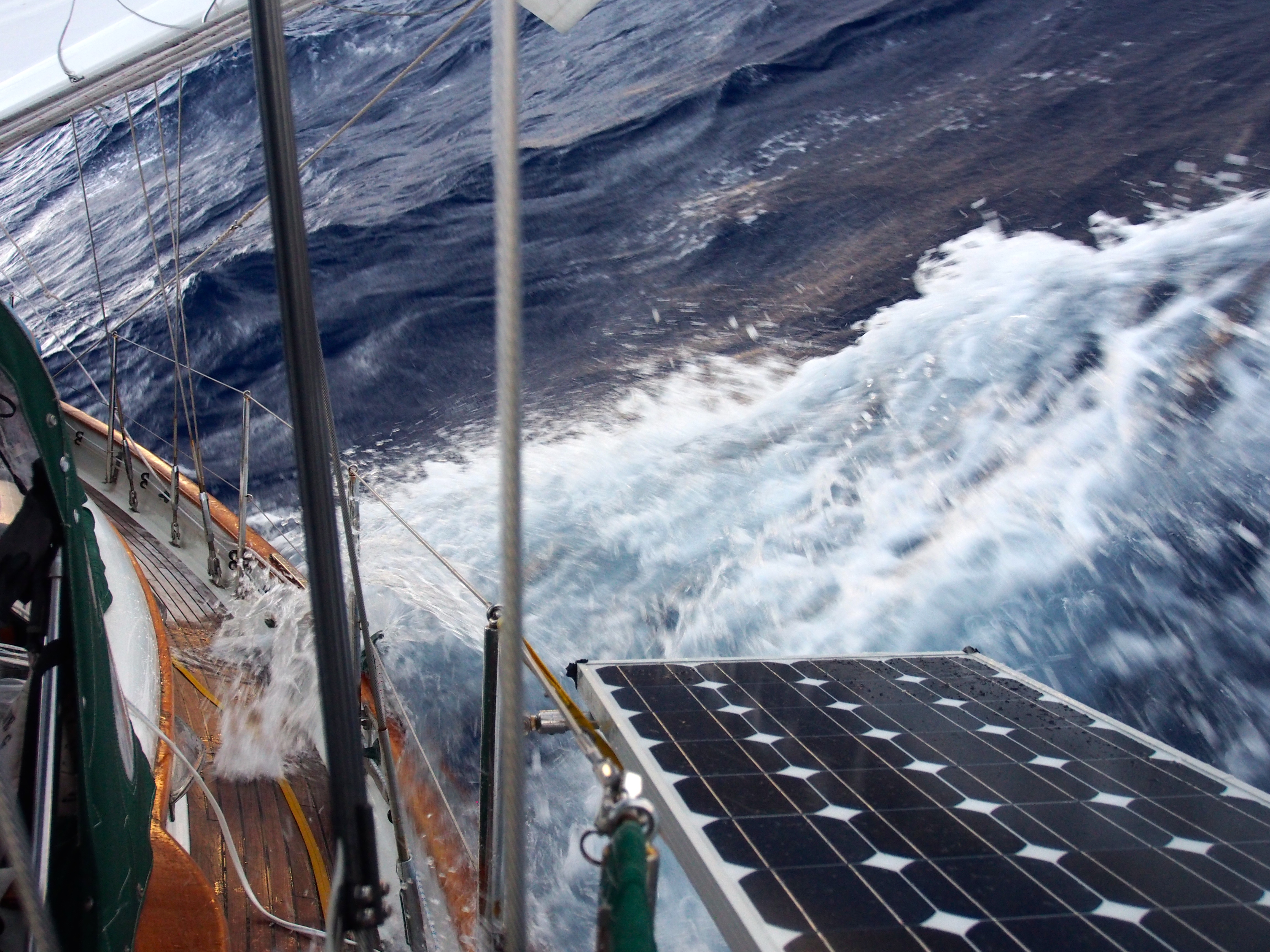
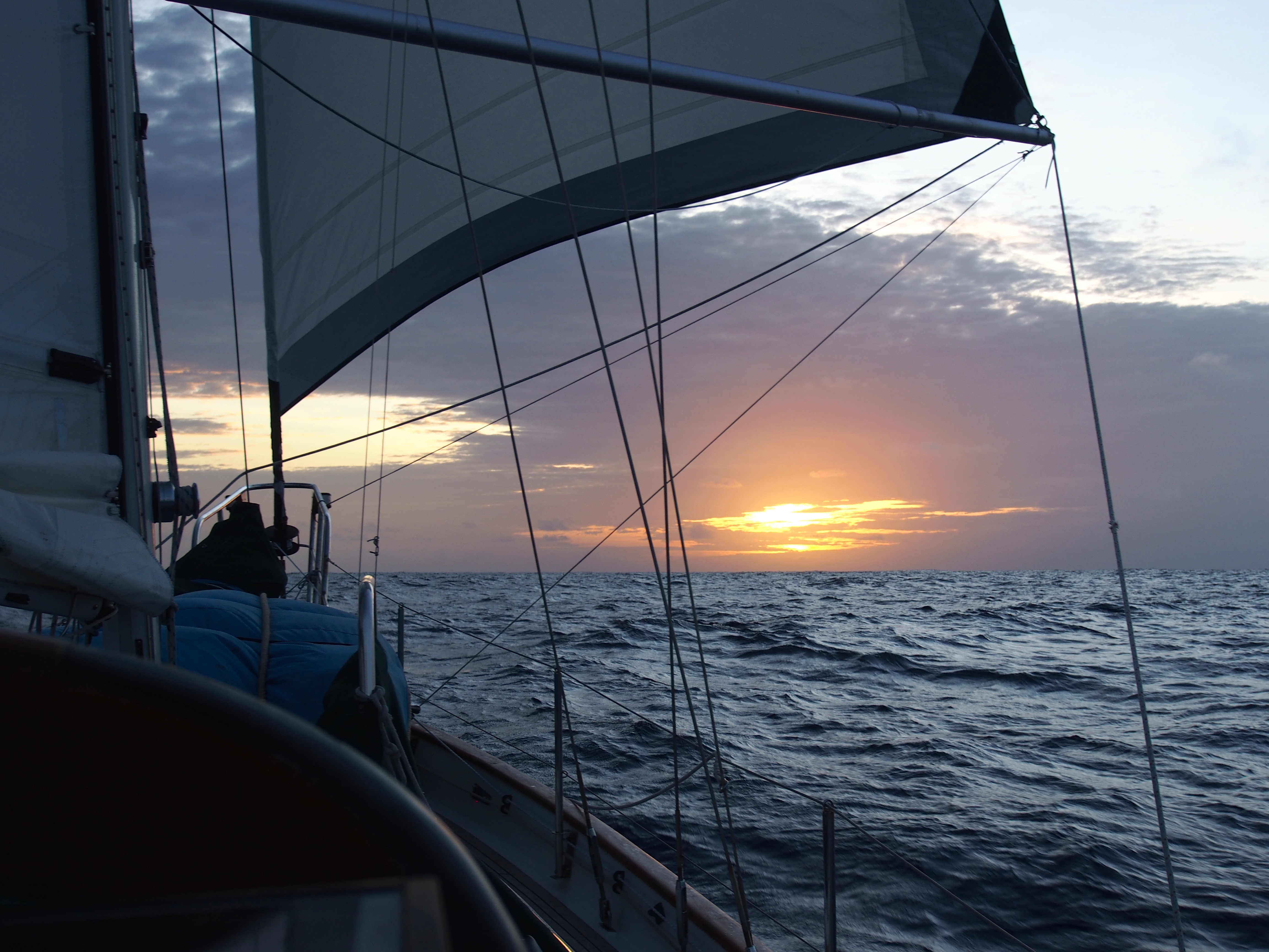
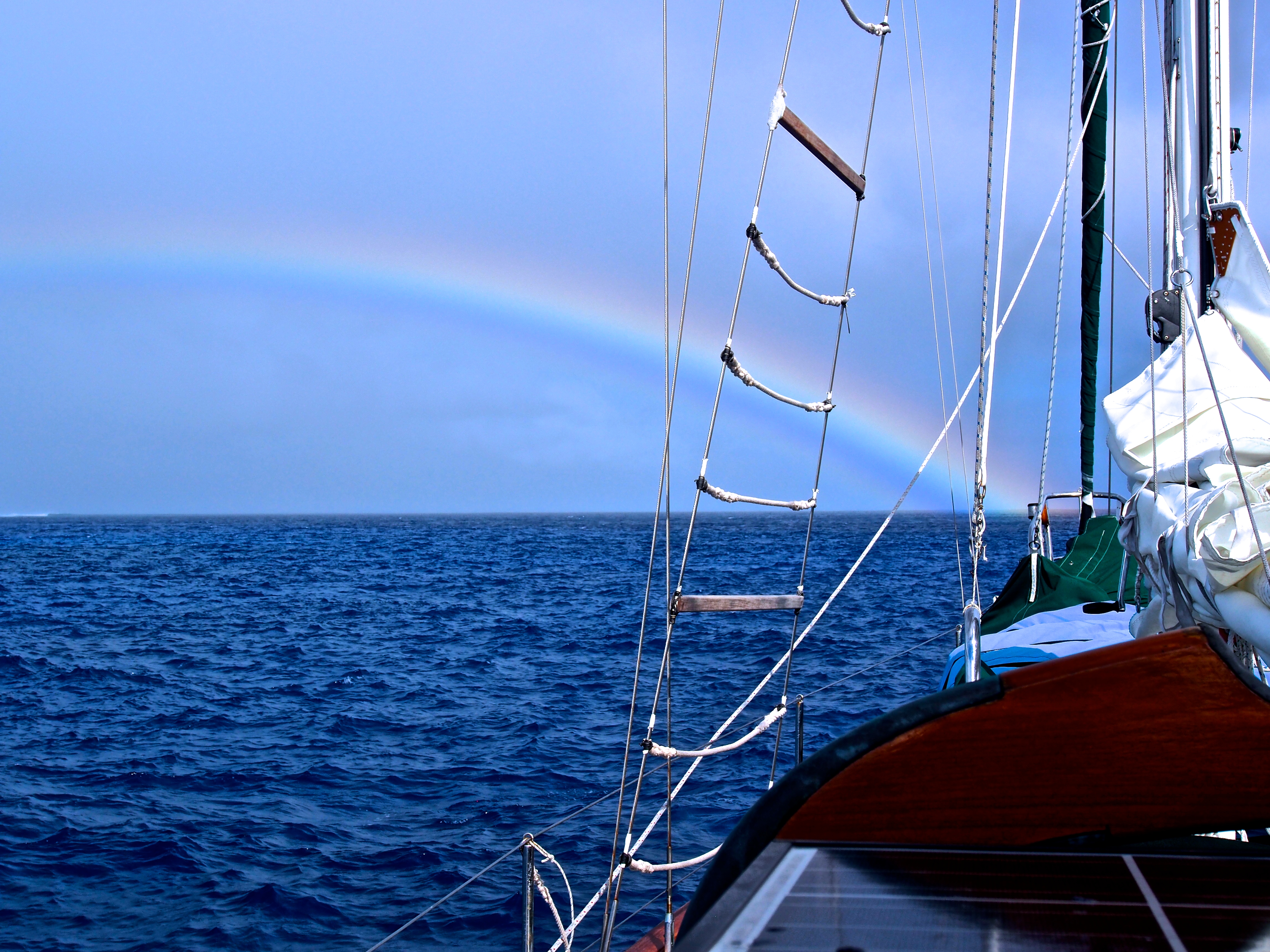
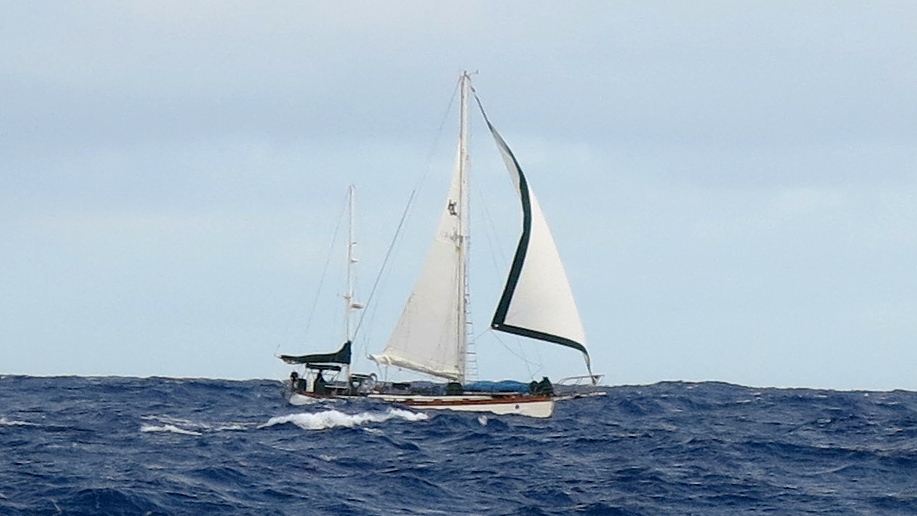
We sailed the entire way from Niue to the Vava’u group in the Kingdom of Tonga. It was a nice 2-day downwind sail with winds averaging 20 knots and seas a bit rought at 10 feet. We were within visual sight of SV Brahminy and within AIS signal of SV Panthera the entire way, and we kept in contact with both on the VHF radio. During the 2-day sail, we experienced a few squalls accompanied by some amazing rainbows. We also spotted a humpback whale a few boat lengths in front of us prompting us to change course. It next surfaced behind us and performed a beautiful show of several breaches. The seas were still rough as we rounded the Vava’u group from the north. We motored the last few miles to the village of Neiafu, the check-in point for the Vava’u group. It was still gusting to 20 knots making the customs wharf too difficult to use, so we anchored alongside and dinghy’d in to meet customs, health, and agriculture officials for clearing into Tonga.
An Approaching Squall at SeaRough SeasTaking on water over starboard gunnelCalm evening sunset after the squall passedRainbow at SeaSV Apropos taken from SV Brahminy
The Vava’u group is 1 of 3 groups of islands that make up the Kingdom of Tonga. It consists of dozens of islands spread out over an area of 250 square miles. There are 42 anchorages with names that are so hard to pronounce that they simplified it by numbering them 1-42. The main town of Neiafu is the center of activity and where most cruisers initially go. There are restaurants, a nice market, churches, bakeries, grocery stores, banks, etc. The other islands are either uninhabited or have very small villages. We used Neiafu as our home base and made several excursions to other anchorages throughout the group.
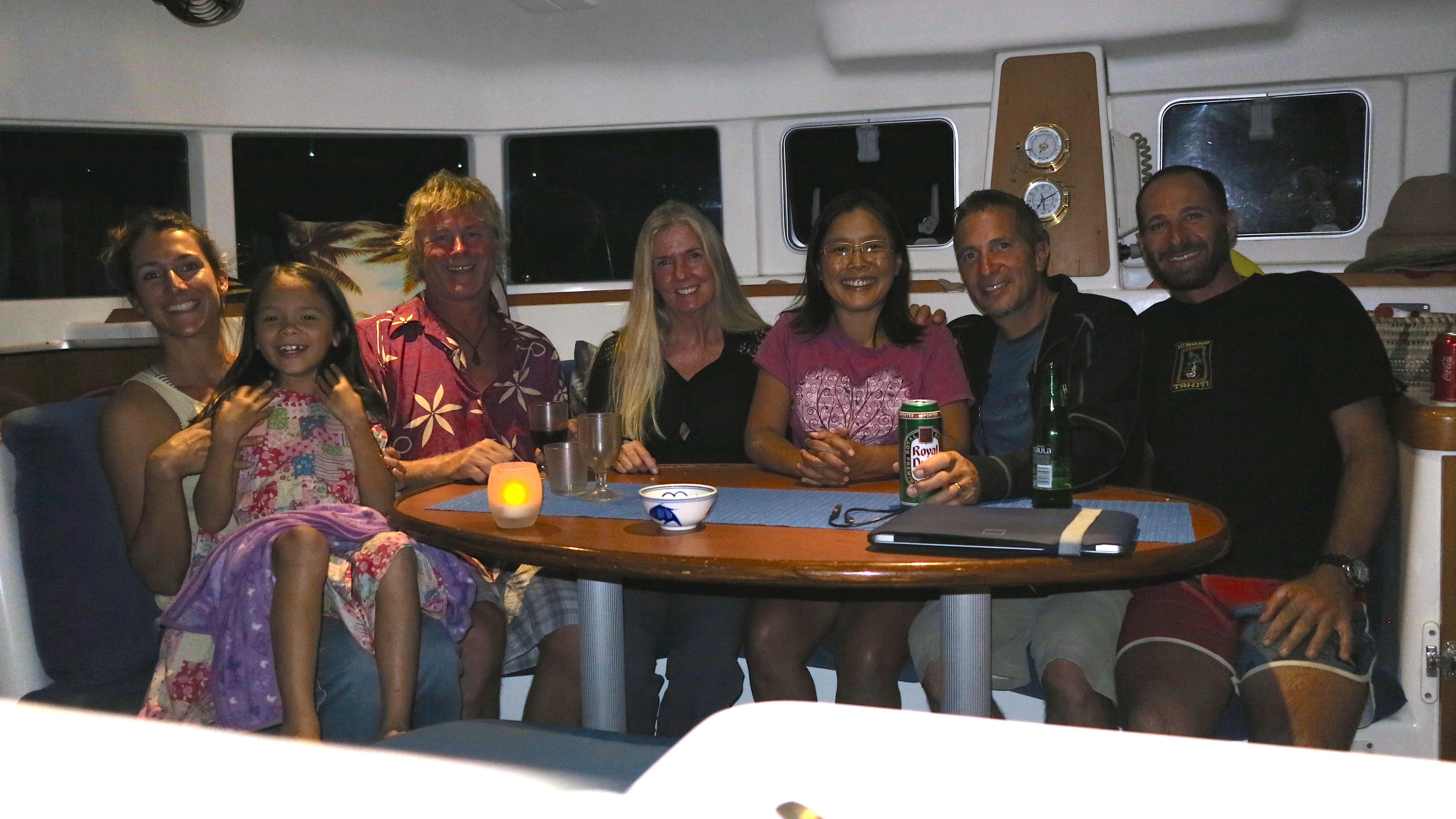
One of the best things about cruising is getting together with other boaters. We had a fantastic dinner aboard SV Brahminy with Dan & Sara who caught a nice Yellowfin tuna coming into Tonga. Richard & Geri from SV Panthera also joined us, then we all went to our boat for dessert—a peach crumble that Karen had made. Jacintha finally got to use the maps she had drawn of Apropos months ago, handing them out to everyone while giving them a tour of our boat.
Dinner on SV Brahminy
Tonga is an amazing cruising ground. Sort of like the San Juan and Gulf Islands in the Pacific Northwest, but with palm trees and warm water. Here are some highlights of our stay in Tonga:
Kava and Ukulele
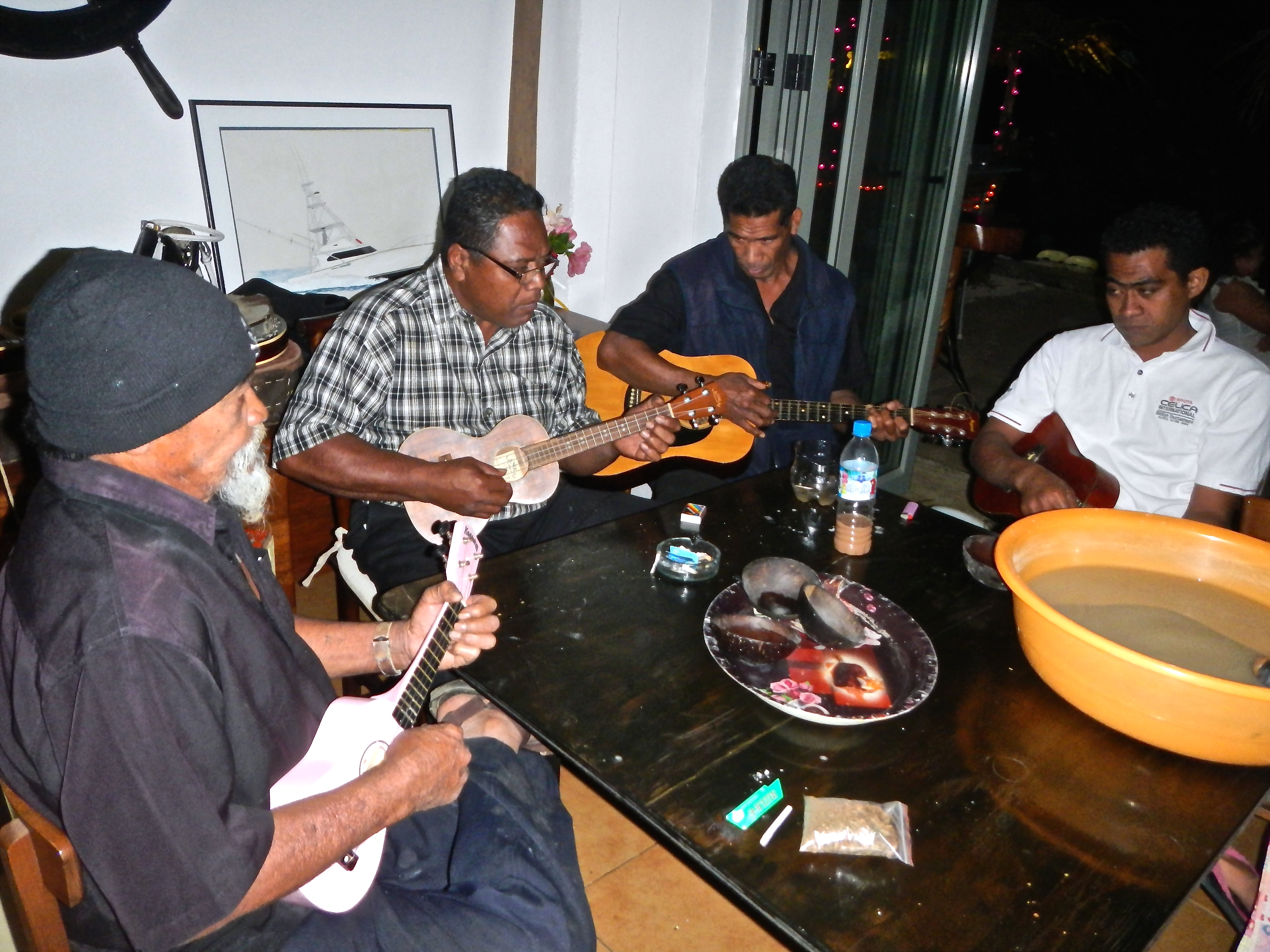
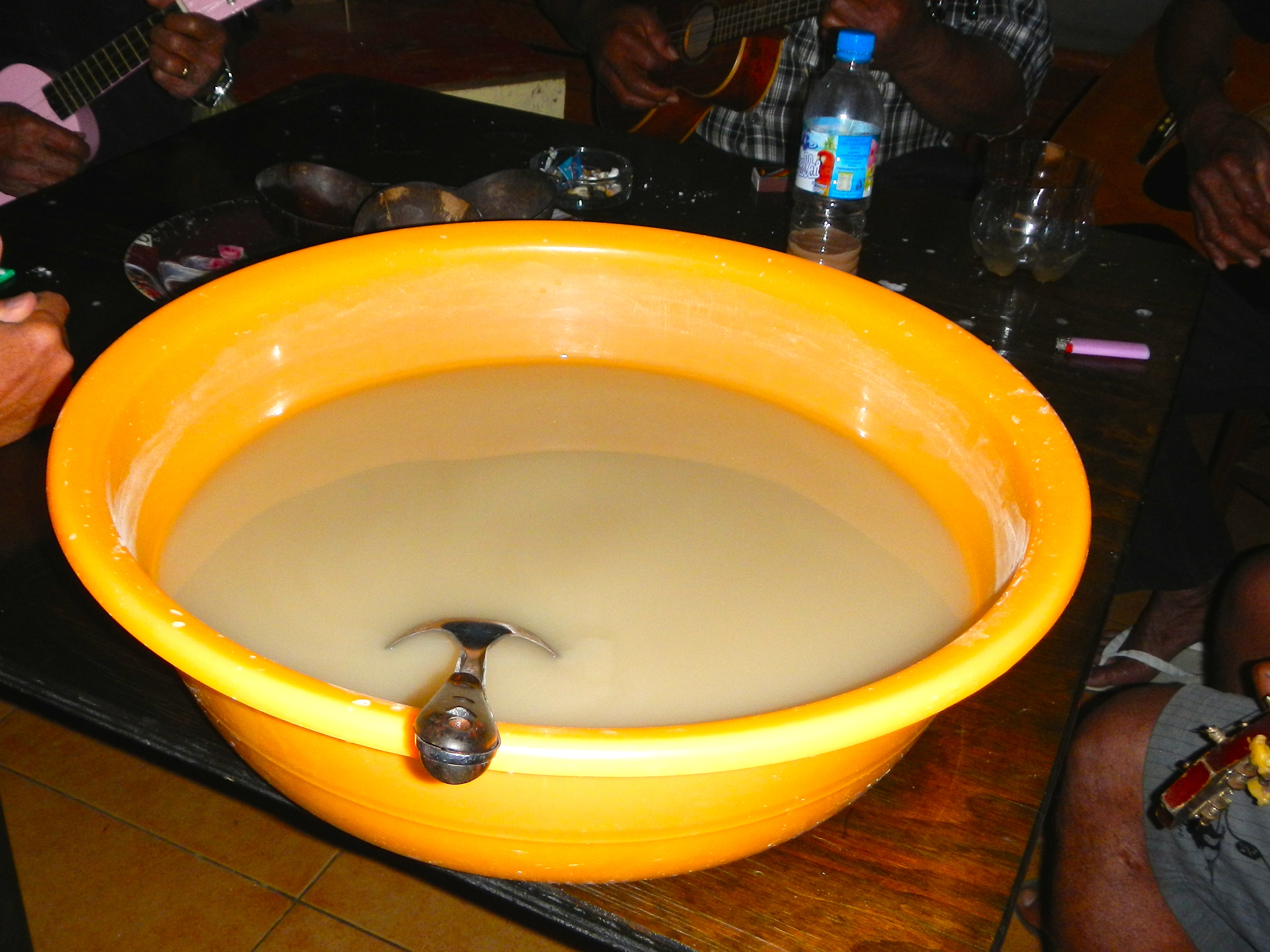
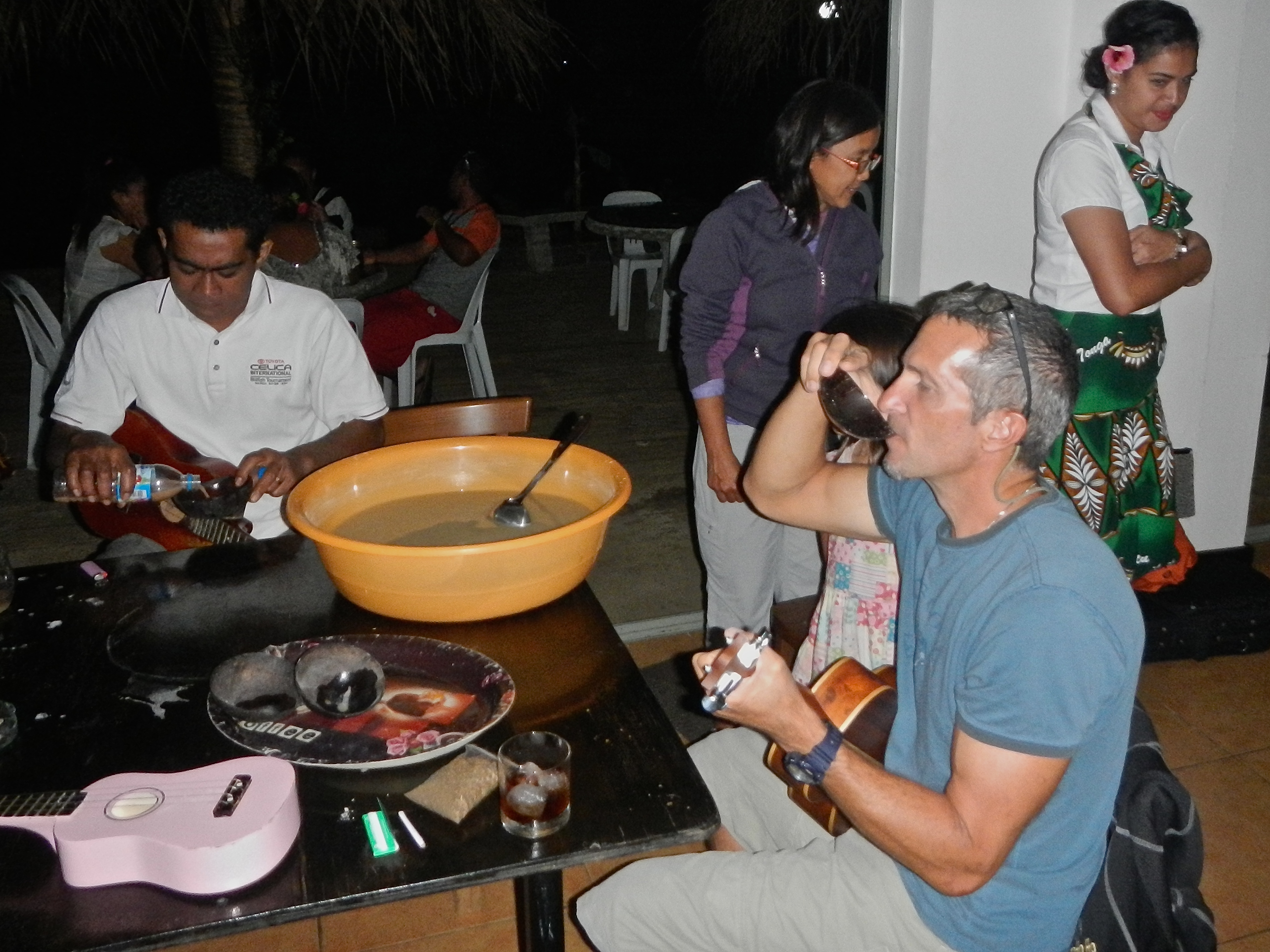
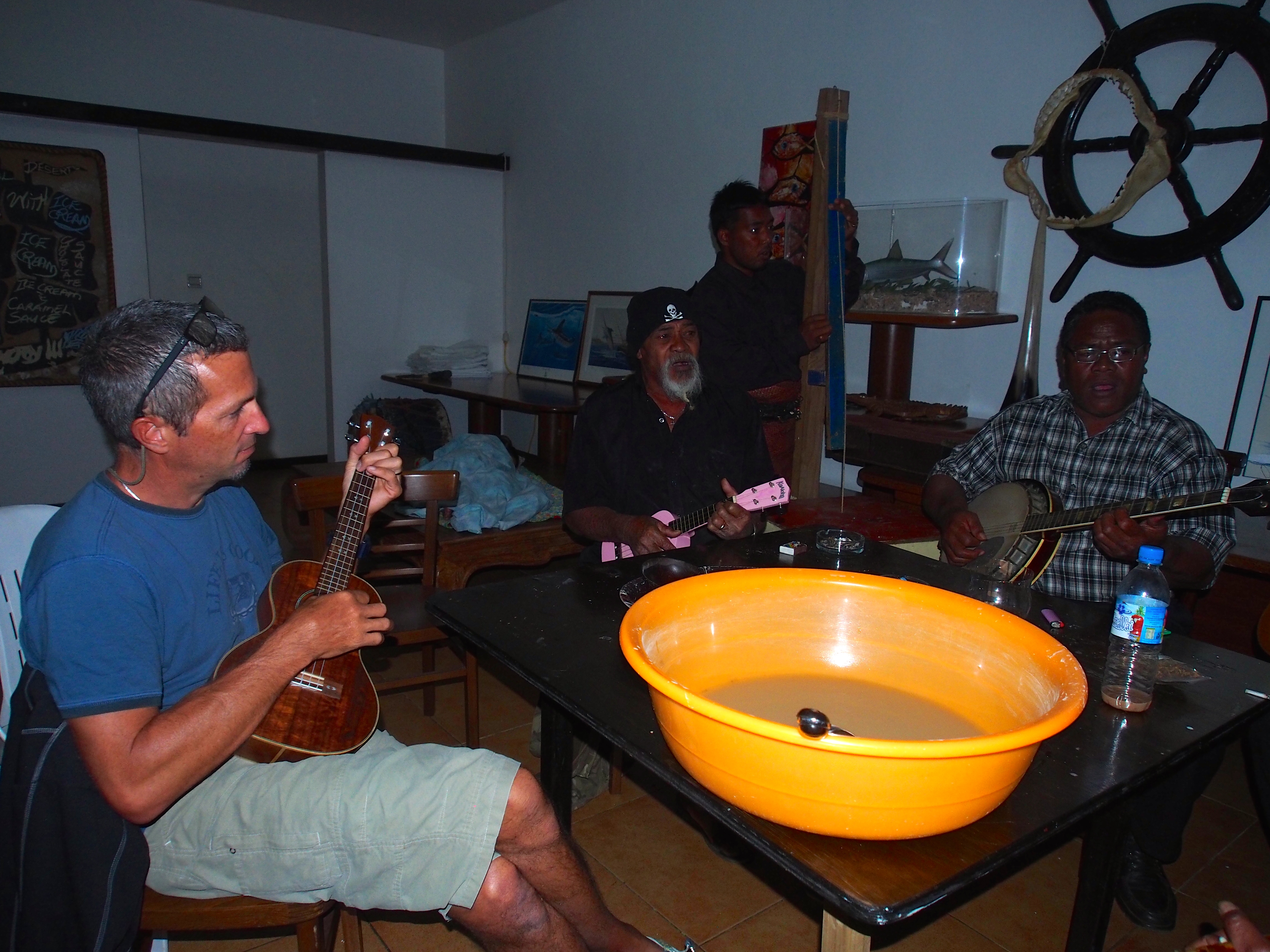
One evening we took the dinghy to shore where we knew there was going to be a band called The Strings playing guitars and ukuleles. I brought my ukulele along and soon was sitting around a table playing Tongan music and drinking kava. Kava is a Tongan tradition enjoyed only by men and served by women. At the end of each song, wooden sipping bowls were filled from a huge yellow bowl of kava and passed around to each player. I’ve never drank kava before but heard about its tongue numbing, mellow/happy feeling effects. After about the 4th song, I was happy and numb! They sang and played traditional Tongan songs (mostly with 3 or 4 chords so I was able to strum along on my uke) until the kava was gone. I figured in the course of 2 hours I drank about a gallon of kava! Karen was the designated kava server, getting instructions from the guys to “stir it more” and “two scoops per bowl”. Jacintha fell asleep and the restaurant staff gave her a blanket and let her lie down on a table. After the last ounce of kava was drunk at around 11pm, we dinghy’d back to our boat where I slept great—and felt fine the next morning!
The Strings BandKava BowlKaren Serving the KavaAfter every song….The Strings band (plus 1)
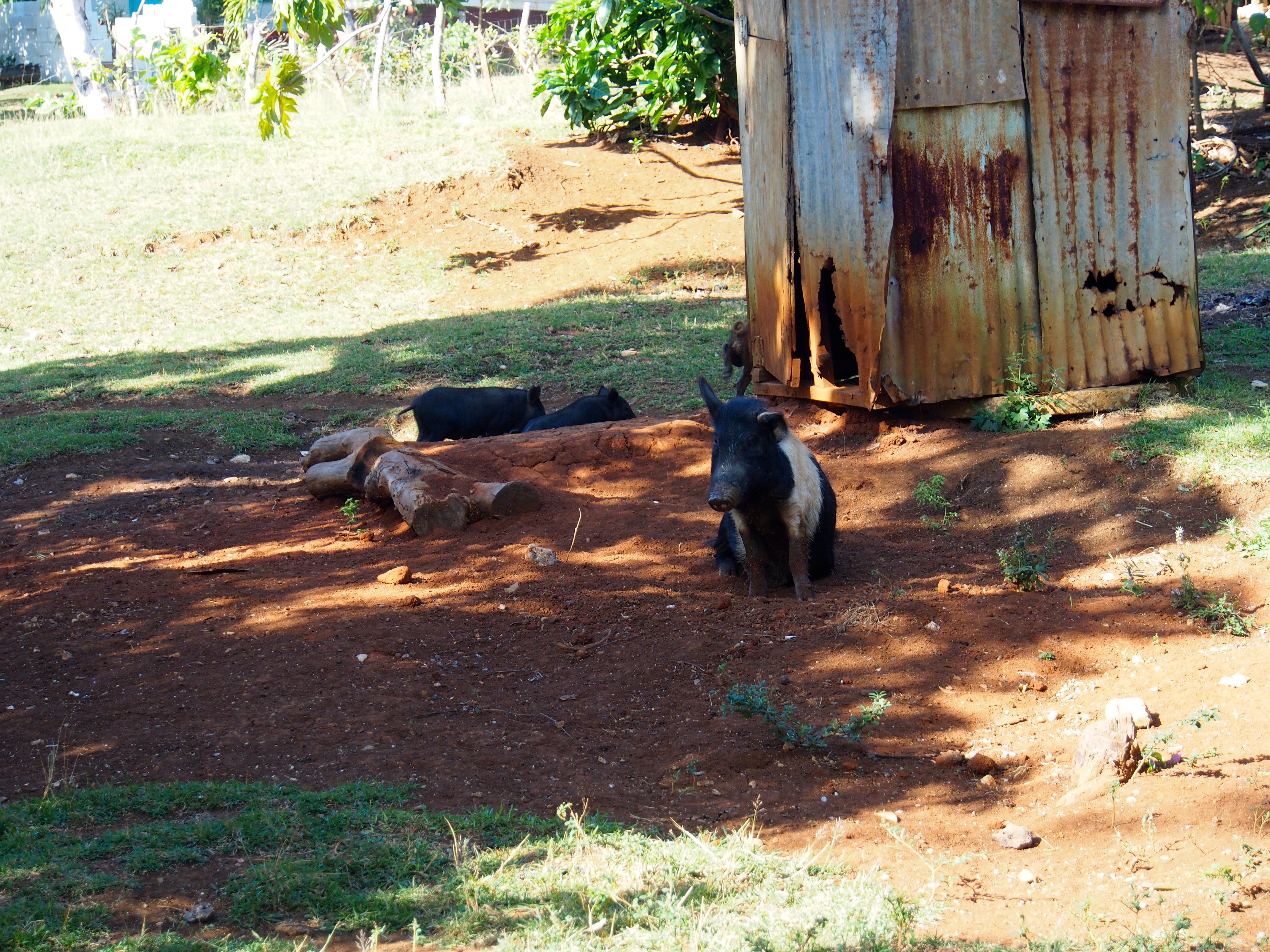
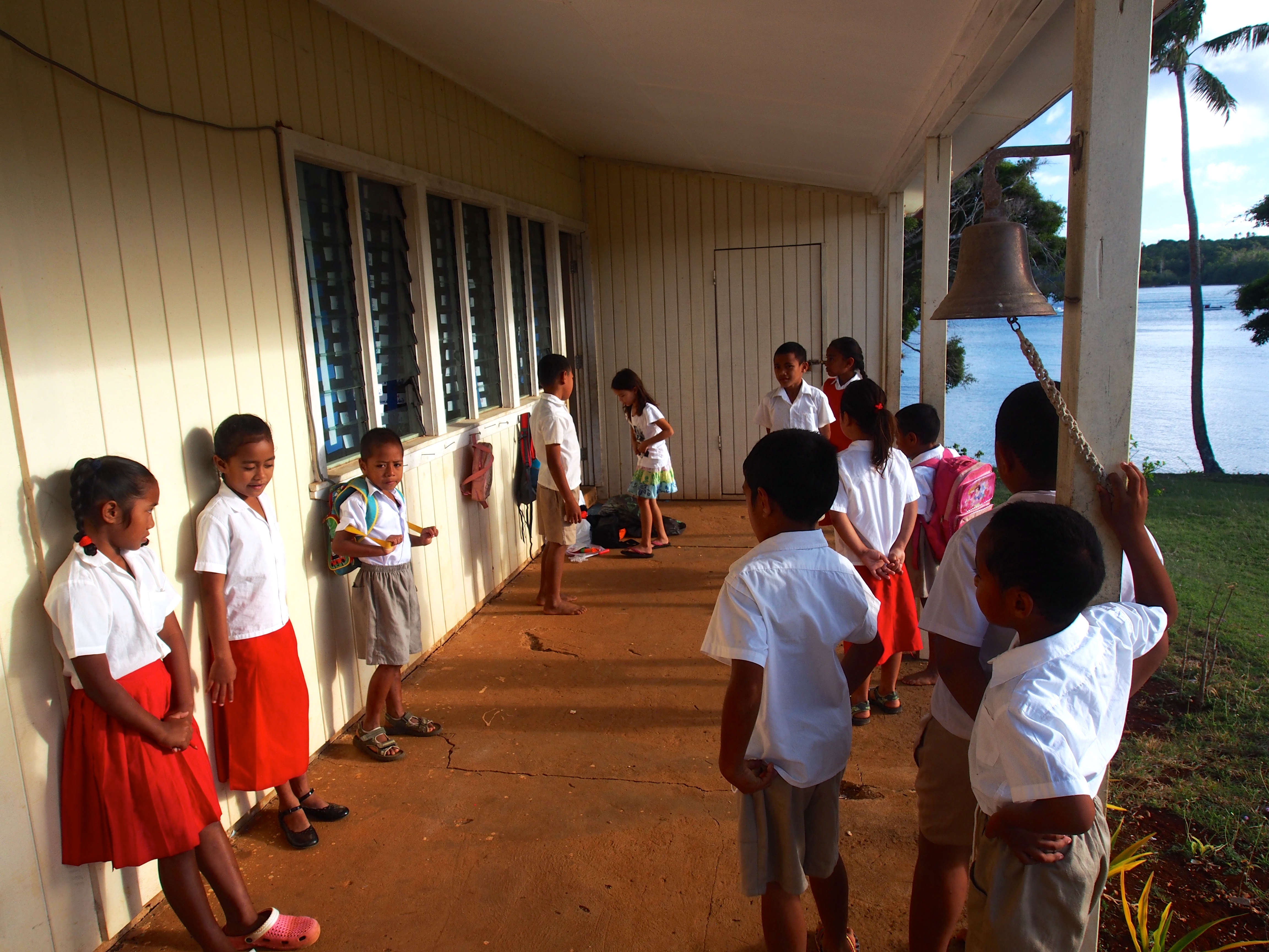
Matamaka
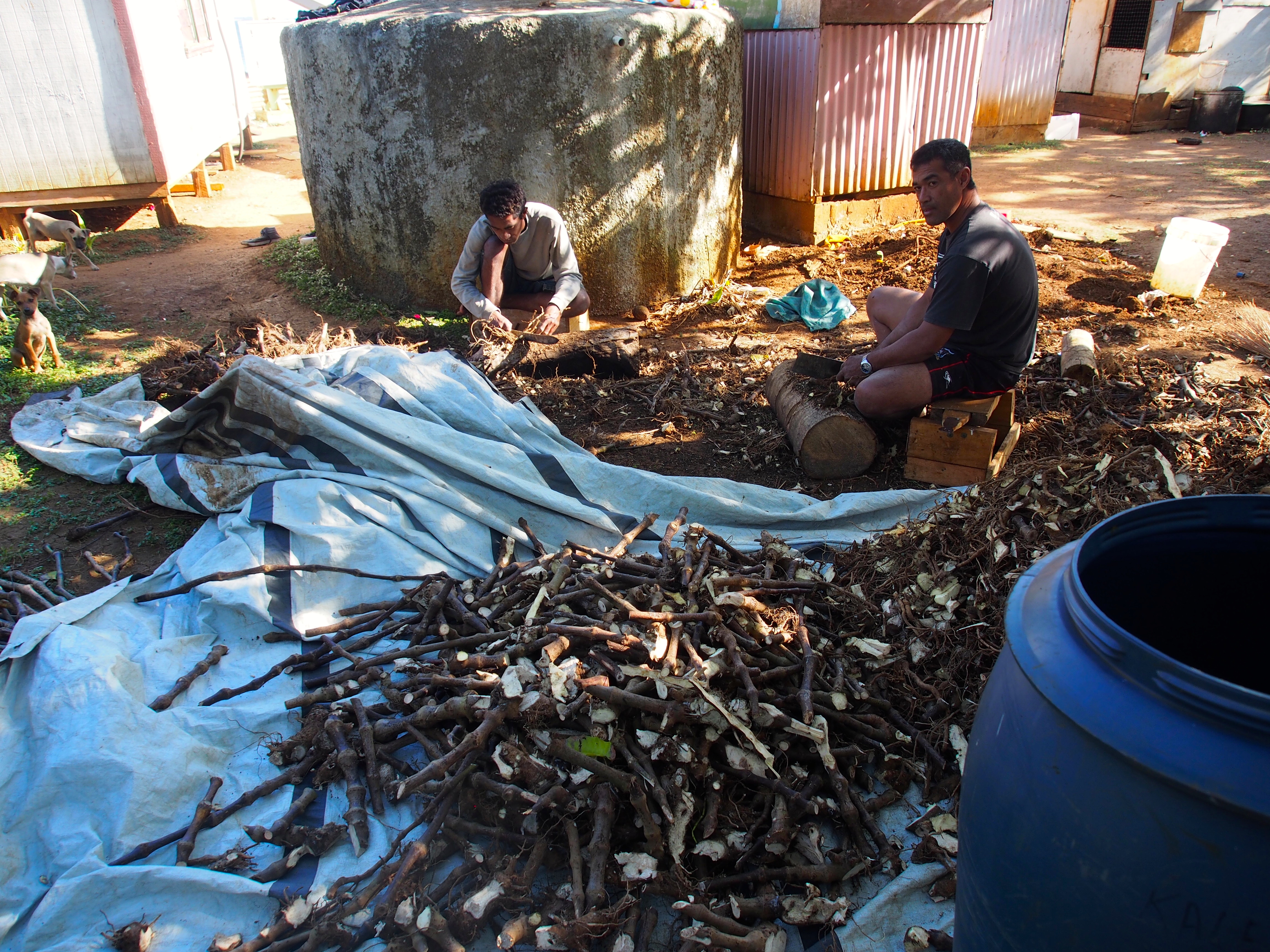
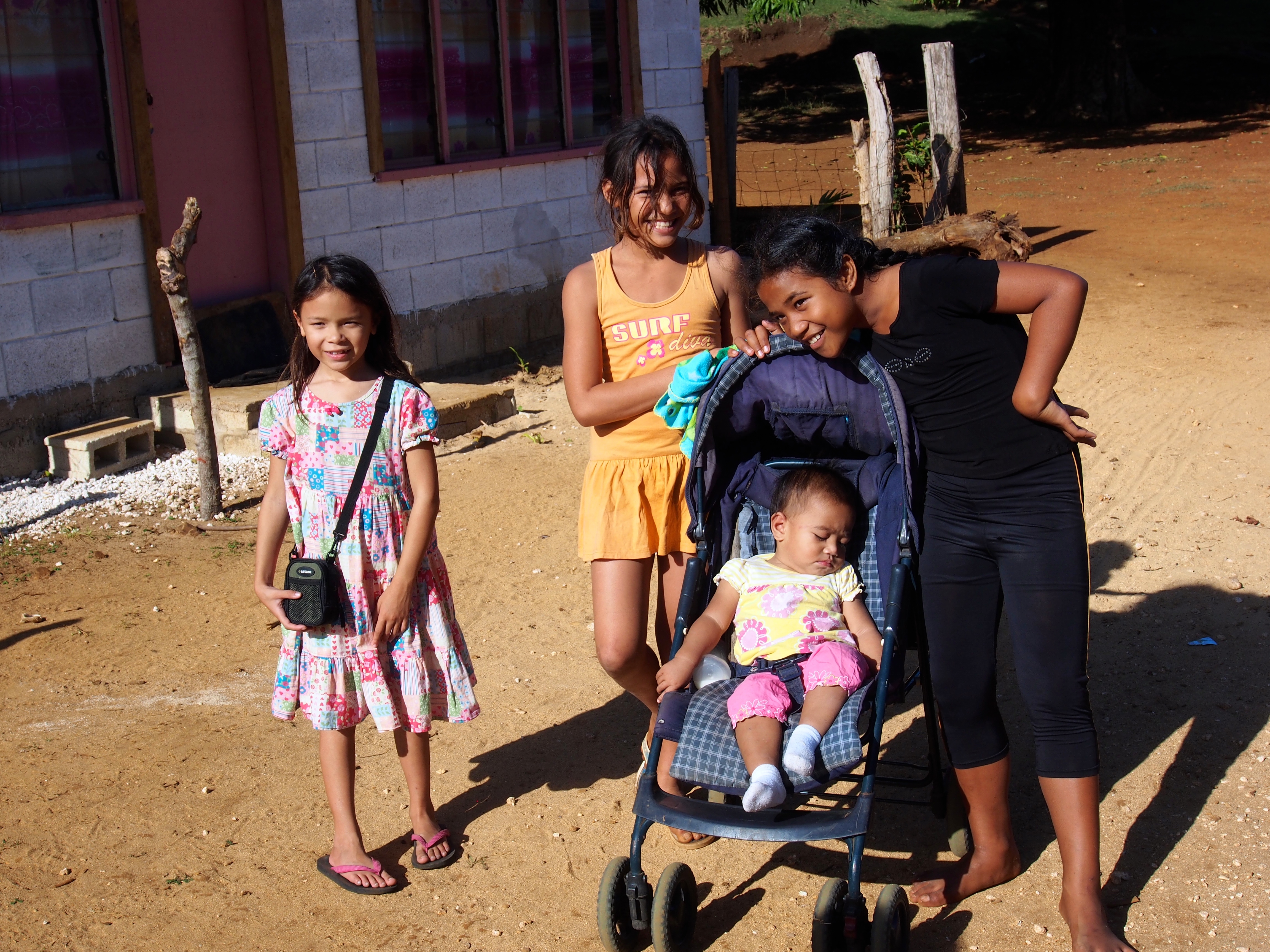
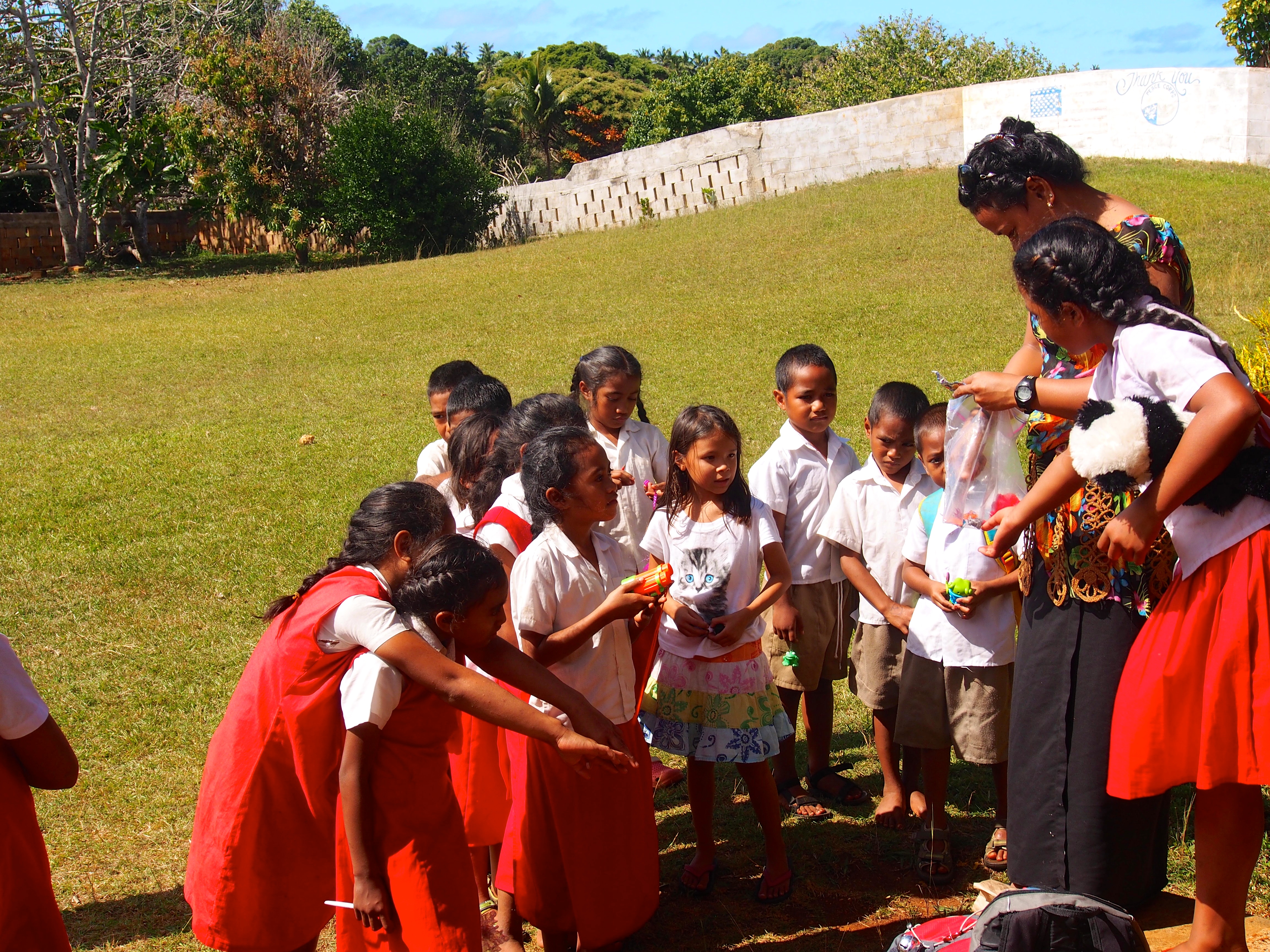
The tiny village of Matamaka (anchorage #15) is a 2 hour sail from Neiafu. We went there after reading about their small elementary school that welcomes cruising kids to join them for a day of school. After tying to a mooring buoy, we walked to the 2-classroom school to meet the teacher and ask if Jacintha could attend the following day. There were 2 classrooms, one for 8-9-10 year olds, and one for 5-6-7 year olds. The principal introduced us to both classes and welcomed Jacintha to join them the following day starting at 8:30am. We then walked around the village of a dozen or so homes, most with gardens and fenced-in areas for pigs. We stopped to talk to 2 men who were chopping up kava root. One of the girls we met earlier in the older classroom gave Jacintha a book and a small plastic toy. She was very sweet and declined our offer to bring her a book the following day. Back at the boat, Jacintha was very excited to be going to school the next day and even went to bed early but couldn’t sleep!
Local’s boats for going to townHouse on MatamakaMen chopping up kava rootPigsGirls in Village of Matamaka
A Day at School
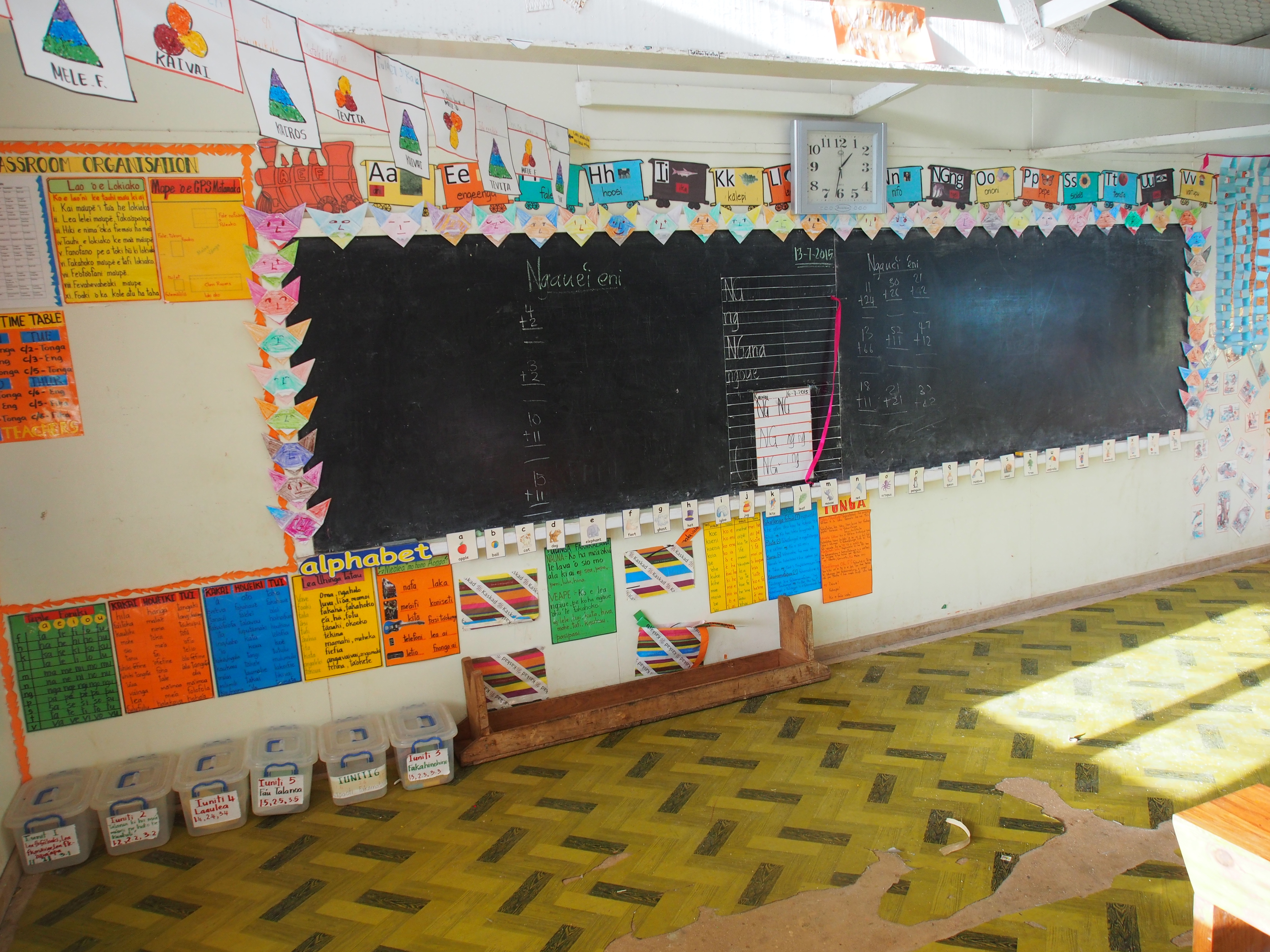
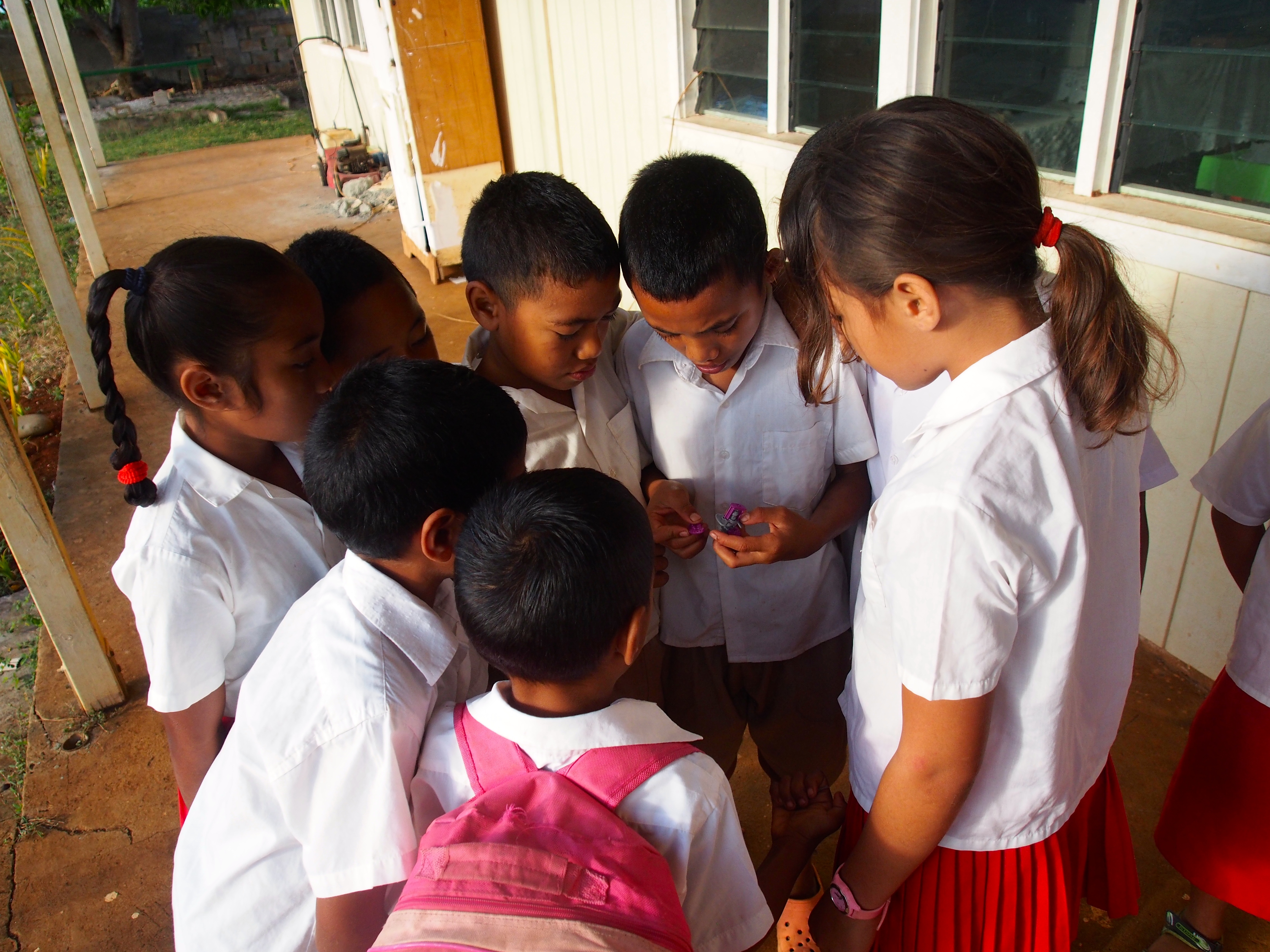
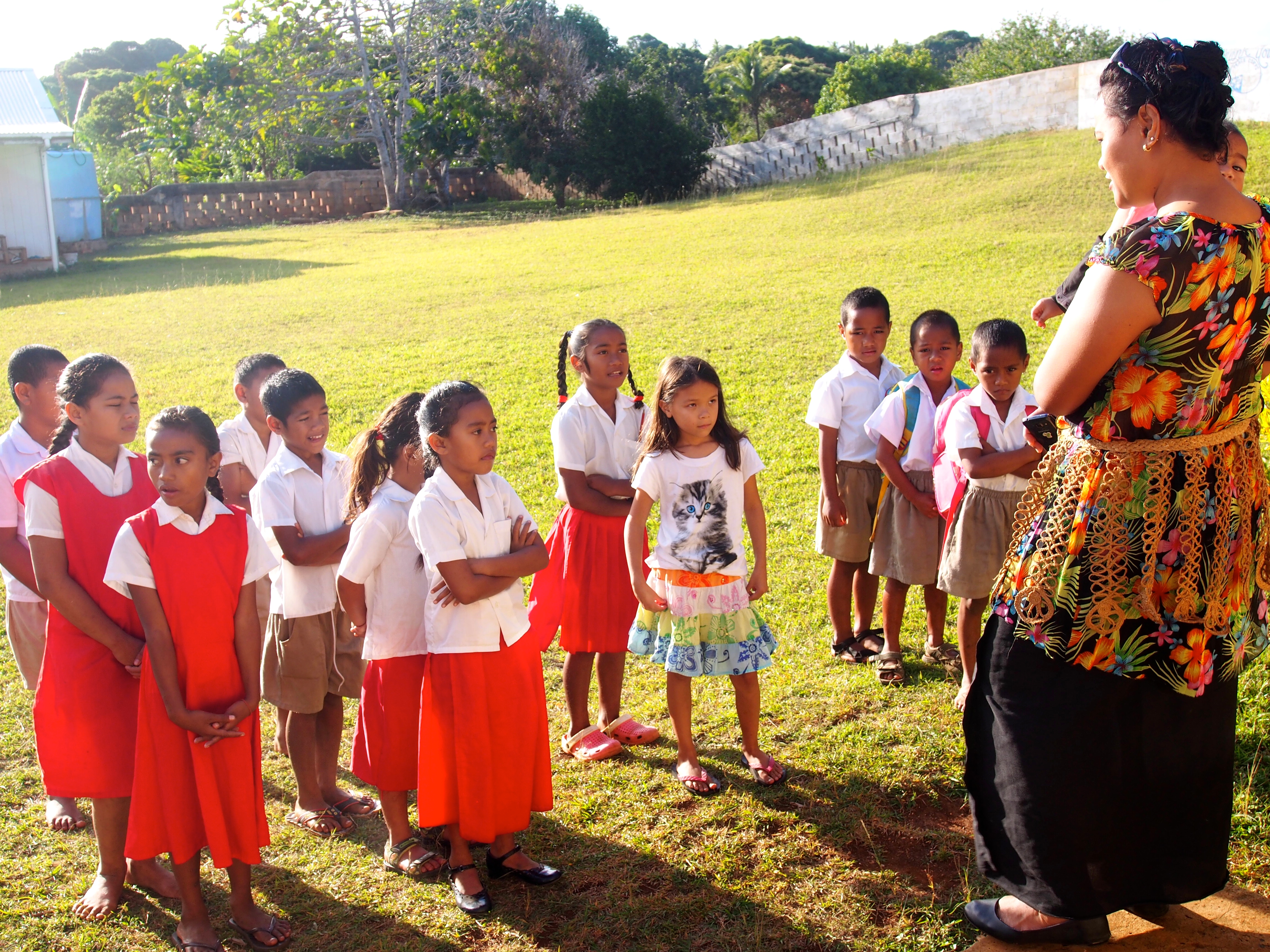
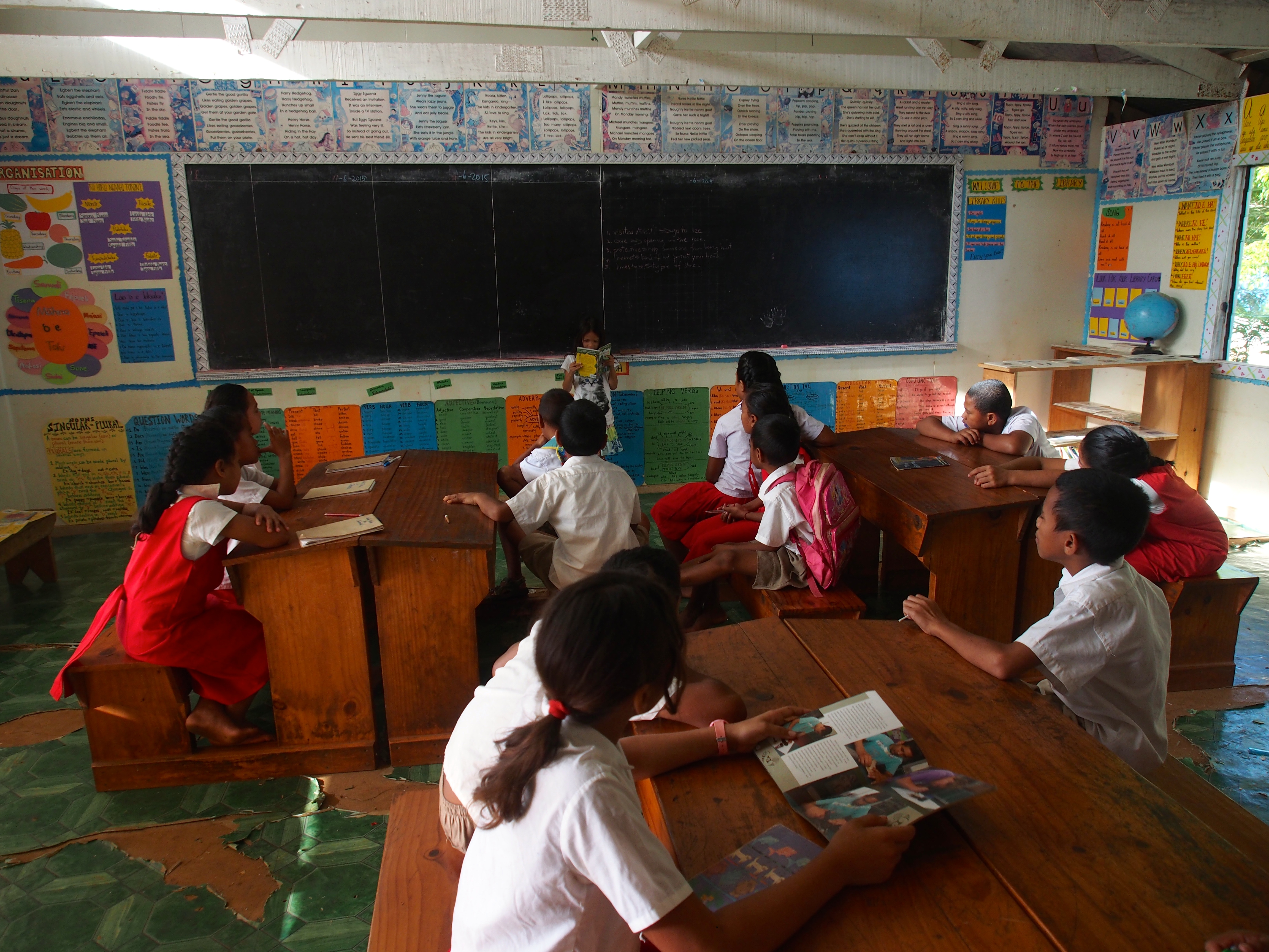
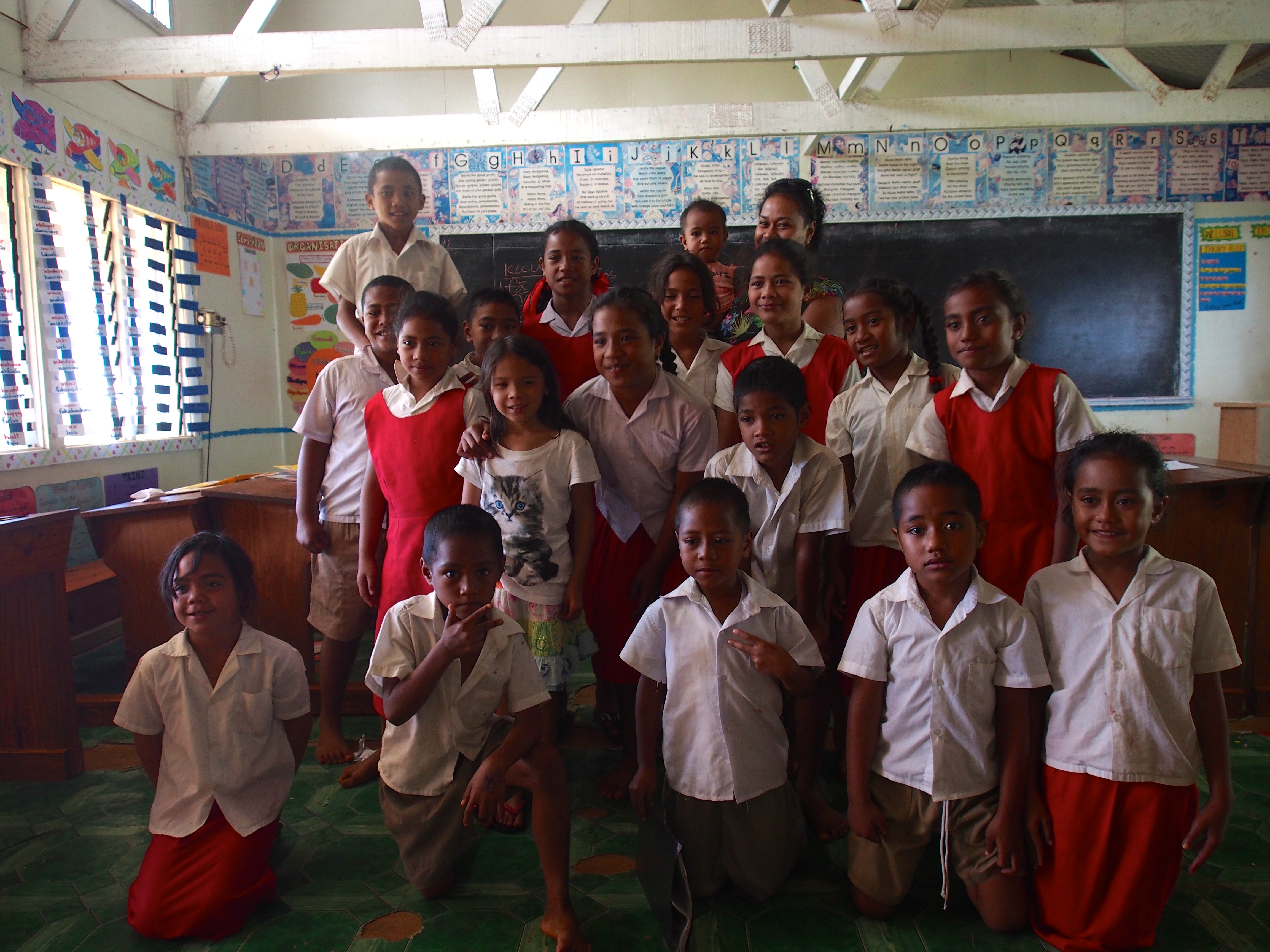
It was Karen’s birthday, so I made her tea and let her have a relaxing morning while I packed a lunch for Jacintha and took her to school. We tied the dinghy to the wharf at 8am and walked a short distance to the school, which sits atop a hill overlooking the bay. Along the way we passed the school principal who was waiting for a boat to take her to town for a meeting. So instead of 2 teachers and 2 classrooms, there would be only 1 teacher with 15 students in a single classroom. Jacintha and the Tongan students lined up outside the building for the morning prayer and announcements, spoken in Tongan. The teacher had her infant baby with her and after we entered the school, asked if I would be ok watching the class until 10am. I gladly accepted and began by asking the kids to introduce themselves and tell me their age. They were very shy at first but soon warmed up. They ranged in age from 6 to 11 years old (the older kids lived and attended school in Neiafu during the week, and returned to Matamaka on weekends). We did some math on the blackboard, with the younger kids doing simple addition and the older kids multiplication. I showed them where Seattle was on the globe and asked them how long they thought it took us to sail to Tonga, getting answers from 2 days to 2 weeks! I also asked them questions about Tonga and found the population of Matamaka was about 40 people. I asked them to sing their favorite song, which went “Good morning, good morning, how are you? I’m fine, I’m fine, and hope that you are too”. Next was reading and Jacintha volunteered to read a book in front of the classroom. Then they translated some English words such as “hello, house, boat, pig” to Tongan. Running out of things to do, I asked what game they wanted to play and they decided on hangman. When the teacher returned at 10am, I went back to the boat and left Jacintha with the class. When we returned at noon, the teacher thanked us for the donations of books and art supplies, and then had 3 of the older girls perform a short dance for us. She then announced the school day to be a half-day and asked the kids to line up outside beneath the bell where she distributed a bag full of toys Jacintha had brought for them. The kids were dismissed and we ate our lunch on a bench overlooking the bay. Afterwards we were joined by one of the boys in a game of stickball on the large lawn in front of the school.
Classroom for 5-7 year oldsCurious students figuring out Jacintha’s toyGathering outside before school beginsMorning announcements and prayersJacintha reading to the classClass photoTeacher handing out Jacintha’s toysA game of stickball in front of the school
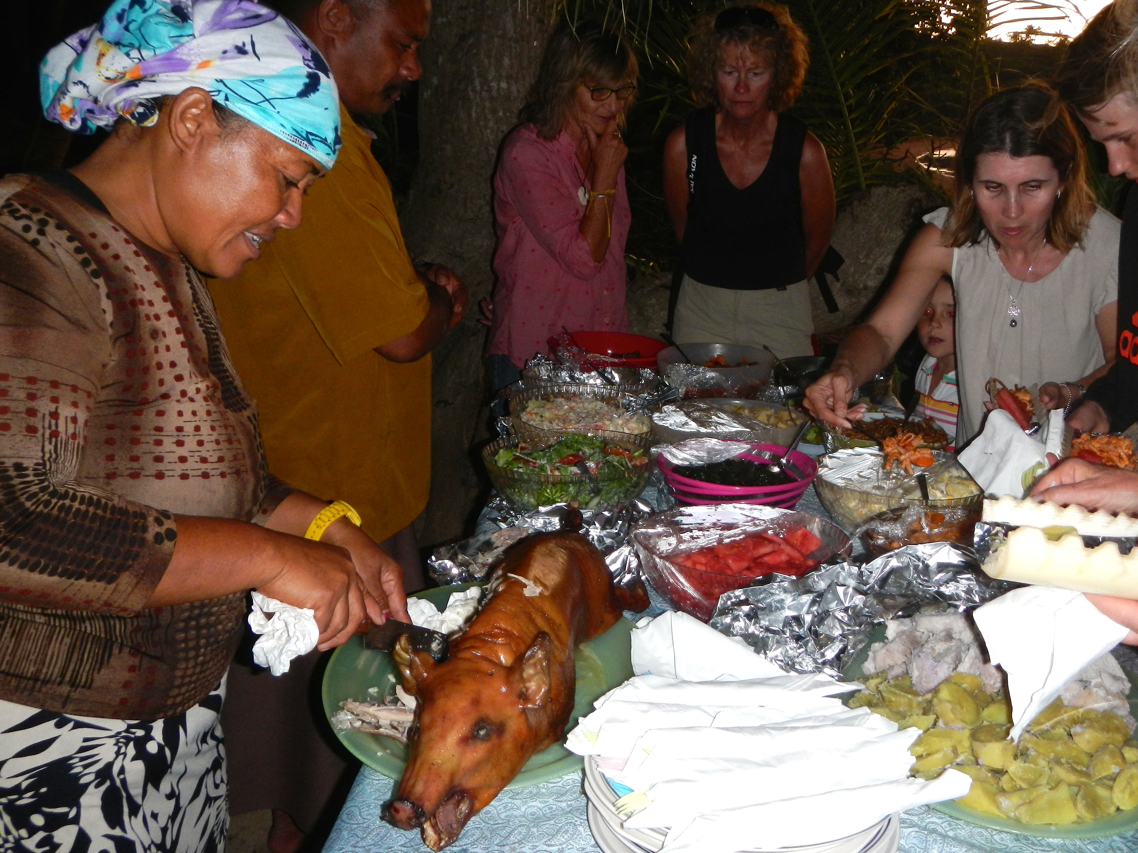
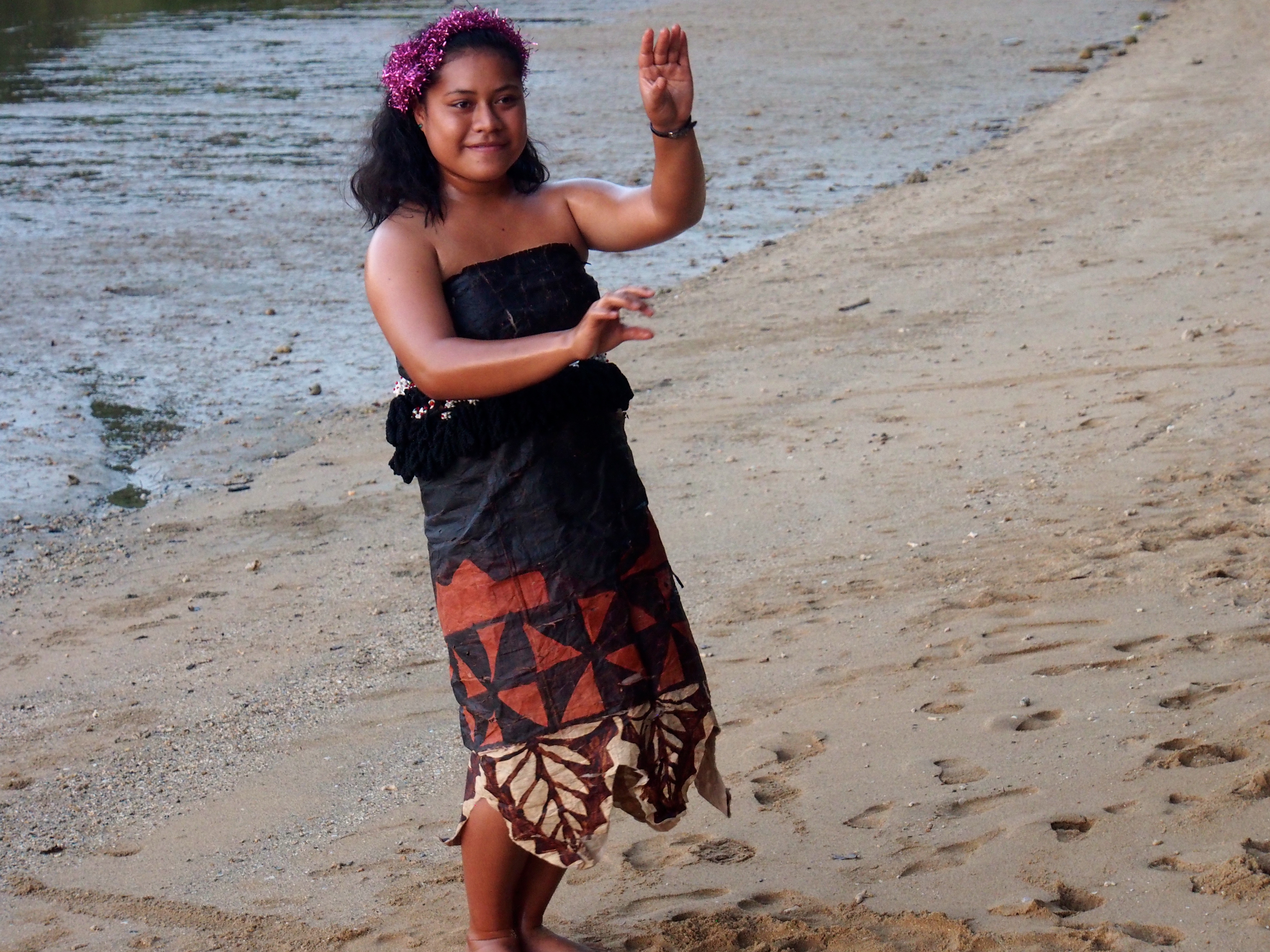
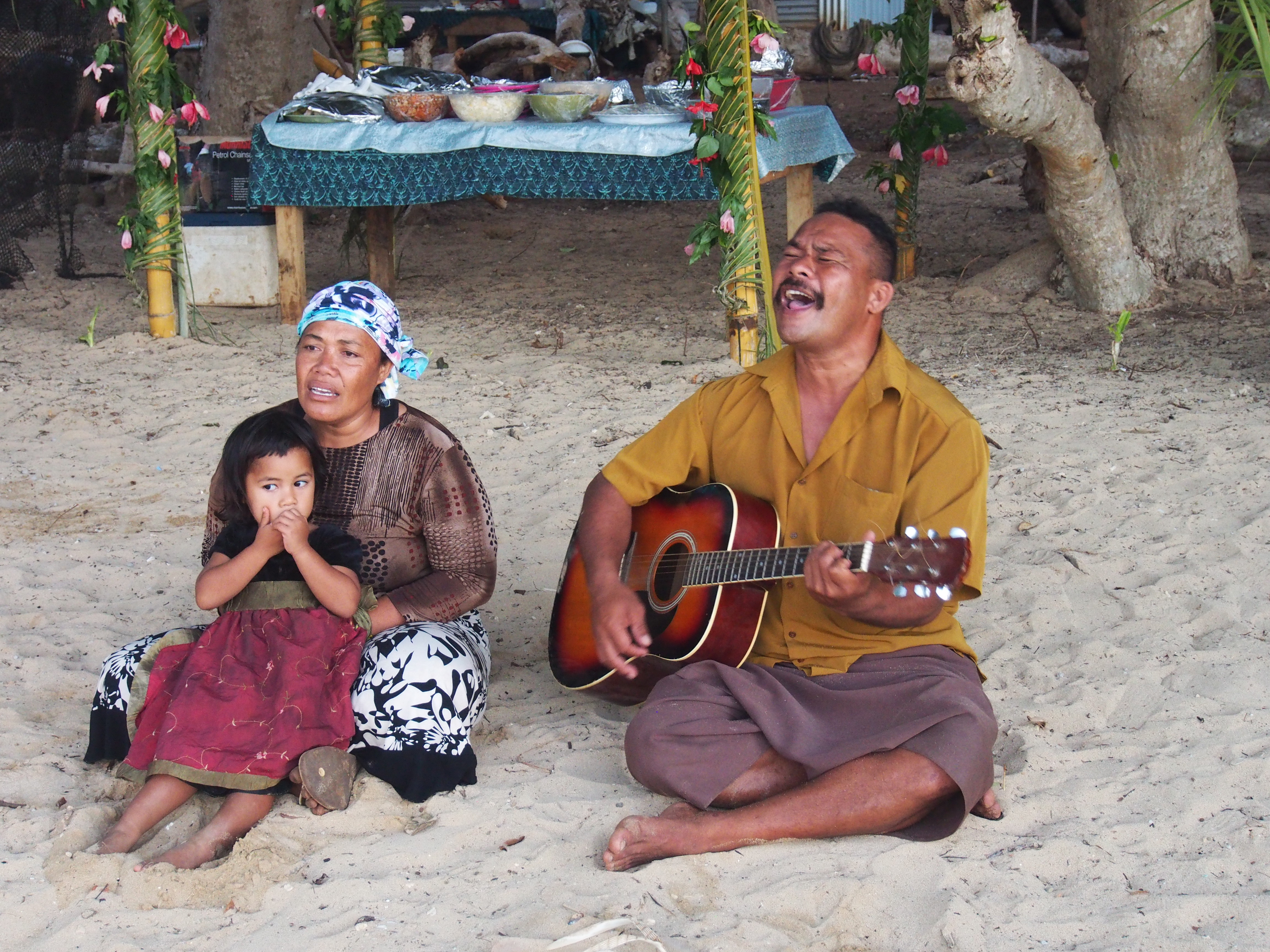
Tongan Feast
We joined 5 other boats at anchorage #16 (Vaka’Eitu) for a Tongan Feast. A wonderful Tongan family provides the entertainment and food along the beach in front of their house. They cooked a suckling pig on a spit, sweet and sour fish, teriyaki chicken, yams, crab salad, taro leaves, fruit, and more. The hosts, who have 11 children, also provided some entertainment with singing, dancing and guitar playing. Jacintha had fun playing with other boat kids while we ate and talked to other cruisers. It was a beautiful night with a new moon, brilliant stars, and hardly any wind.
Feast!Children from the family who put on the feastDancing by an older daughterYoungest daughterHosts singing and playing guitar
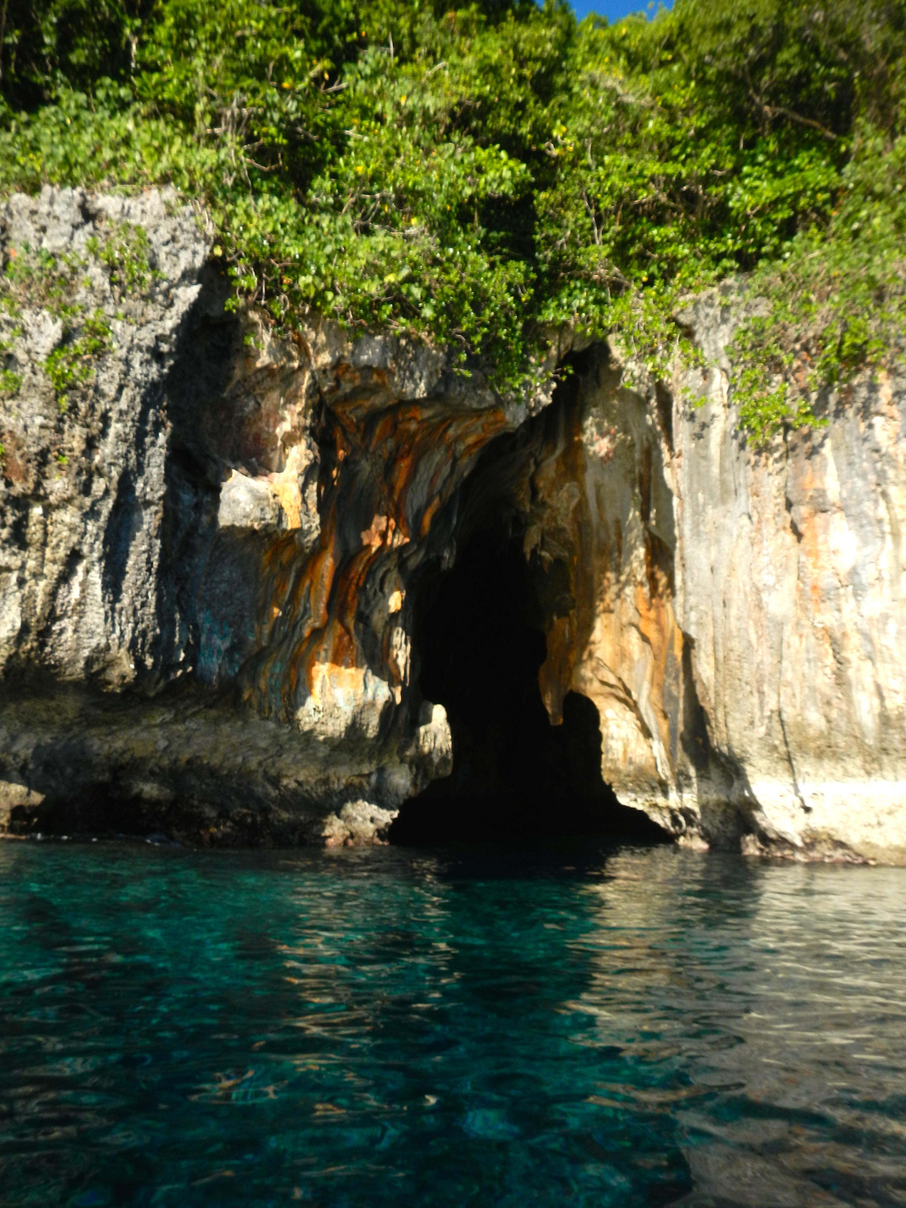
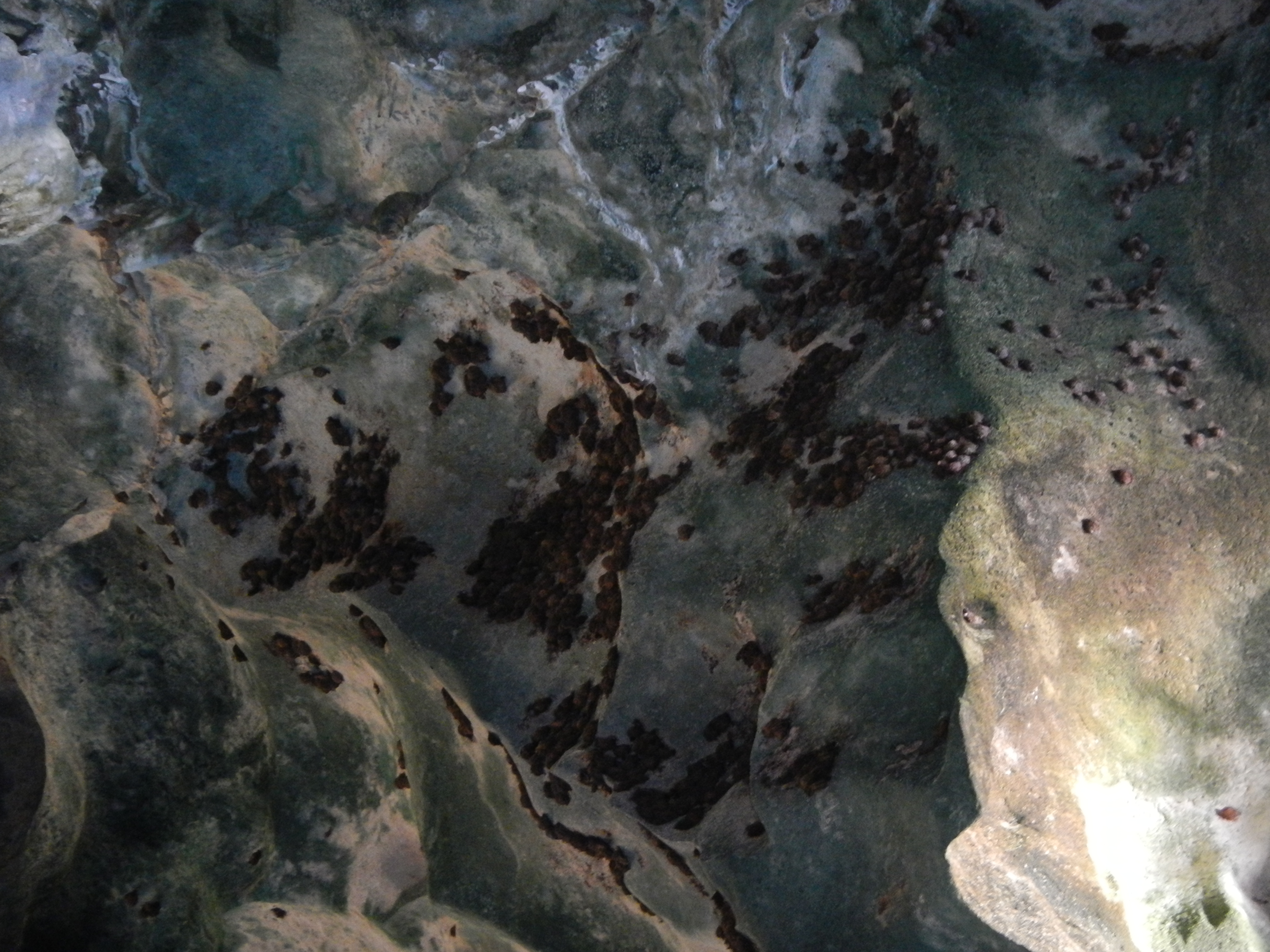
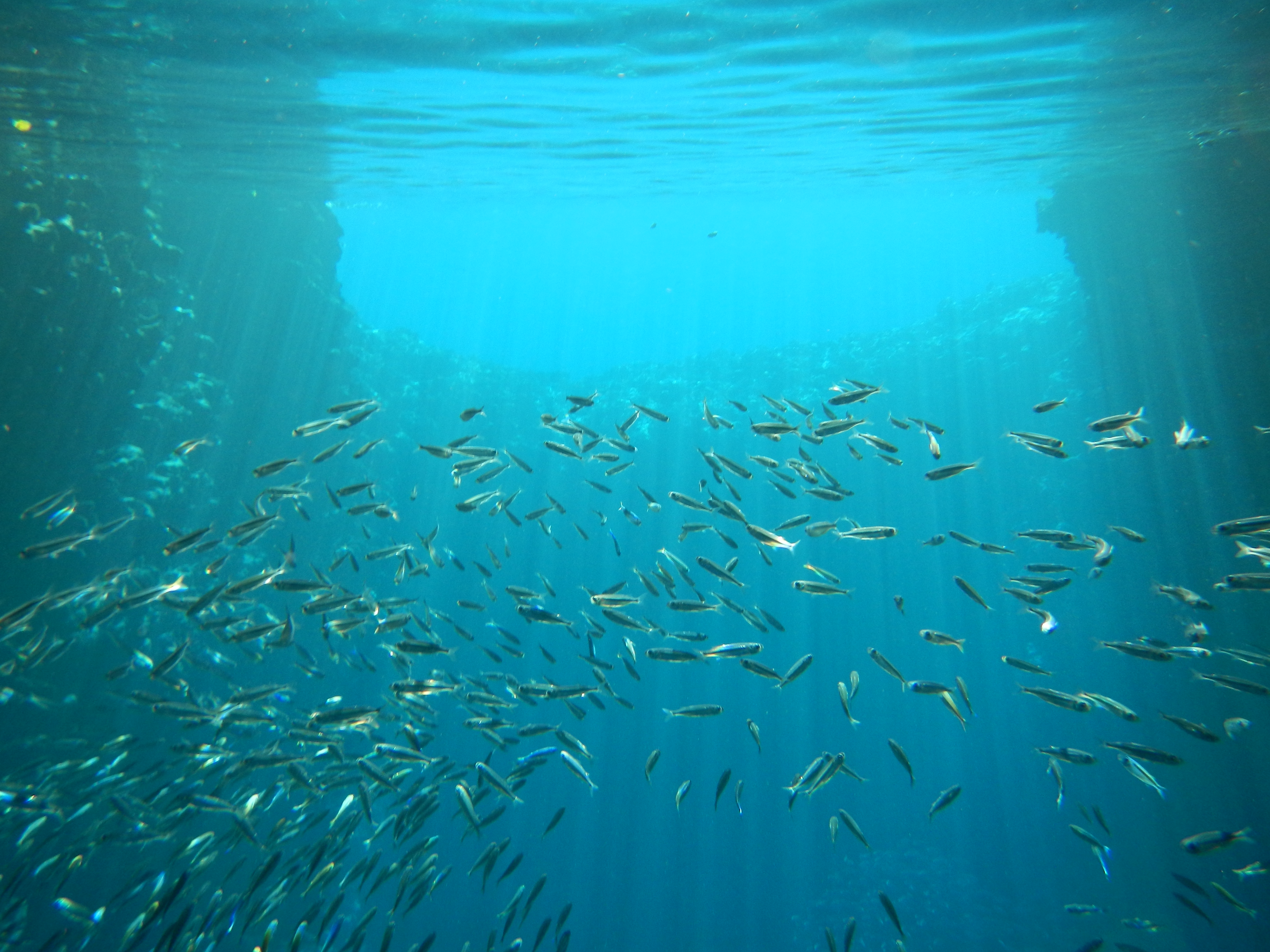
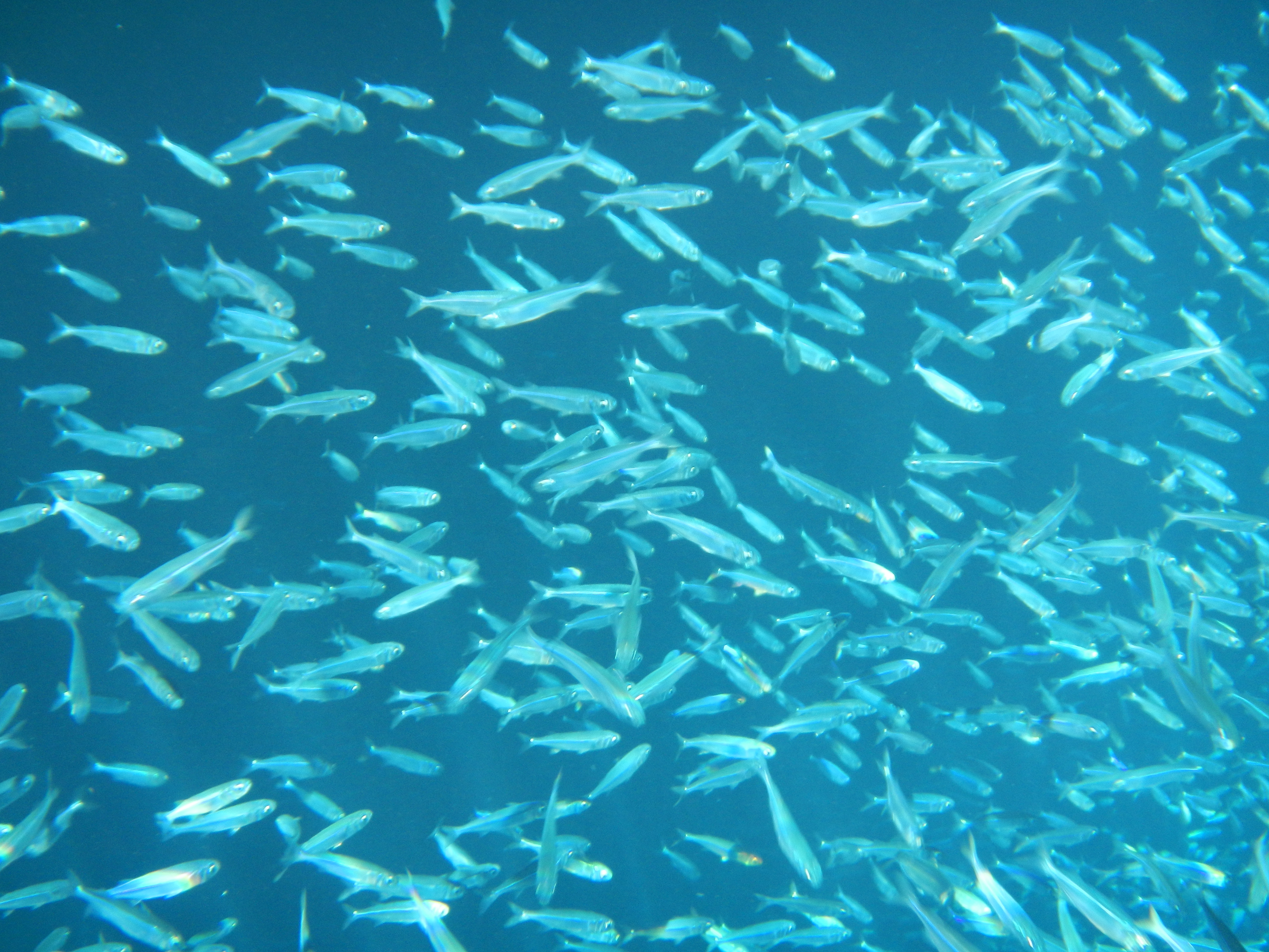
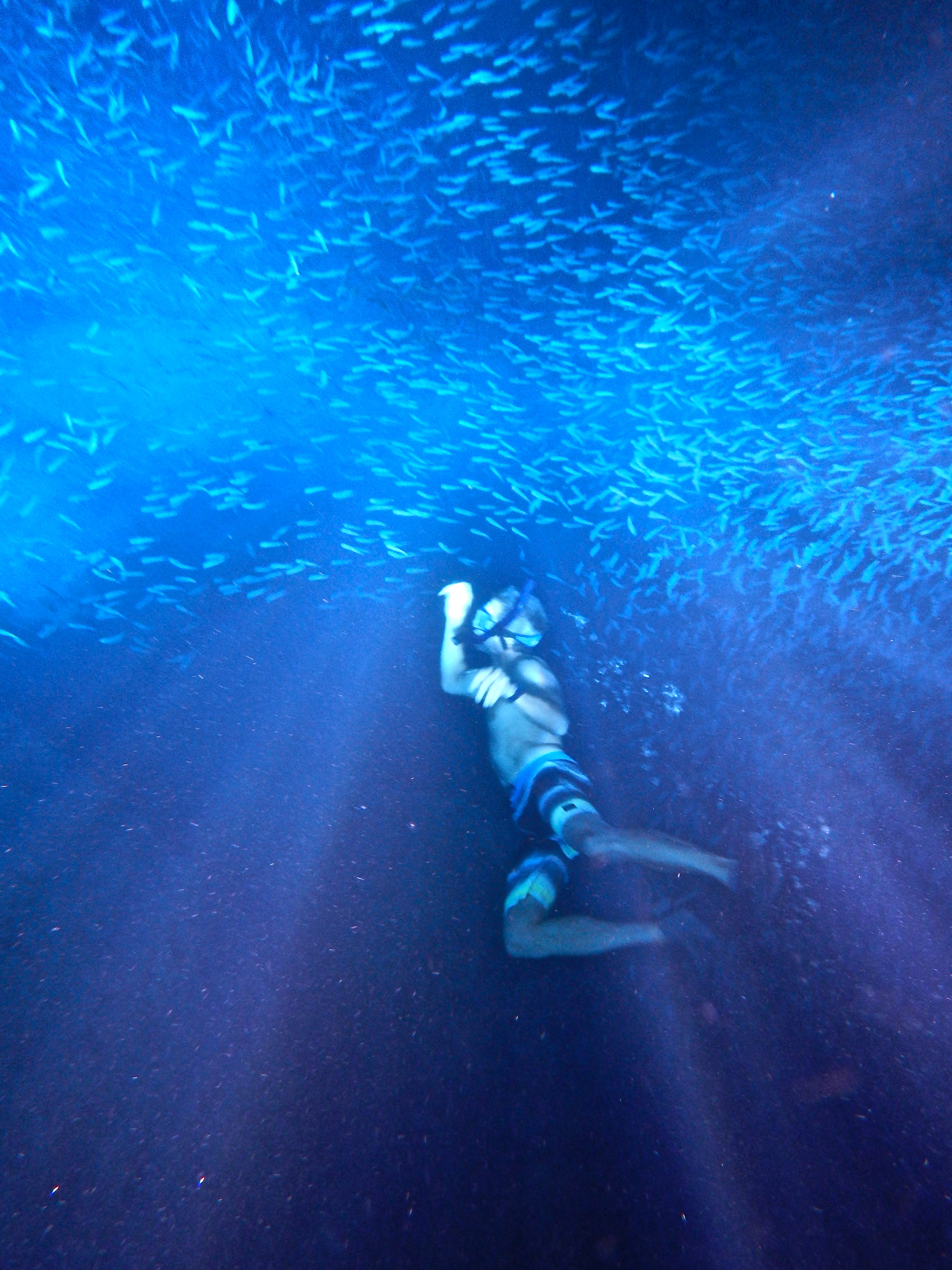
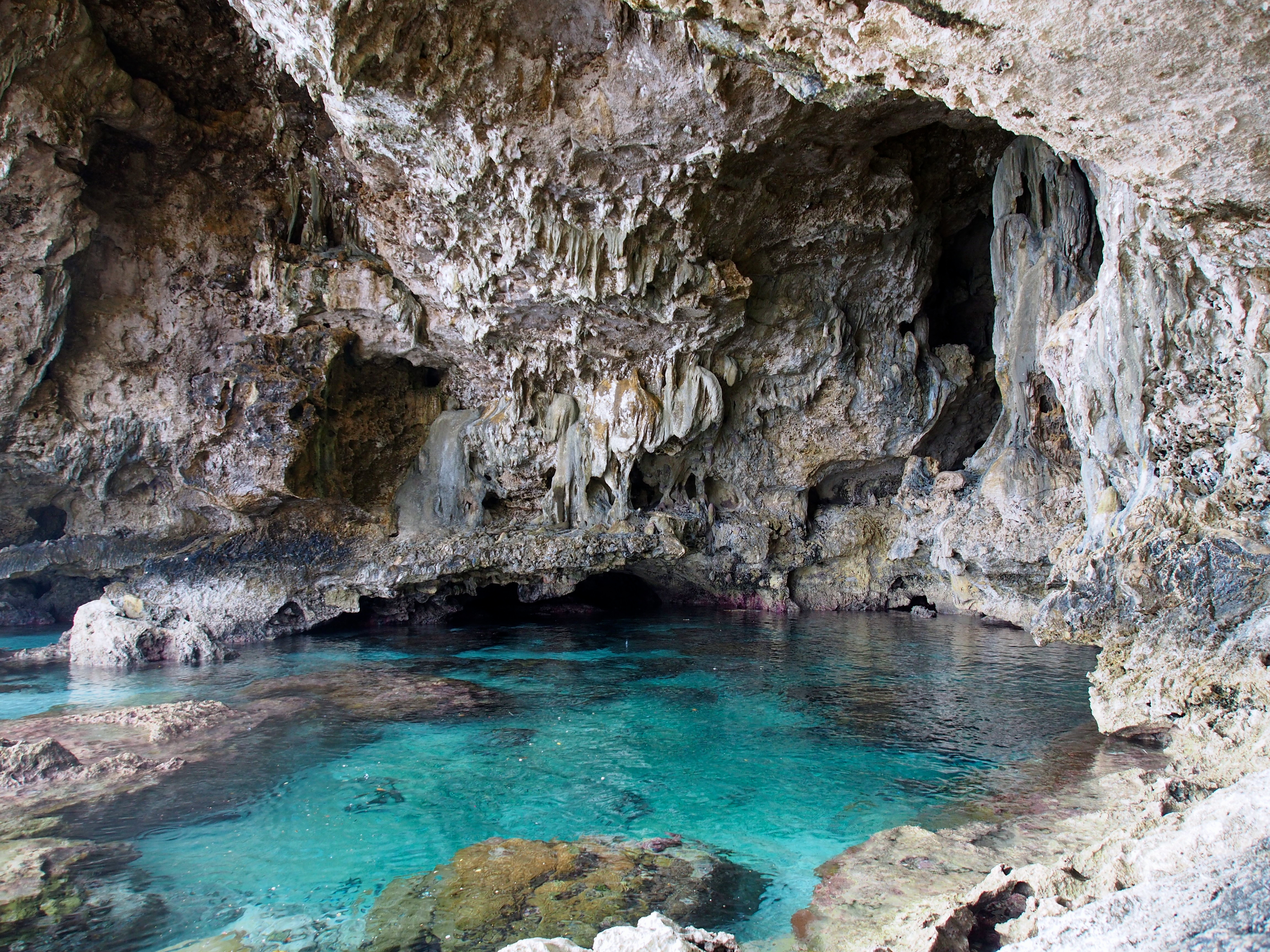
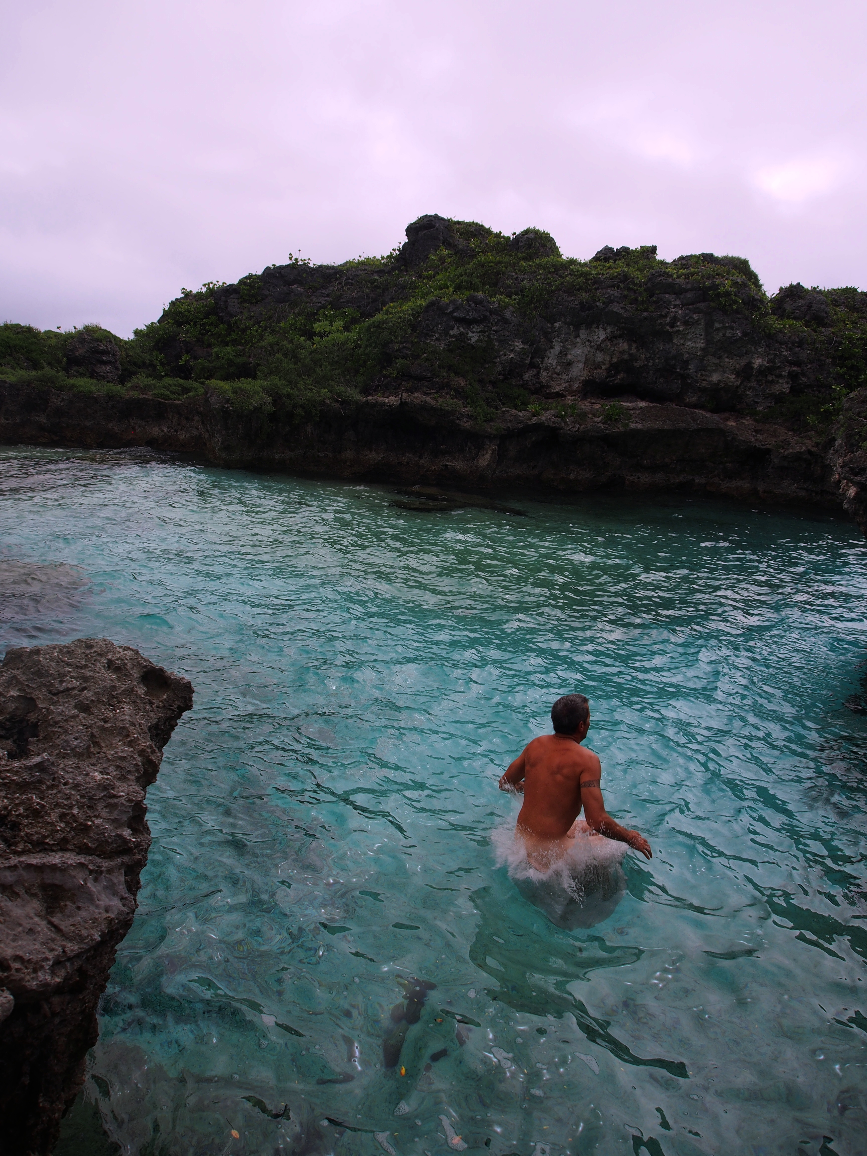
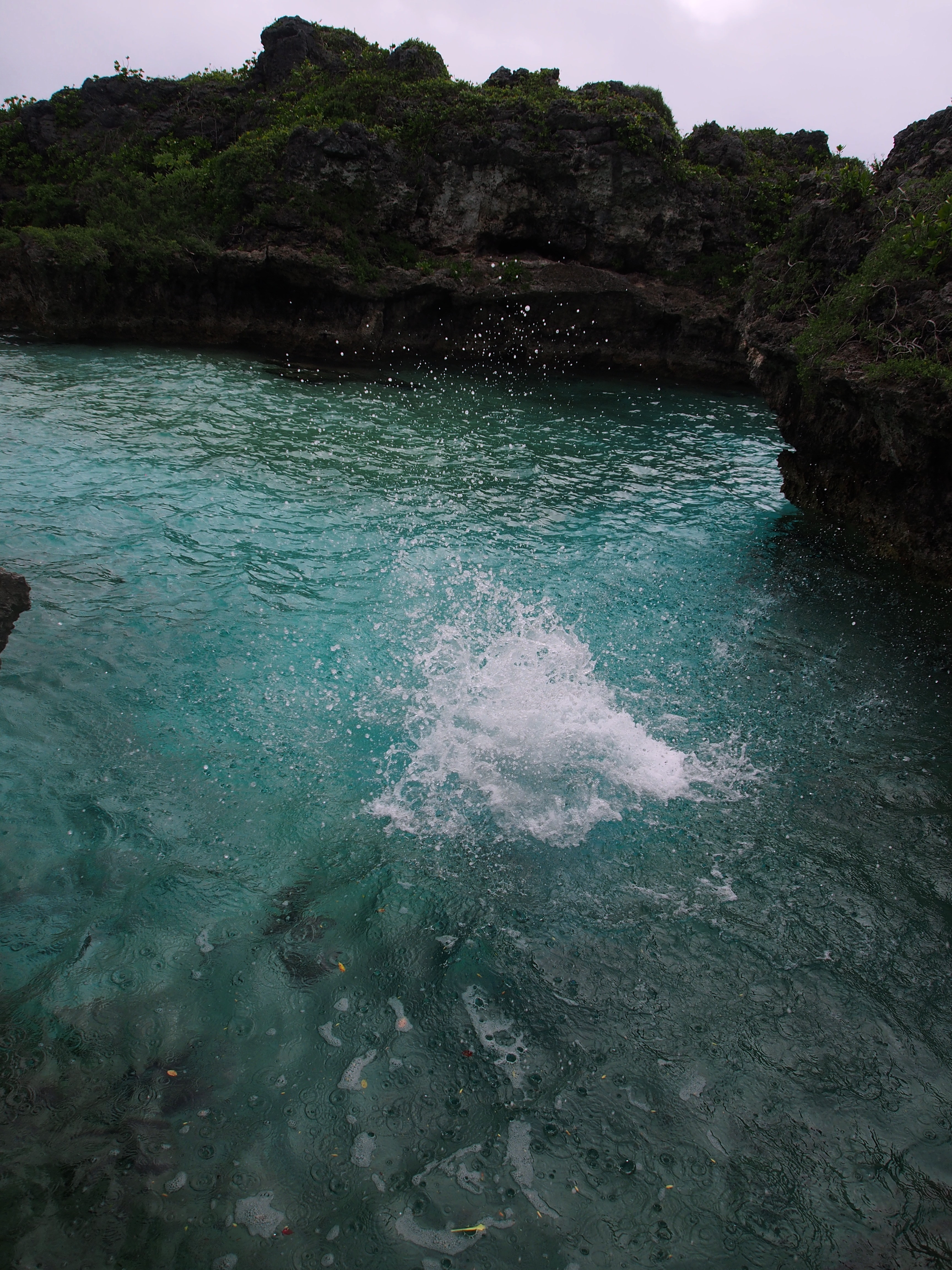
Swallows Cave
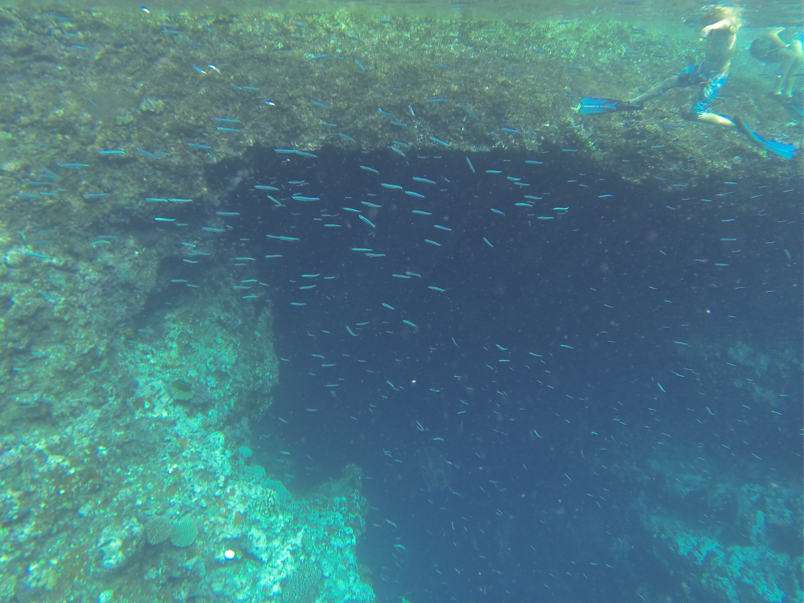
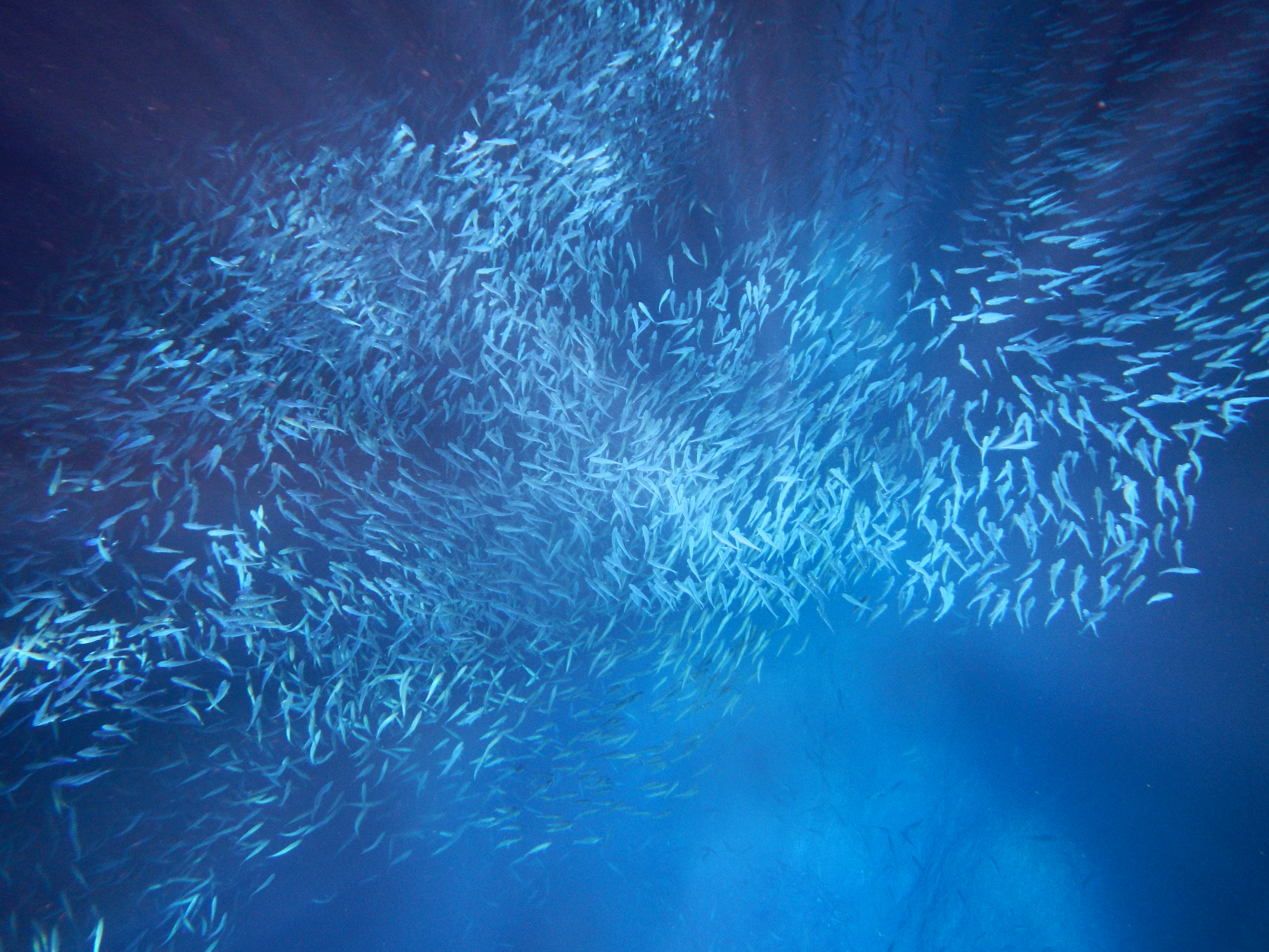
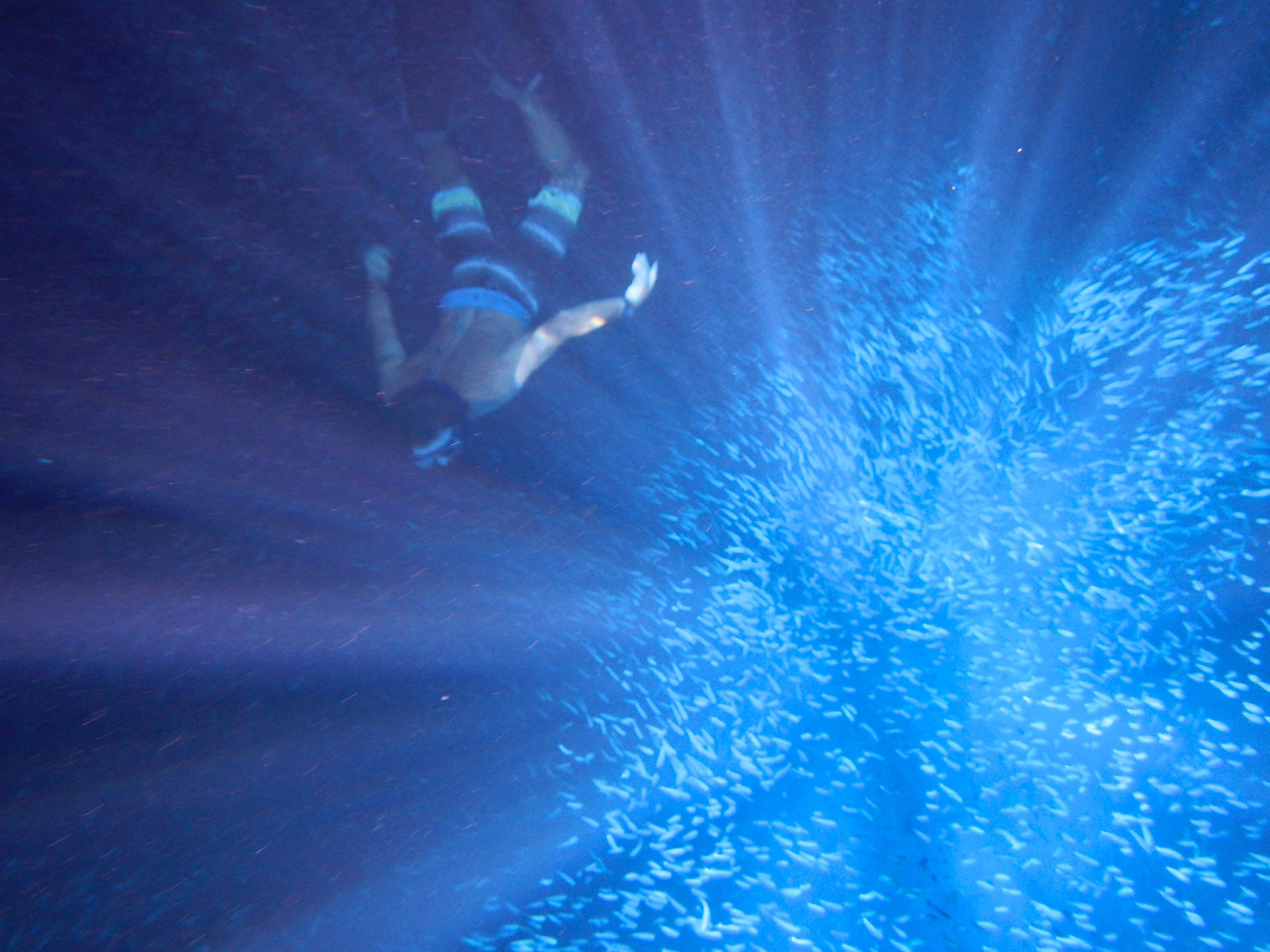
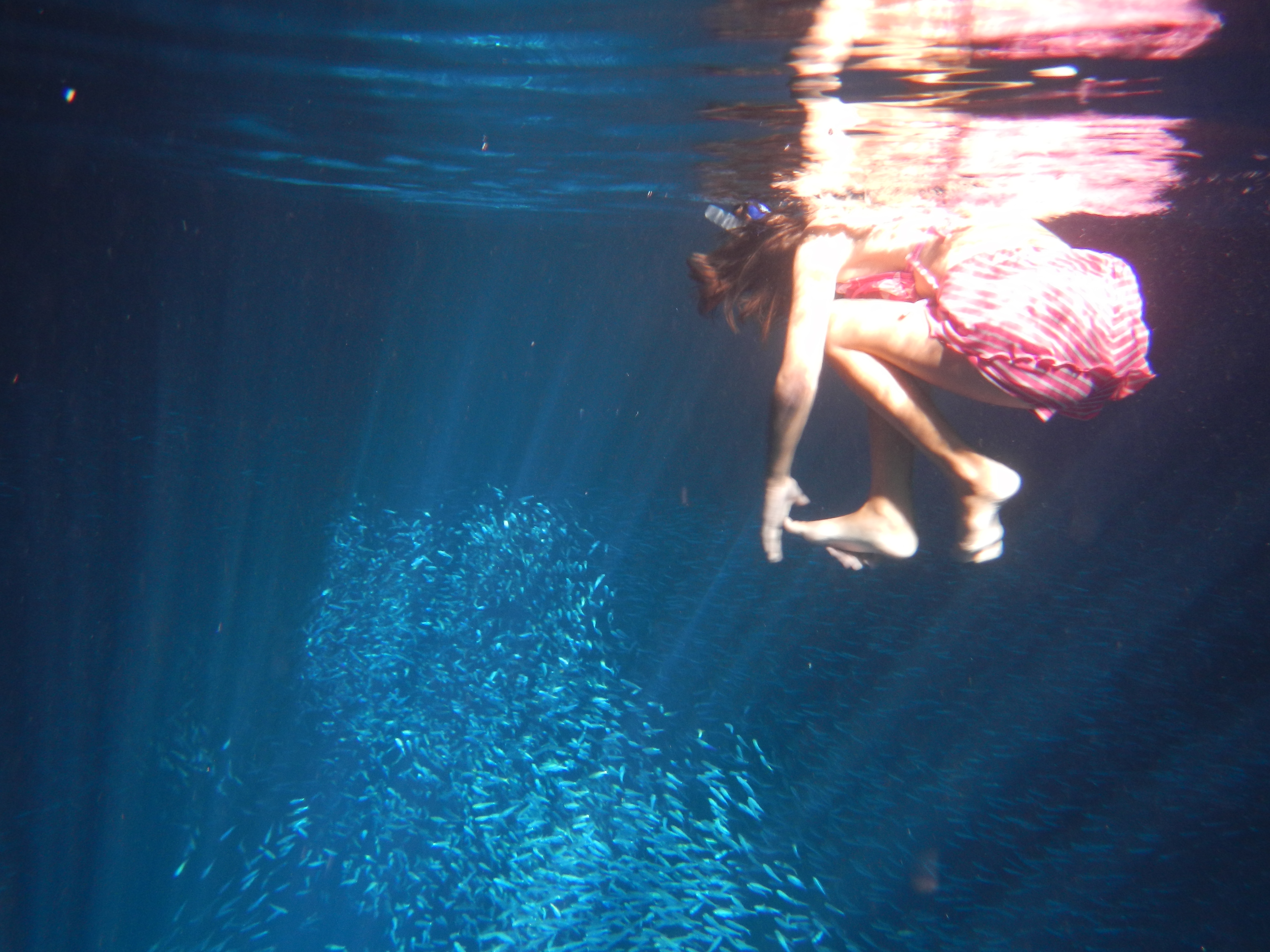
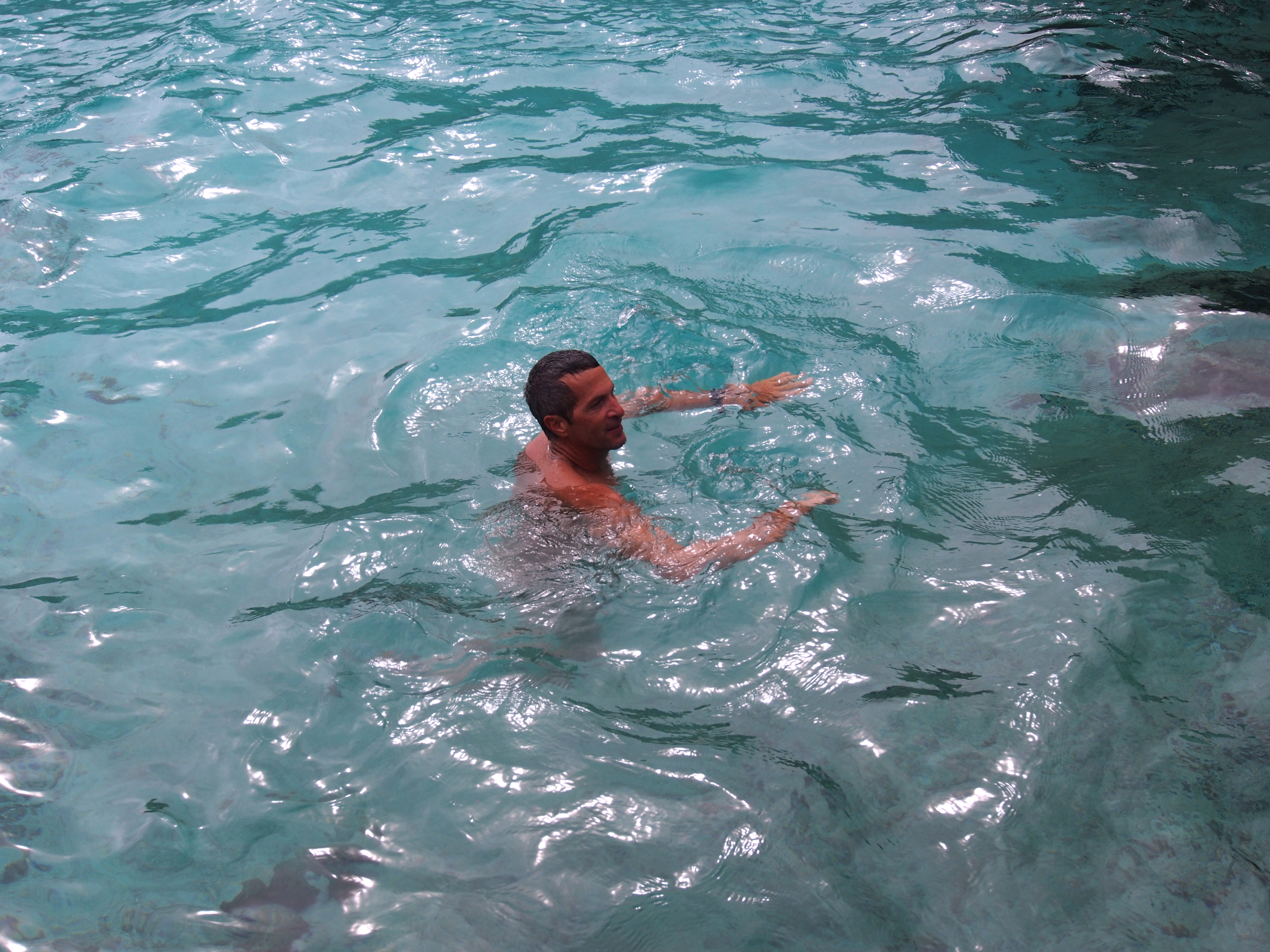
After dropping anchor in Port Maurelle at anchorage #7, we drove our dinghy a mile away to explore Swallows Cave. We heard the best time to go was after 4pm since the cave opening faces west and in the late afternoon the sun shines right into the cave. Arriving at 5:30pm,we found the opening in the coral limestone and drove the dinghy inside. The inside of the cave was amazing—above the water, the ceiling rose to 50’, and below the crystal clear water, the floor dropped to at least 100’. The inside was the size of a small movie theater. With the sun shining into the mouth of the cave, thousands of small silver fish shined in schools a few feet below the surface as well as 50’ down. We put on our mask and fins and snorkeled around for 30 minutes enjoying the underwater scenery. On the cave ceiling were hundreds of swallow nests from which the cave was named after.
Swallows Cave entranceSwallows nests on ceilingUnderwater shot of fish and cave openingSmall fish inside caveSnorkeling under the fishHuge school of fishSnorkeling inside cave with sun rays shining inJacintha swimming inside Swallows Cave
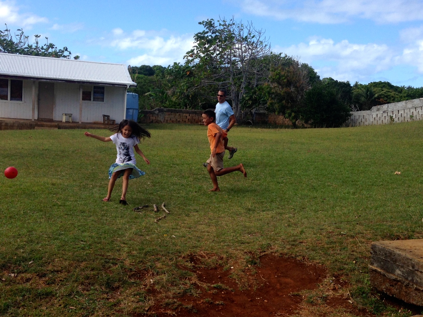
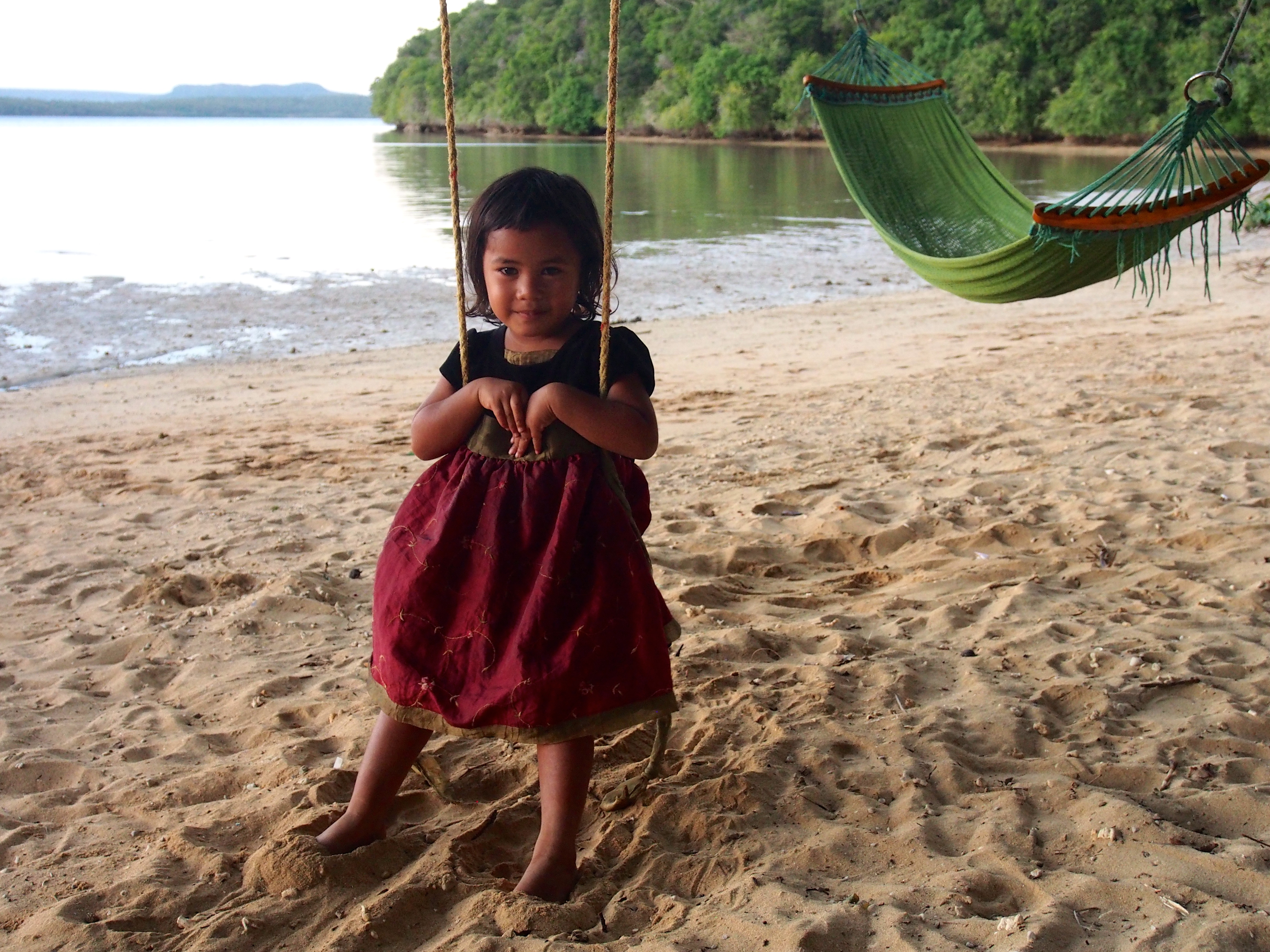
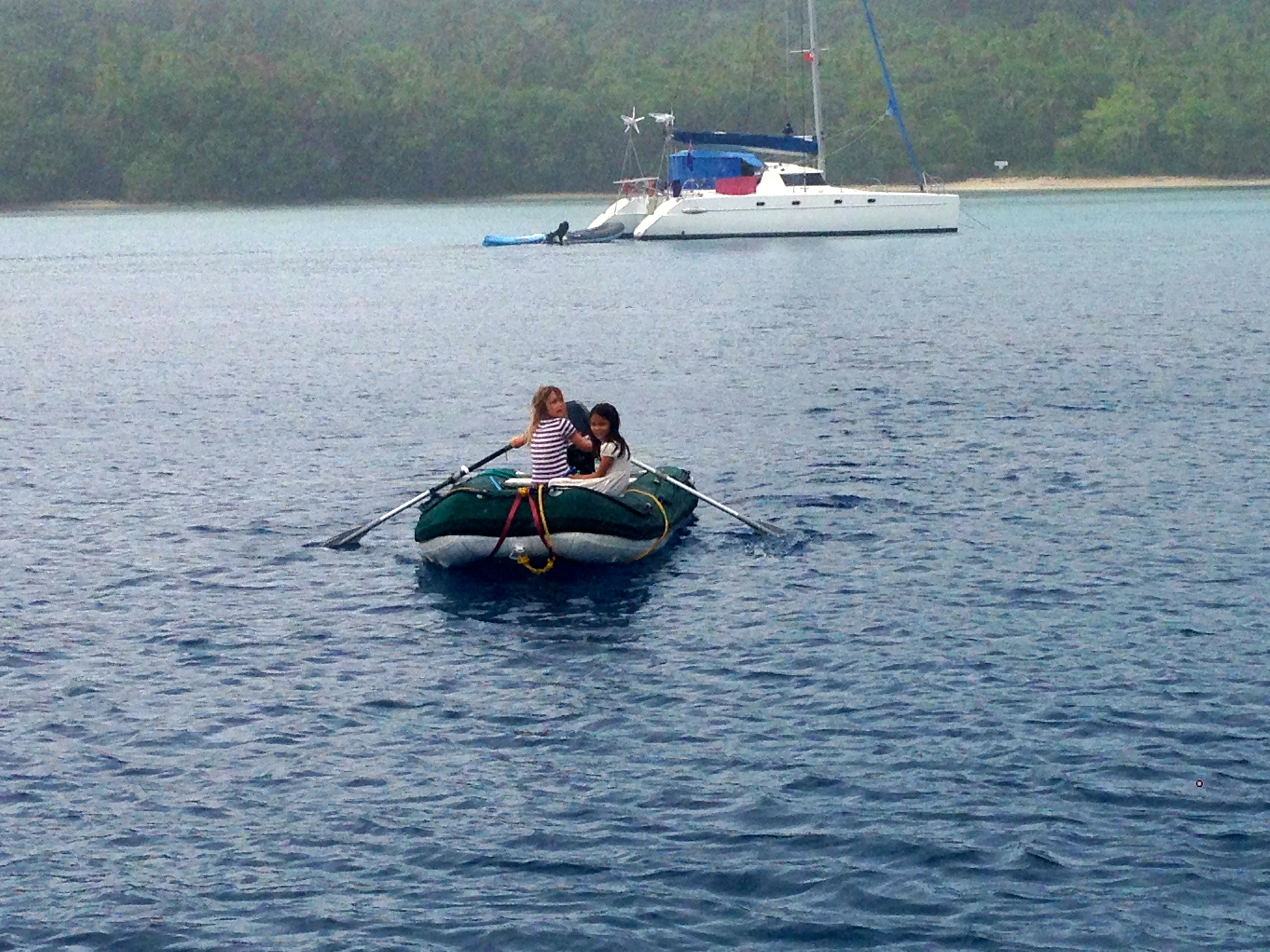
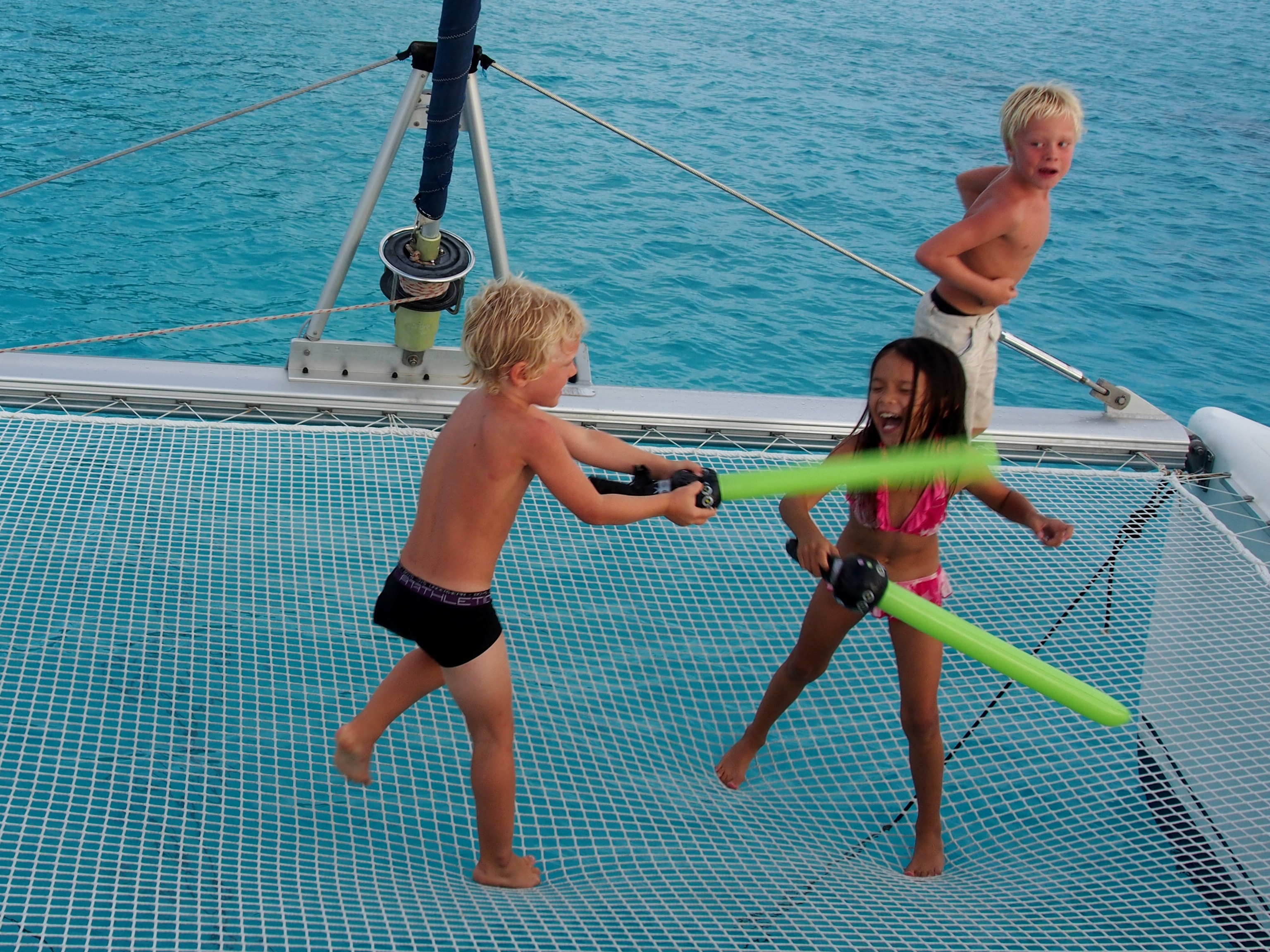
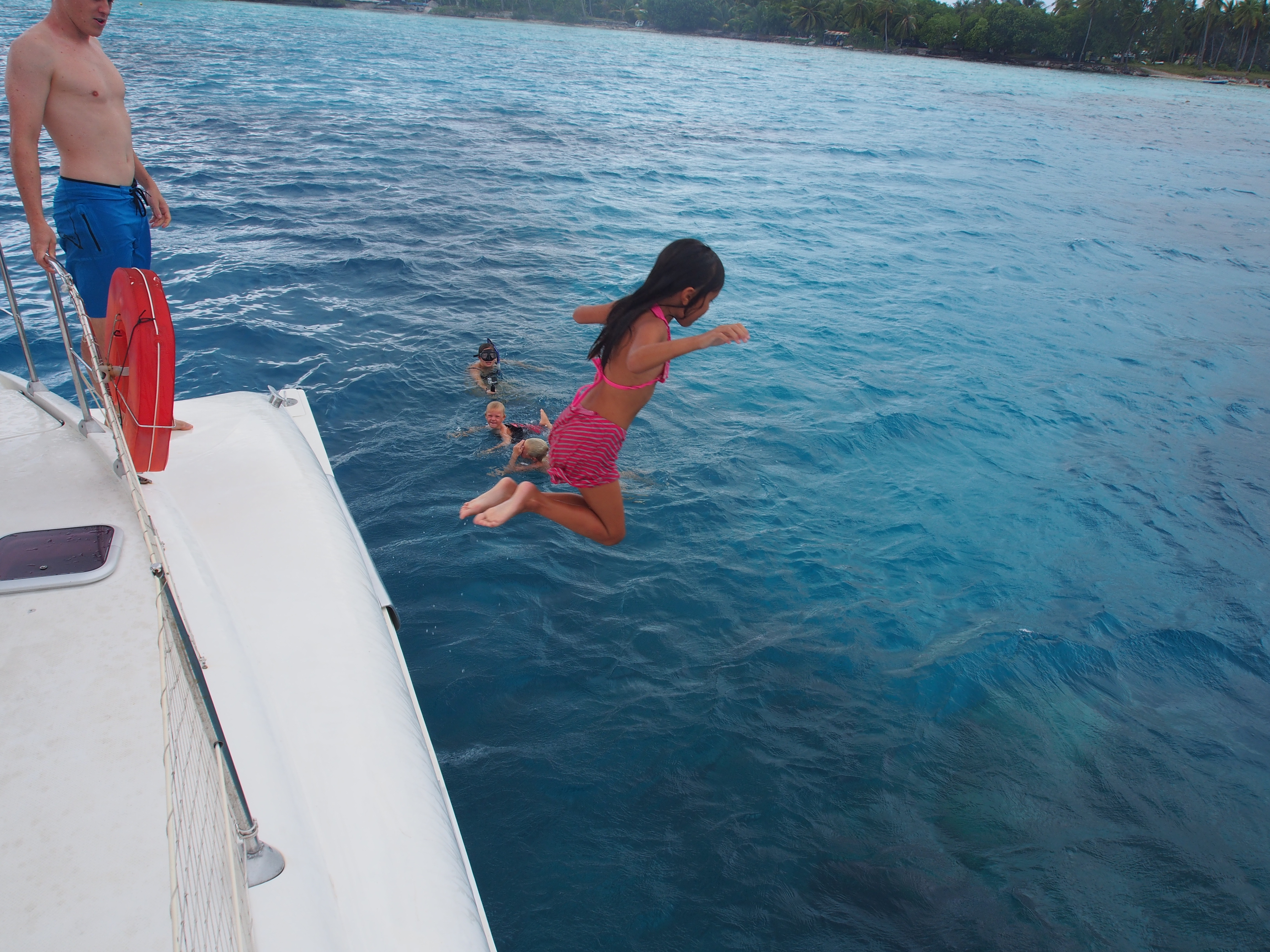
Jacintha’s Friends
After several weeks of hanging out with just mom and dad, Jacintha has been having a field day meeting up with old and new boat kids. While in Tonga, we reconnected with SV Bob The Cat and their 2 boys, and met new kids from SV Javelot and SV Fannie Fisher. Here are some pictures of Jacintha and her friends. Ivan, shown rowing in the picture below, was a great rower and rowed them all the way to shore and back. We later learned his father was an Olympic rower for NZ, and also rowed across the Atlantic, winning the 2-man race!
Ivan and Jacintha out for a rowMatthias, Lucas, and Jacintha on Bob The CatJumping off Bob The Cat
Niue is an isolated independent island nation located 600 nautical miles WNW from Rarotonga. Known as “The Rock”, the island is made up of coral limestone and is 12 miles long by 9 miles wide. There is no surrounding reef and the only mooring is on the west side near the village of Alofi.
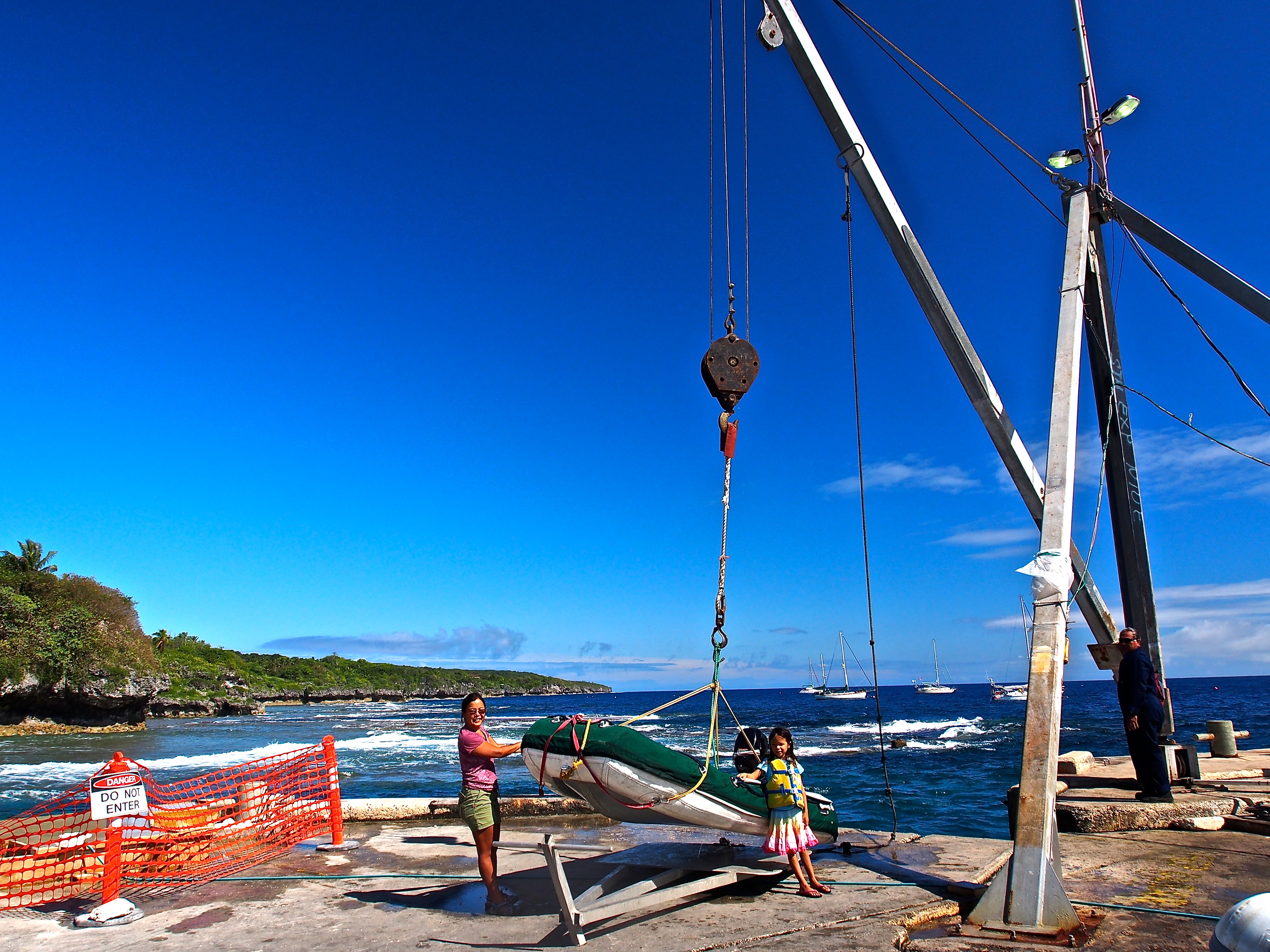
Upon arrival, we tied to a mooring buoy, then took the dinghy to the wharf to meet customs & immigration, agriculture, and health officials for check in. Since there is no beach landing, dinghies are raised up 10 feet onto the concrete wharf by a self-operated electric crane. It’s a difficult and scary process when the surf is rough, which it seemed to be every time we hoisted our dinghy. After connecting the crane’s hook to the dinghy lifting bridle, you climb out of the dinghy via a set of stairs to reach the top of the wharf, where the crane controls are located. After raising the dinghy above the wharf, you swing the crane arm around and lower the dinghy onto a flat aluminum dolly, then park the dinghy in an area clear of the crane. Finally, you return the lifting hook back over the water and lower it for the next dinghy to use.
Dinghy Lift at Alofi
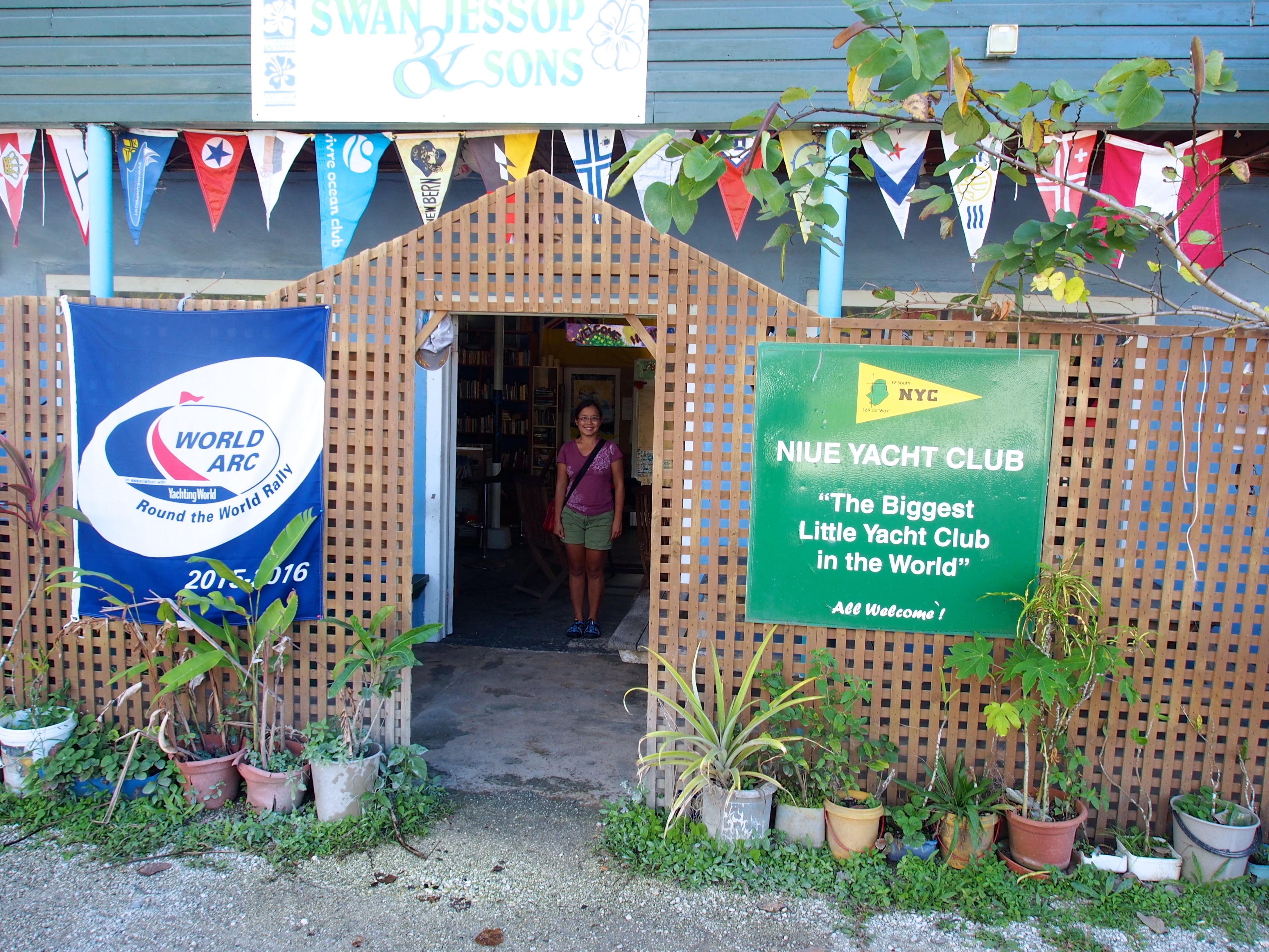
After all the formalities of checking in were complete, we walked around Alofi and found the Niue Yacht Club, who rents out the 20 mooring buoys. The yacht club is a very nice place to relax, use wifi, meet other cruisers, and get information. Ira, who volunteers her time at the yacht club, knows everything about the island. She called to make dinner and car reservations for us, and offered suggestions on what to during our short stay on Niue.
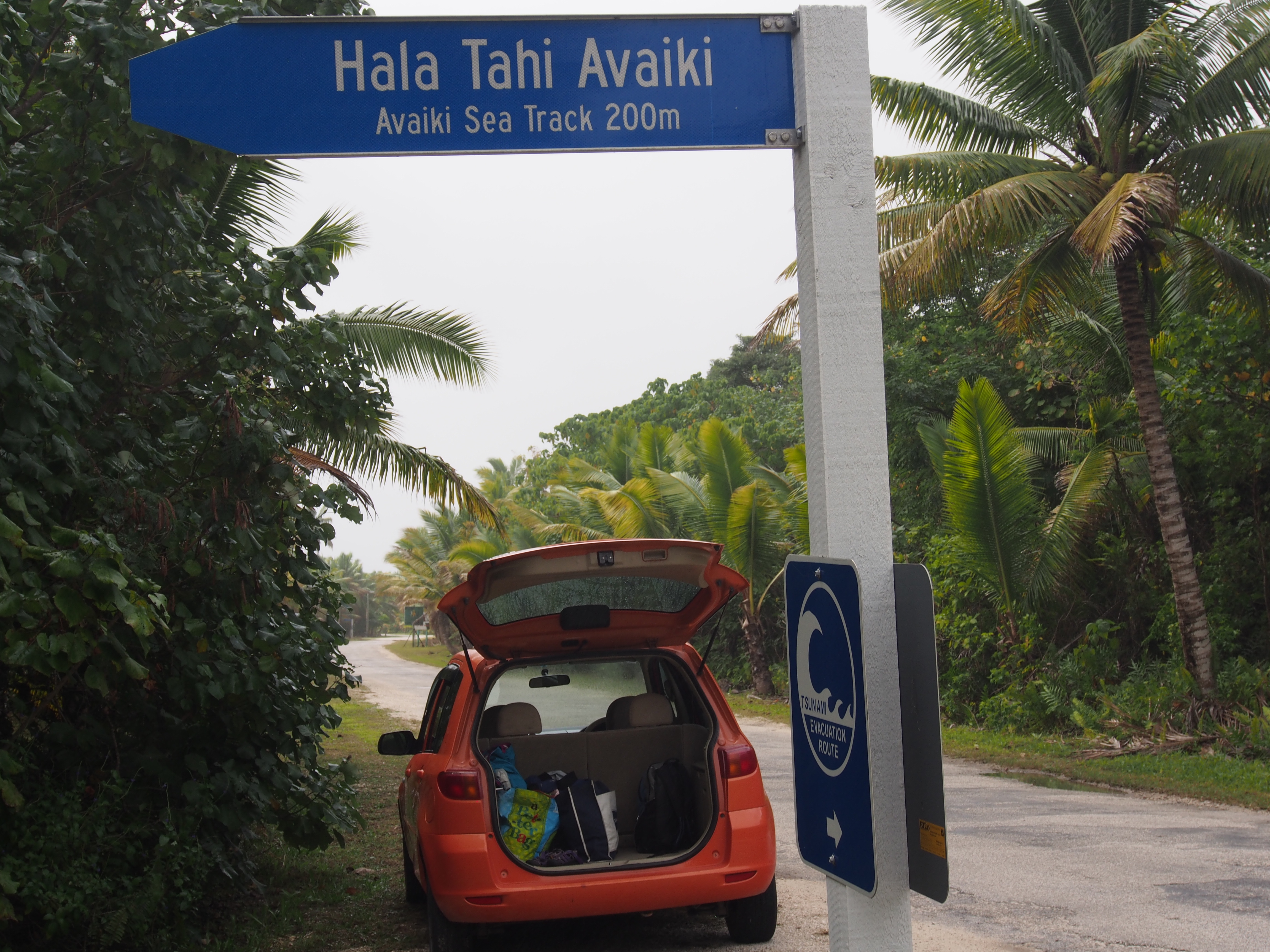
Some of the main attractions on Niue are the caves and chasms carved out of the limestone along the rugged coastline. We rented a car and drove around the island perimeter, stopping at 5 sights along the way. This was the first time I drove a car in 10 months, and after almost a year on a sailboat that moves at an average speed of 5 knots, driving at 45 mph seemed very fast (also scary since I was driving a car with the steering wheel on the right, and driving on the opposite side of the road!). We parked the car at the side of the road and hiked down to the coast on paths called sea tracks. At the end of the sea tracks was either a cave, swimming spot, or chasm.
Niue Yacht ClubTeamwork!Our Rental Car
Here’s our 4 favorite stops driving around the island:
Avaiki
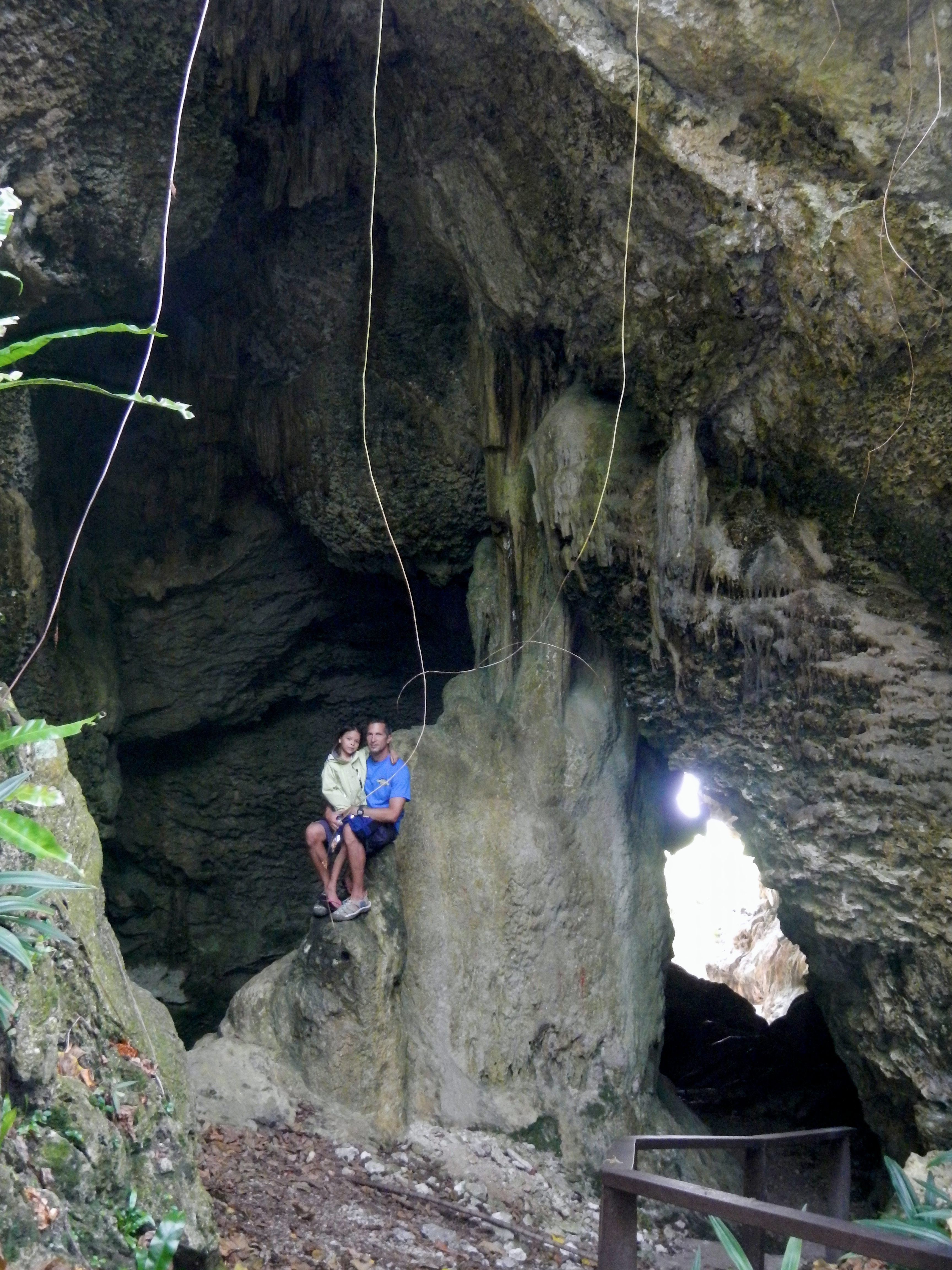
Named after a derivative of the word “Hawaike”, the ancestral home of the Polynesians who first came to Niue on canoes, this site was celebrated by those of high-ranking, in gratitude of their safe passage. A short walk down the sea track, we entered a spectacular dripstone cave. After exploring the cave, we exited along the coast to find small pools of clear water among the coral limestone. These pools can only be reached at low tide and were full of juvenile fish and fragile coral.
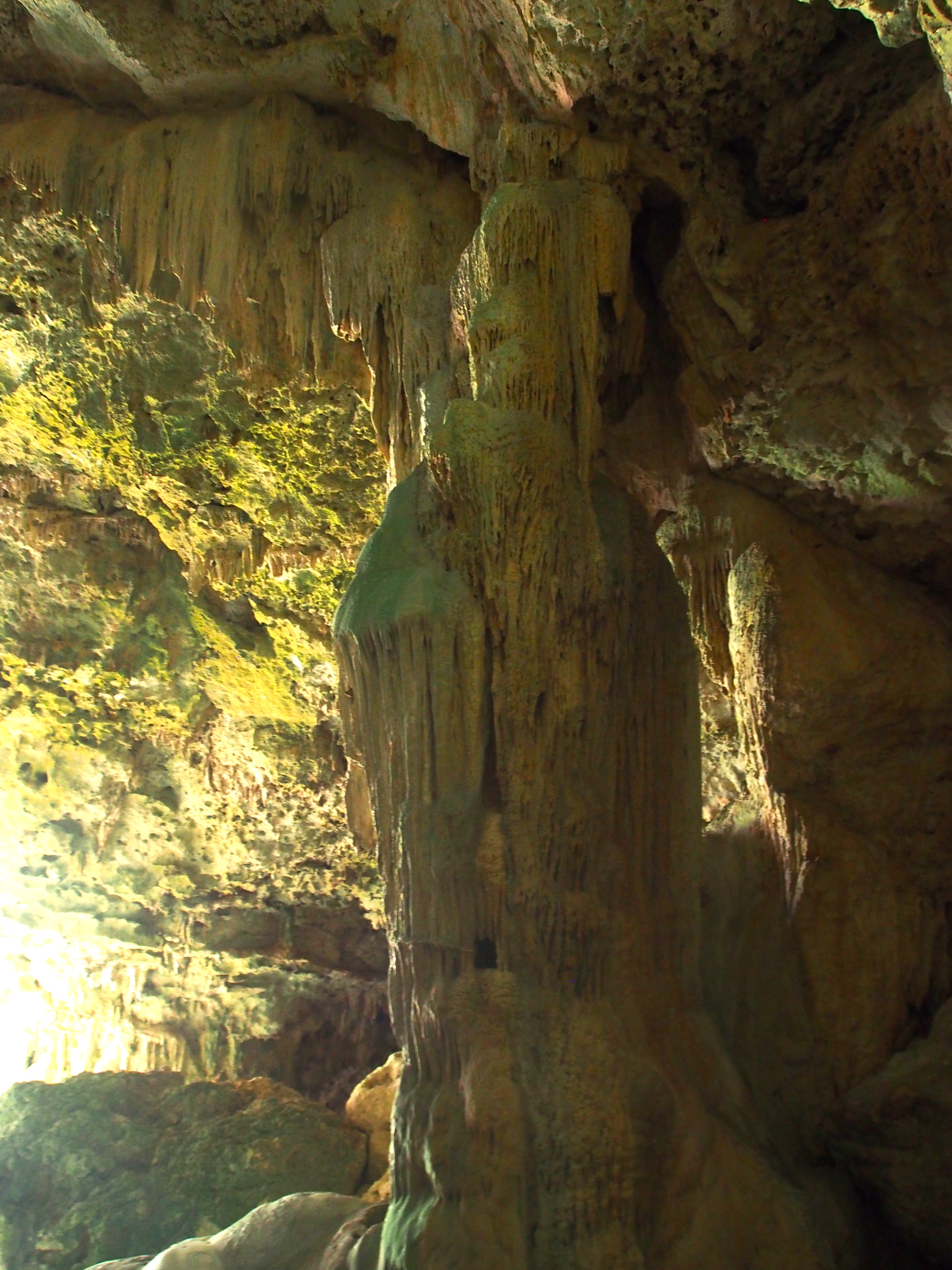
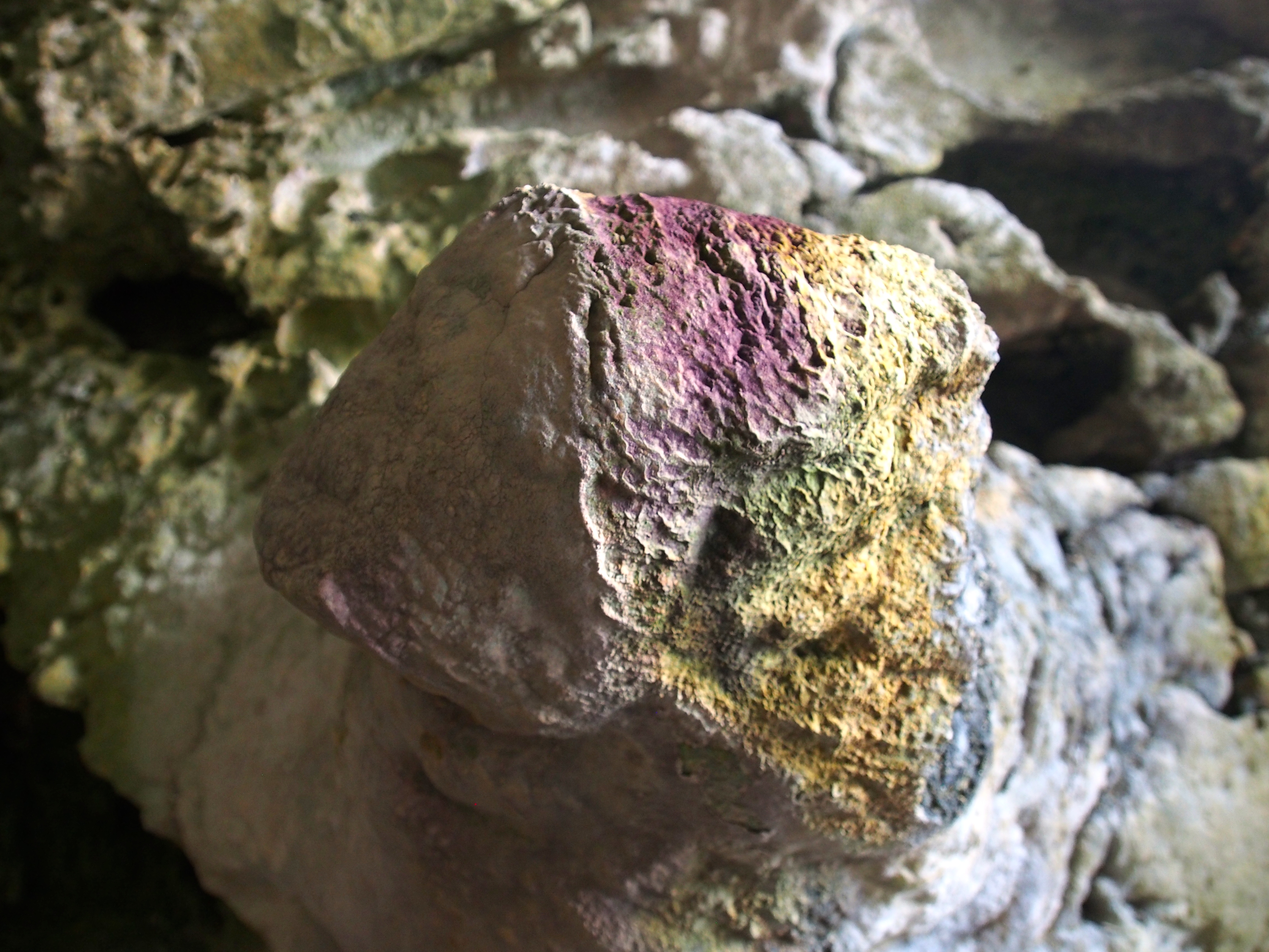
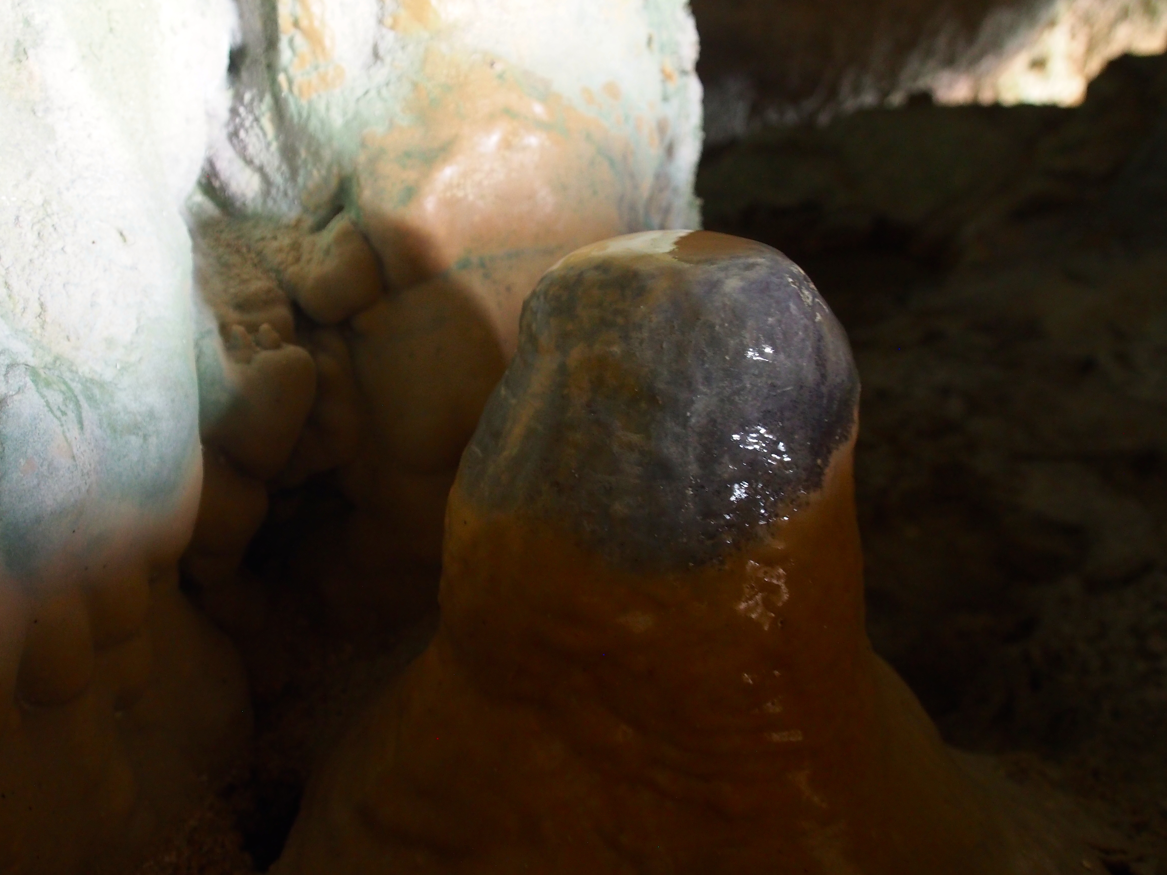
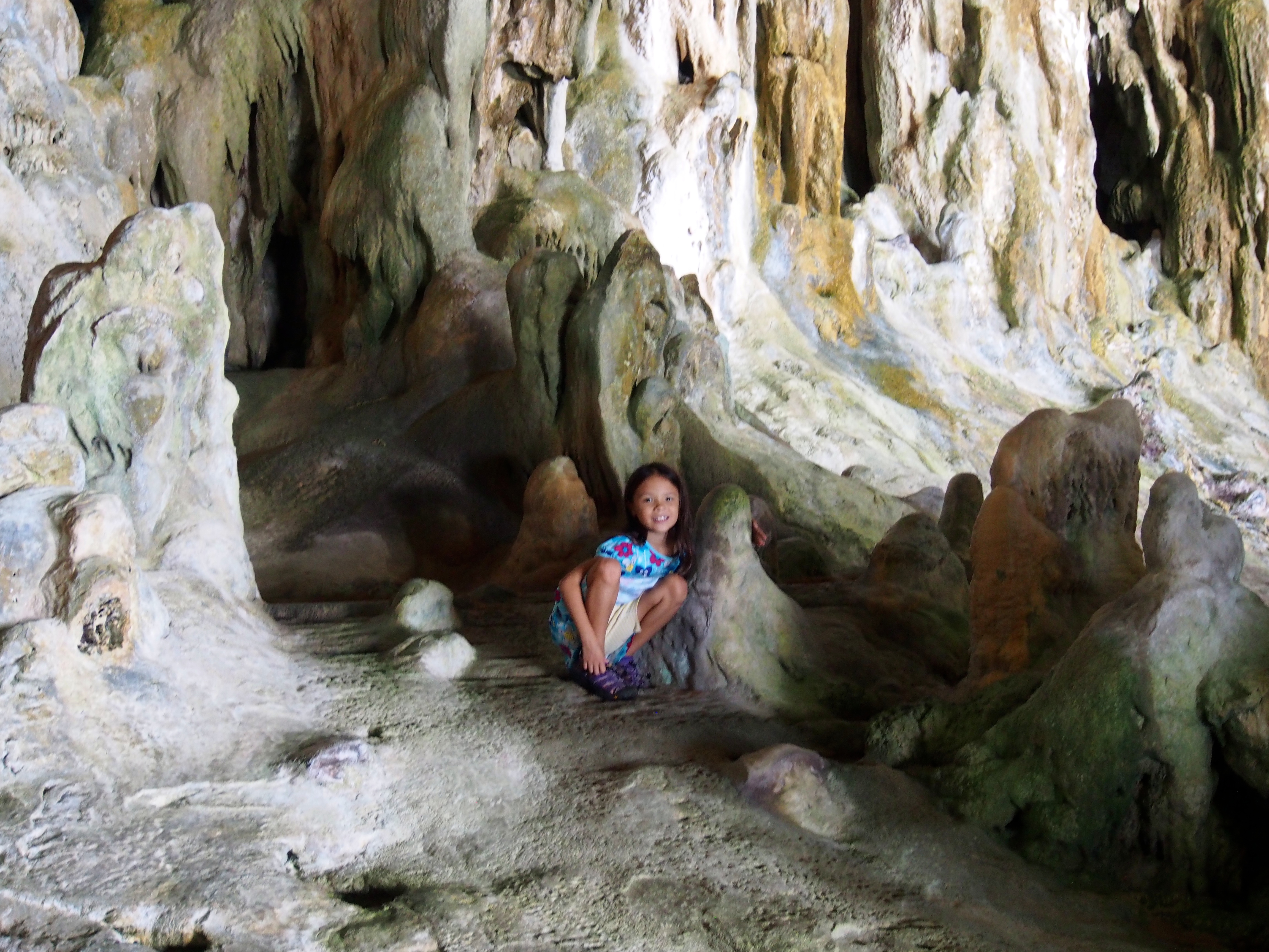
Palaha Cave
Palaha is one of the the biggest caves on Niue with rare limestone formations formed over hundreds of years. We hiked down the sea track and entered the cave to explore the amazing stalactites and stalagmites formed as water drips through the cave ceiling. We could see different colors in the formations from various minerals, as well as the glassy look of a new stalagmite forming.
Inside Palaha CaveMineral Colors in StalagmiteNew Stalagmite FormingInside Palaha Cave
Limu Pools
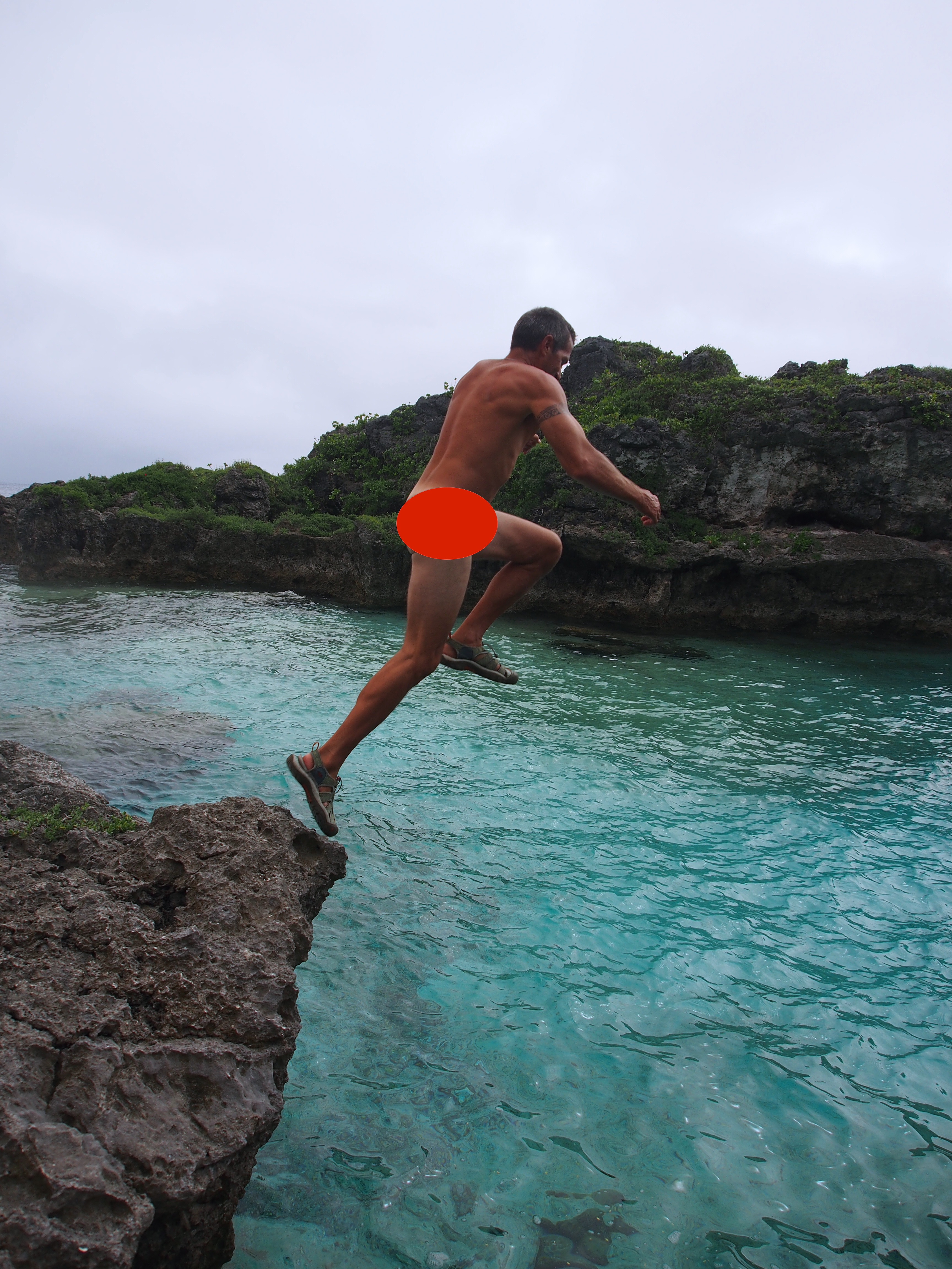
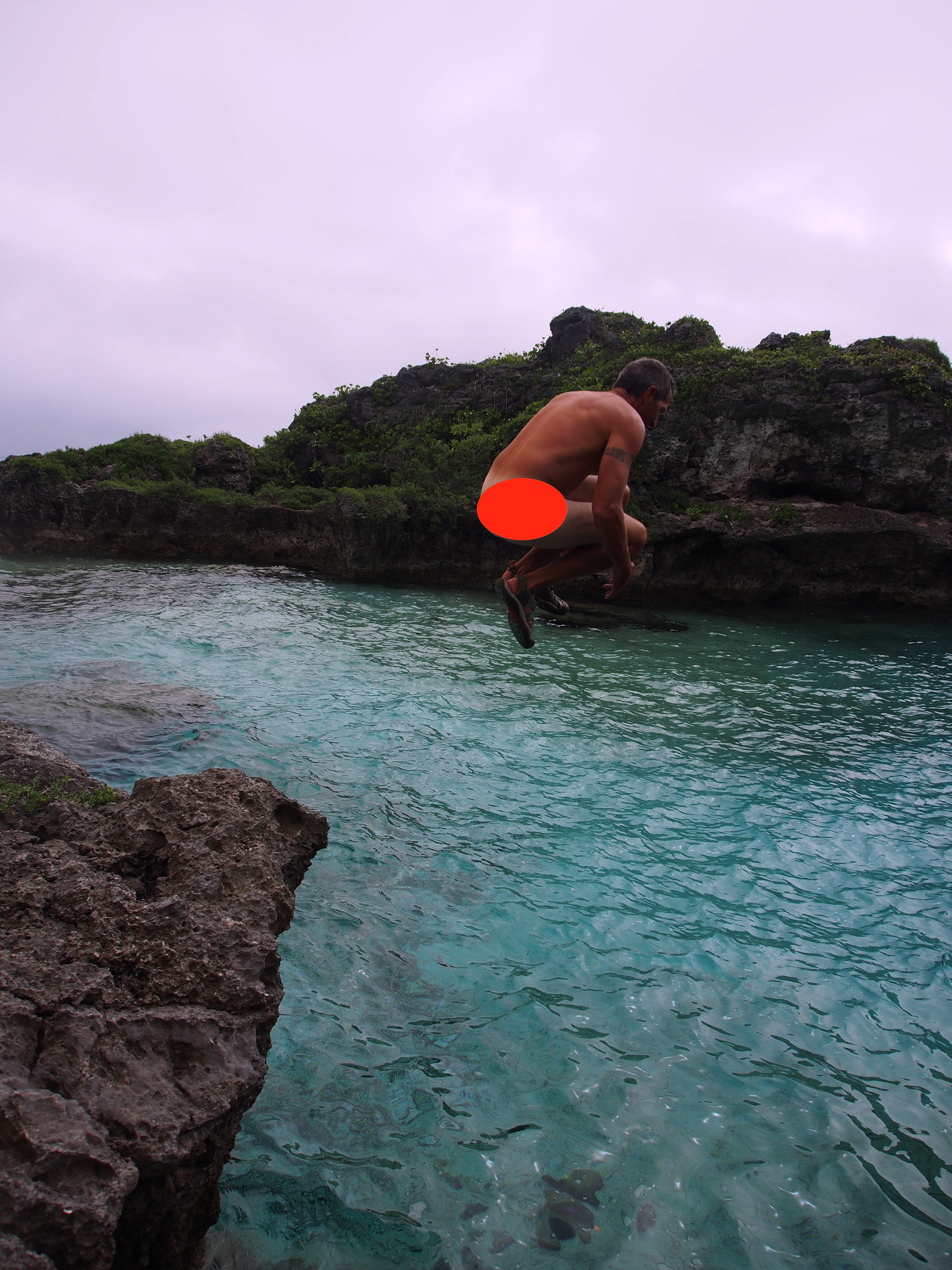
Limu Pools are near the village of Namukulu. A hike down the sea track ended at the sea where a large sea-water pool is protected by huge rocks. The rock ledges and clear, deep water make this a great place for swimming. Since it was a cool, overcast day, we hadn’t planned on swimming so didn’t bring swim suites…but I couldn’t resist jumping off a cliff into the water wearing my red speedos!
LaunchTuckTouch-DownSplashSurface
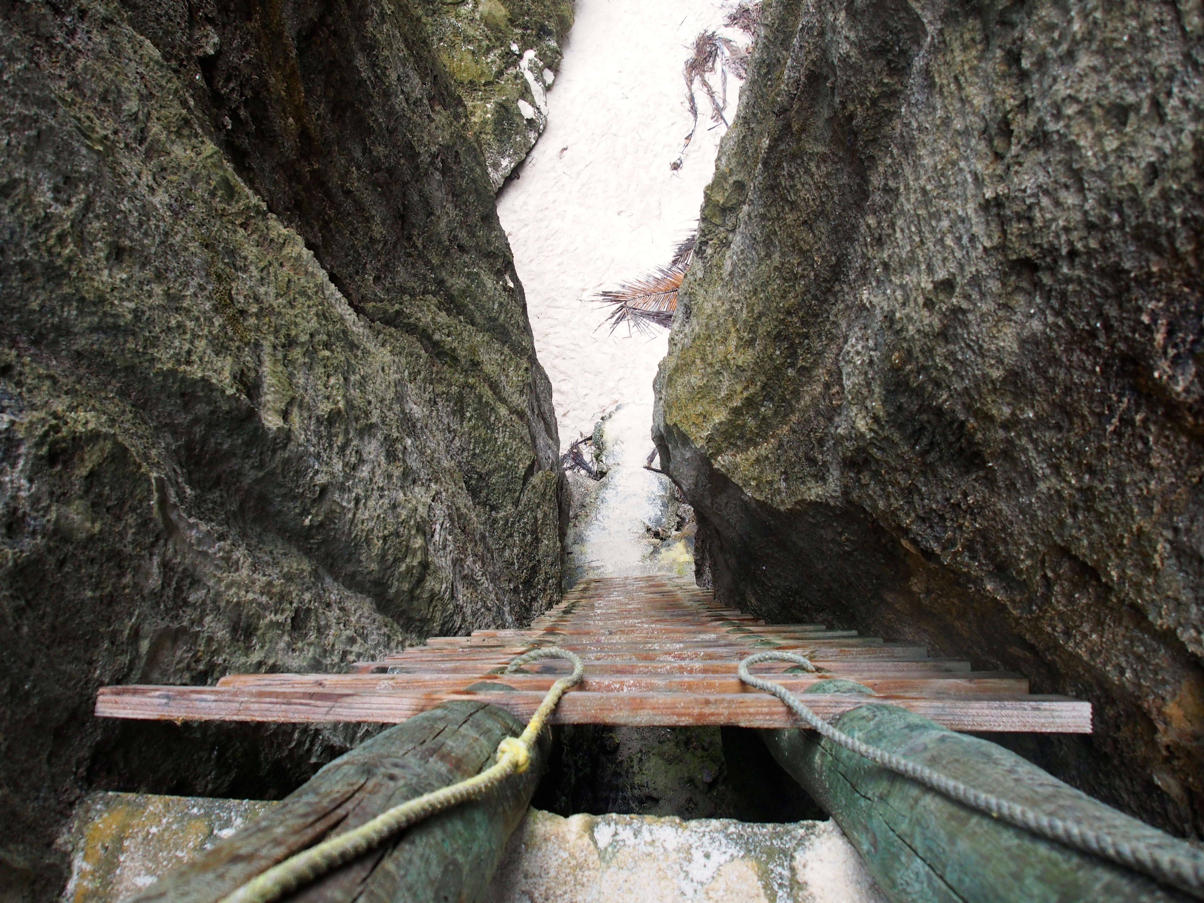
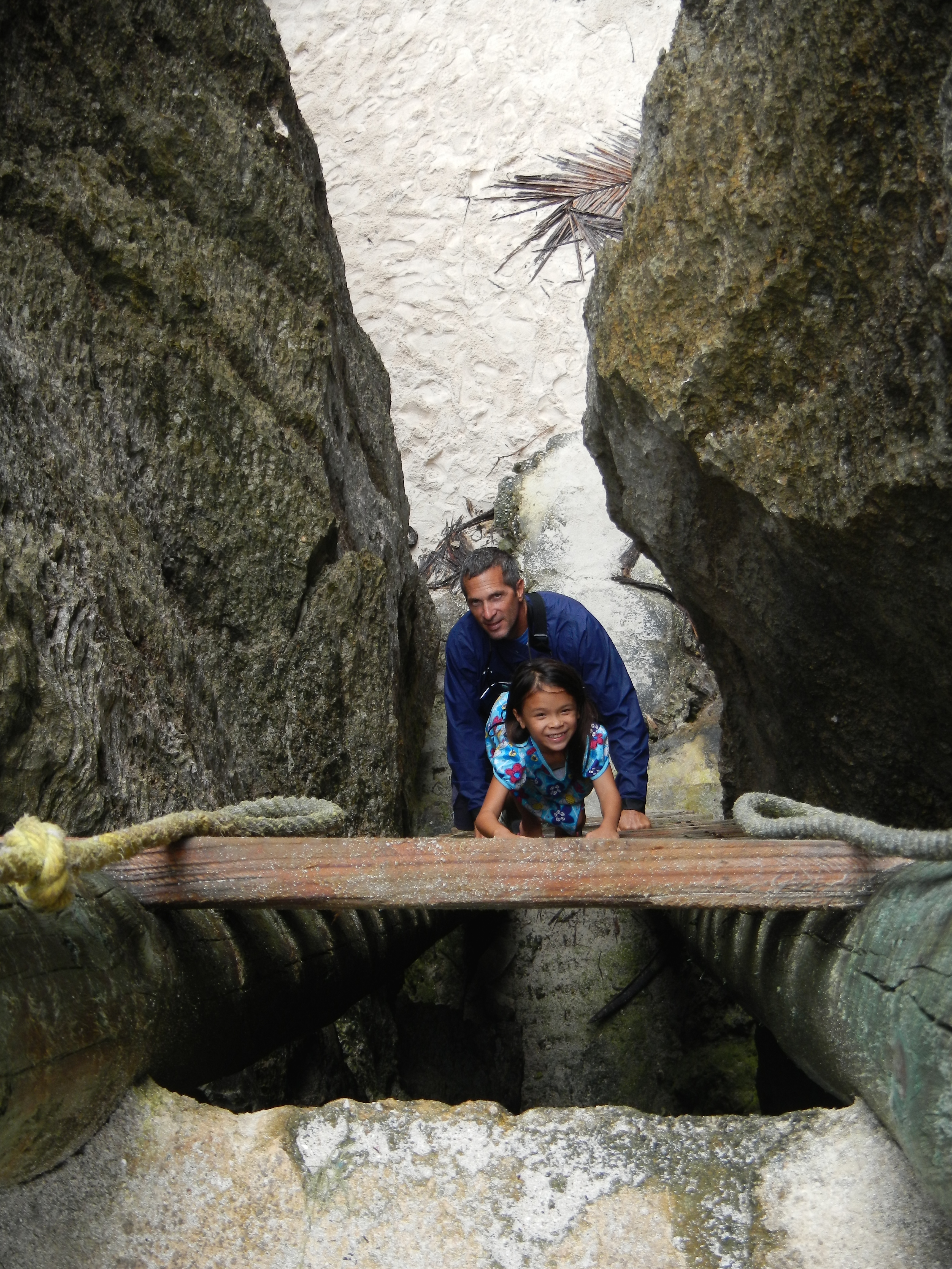
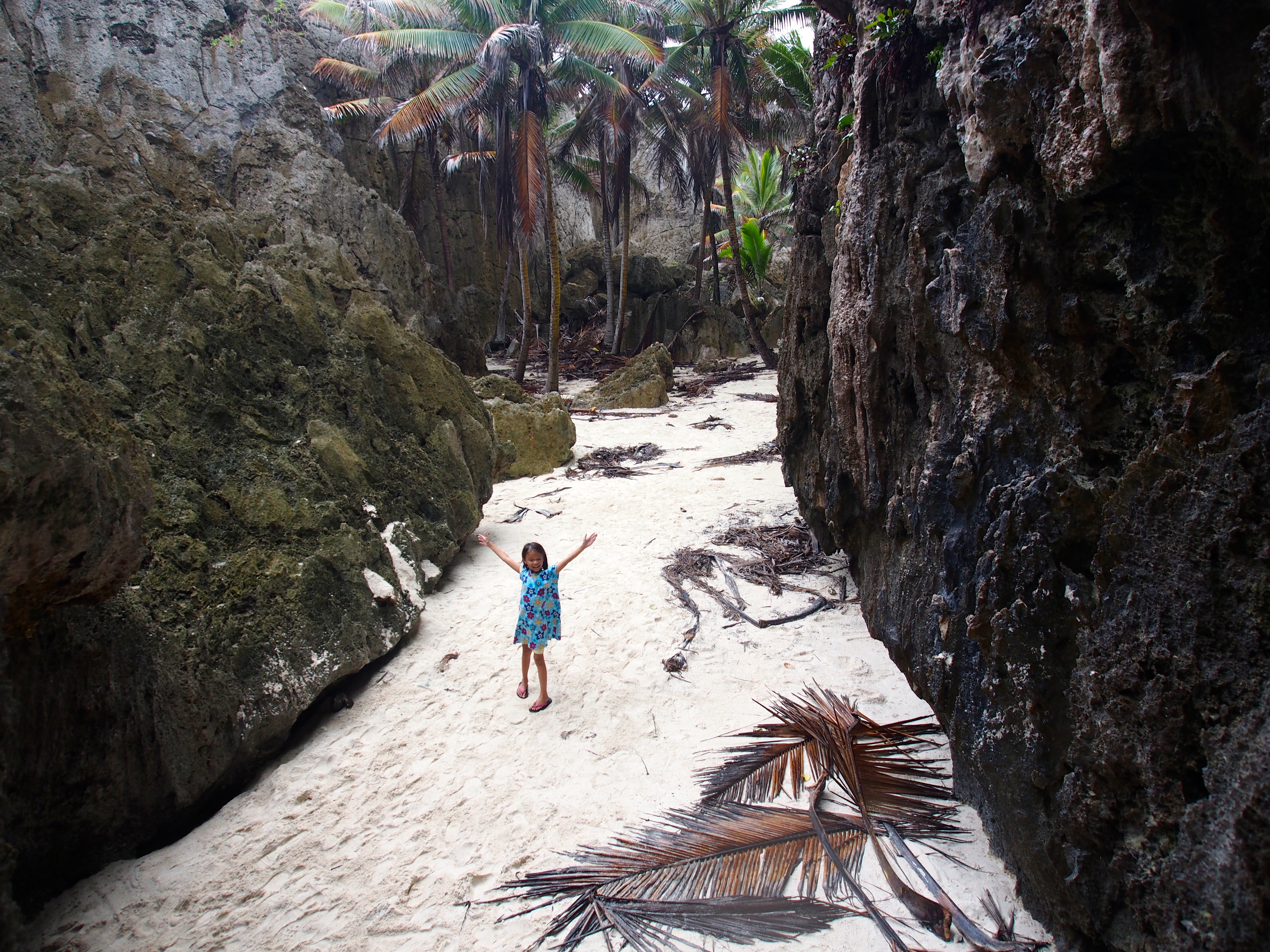
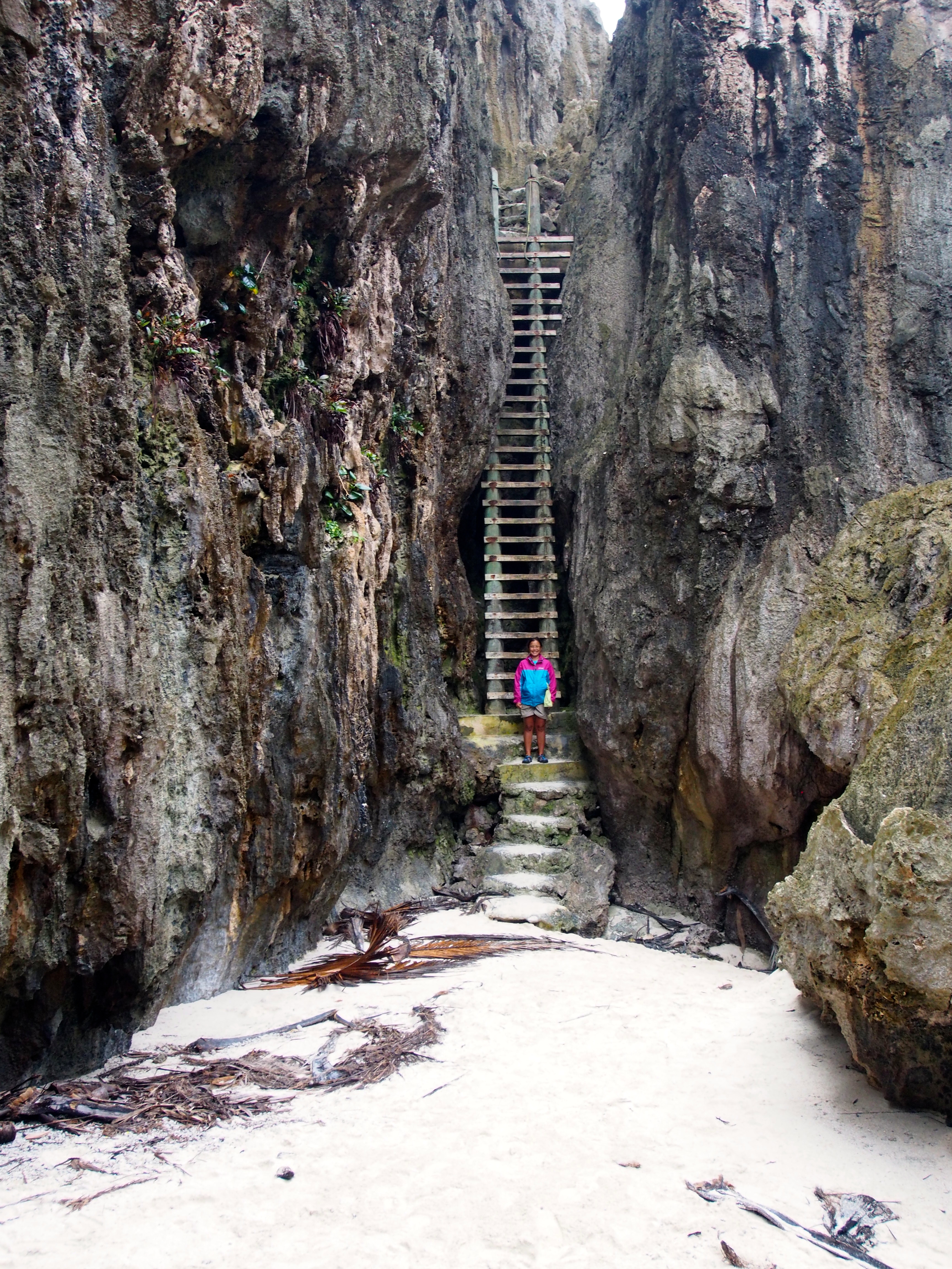
Togo Chasm
Located on the rugged windward west coast of Niue, Togo Chasm was the last stop on our island tour. Along the 30-minute drive there, we passed through several small villages with houses that were mostly abandoned from when a large typhoon passed through in 2008. Similar to a lot of other pacific islands, Niue suffers from a population decline as the natives seek opportunities elsewhere (like the Cook Islanders, Niueans enjoy dual citizenship with New Zealand). A half hour hike through a coastal forest opened up to the coastline with sharp pinnacles and sink holes. A crude cement path made it easier to walk though this area and at the end was an amazing chasm. To enter the chasm, we carefully climbed down a steep 40’ ladder, which was quite scary when looking down from the top. At the bottom was a long sandy strip of flat land surrounded on all sides by vertical rock walls. A few palm trees managed to grow inside the chasm. We climbed through a small opening in the rocks that led to the sea, where we sat and watched the waves force sea water into and out of the opening. Togo Chasm was an amazing place!
Path Through Pinnacles and Sink HolesSteep Ladder to ChasmCarefully Climbing Down LadderChasm FloorTogo ChasmOpening in Chasm to the Sea
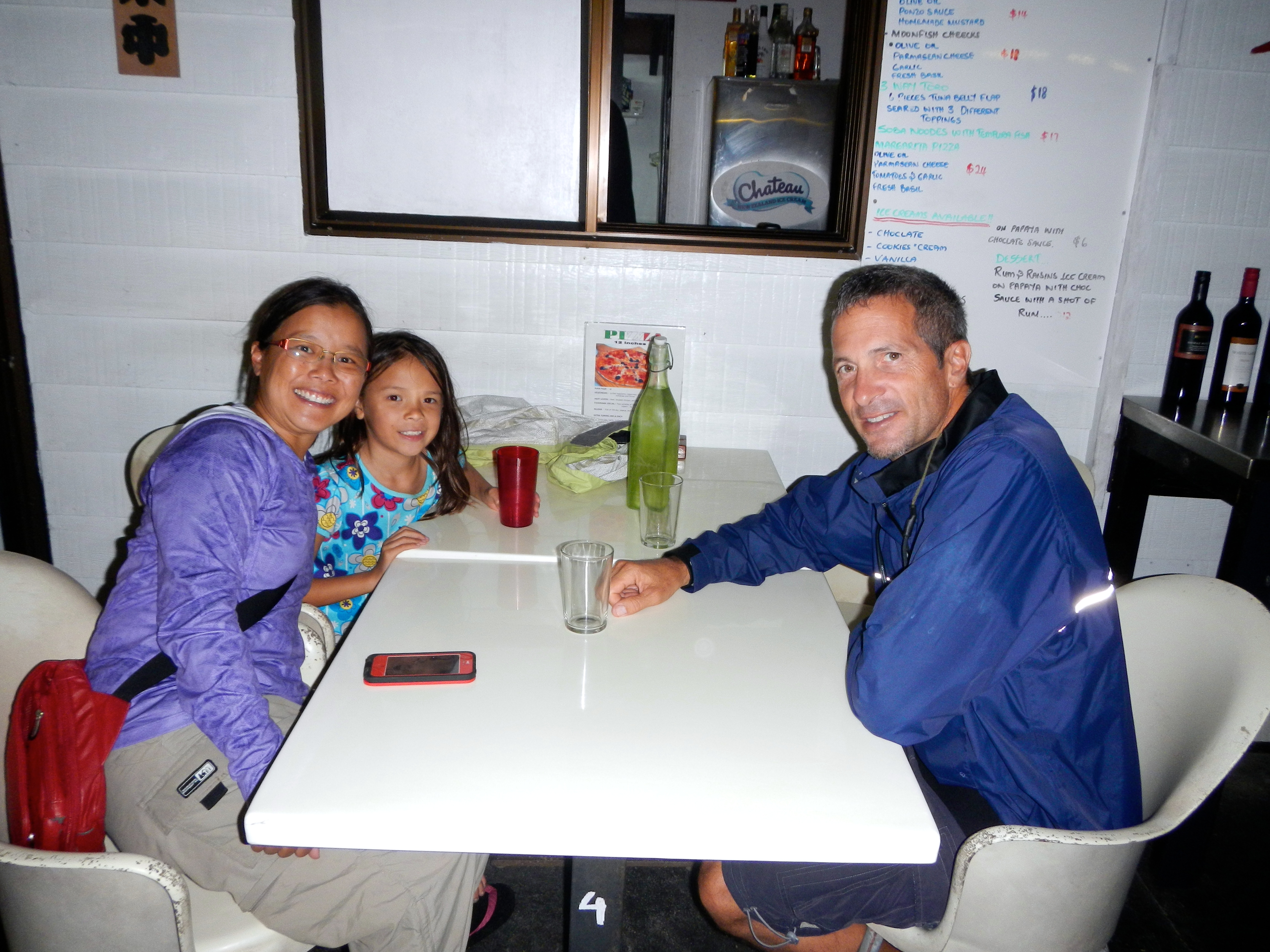
The entire tour took us about half a day. Afterwards, we showered at the bathroom facilities on the wharf, then rewarded ourselves with a nice sushi dinner at Kaika Japanese restaurant, where we had a 6:30pm reservation. The food was absolutely superb—miso soup, fresh seared toro (tuna belly) served 3 different ways, chefs-choice rolls of wahoo, tuna, and mahi mahi, and soba noodles.
Kaika Japanese Restaurant
Although our stay on Niue was only 3 days, we were very glad we stopped. The laid-back lifestyle and friendliness of the Niueans was similar to that in some of the other south pacific islands. We also met some cruisers from Australia who we would end up buddy-boating with to Tonga. Dan and Sara on SV Brahminy bought their boat in the Caribbean and are sailing it to northern Australia. We bumped into Richard and Geri on SV Panthera who are from England and are also on their way to Australia (we met them in Mexico and saw them again in Bora Bora). So on Saturday, we joined both of these boats in up-anchoring for the 2-day sail to Tonga, keeping in touch along the way via VHF radio with weather reports and whale sightings. We even got close enough (within a mile) to take pictures of each others boat during the passage!
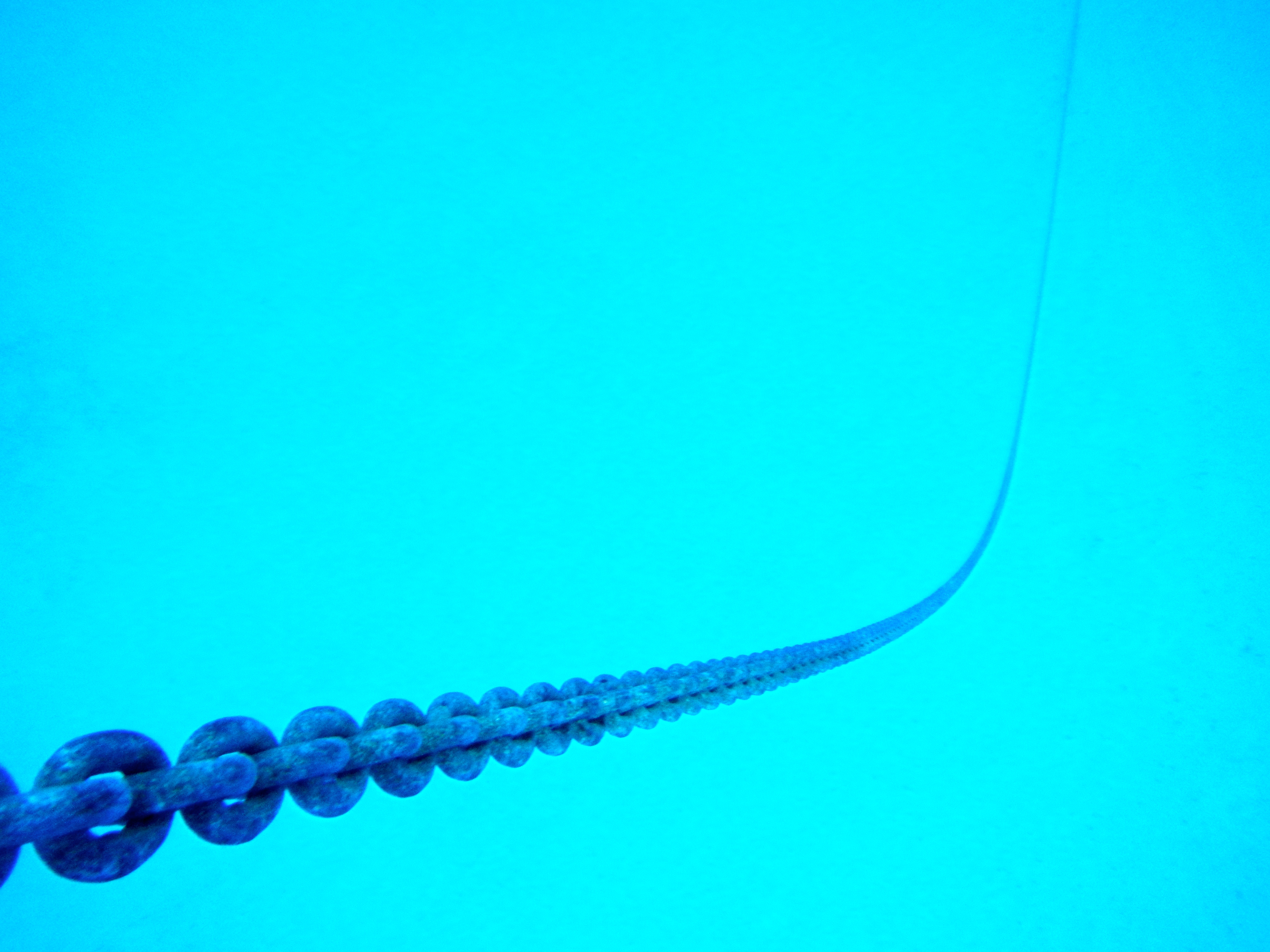
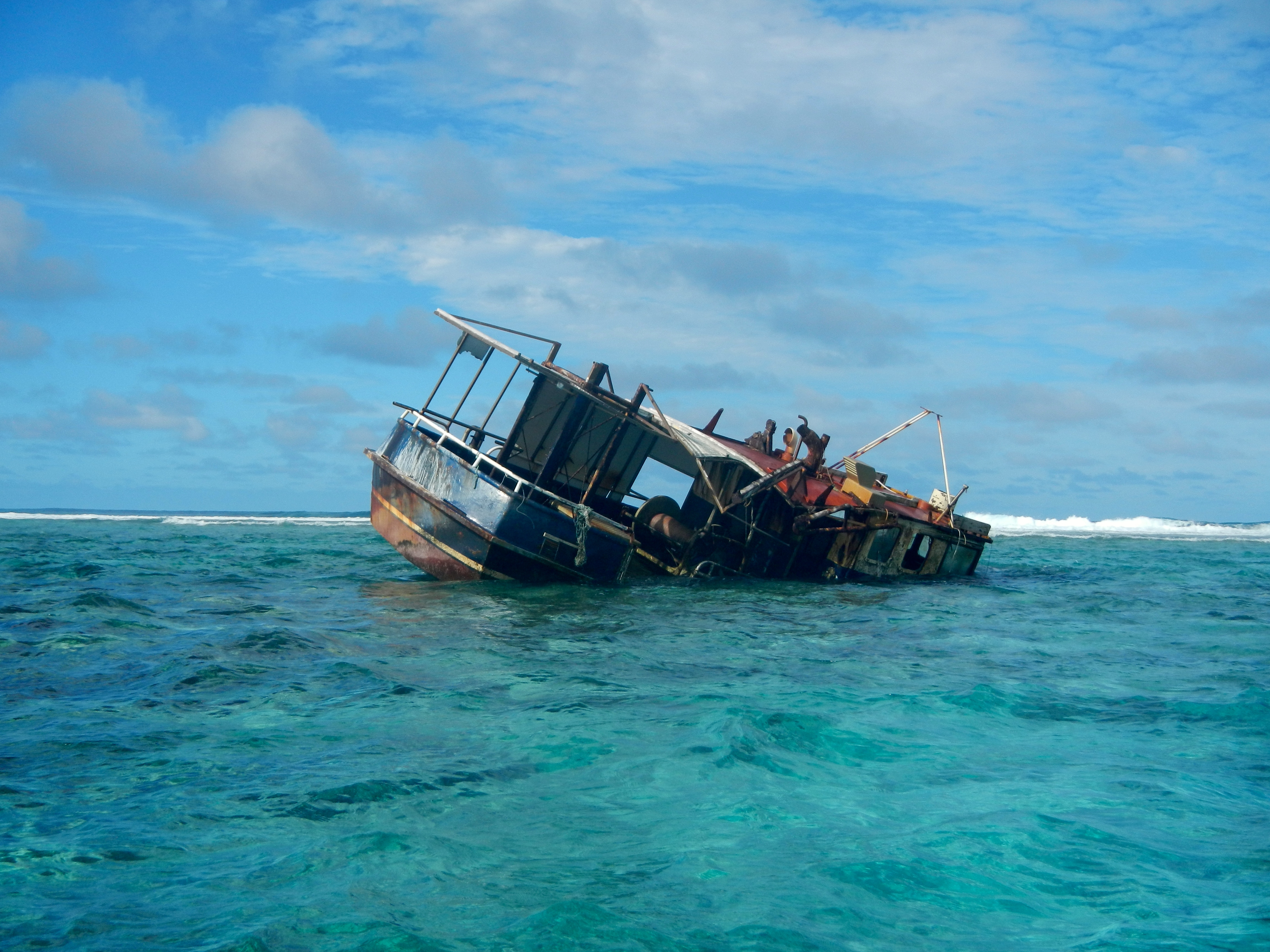
We decided to stop at Beveridge Reef, located about 140nm E-SE of Niue. A cruising guidebook refers to this as one of those “out of this world experiences that shouldn’t be missed”. Beverage Reef is an isolated, horseshoe-shaped, completely submerged (at high tide) atoll with lots of coral and marine life inside. The only entrance into the lagoon is a small gap on the west end. Its turquoise-blue interior lagoon has a wide plateau of white sand that rims the inside of the reef, which is about 4 miles long and 2 miles wide. At high tide the surrounding reef is under water and there is nothing to be seen except the breaking waves on the outer reef and a wreck–a small fishing boat stuck in the coral’s unyielding grasp. This is not a good place to stop during heavy weather as the waves break over the reef and makes anchoring inside uncomfortable. The day we approached the reef, the winds were calm and we had to motor, so it just made sense to stop. We arrived at 3pm, crossed the lagoon, then anchored near the east side of the reef in 20′ of crystal clear water. As we crossed the lagoon, the depth never varied much from 30′. We saw grey sharks and a stingray swimming under the boat, and could hear the surf breaking on the reef 500 yards away. Our boat was completely still at low tide and barely rocked even at high tide. We celebrated our arrival with some nice, cold “beveridges”!
Two other boats were here when we arrived, and one stopped by in their dinghy to say hello. About 8 years ago, Ken and Beth on SV Eagle Wings sailed from Chicago through the Great Lakes, down the Atlantic coast, through the Caribbean and the Panama Canal, and across the Pacific download photoshop cs5. They now cruise between New Zealand and the South Pacific http://canadianviagras.com/.
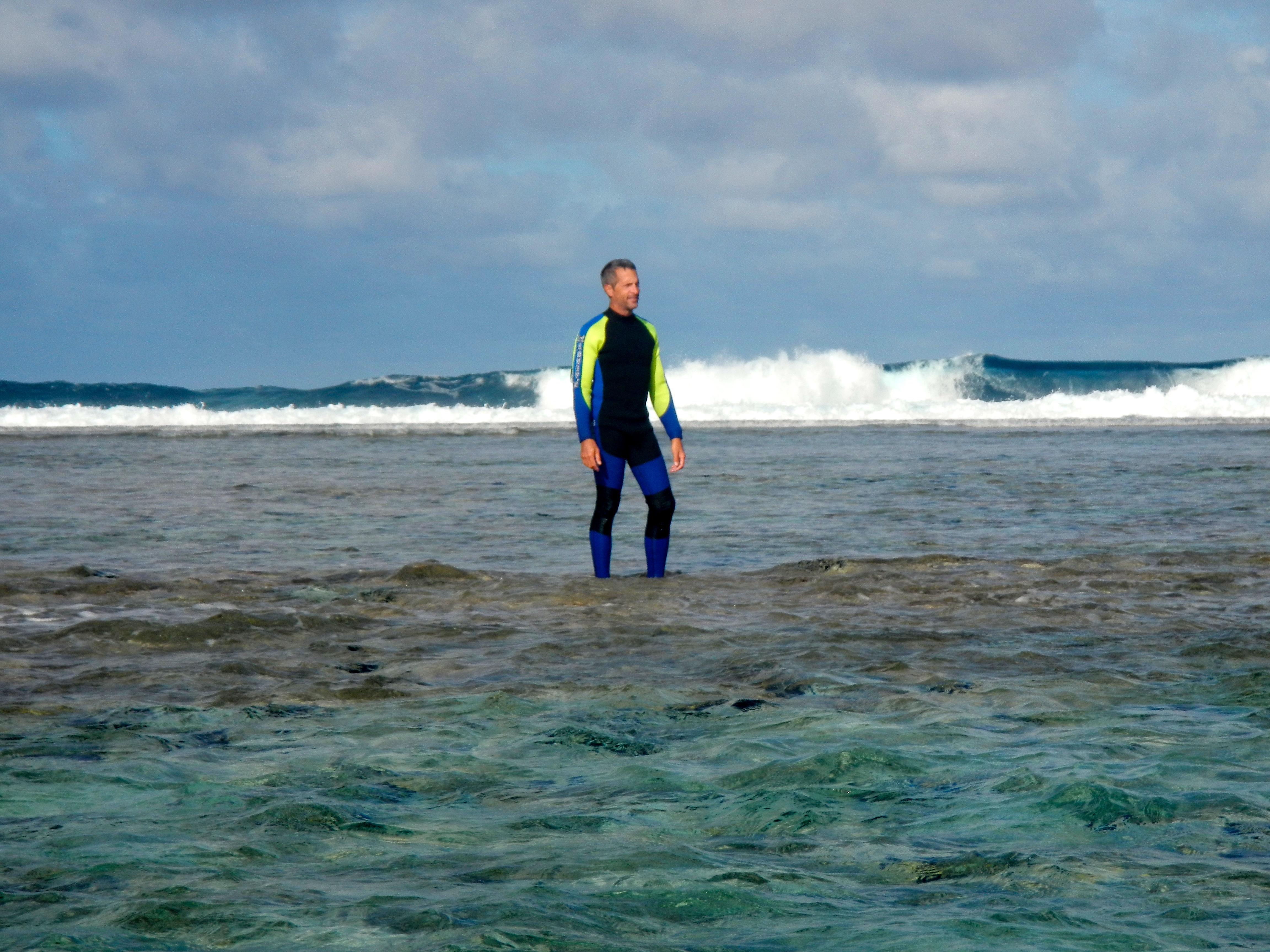
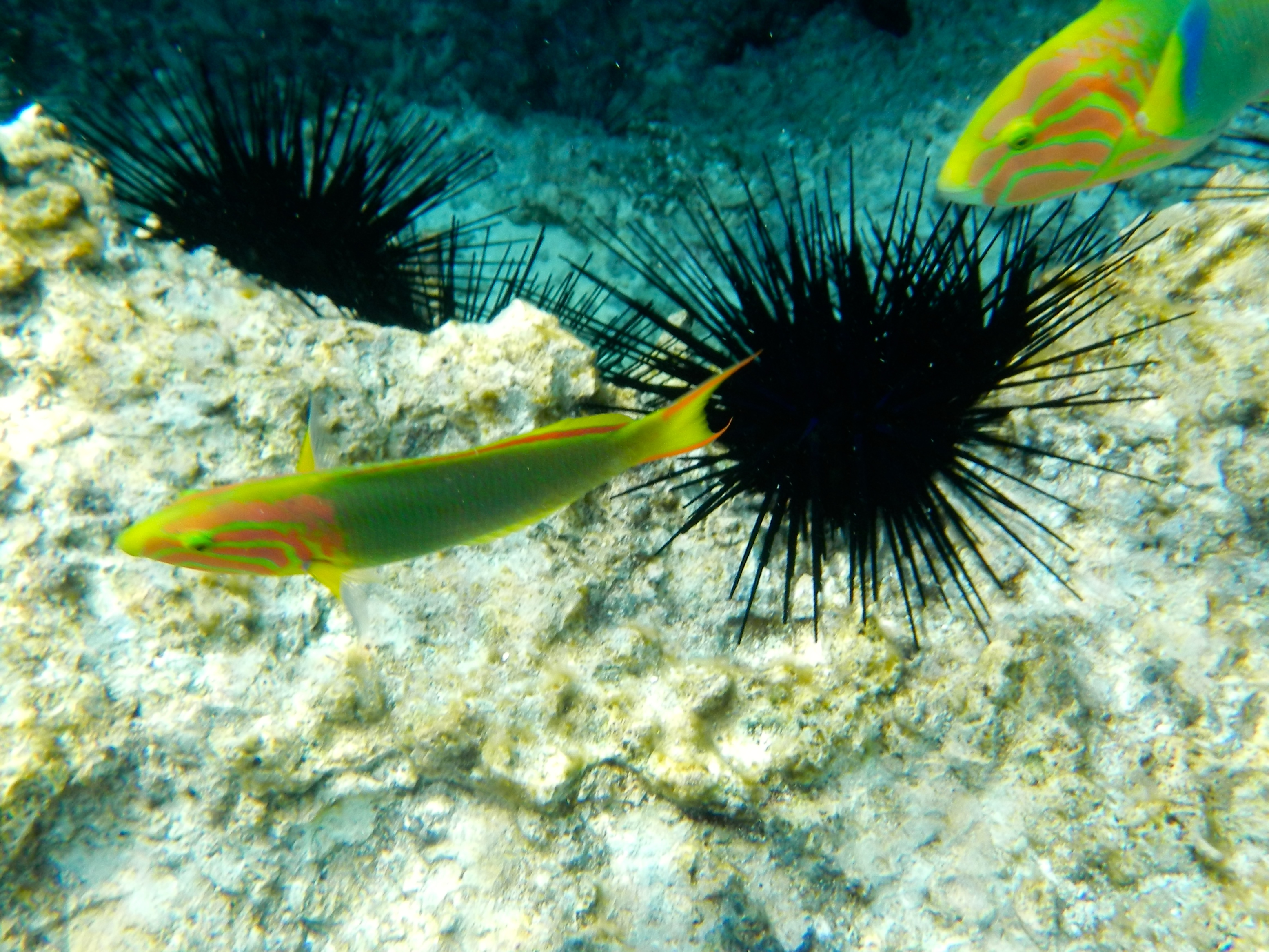
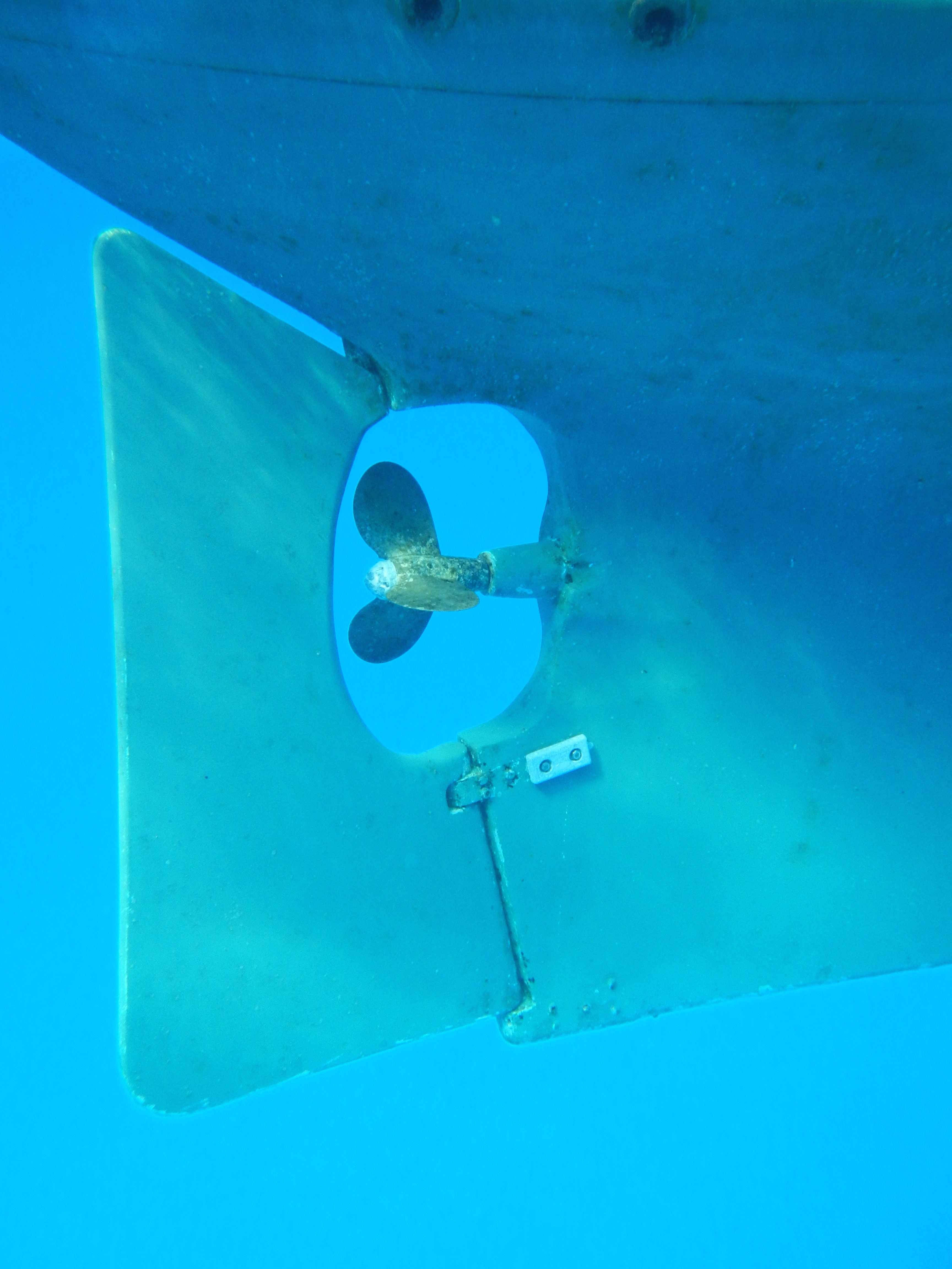
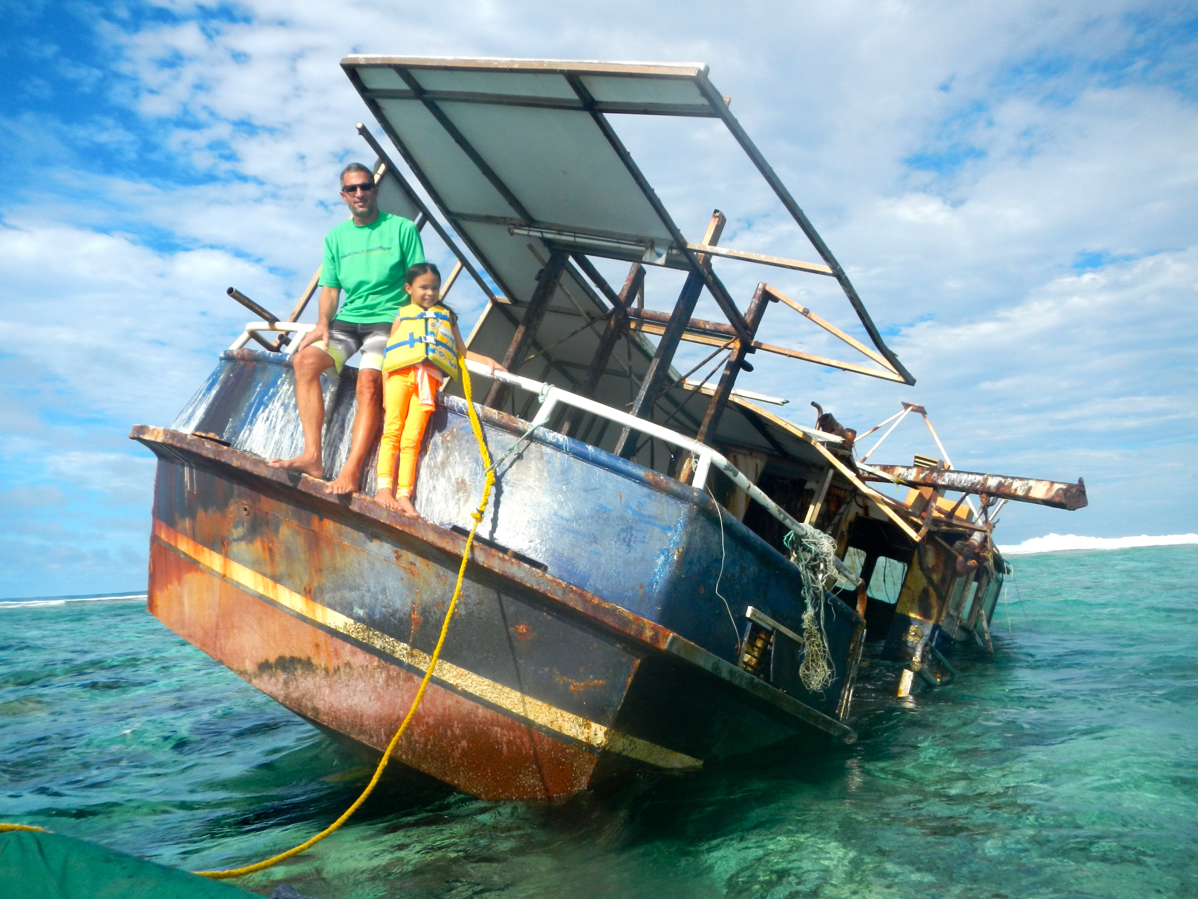
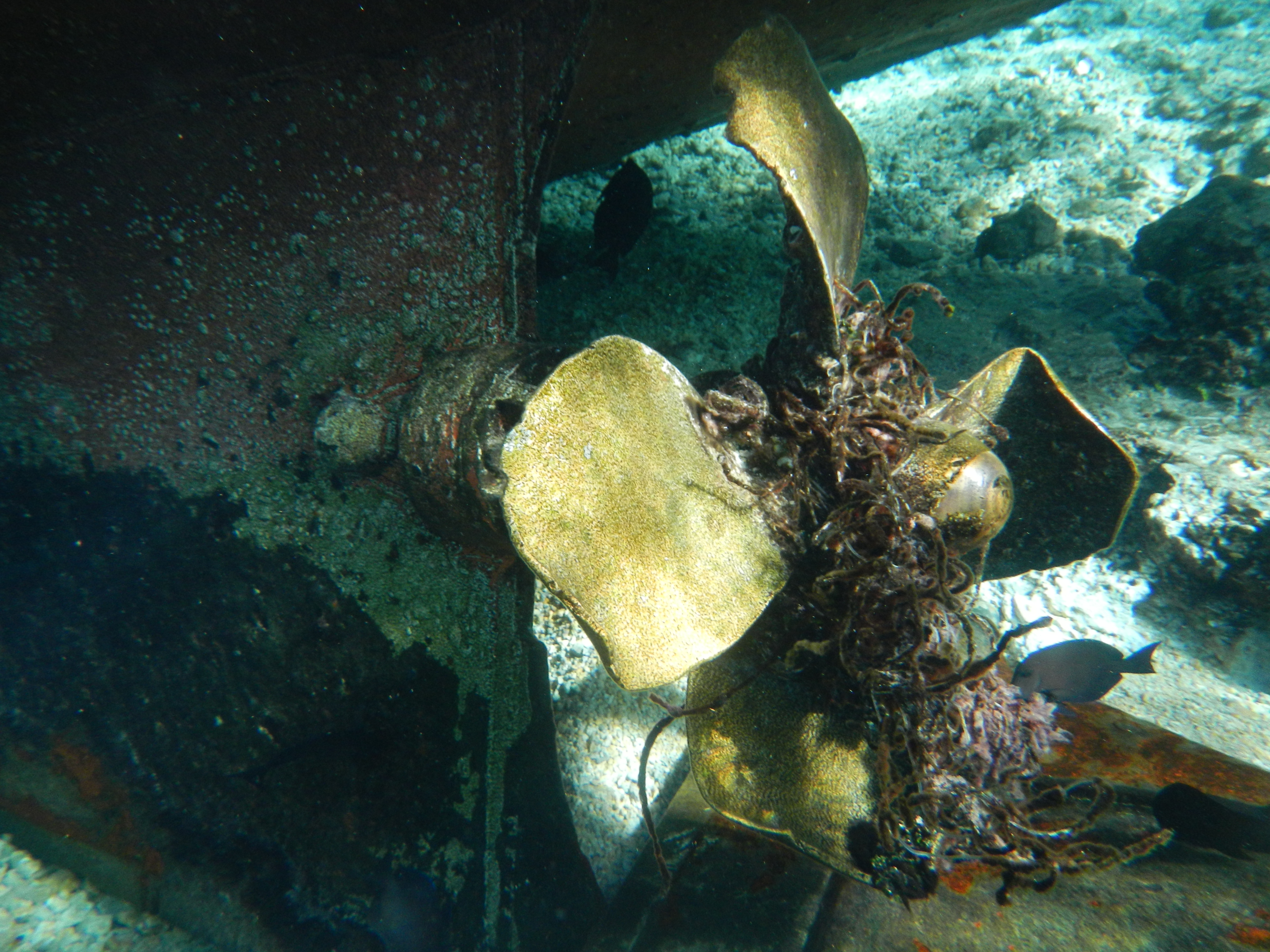
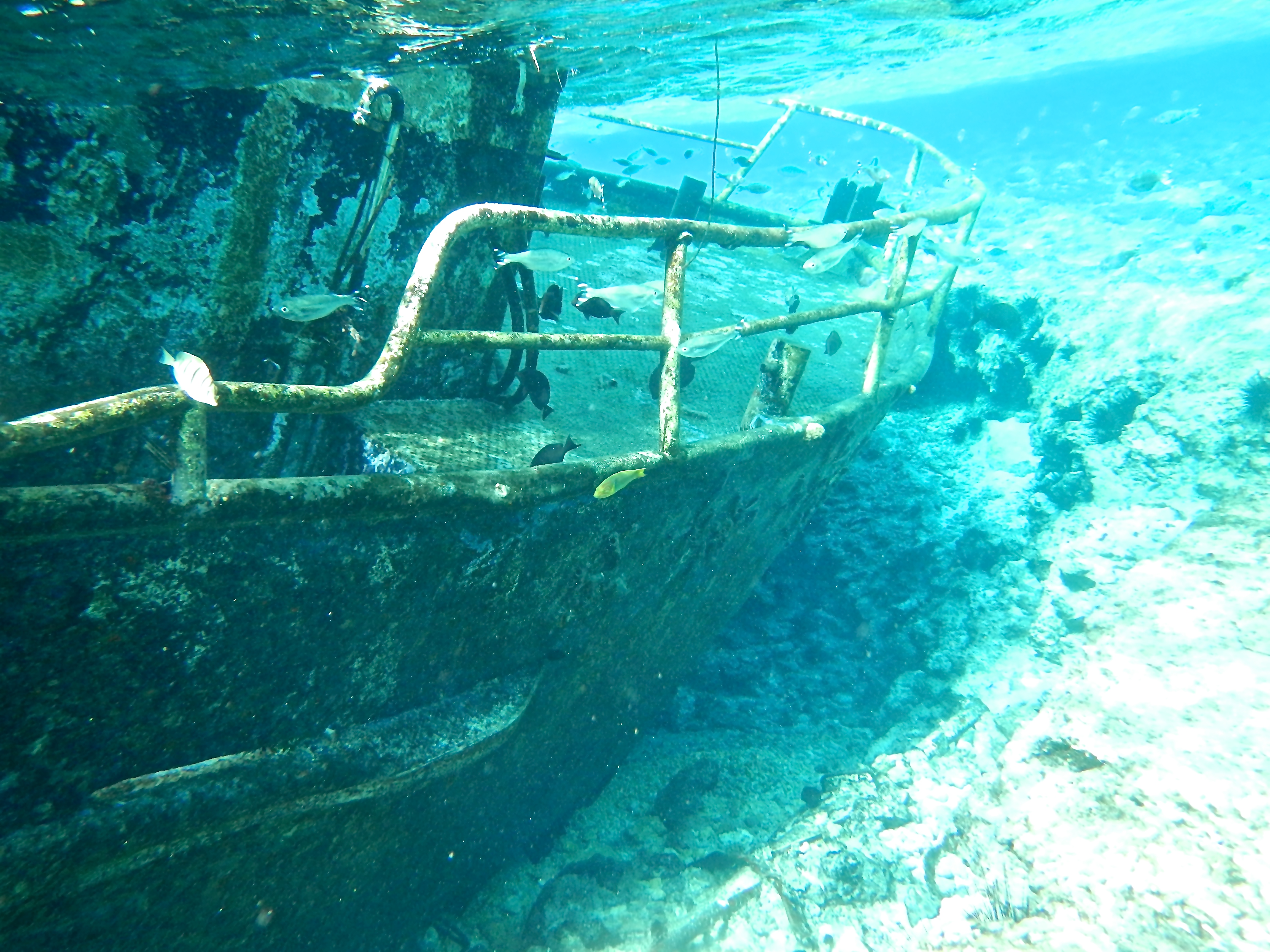
We liked Beveridge Reef so much that we decided to spend another day. After a relaxing morning of reading and drinking coffee, we hopped in the dinghy and explored the wreck on the NE side of the reef. The MV Liberty was a steel fishing boat that has been on the reef for at least 8 years. We tied our dinghy to the stern and Jacintha and I hopped aboard. The wreck sits at an angle with the bow under water and the stern above. After snorkeling around it, it became obvious how it came to its end on the reef–a tangled line can still be seen wrapped around the propeller. I imagine they were fishing to the east of the reef when they fouled the prop, and were unable to free it before crashing. We were told that the captain and all the crew survived. Next we took the dinghy closer to the breaking waves until we were on the reef in 2′ of water. We dropped our dinghy anchor and walked onto the reef. At nearly low tide, we were standing in 6″ of water and about 50′ away huge waves were crashing onto the outer edge of the reef. It was an amazing experience to think we were over a hundred miles from land and were standing on the edge of a reef!
Standing on Beveridge ReefParrot Fish and Sea UrchinApropos Rudder and PropAnchor Chain Dropping Down to a Sand BottomDinghy Ride to the Reef with Apropos BehindWreck of the MV LibertyShipwrecked!Fishing Line Fouled the PropSnorkeling around the Wreck
Since we arrived at the north end of Rarotonga at 8pm, we had to wait until the following morning to radio the harbormaster to get approval and mooring instructions. Heaving-to is a way of stalling a boat and is usually used in high winds so the crew can rest. The typical procedure is to tack without releasing the genoa sheet so the headsail is back-winded, then lashing the rudder at an angle. The sheeted-in mains’l provides a little movement to windward and the back-winded genoa provides a little movement to leeward. These two counter-balance each other and the boat stalls facing into the wind, ideally moving at less than a knot. We’ve done this before in winds over 15 knots and it worked well. But trying to hove-to in only 5 knots of wind doesn’t work so well on Apropos. We tried different combinations of reefing the main and genoa while hove-to but the boat kept turning away from the wind and sailing on a beam reach at a speed of 2 knots. Since we would be hove-to for 12 hours, this would put us 24 miles away. Our goal was to stay in the lee of the island. So our only solution was to heave-to for a while starting at point A, sail slowly to point B, then turn the boat around and return to point A and repeat…..all night long! So instead of getting some rest, we would have to take shifts doing this. We thought about just dropping the sails and drifting, but a 1 knot current would take us away from the lee of the island and we’d get blown further away and into rougher seas. We found that going from point A to B took 2-3 hours, and returning to point A took 1 hour. So it took 3 cycles of this until daybreak. We then took the sails down in the morning and motored into Avatiu Harbor after contacting the harbormaster on VHF and hoisting our yellow quarantine flag.
Avatiu Harbor can only hold about 6 cruising boats and is exposed to the north, so any northerly winds makes this a risky place. Boats are required to med tie to a sea-wall. This means dropping an anchor in 20’ of water, backing up to the sea-wall, then tying 2 stern lines to cleats on the sea-wall. The day we arrived, there were no other boats moored here. The med mooring went well and a port worker caught our lines as we backed up to the sea wall. After meeting with custom officials to get checked into the Cook Islands, we took down the Q flag and were free to go “muck about” as the customs official put it. Later another official stopped by to confiscate all remaining fruits and vegetables. The cruising guides say they come aboard to search and fumigate the boat to kill any fruit flies, but he was satisfied with us handing over a few limes and didn’t even come aboard.
Med-moored to the sea wall in Avatiu Harbor
Being the only cruising boat in the harbor, we had lots of people stopping by the quay for a look. A lot of New Zealanders come here this time of year to escape from their winter and we invited some aboard for coffee. We also found the locals to be very friendly. At the marina office I was asking where I could fill up our 5-gallon diesel containers and ended up riding on the back of her scooter while holding onto the two containers, to a gas station a block away. I decided to walk there for the next 2 trips and this supplied us with 30 gallons, enough to top off the tanks. A worker in the cafe located next to the quay offered to drive us to the laundry service a few miles away. Turns out she has a daughter Jacintha’s age so they played together when she was off school. Two other sailboats arrived over the next few days, both flying French flags.
The Cooks consist of 15 small islands scattered over 750,000 square miles. Captain Cook, after whom the islands are named, explored most of them in the 1770s. Rarotonga is only 25 square miles in area. The mountain peaks reach to about 2000’ and are a spectacular sight from offshore. This is the most important of the Cook Islands and over half of the population resides here. The town of Avarua is near the moorage and there is a public market, grocery store, hardware store, and lots of restaurants nearby. A road circles the island and a 50-minute bus ride takes you around the island.
Celebrating
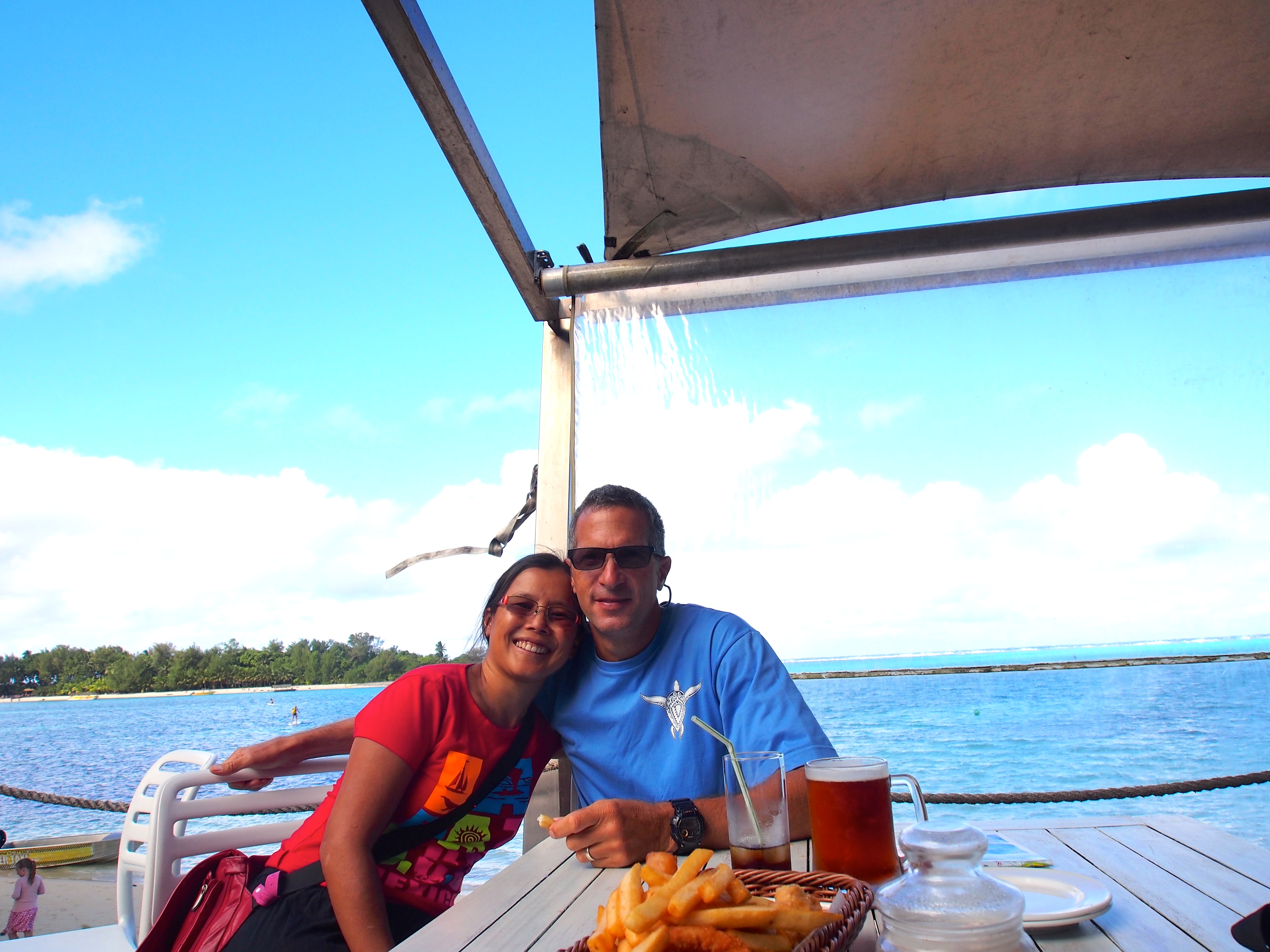
We celebrated our wedding anniversary with a nice lunch at the Rarotonga Yacht Club at Muri Beach, located on the SE side of the island. We took a bus there and hitchhiked back. A young couple from Scotland and Montana picked us up and we invited them on our boat to chat.
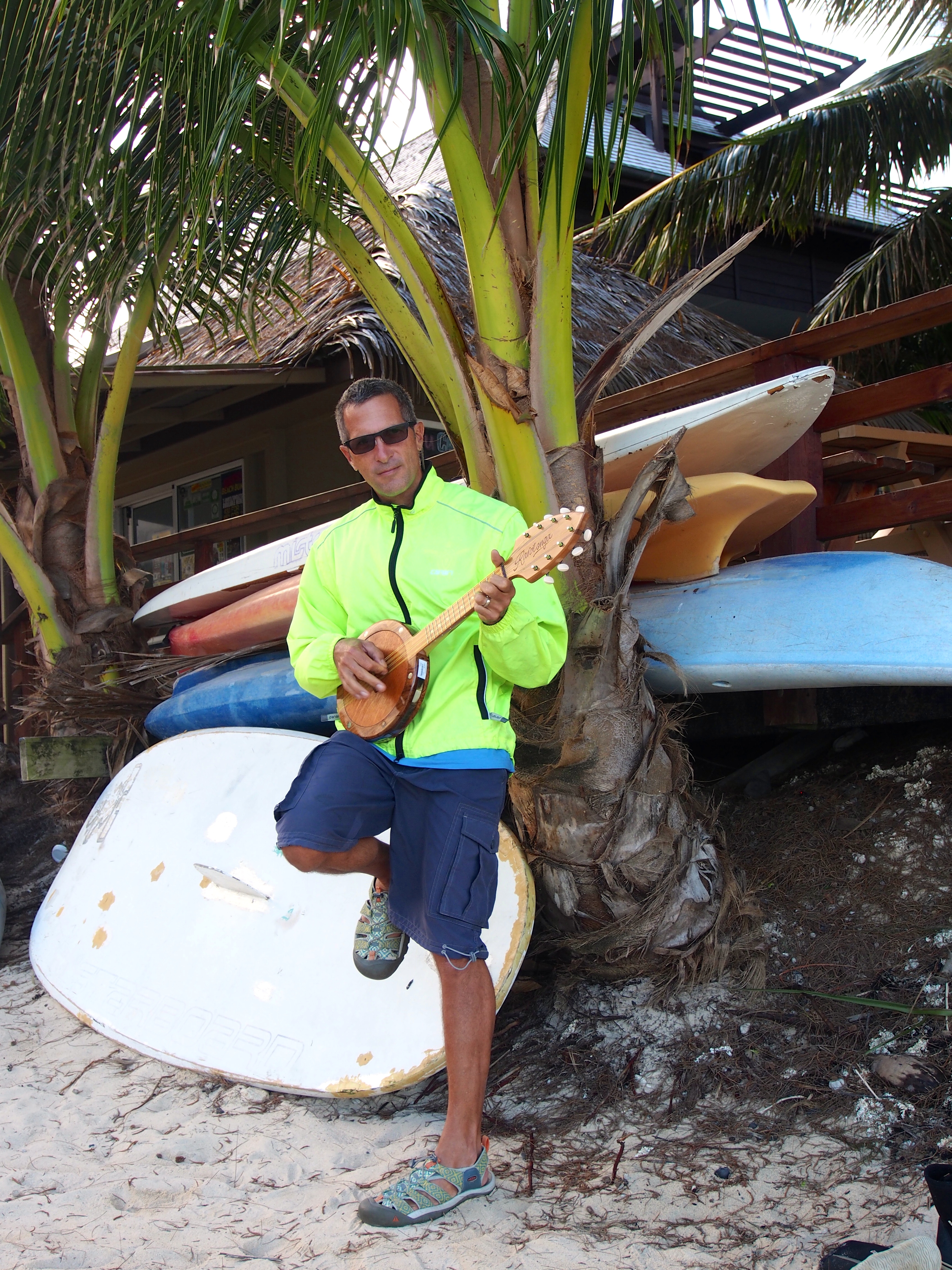
I also picked out my belated birthday present–a nice Tahitian ukulele, something I’ve been eying during our 2 months in French Polynesia.
Lunch at the Rarotonga Yacht ClubMy new uke!
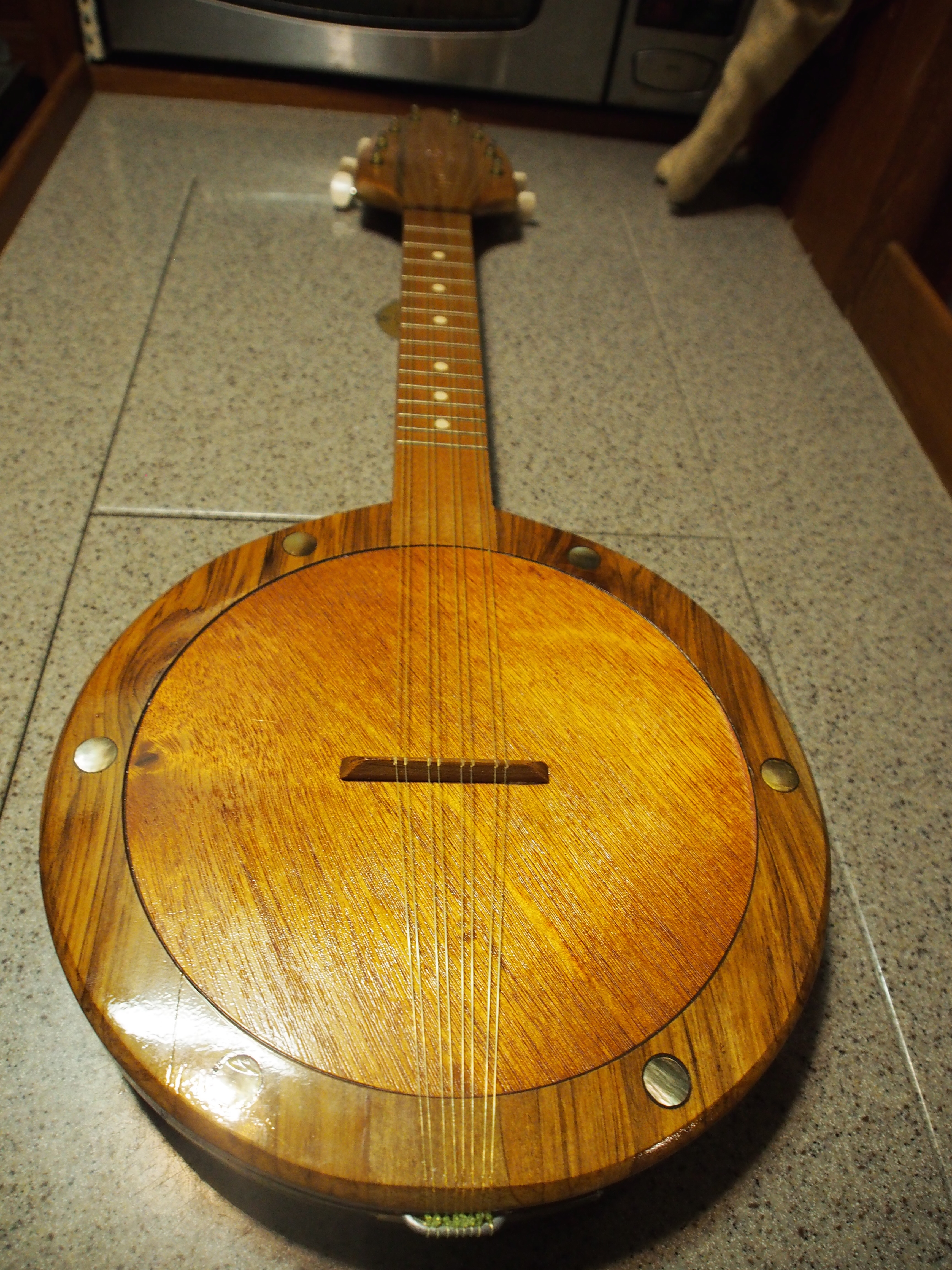
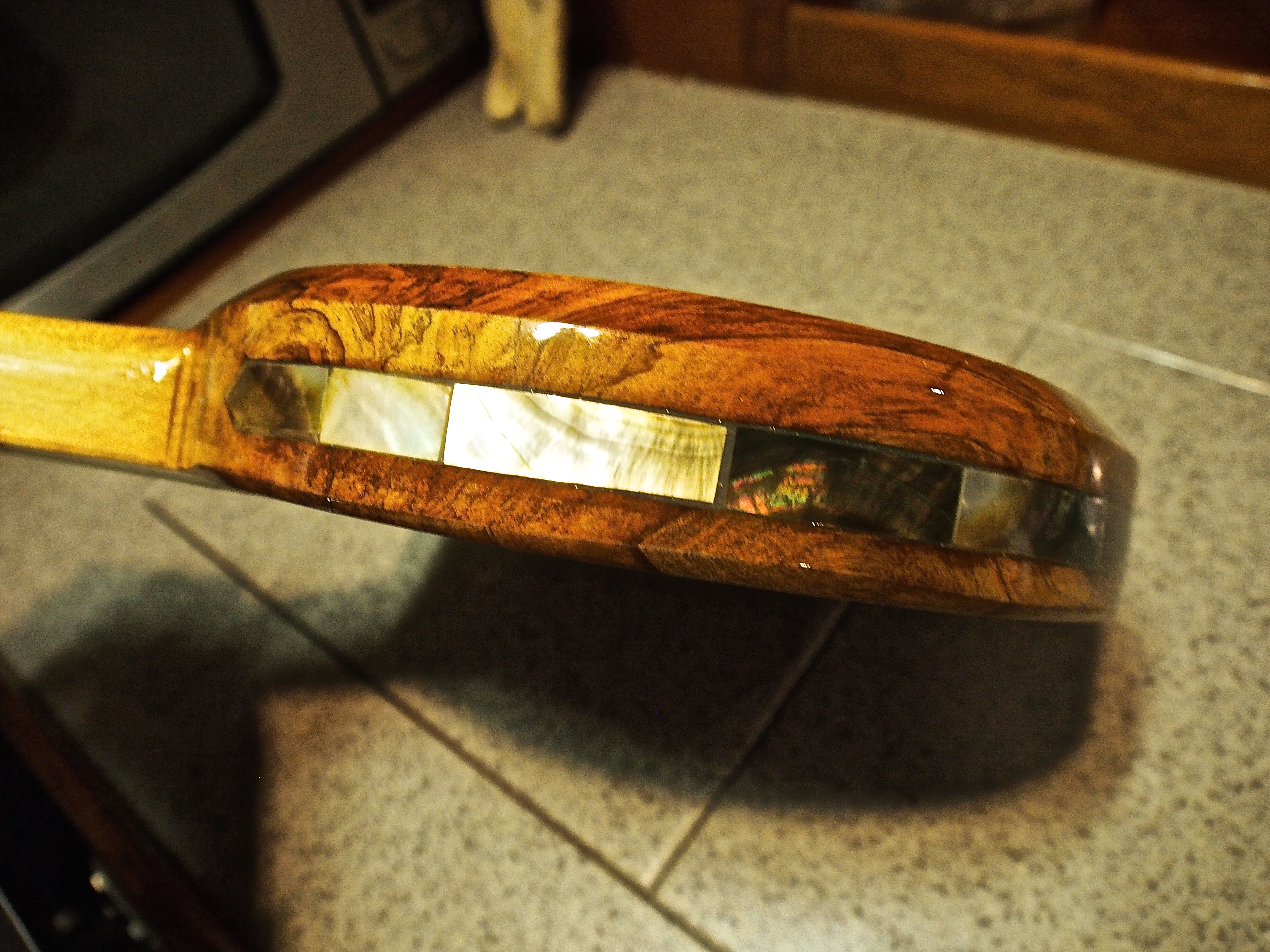
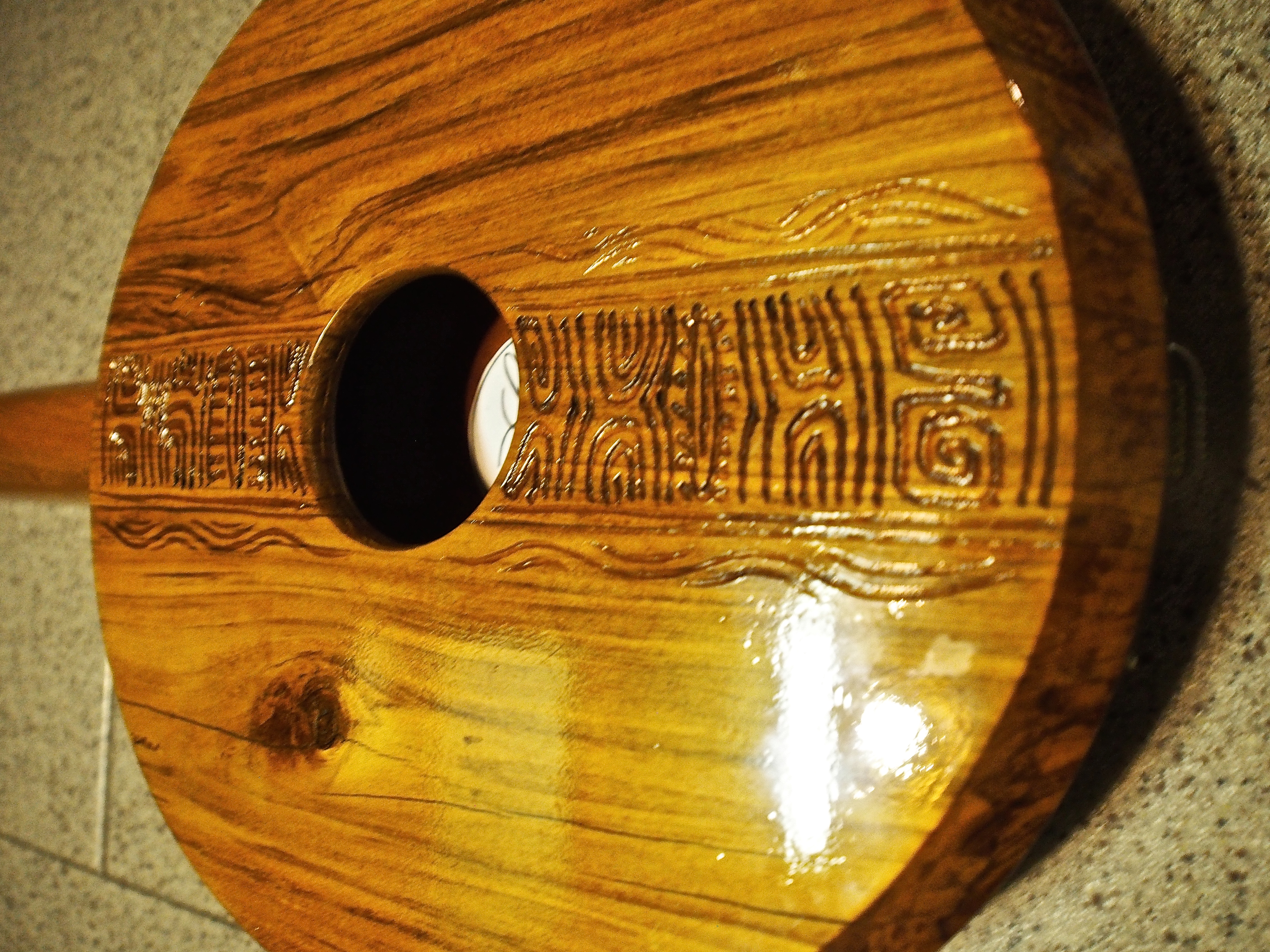
Tahitian Ukulele
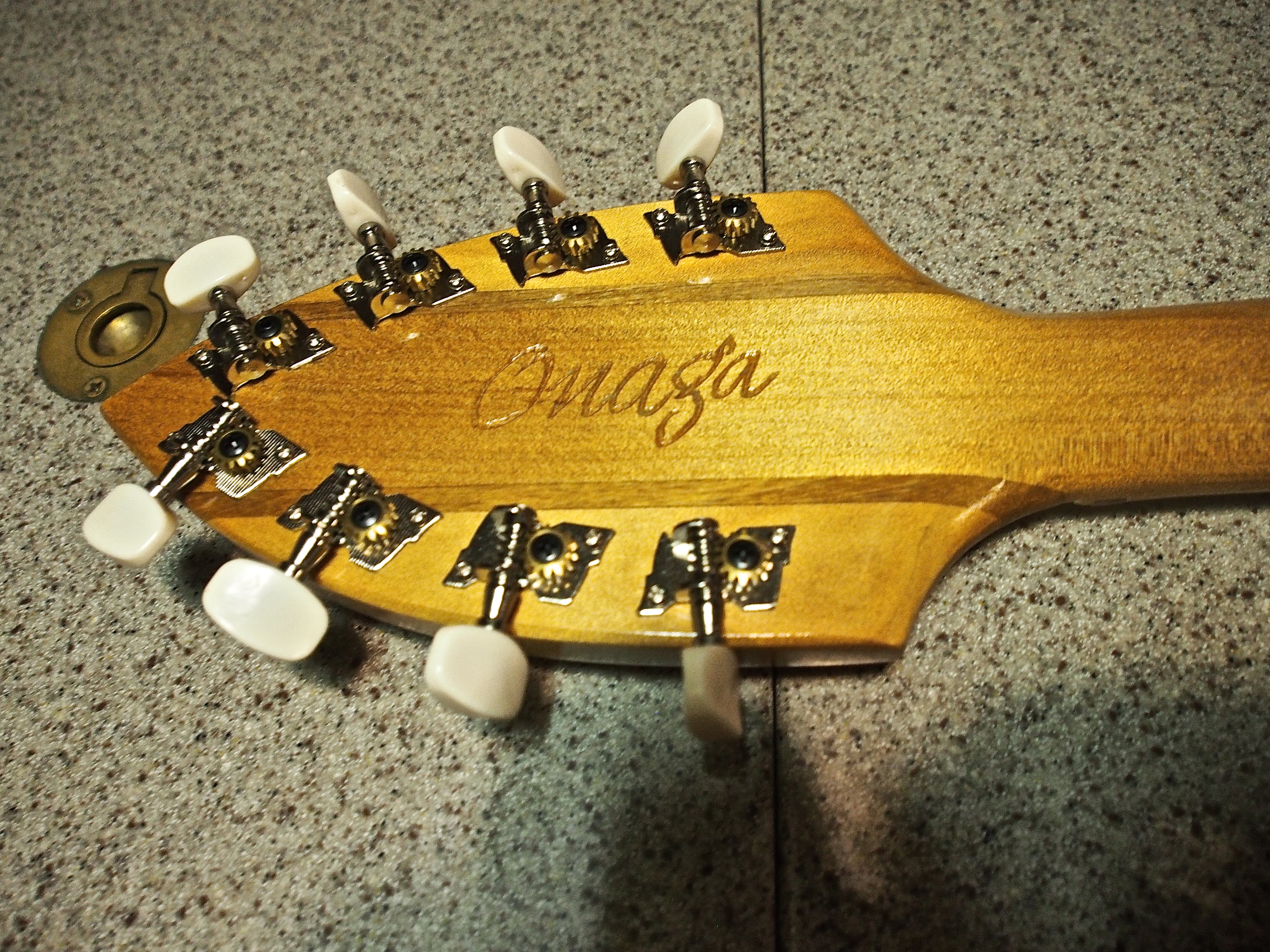
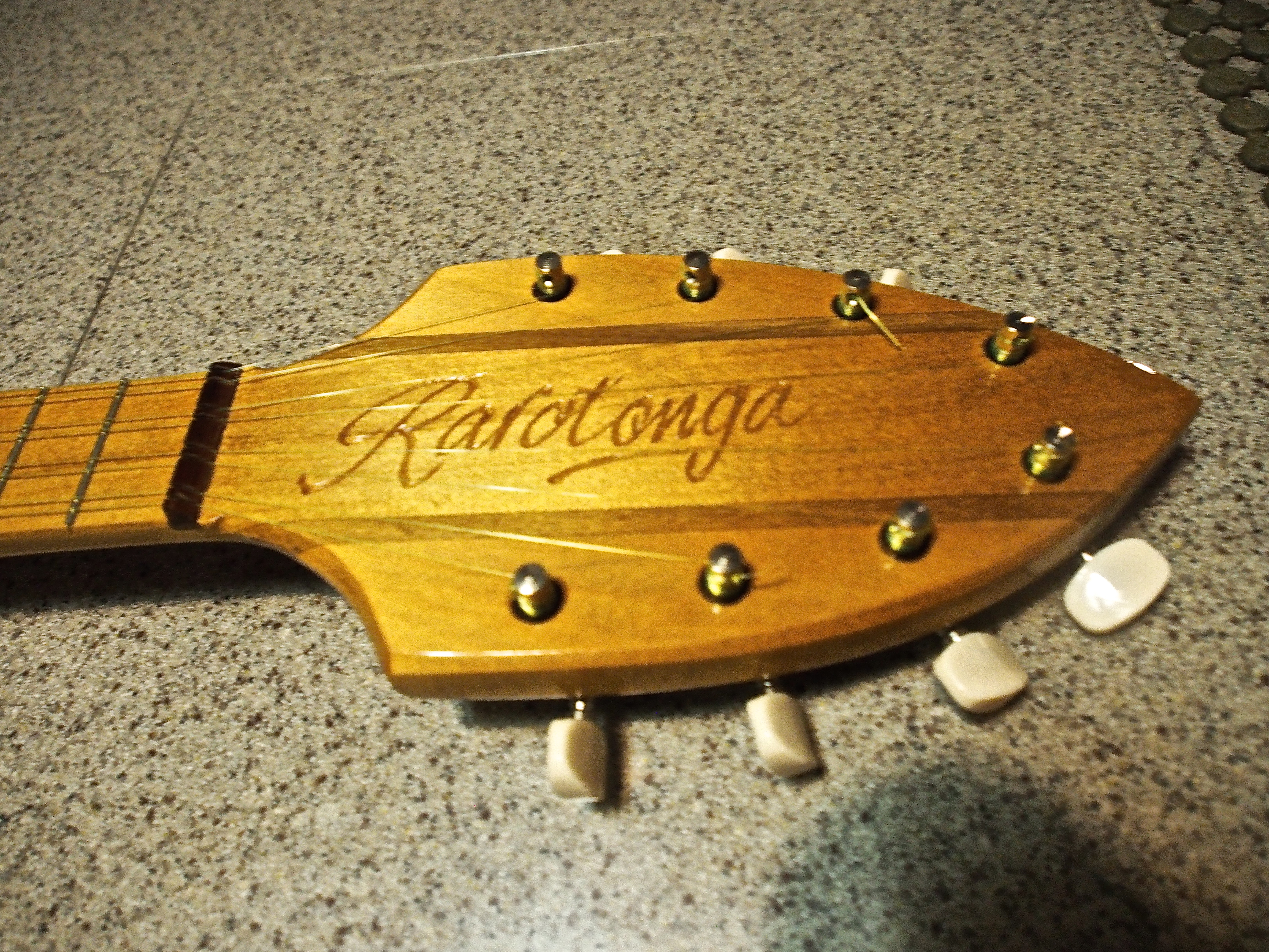
I first learned about this type of ukulele, which has 8 strings doubled in 4 pairs and tuned to GG CC EE AA, in the Marquesas. I kept hearing them being played in places like Rangiroa, Tahiti, Huahine, and at the Heiva festival in Bora Bora. The one I chose is made in Tahiti by Raromatai, and is the Onaga model. I chose it for it’s superior acoustics compared to the other models I looked at. It also is a work of art with embedded pearl around the front and side body, carvings on the rear body and neck. A 4cm hole is bored in the back and a 10cm hole is bored in the front, then covered by a thin piece of wood. This works as a wood-skinned banjo and gives the Tahitian ukulele it’s unique sound. I’ve already found some good sources on YouTube for learning how to play it. My other ukuleles are 4-string Hawaiian-type and I mostly play finger-pick style. The Tahitian ukulele is meant to be played in a fast strumming manner.
Wood body (front) embedded with pearl shellSide body embedded with pearlTahitian engraving on the body (rear). 4cm boreOnaga engraving on head (rear)Rarotonga engraved on head (front)
Departing Rarotonga
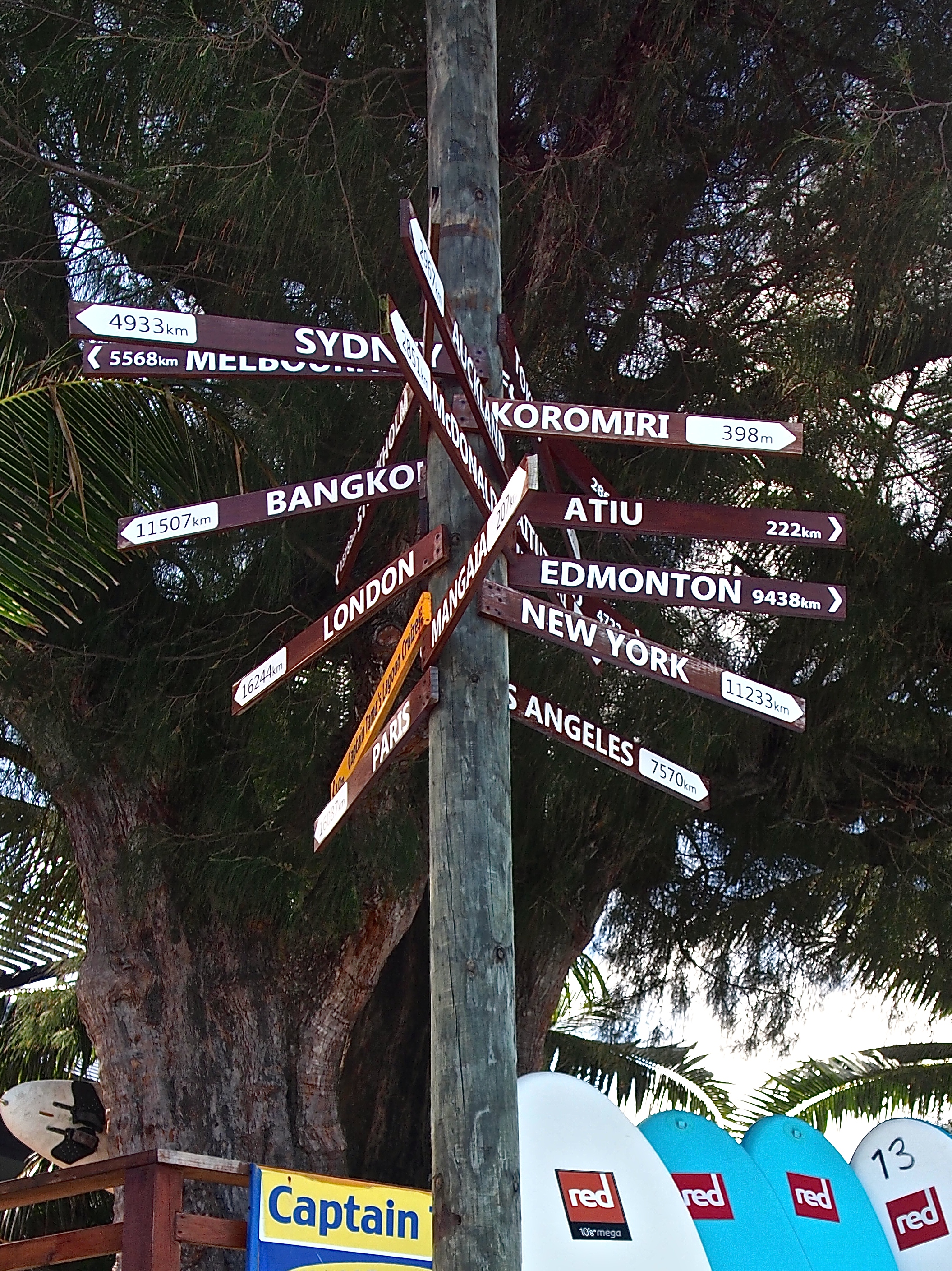
After a 4 day stay, we will be departing Rarotonga and sail to Niue, about 600 miles away. We took care of the formalities (port captain, immigration) a day ahead. We still have a long way to go to reach Sydney…
4933 km to Sydney!
I’m reading the book “The Bounty, The True Story of the Mutiny on the Bounty”
The HMS Bounty stopped in Rarotonga after their stay in Tahiti. Next they departed for Tonga, which is where the mutiny took place under the direction of Fletcher Christian. The mutineers sailed the Bounty back to Tahiti and some went on to Pitcairn Island where they started a colony which still exists today. Captain Bligh and 20 of his loyalists were placed in a 23’ launch boat and miraculously survived the 3,500 nautical mile trip to Timor. He then went back to England to begin the process of bringing the mutineers to justice.