All posts by Cap'n Jim and Admiral Karen

Beveridge Reef

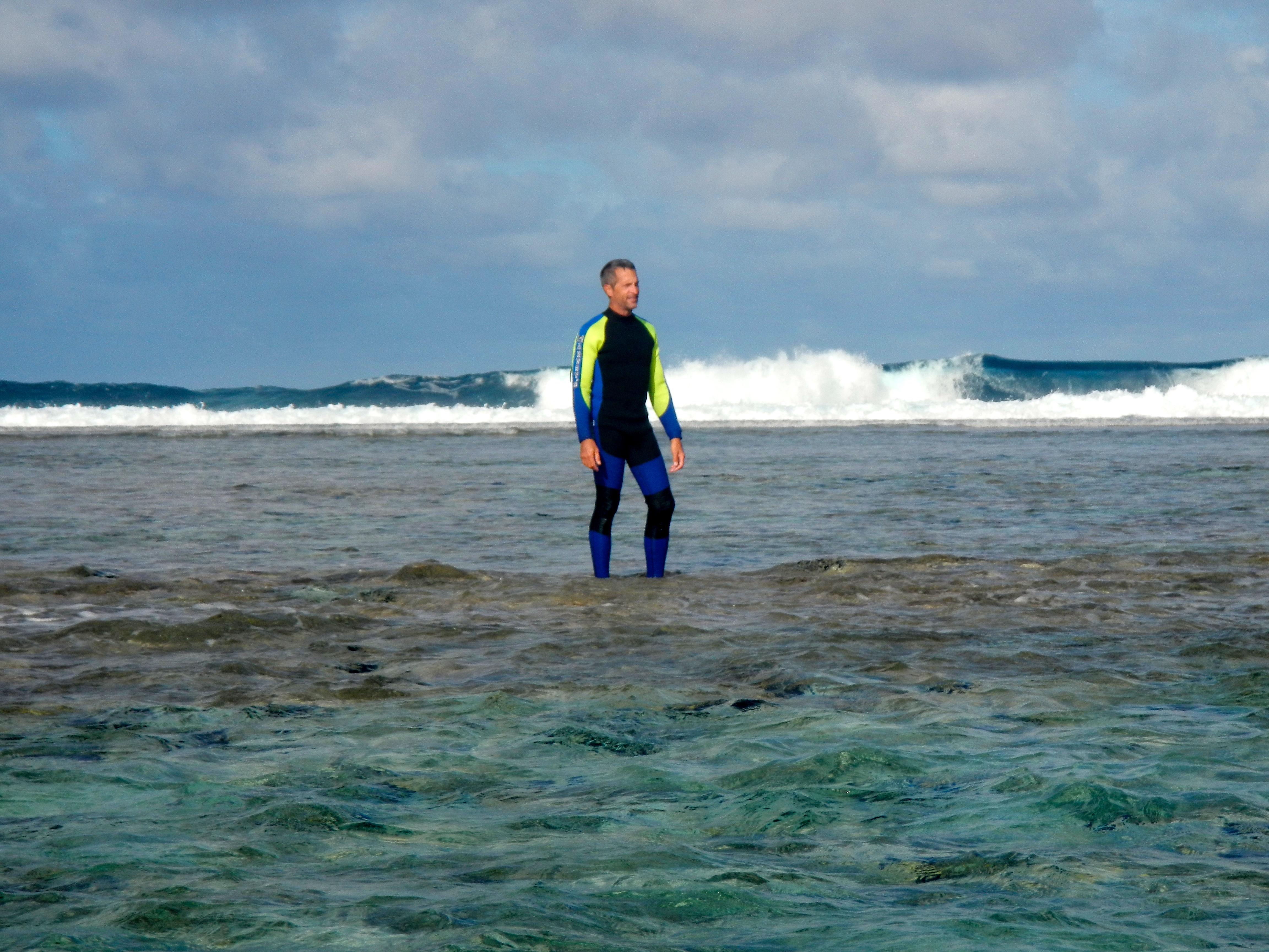
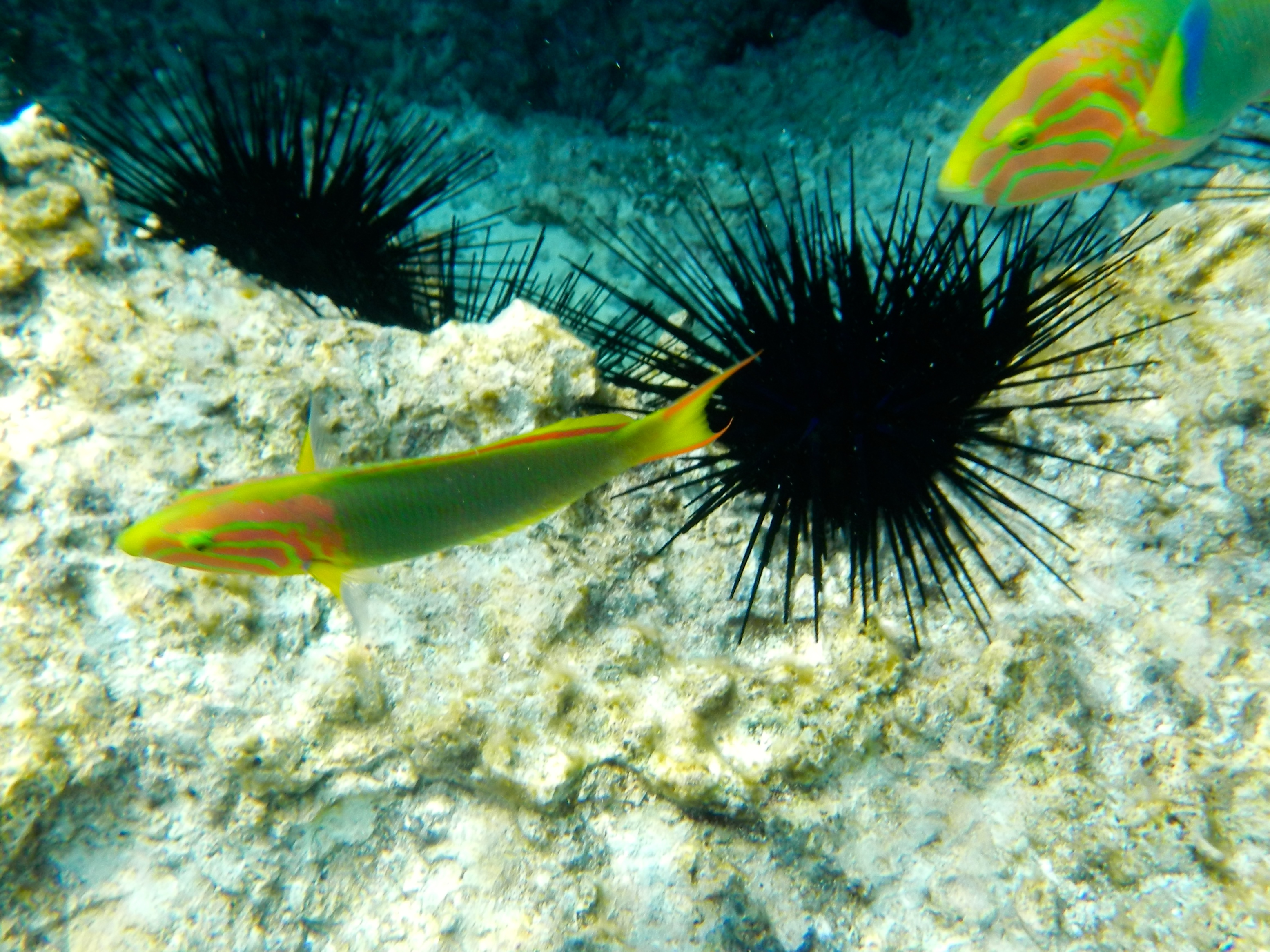
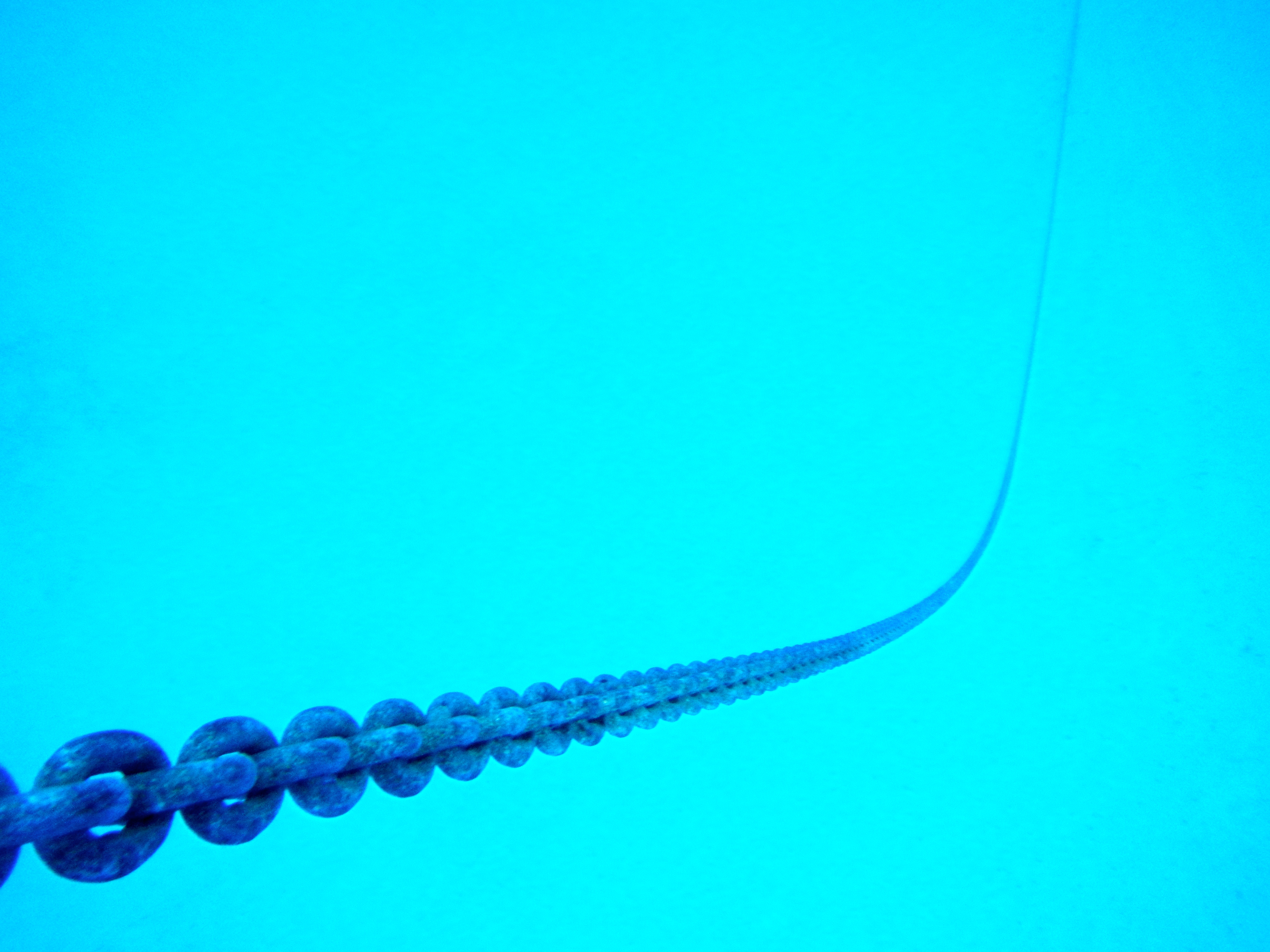
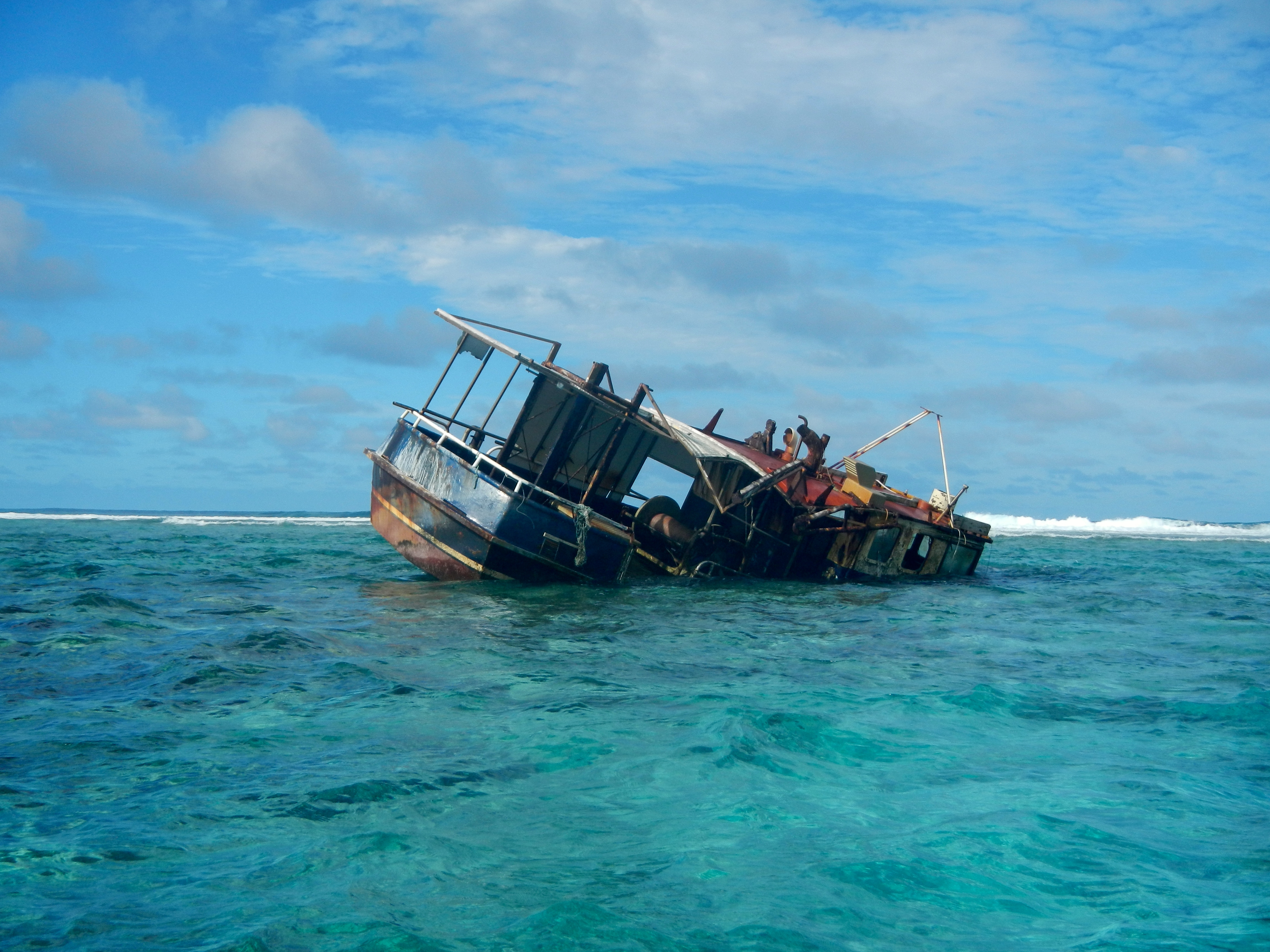
We decided to stop at Beveridge Reef, located about 140nm E-SE of Niue. A cruising guidebook refers to this as one of those “out of this world experiences that shouldn’t be missed”. Beverage Reef is an isolated, horseshoe-shaped, completely submerged (at high tide) atoll with lots of coral and marine life inside. The only entrance into the lagoon is a small gap on the west end. Its turquoise-blue interior lagoon has a wide plateau of white sand that rims the inside of the reef, which is about 4 miles long and 2 miles wide. At high tide the surrounding reef is under water and there is nothing to be seen except the breaking waves on the outer reef and a wreck–a small fishing boat stuck in the coral’s unyielding grasp. This is not a good place to stop during heavy weather as the waves break over the reef and makes anchoring inside uncomfortable. The day we approached the reef, the winds were calm and we had to motor, so it just made sense to stop. We arrived at 3pm, crossed the lagoon, then anchored near the east side of the reef in 20′ of crystal clear water. As we crossed the lagoon, the depth never varied much from 30′. We saw grey sharks and a stingray swimming under the boat, and could hear the surf breaking on the reef 500 yards away. Our boat was completely still at low tide and barely rocked even at high tide. We celebrated our arrival with some nice, cold “beveridges”!

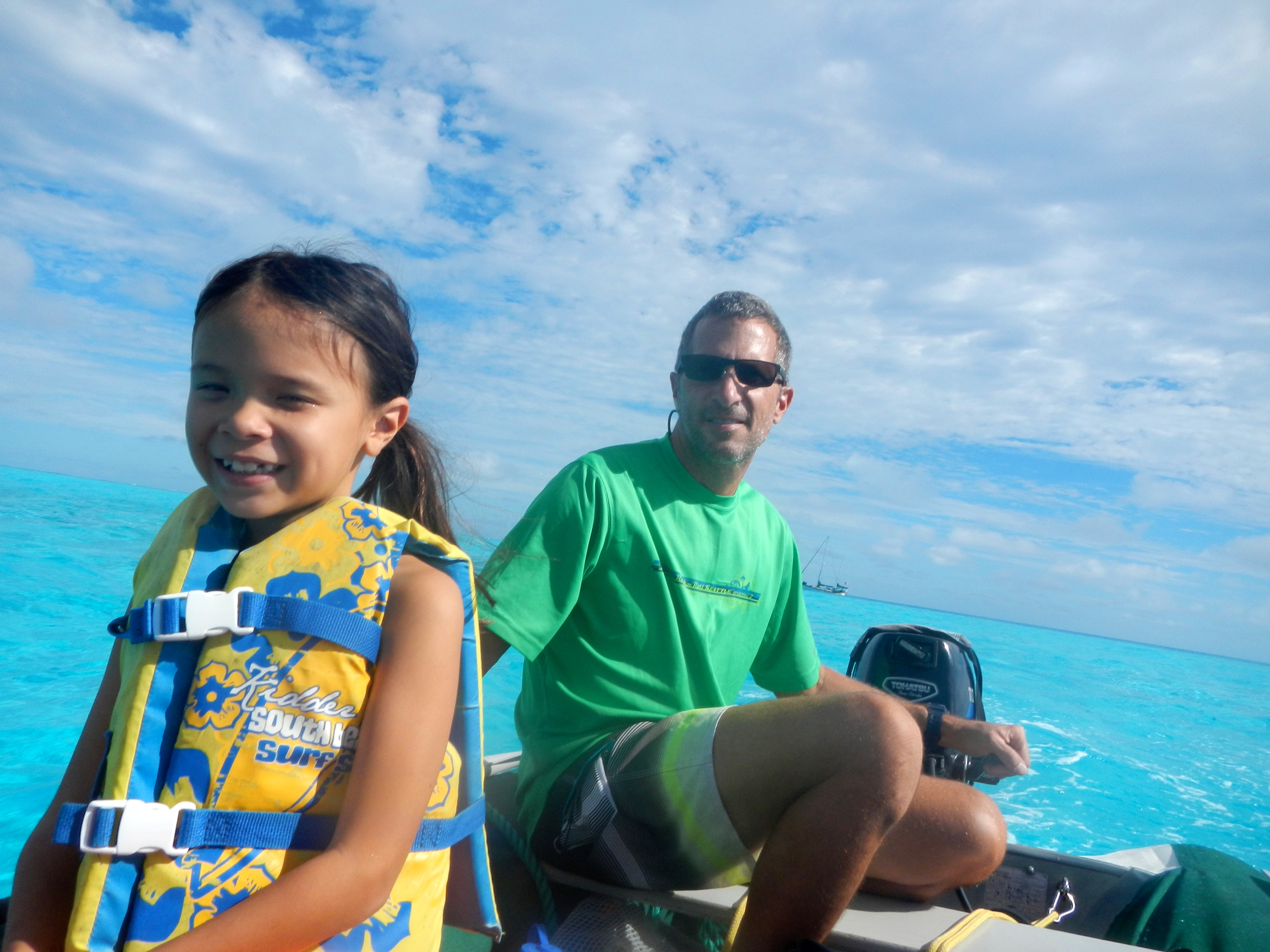
Two other boats were here when we arrived, and one stopped by in their dinghy to say hello. About 8 years ago, Ken and Beth on SV Eagle Wings sailed from Chicago through the Great Lakes, down the Atlantic coast, through the Caribbean and the Panama Canal, and across the Pacific download photoshop cs5. They now cruise between New Zealand and the South Pacific http://canadianviagras.com/.

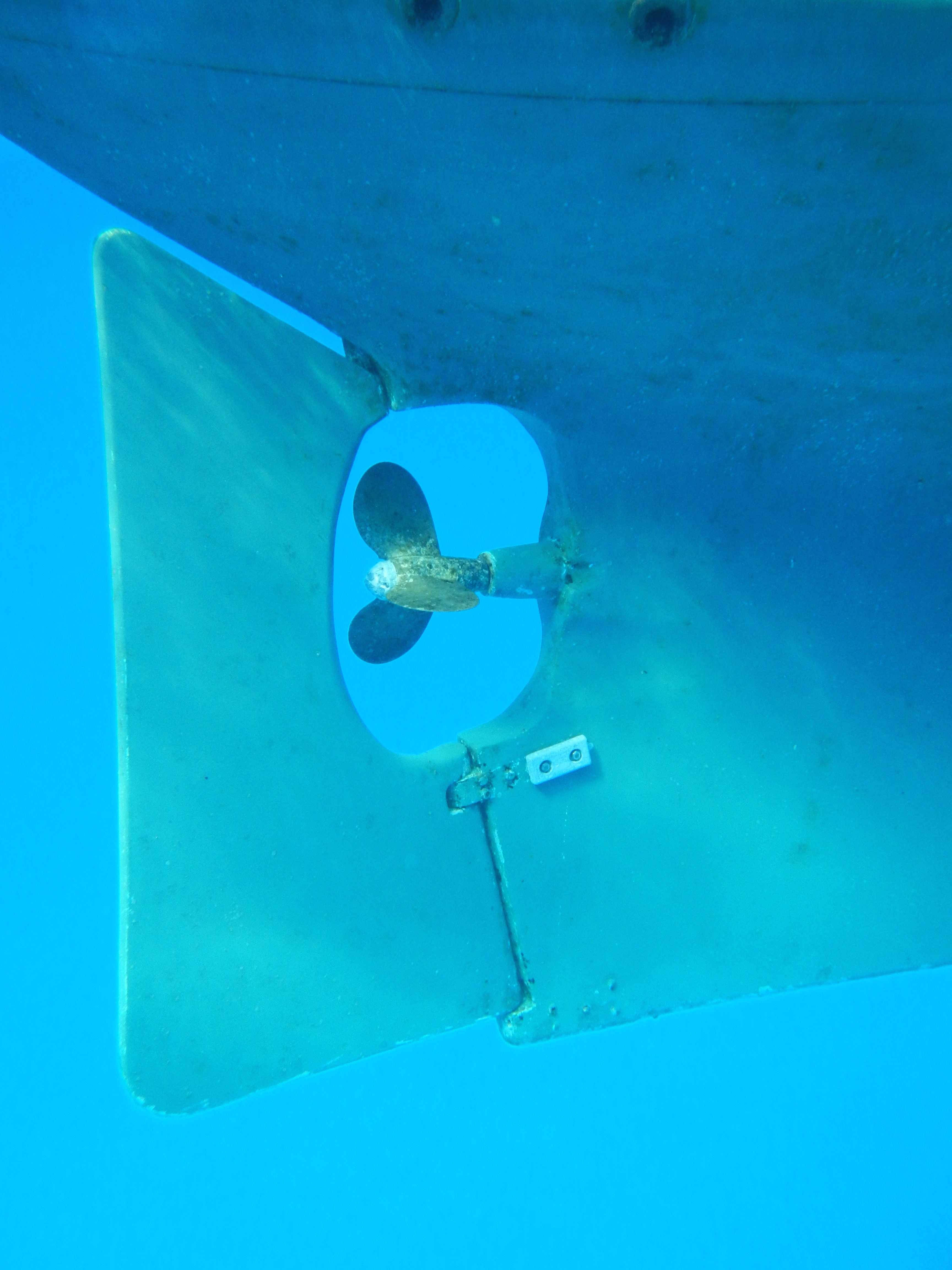
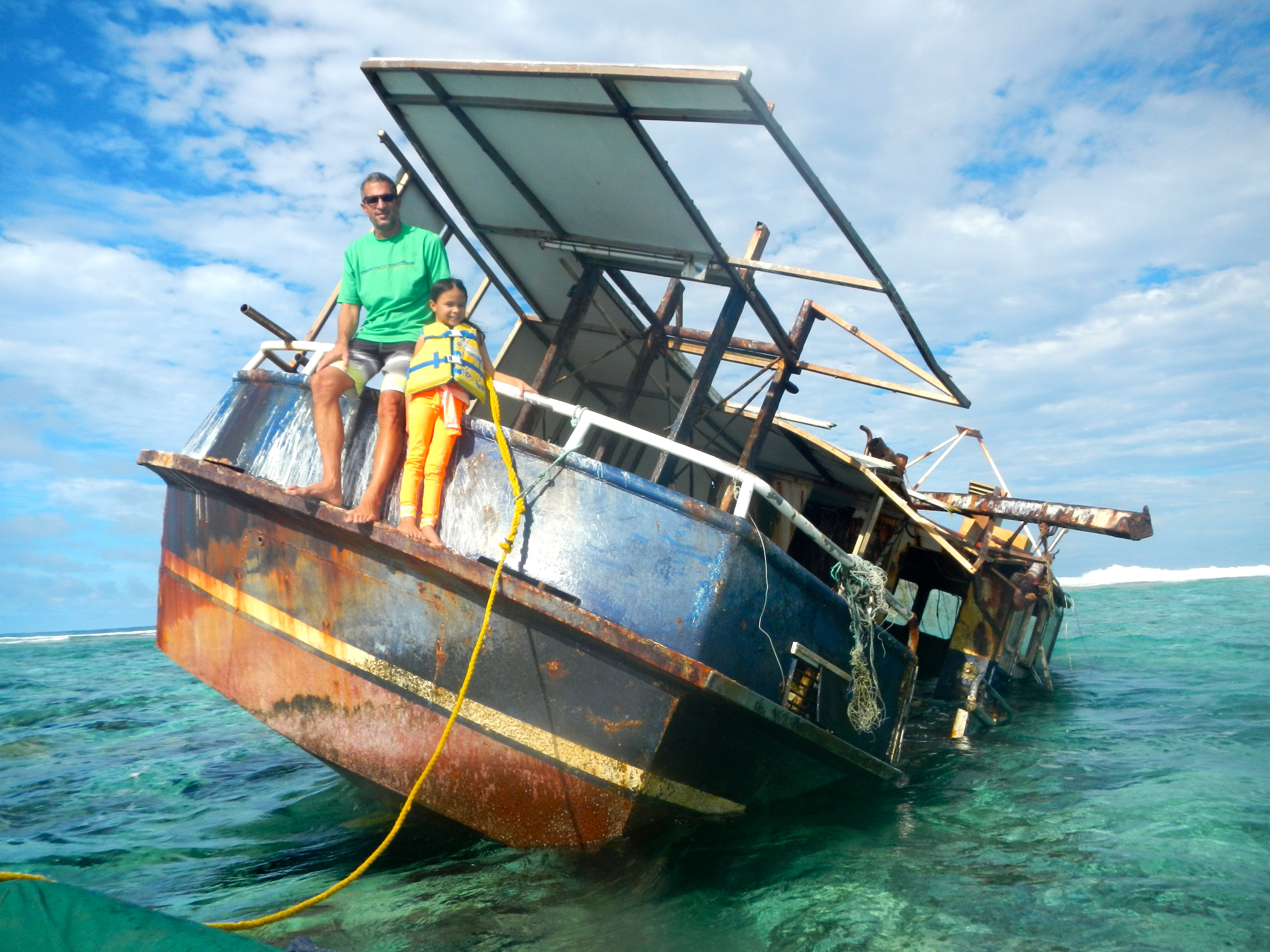
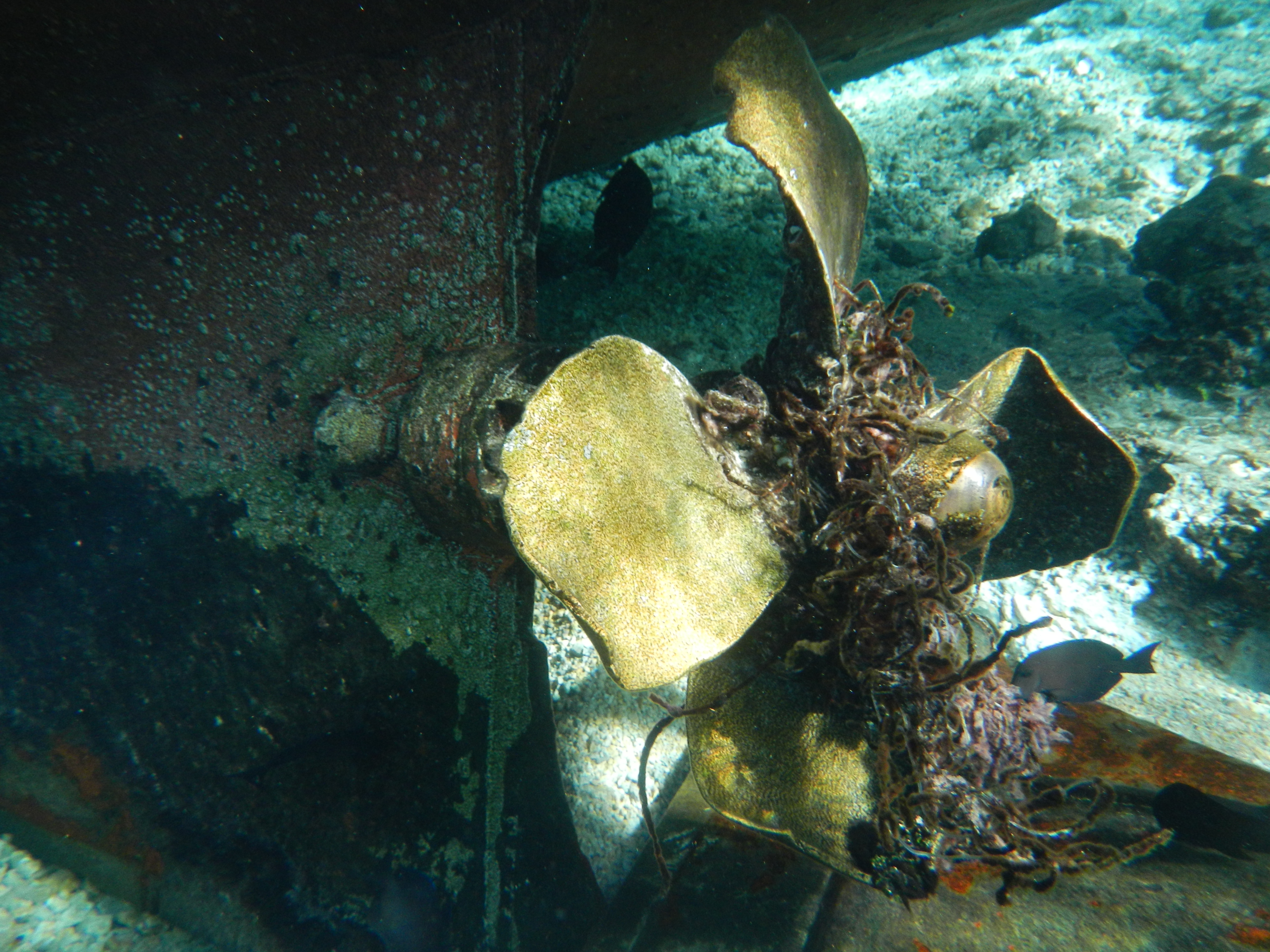
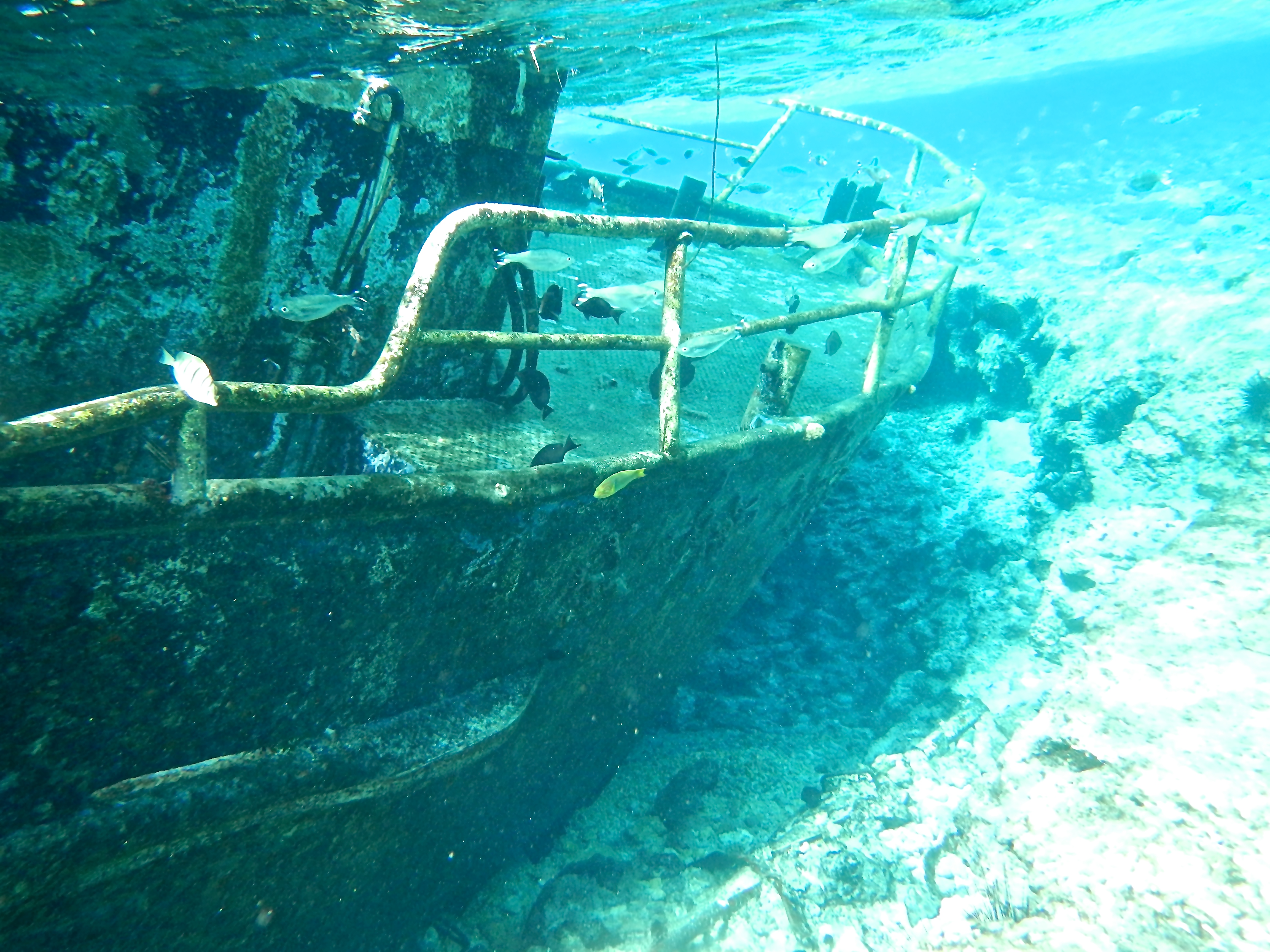
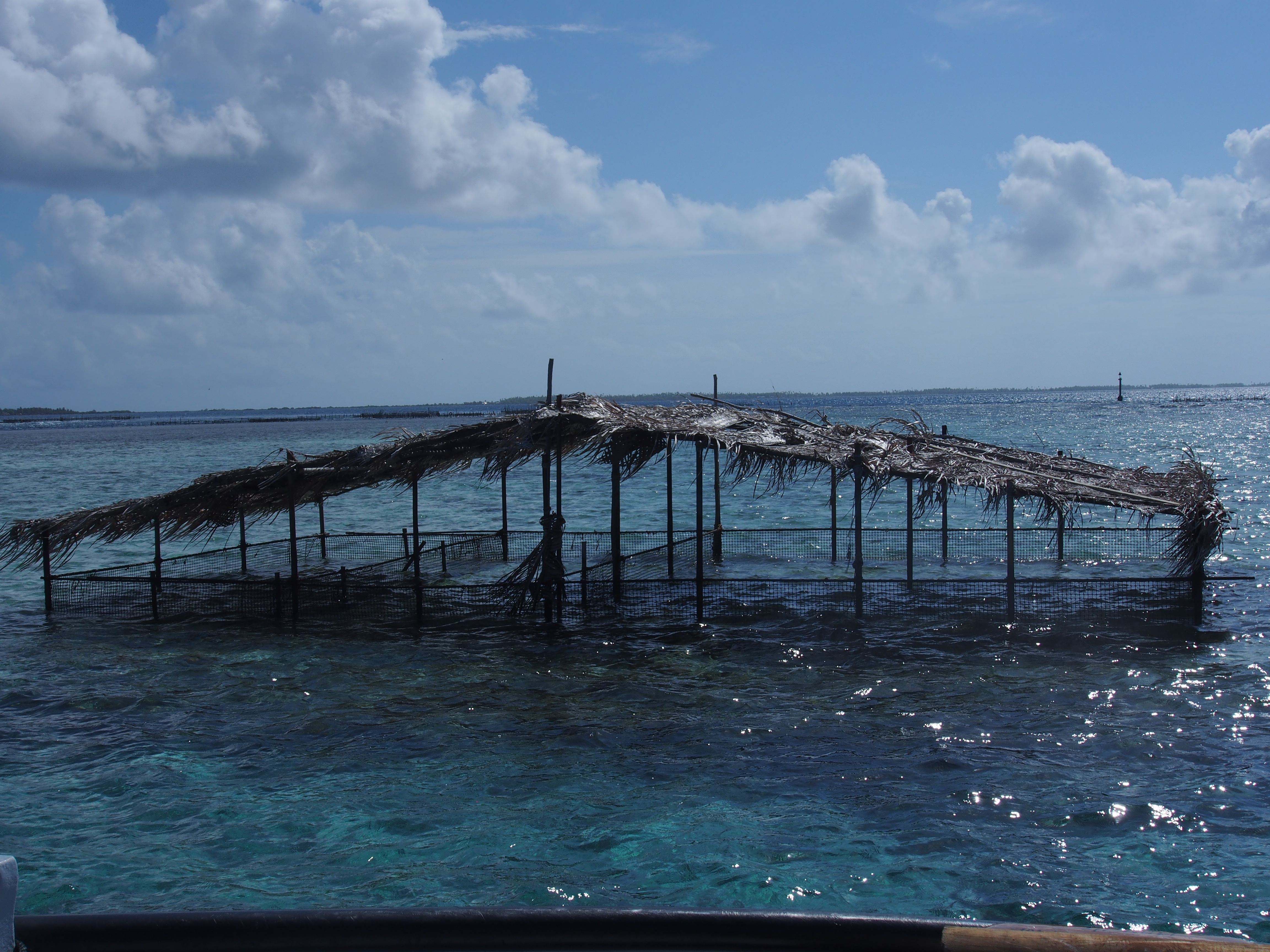
We liked Beveridge Reef so much that we decided to spend another day. After a relaxing morning of reading and drinking coffee, we hopped in the dinghy and explored the wreck on the NE side of the reef. The MV Liberty was a steel fishing boat that has been on the reef for at least 8 years. We tied our dinghy to the stern and Jacintha and I hopped aboard. The wreck sits at an angle with the bow under water and the stern above. After snorkeling around it, it became obvious how it came to its end on the reef–a tangled line can still be seen wrapped around the propeller. I imagine they were fishing to the east of the reef when they fouled the prop, and were unable to free it before crashing. We were told that the captain and all the crew survived. Next we took the dinghy closer to the breaking waves until we were on the reef in 2′ of water. We dropped our dinghy anchor and walked onto the reef. At nearly low tide, we were standing in 6″ of water and about 50′ away huge waves were crashing onto the outer edge of the reef. It was an amazing experience to think we were over a hundred miles from land and were standing on the edge of a reef!

DSCN1960
Standing on Beveridge Reef
DSCN1958
Parrot Fish and Sea Urchin
DSCN1982
Apropos Rudder and Prop
DSCN1985
Anchor Chain Dropping Down to a Sand  Bottom
DSCN1910
Dinghy Ride to the Reef with Apropos Behind
DSCN1915
Wreck of the MV Liberty
DSCN1928
Shipwrecked!
DSCN1951
Fishing Line Fouled the Prop
DSCN1954
Snorkeling around the Wreck
Share

Land Ho!

Current conditions: 15knt S wind, sunny skies, 6knt boat speed.
We spotted the tall mountain on Rarotonga from 50 miles out on day 5. We are now 25 miles away and will arrive between 9 and 10pm. There is no anchorage on Rarotonga and the only mooring is at Avatiu Harbor on the north end of the island. We’ll have to hove-to a few miles off the coast until tomorrow daybreak, then radio the harbor master to get instructions on checking into the Cook Islands.
Dividing the nearly 600 mile passage into two halves, the first half can be summarized as light winds, smooth seas, and a lot of motoring. The second half was quite the opposite–plenty of wind, rough seas, and almost all sailing. The wind direction changed a lot, but was always in front of the beam, making it a slower than normal passage. Most of the time we sailed close-hauled and beat into the waves. As a front went through us late on day 3, the wind went to the mid-20’s and waves were breaking on deck (and of course it was night-time). After that it was mostly a S or SW wind, not the typical SE trade winds we were hoping for. In spite of that, we had a good passage with Otto (electric auto pilot) steering most of the first half, and Ian (mechanical steering wind vane) steering most of the second half. I remember hand-steering during a 4-hour night shift when the seas were too rough for Ian to maintain good control–other than that, we mostly relaxed and just made periodic adjustments to the wind vane.
This has been our longest passage with just the 3 of us aboard and we were wondering how the sleep deprivation would affect us. Karen and I did 4 hour watches at night–I took 8pm to midnight, Karen took midnight to 4am, and I did 4am to 8am. The rest of the day we took turns in the cockpit while the other got caught up on sleep. We ran the Garman chartplotter with AIS to alert us if an AIS-equipped vessel came within 12 miles of us, which allowed us to take short naps while on watch (something we didn’t do during the 23-day crossing when we had 3 taking watch). This worked well for us and we aren’t exhausted after 5 days. We didn’t spot any boats (visually or on AIS) during the entire passage.
Jacintha did great on the passage too. On the first day out, she asked me when we’d get there. This was right out of Bora Bora and the sea was choppy so we were all not feeling so great. I told her it would be 5 days, and she smiled and said, “well, at least it’s not 10”! Now that’s a great attitude!! She finished her math book, worked on some vocabulary, read a lot, and watched a lot of movies. She slept in the cockpit most of the nights under blankets. Since the Marquesas, we’ve moved south through 12 degrees of latitude, or 720 miles. Being mid-winter in the southern hemisphere, we are now feeling the temperature change, especially at night. Sailing into a headwind, we needed 2 layers at night to stay comfortable. We even pulled out our foul weather gear when the spray was coming into the cockpit.
During the passage we noticed the Mizzen boom topping-lift broke. Since the Mizzen sail was up, it didn’t matter, but when we take the sail down there would be nothing to support the boom. A cotter-ring used on the pin to attach a block to the topping-lift line failed, but luckily the pin landed on deck and I had plenty of spare rings. With me clipped-in and standing on the push-pit reaching overhead and Karen handing me tools and the parts as needed, we were able to fix it in a very rolly sea!
Looking forward to exploring Rarotonga!

OLYMPUS DIGITAL CAMERA
Pulling into Avatiu Harbor, Rarotonga
Share

Heading for the Rarotonga

Hi from Apropos on day 3 out of Bora Bora, heading to Rarotonga. Our current position is 19deg 5min S, 156deg 00 min W which puts us over half way there. Calm seas, light winds, and sunny skies. We’re presently sailing along the rhumb line at 5.7 knots in a NW wind of 7-8 knots with full Genoa, Main, and Mizzen sails up. Nothing to see out here but blue ocean–no birds, no islands, no ships. Jacintha and I just finished watching the movie We Bought A Zoo. Karen made a big pot of Minestrone for dinner!! We have to eat all our fruits and vegetables before reaching Rarotonga or customs will confiscate them upon arrival when they come aboard for the required inspection. We still have some limes, bananas, oranges, carrots, and potatoes.
I was beginning to worry about fuel consumption since we motored for a straight 40 hours on days 1-2, but the wind picked up enough to sail. We still have over half of our fuel supply in the tanks. The long motoring did our batteries good since they were running low from our 16-days at anchorage in Bora Bora. Even though we used the generator every few days, it takes a long-running charge to get them back to a fully charged state. We even used the microwave last night to make popcorn!

“An adventure is not about where it ends. Because that’s not what an adventure is about.  So anything that happens from here on out is a bonus”. –quote from We Bought a Zoo.

Share

Onwards to the Cook Islands

Our total time in French Polynesia (Marquesas, Tuamotus, and Society Islands) was 70 days. We ended up spending 16 days in Bora Bora vs our planned 9! Seeing part of the Heiva festival made it worth it, but now we need to move faster through some of the island groups west of here so that we reach Australia by early September.

We’re setting sail tomorrow morning with less than optimum conditions. We know that we will be passing through a front in a few days that will bring stronger winds and higher seas. As the front, which will be moving east, passes through us, the winds will veer to the west and it will be squally. We expect to make landfall on Rarotonga in about 5 days. Till then, we’ll update the blog from sea using the SSB.

OLYMPUS DIGITAL CAMERA
Our path so far….and the next passage (between divider points)
Share

Manihi Atoll in the Tuamotus

Hi from Apropos in the Tuamotus. After 18 wonderful days in the Marquesas, visiting 4 of the islands, we up-anchored and sailed towards the Manihi atoll in the Tuamotus Archipelago. The passage took 3 days, 4 hours and covered 499 miles. We broke our best 24-hour distance-covered-record during the Pacific Puddle Jump crossing by 2 miles–162 nm on day 3. The passage was more tiring with just two of us on watch, but we managed well. We sailed the entire way with winds averaging 15 knots on a beam reach. The first 2 nights we sailed through squalls with winds reaching 25 knots. Seas were 4-6′ on the beam, so as usual, cooking or doing anything down below was difficult. I pulled in a 30″ Wahoo on a hand line in the morning of day 2, so we had a real nice dinner that night.

Entering an atoll requires precise timing. Most atolls have 1 or 2 passes and when the tide is going in or out, strong currents flow through them. The best time to transit a pass is during slack (just after high tide or low tide), when current is at a minimum. A few hours before or after slack can make a big difference with current and breaking waves. When you leave on a long, multi-day passage, you try to plan for arriving before a slack time, but many factors influence the actual arrival time–wind, current, sea state. We up-anchored at 8am and knew the passage was 500 miles, so I based our arrival on a 5.0 knt average. This would take 4.2 days and our arrival would be in the late morning so we could transit the pass near noon. 5.0 knt is slow for our boat, but the wind predictions are not usually very accurate and I figured some motoring would be required. An early arrival would just mean waiting at the pass entrance until slack occurred (slack occurs 2-3x per day, but evening times are never good for entering an atoll that has lots of reefs inside). Worst case scenario would be needing to wait outside the atoll overnight if we arrived in the afternoon. Since the winds were stronger than expected, we had a fast passage and averaged a whopping 6.6 knots! This not only cut 24 hours off the passage, but also timed our arrival perfectly, 15 minutes before slack (ok, I admit that was mostly luck, but we hand-steered the final leg to maximize speed). So we motored through the pass at slack with Karen at the helm and me up the ratlines to look for shallow reefs. We had information that said the channel depth at low slack was 8′, so didn’t panic too much when we saw the depth sounder drop to 2′ (measures water depth below the 6′ keel) near the reef crossing. It soon went back up to 30′ and we breathed a sigh of relief.

The Manihi atoll is 14 miles long and 5 miles wide. Inside are lots of shallow reefs, and lots of black pearl farms. The outer fringe is lined with trees, and a small village is located near the pass entrance on the west fringe. A luxury resort and a small airport are on the north fringe. After anchoring in 60′ of water near the village, we relaxed and got caught up on our sleep.

Today we explored the village where we met Fernando (we heard about him from our cruising guidebook).  He’s full of energy and runs the village bakery that makes 300 baguettes per day and also fishes. He showed us the bakery equipment and explained how the baguettes are made. He also explained how he fishes for Tuna and offered to take me fishing on Friday. Tomorrow he is going spear-fishing on the other end of the atoll and showed us a good spot to anchor there, so we will move the boat 12 miles to the eastern end of the atoll and see him over there. He said the water is clear and snorkeling is great there, so we hope to get in the water and relax on the white-sand beaches there.  Right now we’re sitting in his wife’s cafe eating casse croute (baguette with ham, cheese, and egg) and using wifi to update the blog.

We learned that the black pearl farms went out of business about 3 years ago here in Manihi. The market crashed then as China began farming black pearls, glutting the market. Ten years ago the population of Manihi was 1000, and today it’s only about 300. We found the natives to be very friendly and happy people.

OLYMPUS DIGITAL CAMERA
Our First Wahoo catch, Yahoo!
OLYMPUS DIGITAL CAMERA
Manihi Atoll in the Tuamotus, Next Stop is Tahiti, then Bora-Bora
OLYMPUS DIGITAL CAMERA
Fernando runs the village bakery and fishes
OLYMPUS DIGITAL CAMERA
Fernando showing us how he fishes for Tuna
OLYMPUS DIGITAL CAMERA
Jacintha climbing the Tau Tree at “town center”
OLYMPUS DIGITAL CAMERA
Black Pearl Farm
Share

Update from Bahia Santa Maria, MX

(This update is being done by SSB radio, so no pictures can be added until we get to Cabo San Lucas)
Apropos is currently anchored in Bahia Santa Maria, our 2nd stop along the Baja peninsula. The 1st stop was Turtle Bay, which was a 2-day sail from San Diego. It’s been a lot of fun with the Baja Ha Ha fleet–a beach party in Turtle Bay, trick or treating by dinghy to neighboring boats, paddle boarding, playing baseball with the locals, a party here in Santa Maria complete with a live band, and getting to know crew from some of the 140-boat Ha Ha fleet. The 1st leg to Turtle Bay was almost all motoring with very little wind but the 2nd leg was almost all sailing. Unfortunately our electric autopilot wasn’t working properly so we’ve been hand-steering during the 2nd leg https://advising.wisc.edu/facstaff/sites/all/libraries/d3/js/adobe-illustrator-cs6.html. We arrived into Bahia Santa Maria very tired at 5am, but had 2 full days to recover! The scenery here is amazing with a huge bay surrounded by some tall rocky peaks, mangroves, and sand dunes. I hiked up to the highest peak today which is at 2000′ and the view was fabulous (pics will follow when we find wifi in Cabo). Jacintha has been having fun playing on the beach with friends she has made and Karen has been relaxing on the beach (and helping other boaters with some minor medical issues).

We plan on an early 4am departure tomorrow morning for the 3rd leg of the Baja Ha Ha and will arrive in Cabo about 35 hours later.

Share