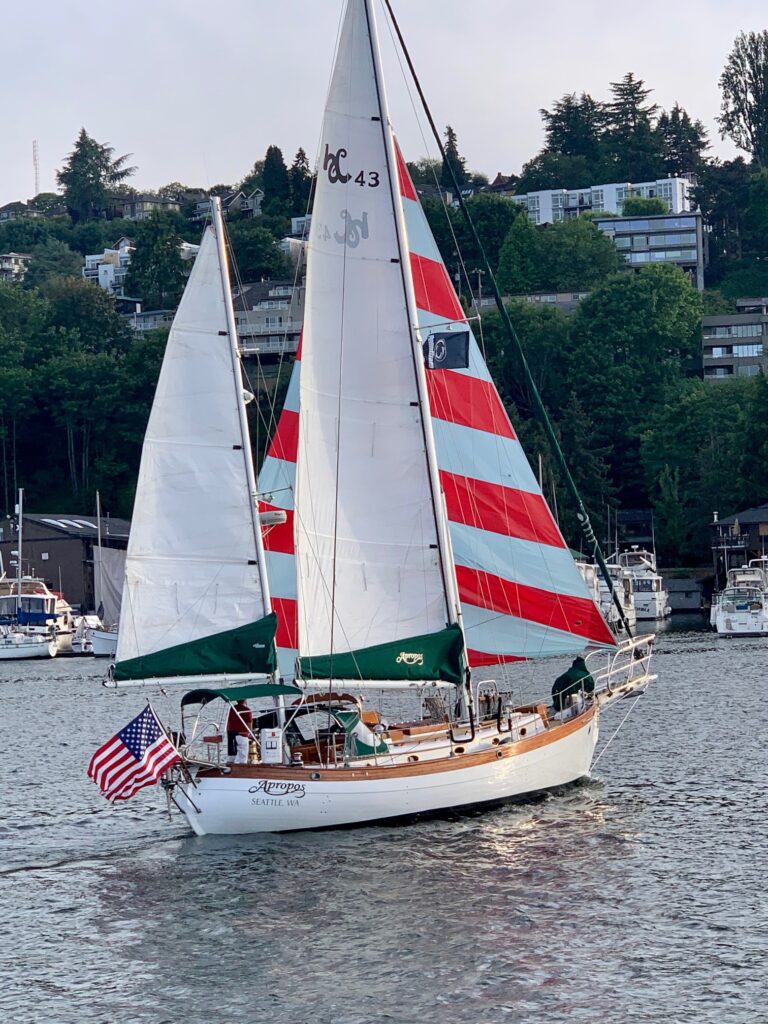
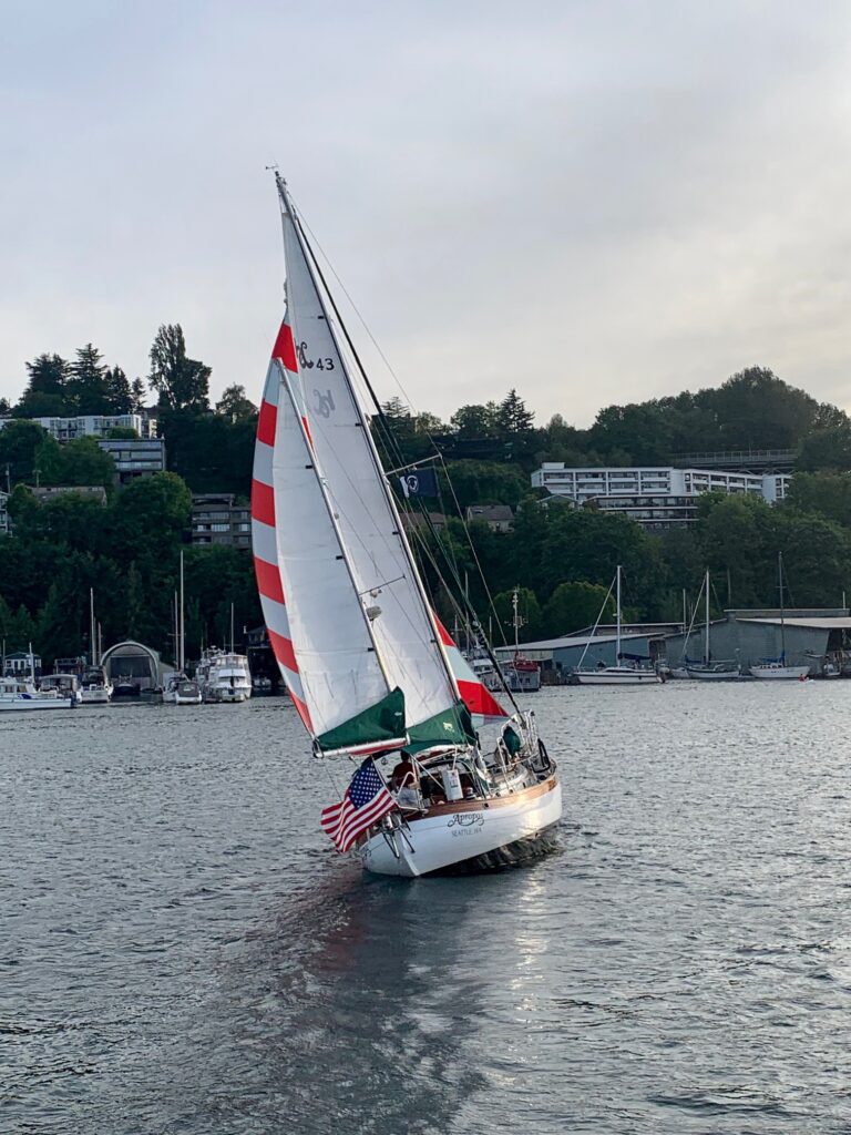
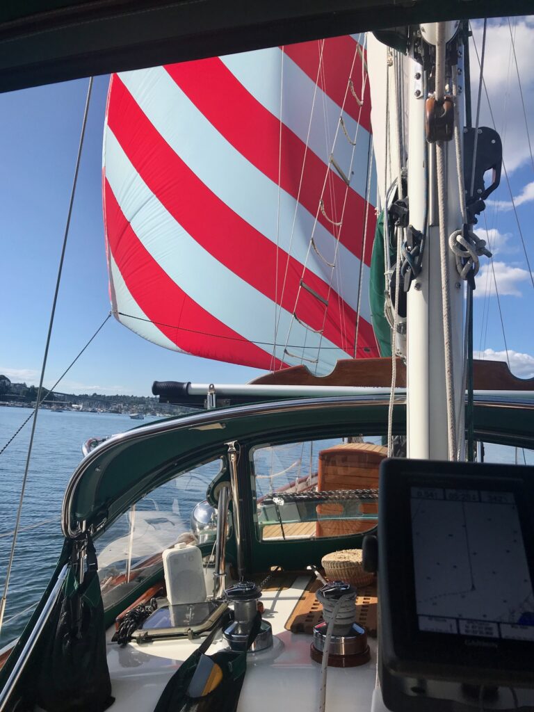
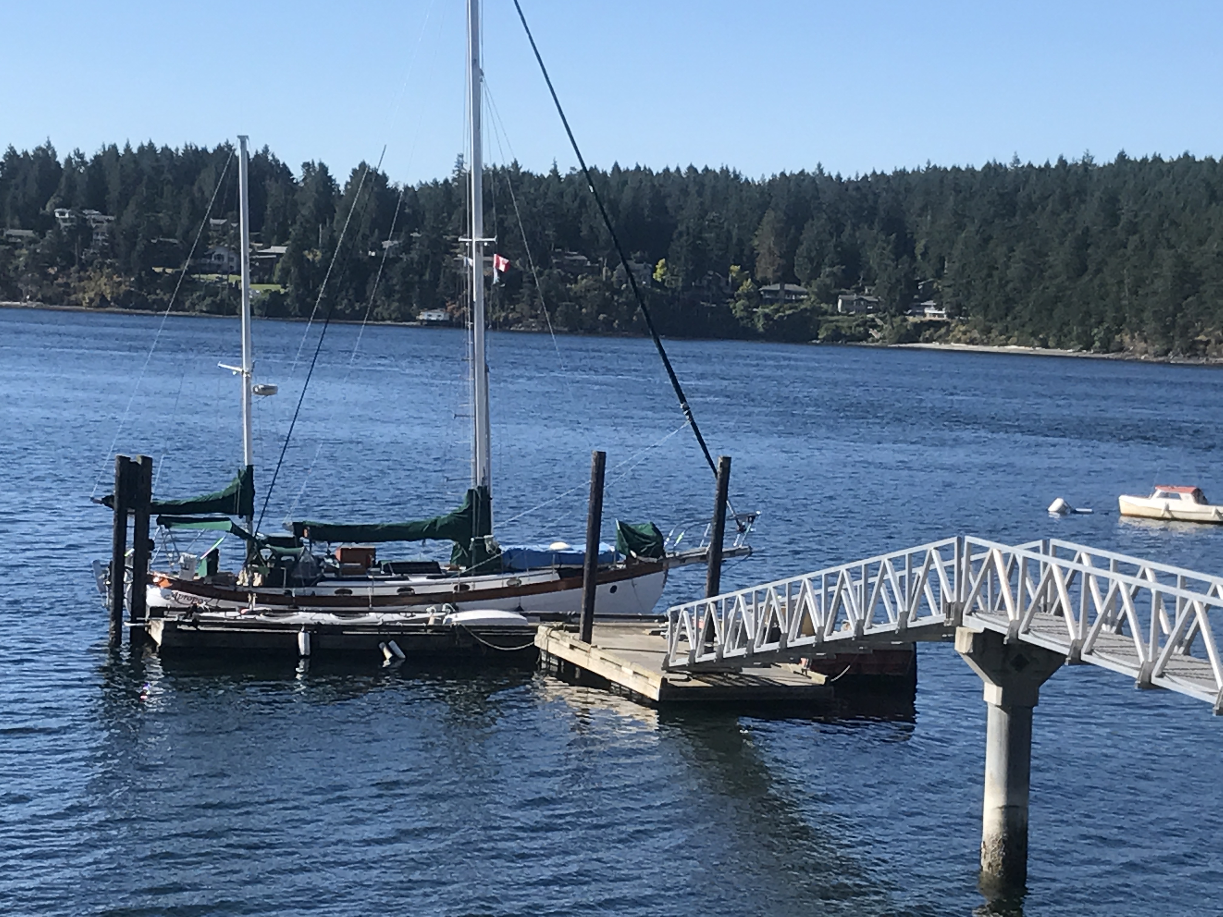
Some pictures from a recent sail on Lake Union
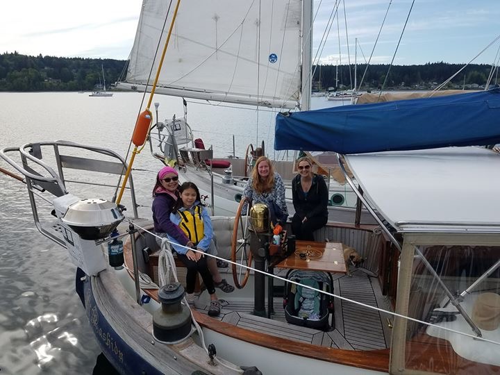
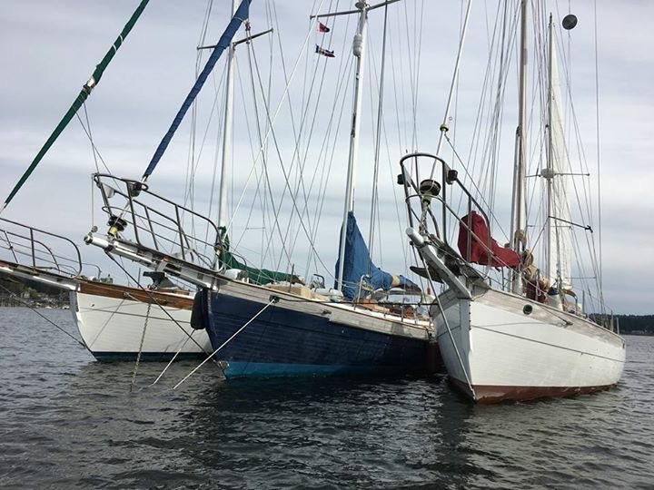
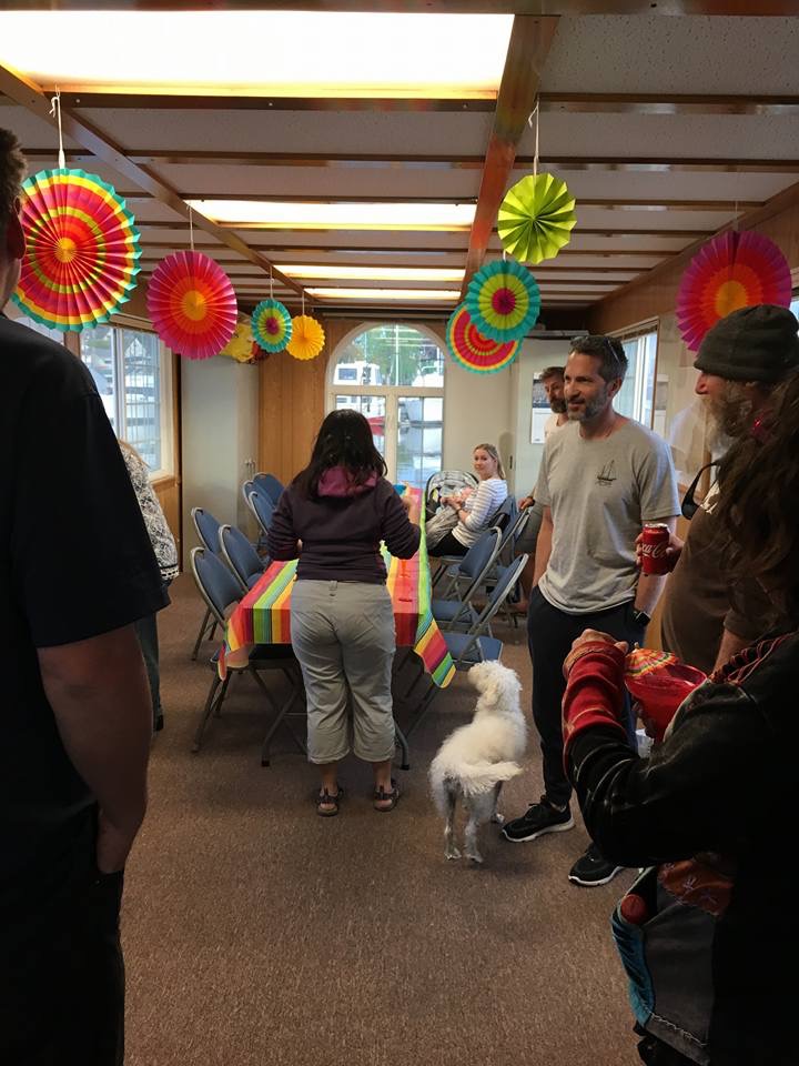
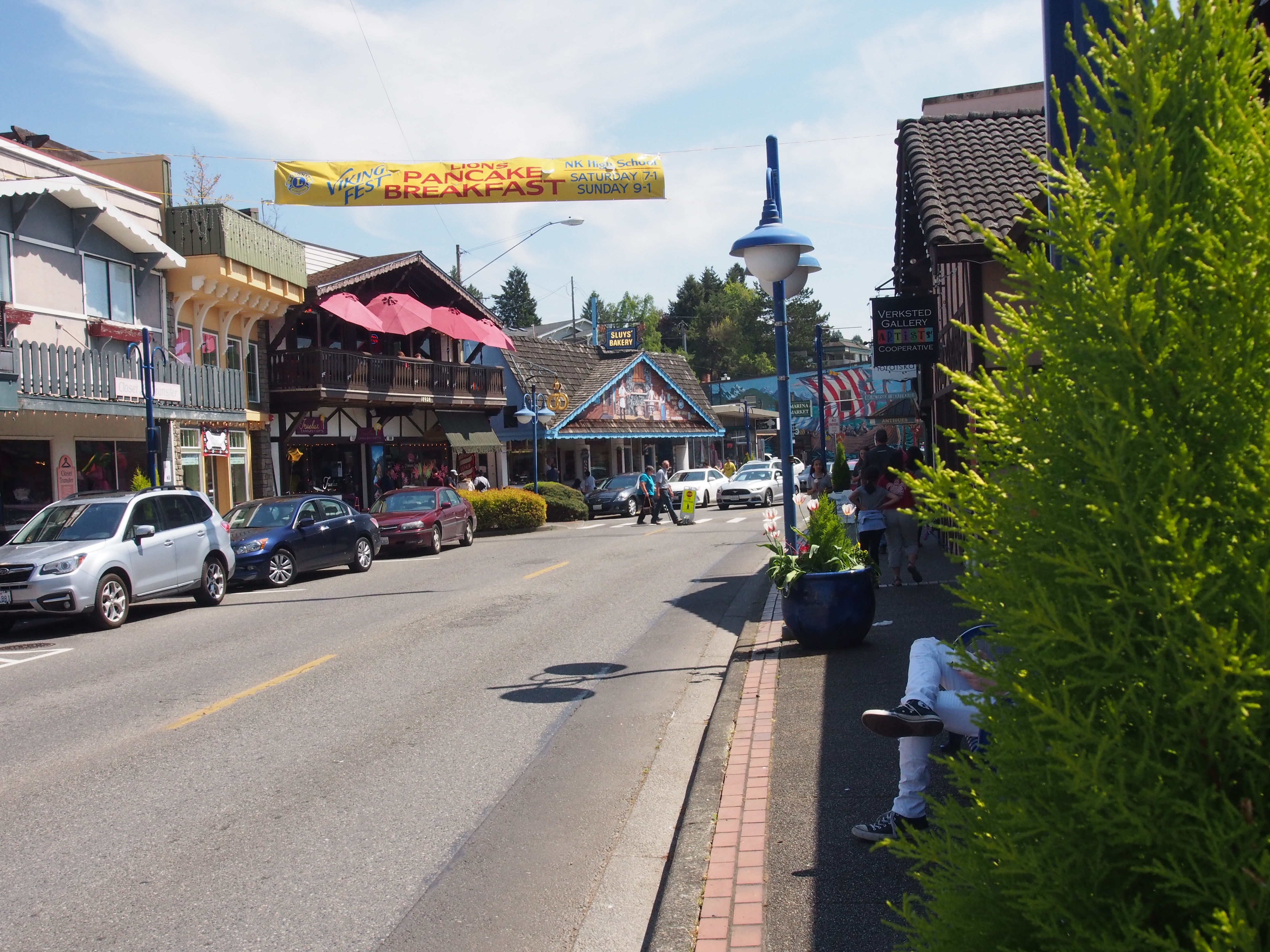
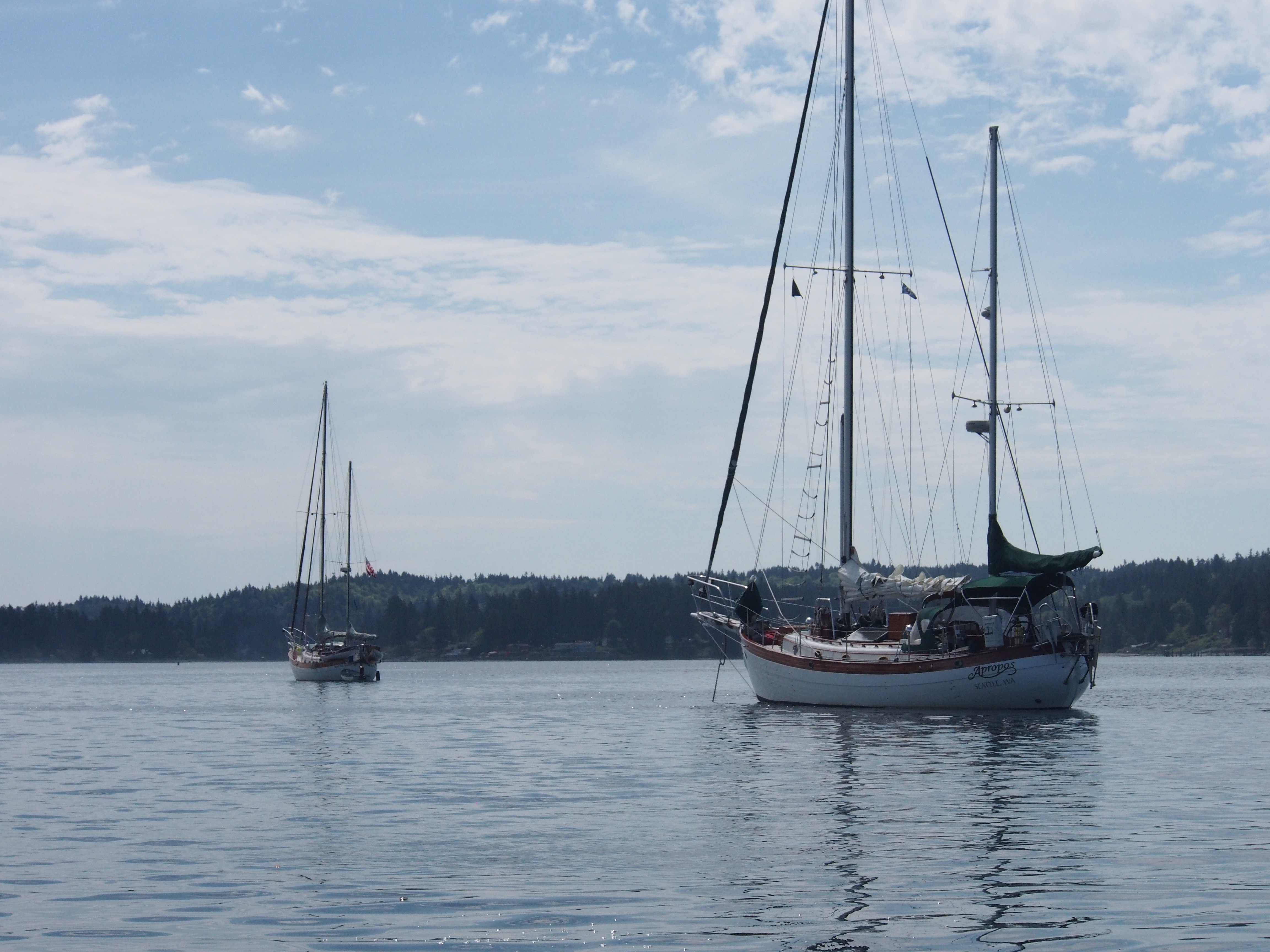
We sailed across Puget Sound to Poulsbo for a fantastic weekend gathering of Hans Christian sailboats. Five boats showed up–3 HC43s and 2 HC38s. One of the 43’s was a sister-ship to my 43′ Ketch. We enjoyed meeting the other owners, touring their boats, and having a Mexican themed potluck on Cinco de Mayo. We also gathered for a Sunday morning breakfast before departing around 2pm. We hit our old favorites while in Poulsbo–Mora’s Ice Cream, Sluys Bakery, and Longship Marine Chandlery. Sailing was good on the way over, but we had to motor on the return trip.
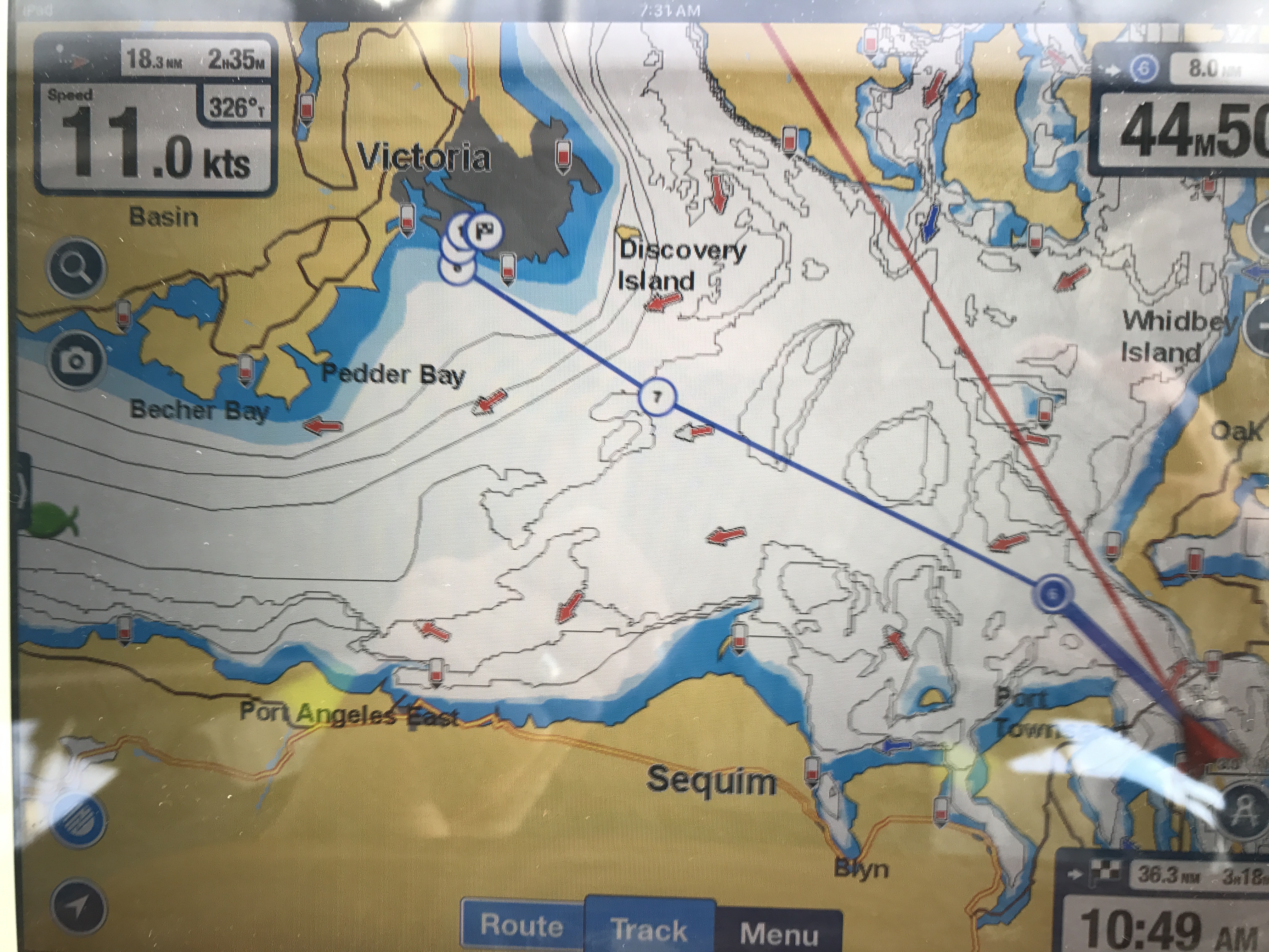
We took a 1-week trip up to the Canadian Gulf Islands earlier this summer. An early morning (4am) departure from Kingston marina put us at Admiralty Inlet at max ebb under motor, so we were getting a 5 knot boost from the current and moving at 10-12 knots. That was great until we entered the straits, where the wind picked up to about 10 knots out of the north. Even a light wind blowing against a 5 knot current can create short-period, extremely steep waves. We went from a smooth 10 knots to a very uncomfortable 5 knots bucking into 10′ waves. After about 30 minutes of this (enough time for some crew seasickness to set it), we got far enough into the Strait of Juan de Fuca (living up to it’s nickname Strait of Wanna Puke-up) for the ebb current to subside and the wind shifted enough to the west that we sailed most of the way to Victoria.
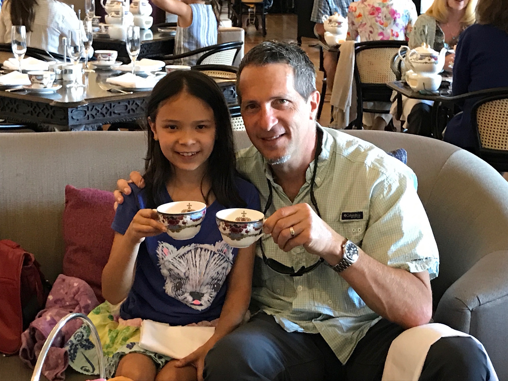
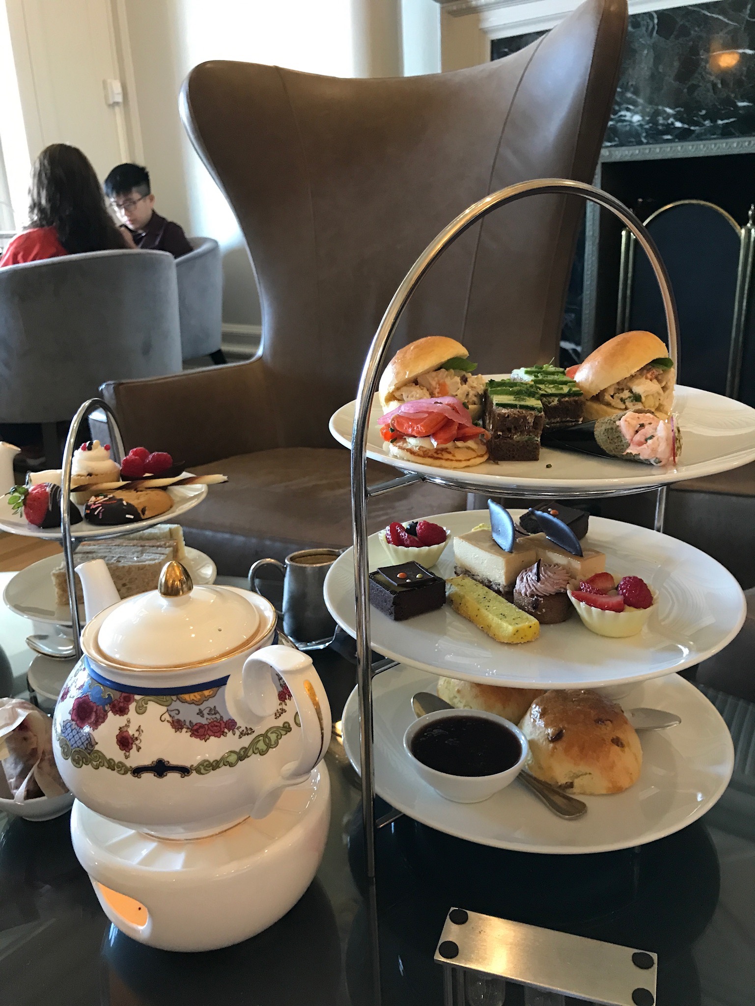
Clearing into Victoria was easier than last time we were here (over 5 years ago). The new customs dock is located in a nice area away from the busy east bay where it used to be. The dock is now much bigger and has enough room for several big boats to tie up. The phone check-in took 15 minutes, then we were on our way to tie up to the outer side of a long dock just north of the Empress Hotel. Our 2 days in Victoria were spent visiting our friends and fellow Hans Christian owners Lance and Carol, having afternoon tea at the Empress, and eating at some nice waterfront restaurants. Top on our list was a Fish -n Chips stand next to the marina that seemed to have an hour-long line any time of day, and it was well worth the wait.
Our next stop was a short 3 hour sail north to Piers Island to visit the crew of Seahorse V, a cruising family we first met during the Baja-Haha rally in 2015, and shared a few anchorages with in various Mexico harbors. We tied Apropos up to their private dock with a nice aluminum ramp leading to their waterfront house. Jacintha was happy to see Billy and Gracie, and it was great to catch up with Cap’n Steve and Tina, whose boat is currently in the Caribbean (just outside the hurricane belt, thankfully).
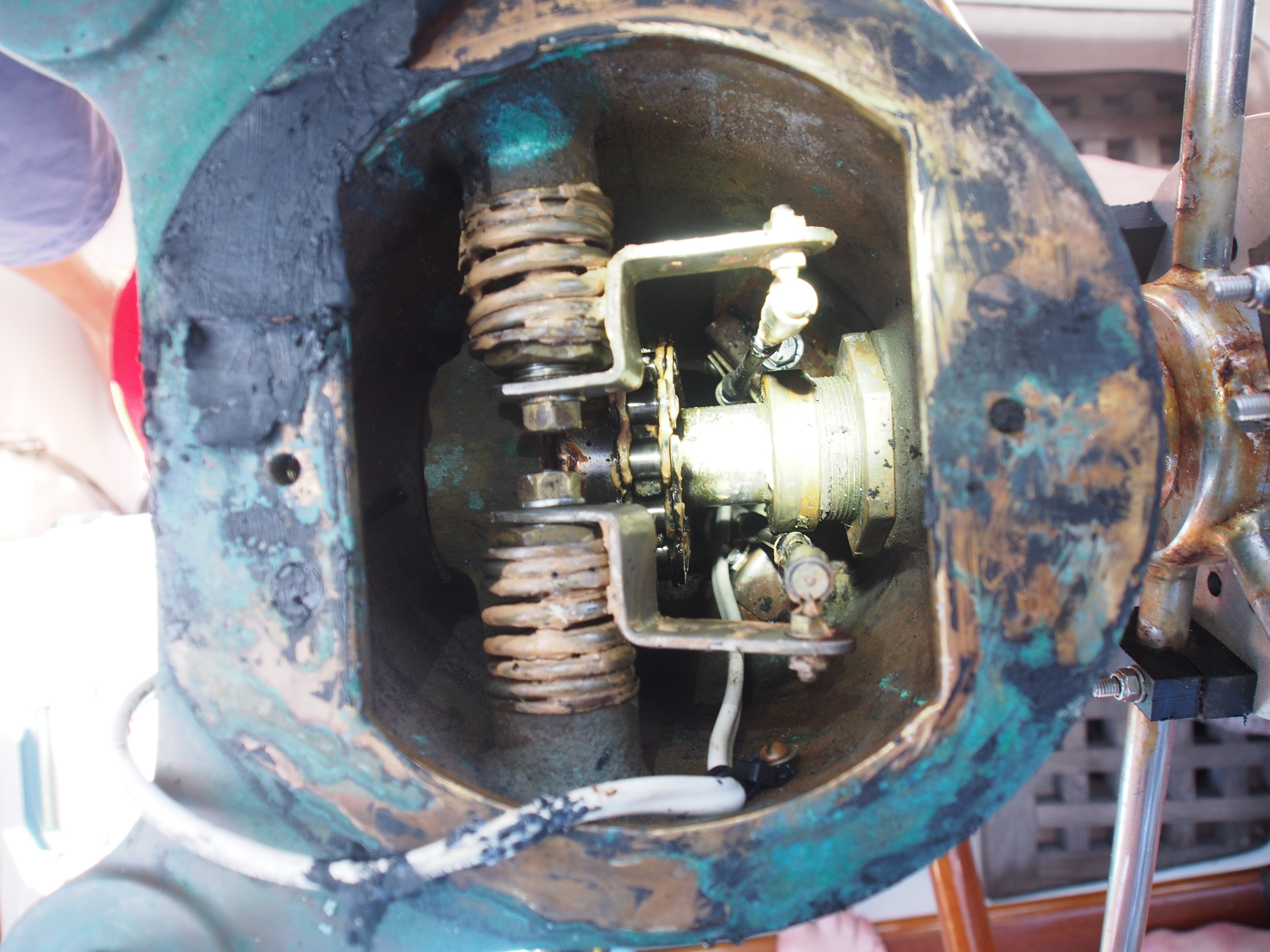
Our next stop was another short sail north to Saltspring Island and the harbor of Ganges. This was our 3rd visit to Ganges and is one of our favorite Gulf islands. We spent a relaxing 2 days there reading, playing ukulele, and visiting coffee shops, restaurants, bookstores, etc. I also managed to tear into the dinghy engine that was having problems starting. The last time I took apart and cleaned the carburetor was in French Polynesia, so lots of varnish from gas had built up in the float bowl and clogged the small openings inside the throttle body.
We cleared back into the US at Roche Harbor on San Juan Island, and anchored overnight in the bay. This was the first real need for the dingy and the engine started right up, but ran poorly at higher rpms, so I suspect the inline fuel filter needs replaced. It worked well enough to get us back and forth from the anchorage, so that was good. The highlights were visiting the outdoor sculpture park a short walk from the marina, and having bloody mary’s and french dip at our favorite cafe. Jacintha talked us into spending a few hours at the outdoor pool with Karen, while Champ (more on him later) and I relaxed under a shade tree near the pool.
The trip back to Seattle went well as far as timing the tides. We sailed the entire way from Roche Harbor to Kingston, getting in just after dark and anchoring near the ferry landing outside the marina. We made it back to Lake Union the following day to complete an 8-day cruise that covered about 200 nm.
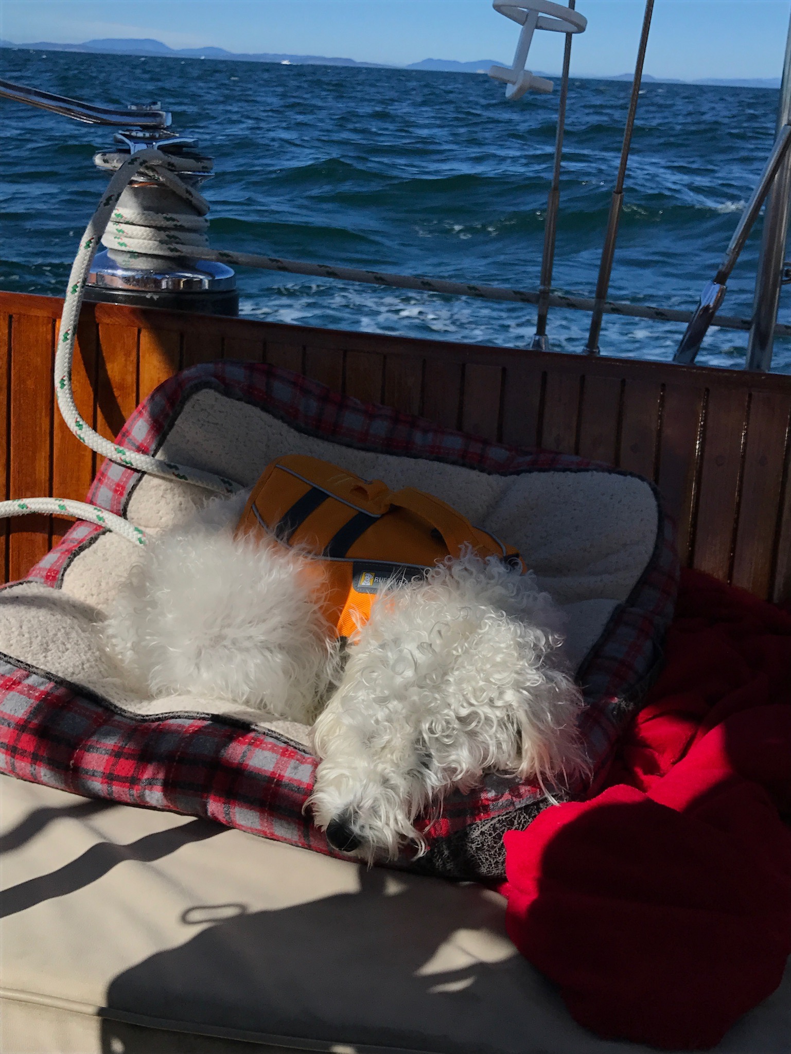
Champ is our dog we’ve had for almost a year now. He’s a mixed breed (mini poodle & terrier) rescue dog who came to the the US from Tijuana, MX. This was Champ’s first sailing trip so he deserves his own section in this post. He did extremely well and makes a great boat dog. The biggest challenge was to figure out how and when to get him off the boat for potty breaks. Before we departed Kingston marina at 4am, we took him for a quick walk. Good thing he peed because we wouldn’t be on land again for 12 hours. After we were in Canadian waters, the passages were shorter and it wasn’t a problem. He had a lot of fun running around Piers Island with another dog and when he returned he was a black dog. We hosed him down before getting back on the boat. He’s quite comfortable on the boat and likes to be in the sun sitting in the cockpit. The trip from San Juan Island to Kingston took about 12 hours, then we dropped anchor and spent the night. We tried to get him to use a 2’x2′ square turf that’s made for dogs, but he just wanted to sit on it. In the morning, we motored into the marina to fuel up and let Champ go to the bathroom. Yes, Champ has great control of his bladder (although he seems to eat/drink less while we are sailing underway)!
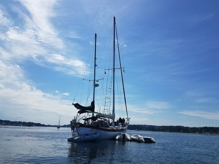
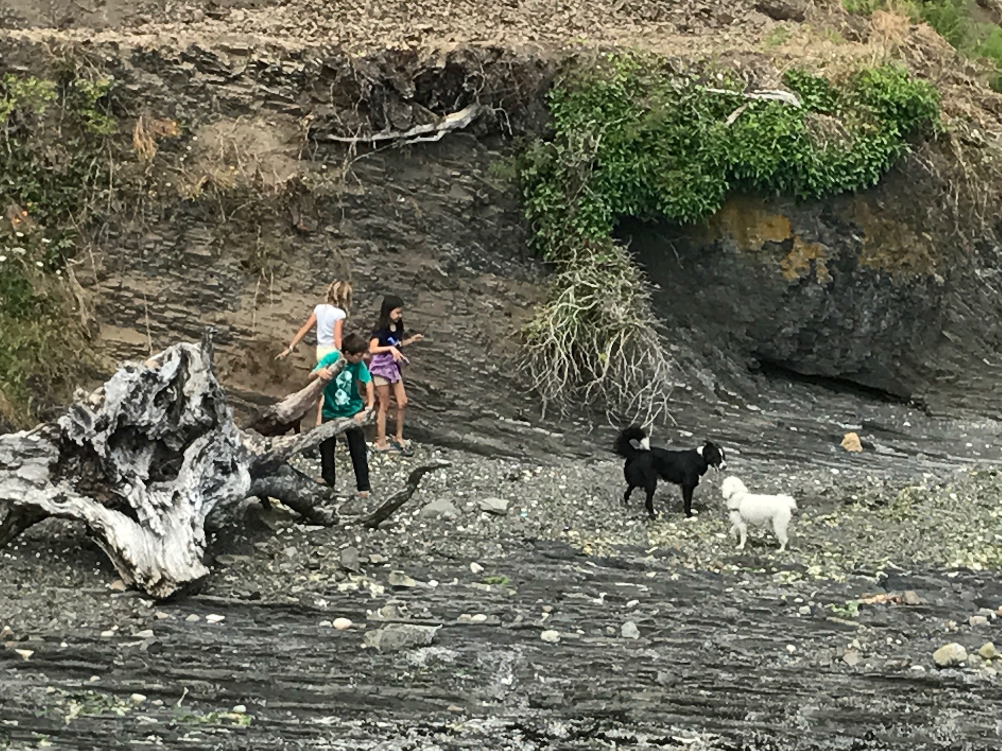 Exploring Piers Island at low tide
This video was shot off the Washington coast as we approached Cape Flattery. The large following sea is the result from the sudden depth change near the continental shelf.
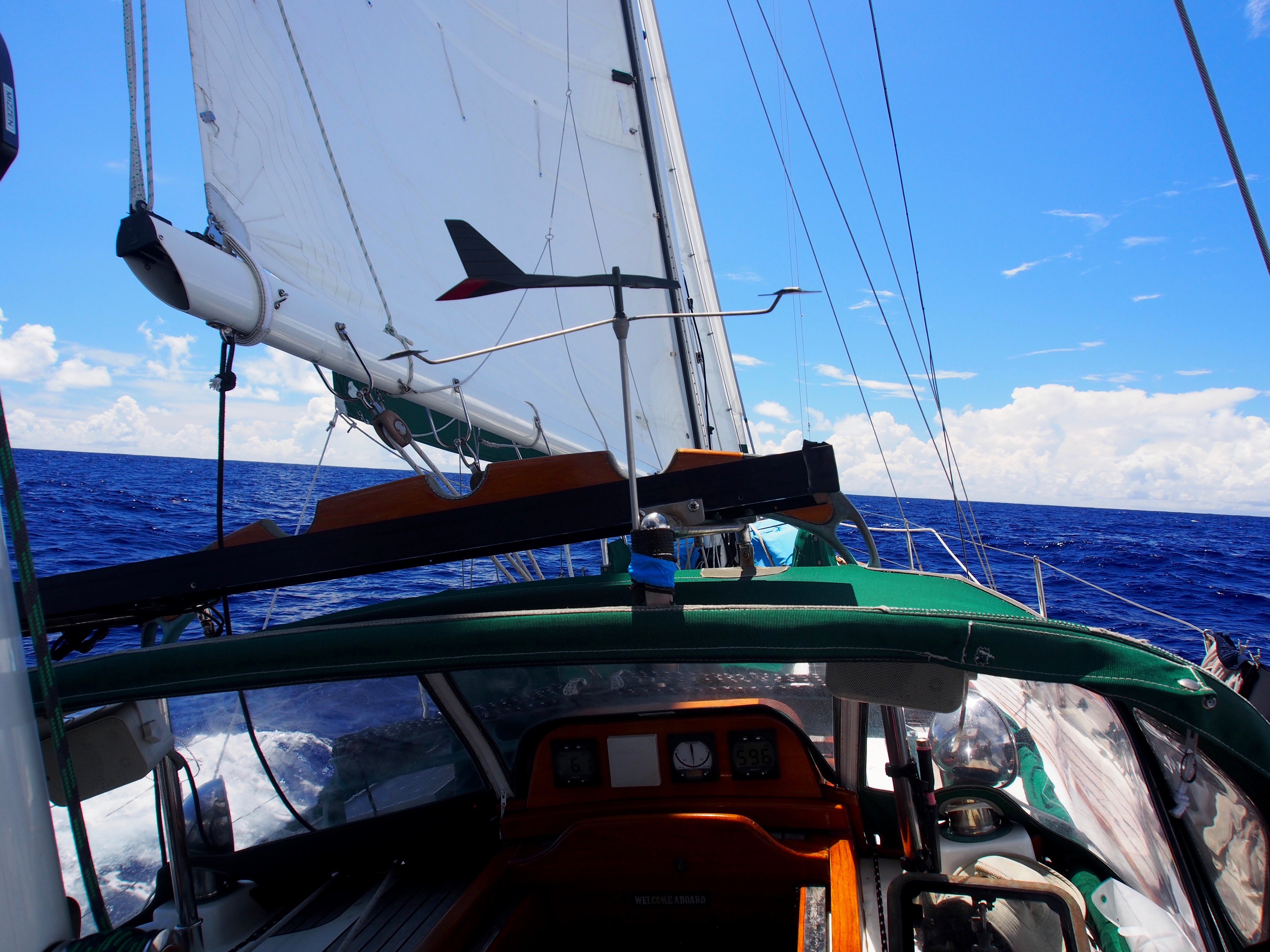
This video was shot about 1000 nautical miles from Washington. We were sailing close-hauled with all 4 sails (1320 sq ft of sail area).
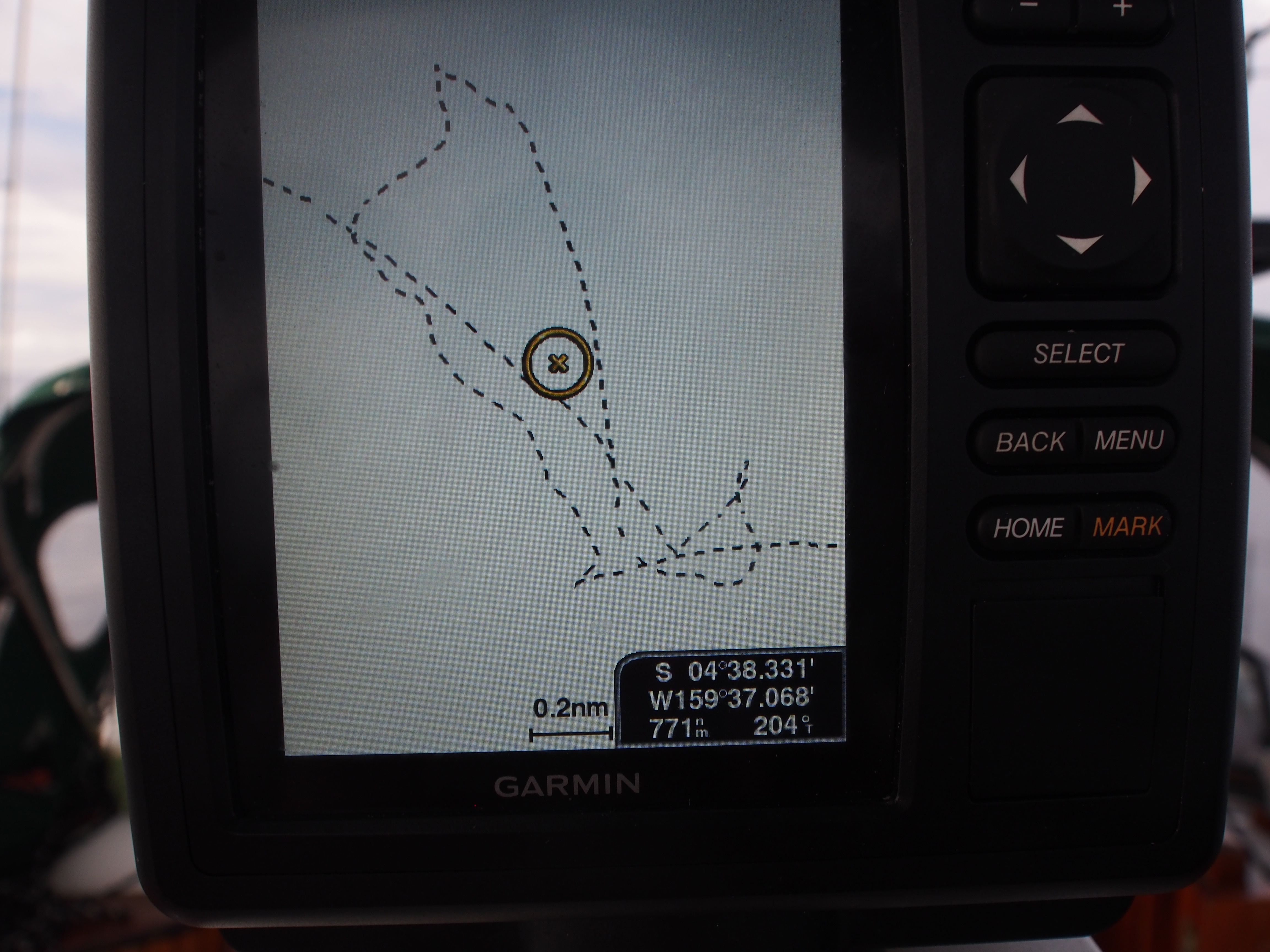
Today is day 14 on the Hawaii to Seattle passage. We are at 43deg30min N, 145deg27min W on a heading of 65 degrees. That puts us roughly 2/3 of the way there! We motored for another 20 hours last night before the wind returned at noon and we’ve been averaging a fast 6-6.5 knots since. Weather has drastically changed to slate-grey overcast days and cold, damp nights. We’re surrounded by fog now with visibility of a half mile. We’ve been in the shipping lanes for a few days now and spot 2-3 cargo vessels daily on AIS. Closest point of approach has been 20 miles or more, so no visual sightings. Some are going west to Asia and some are moving east to SF, LA, or Panama.
Some issues we’ve been dealing with–
1. Engine is not running well when using the starboard tank. The rpm’s go up and down, signaling a flow restriction between the SB tank and engine. We circumvented the problem by running only on the port tank and pumping fuel from the SB tank into jerry cans, then topping up the port tank as needed. This worked until it didn’t–as the SB tank drew below half a tank, our fuel pump wasn’t able to lift the fuel to the jerry cans on deck. Today we removed the 12″ plate on the SB tank (located under the aft berth where Brian sleeps) and were able to pump the remaining 25 gallons out, emptying the tank. It was hard, tedious work with the pump filling a 5 gallon jerry can in 30 minutes. This was done in the morning when the seas were still flat, and was accomplished without spilling much in the cabin. We’re now happy that we have access to the remaining 80 gallons of fuel if needed.
2. We think we just figured out the cause of vomiting with John and Brian recently–both ate un-refrigerated cheese. We didn’t think those wax-wrapped cheese needed refrigerated. Problem is, I just ate one 2 hours ago (before we figured it out)! Will report back on this later…
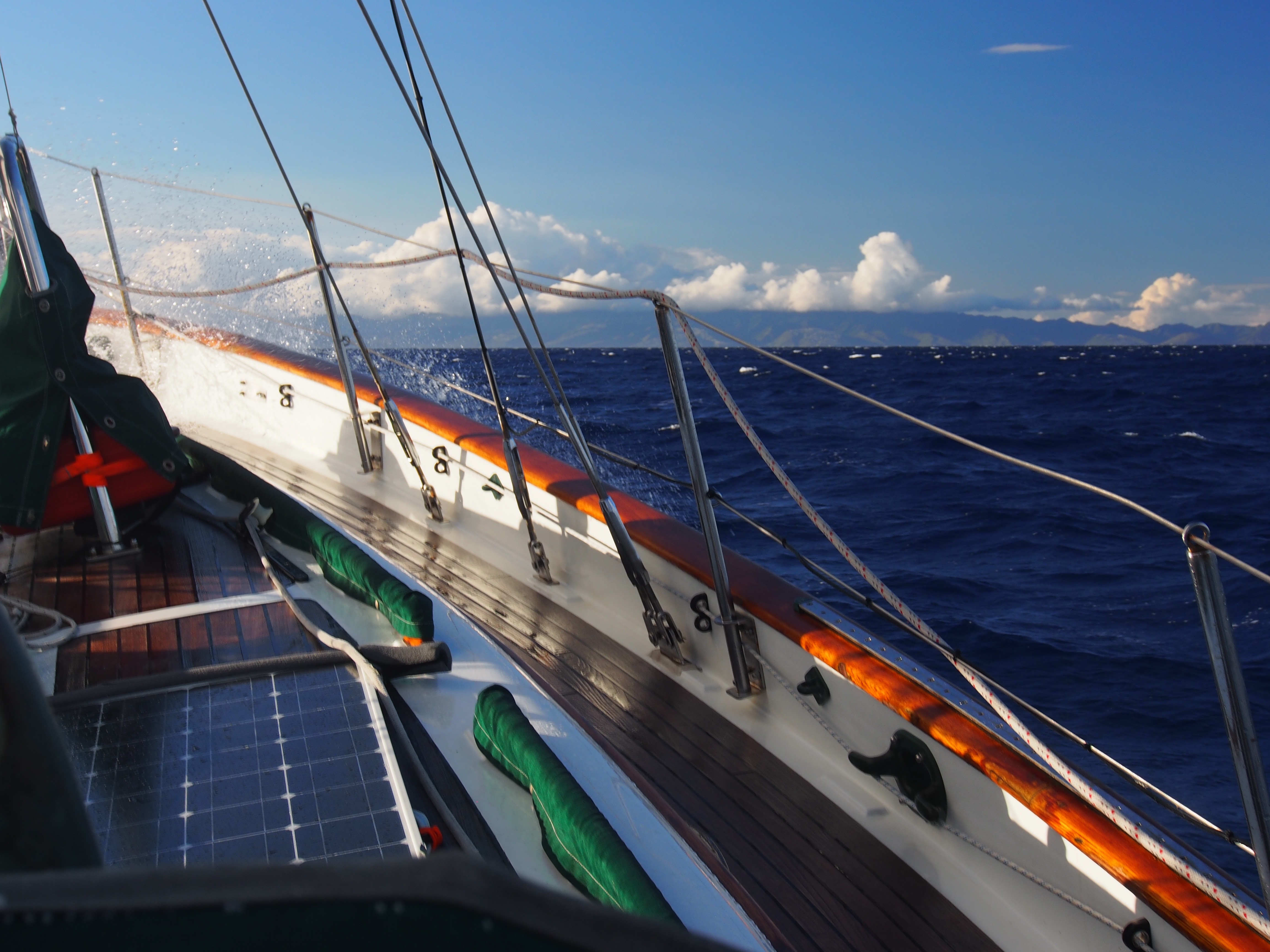
3. Damp, damp, damp–without any sun to dry things out, most of our clothes and bedding are damp. Makes it a challenge to get out of bed for night watch. Then it takes 10 minutes to get prepared for the cold. I’m now wearing 3 layers top and bottom, Tuf neoprene boots with wool socks, gloves, wool hat, and foul weather top and bottoms. This ain’t the South Pacific I’m accustomed to! Despite the above issues, morale is great aboard. John and Brian have been awesome crew and fun mates. Both are boat owners and know lots about boat maintenance, engine issues, sail trim, etc. We still have plenty of food and even some fresh oranges and apples. I sliced up 1 of our 2 Hawaiian pineapples today. Brian has been chief cook and makes dinners like spaghetti and burritos. John’s specialty is pancakes. Mine is making coffee and doing dishes! I pull in GRIB files daily on the SSB radio to provide us with weather info. After sailing north from Hawaii for 1100 miles, we turned NE and set a great circle route to Cape Flattery. We use the daily weather updates to determine whether or not we can stay on the great circle route, and so far we have been. At our current rate (130nm daily average), we should enter the Strait of Juan de Fuca in 7 more days.
Christmas Island to Hilo, Hawaii is a 1080nm passage (direct line) on a 9 degree heading. The predominant wind is NE, making it another close-hauled slog. Our plan was to sail 2-1/2 degrees of longitude (150nm) further east from the direct path in the first half of the passage to set us up for the stronger NE trades further north. We figured that we could always make landfall in Maui or Oahu if the wind shifted more north. In the end, we decided on Oahu due to the schedule and convenience of flights for crew. Since we went went so far east earlier, this added about 300 miles to the direct path to Honolulu.
Here are 2 blog updates from sea on day 5 and day 9:
Update from Sea–17deg N, 156deg W
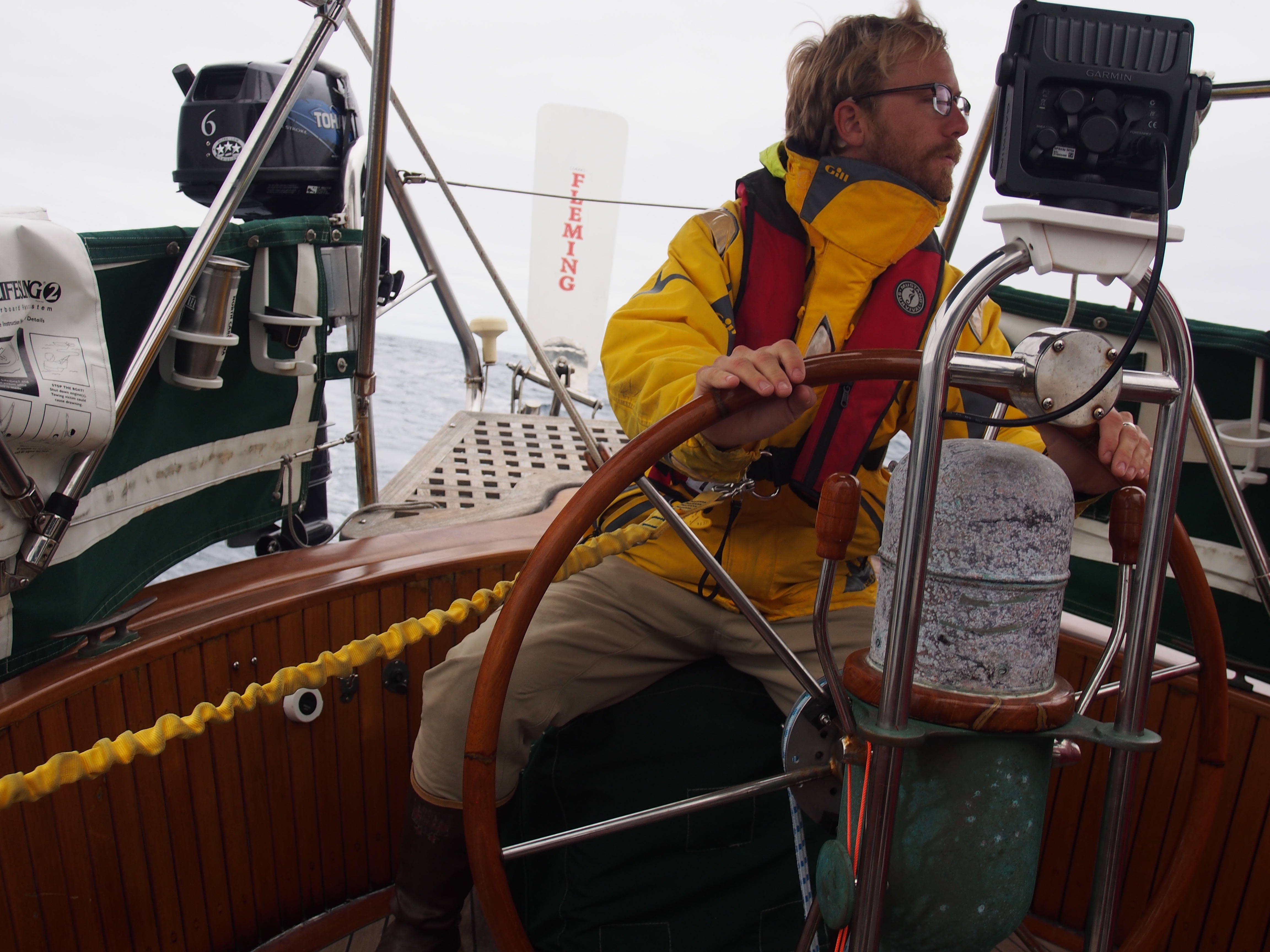
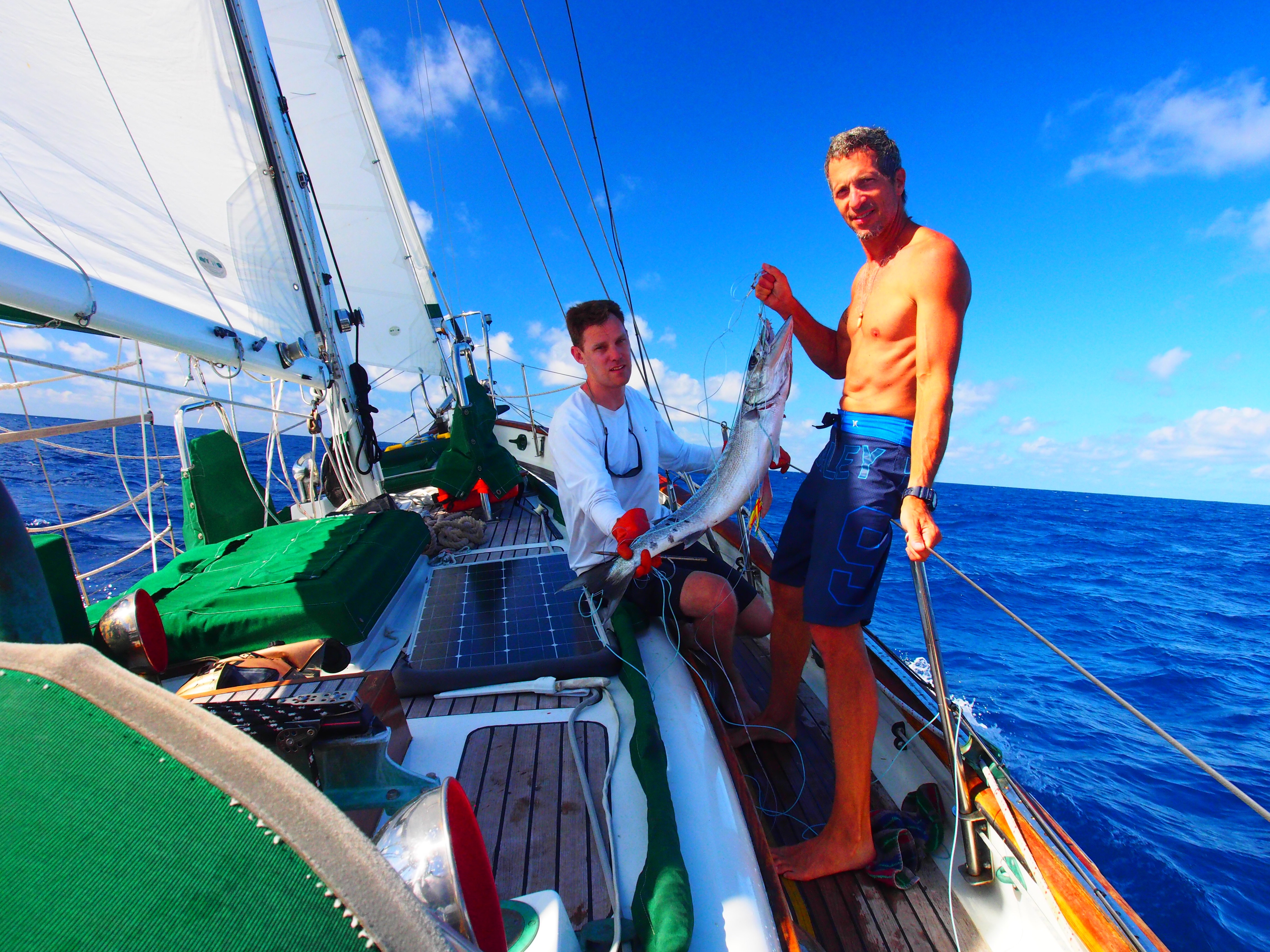
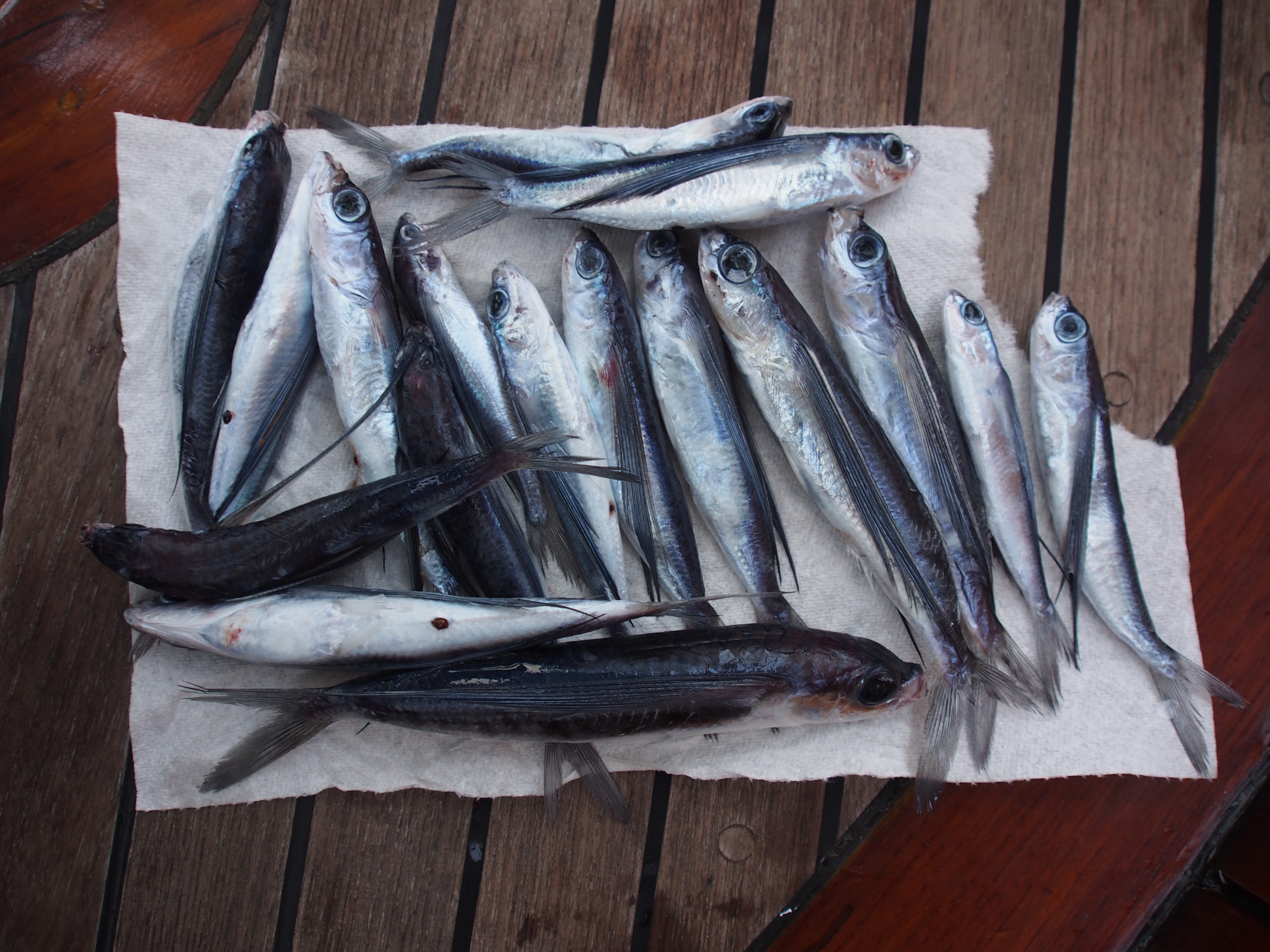
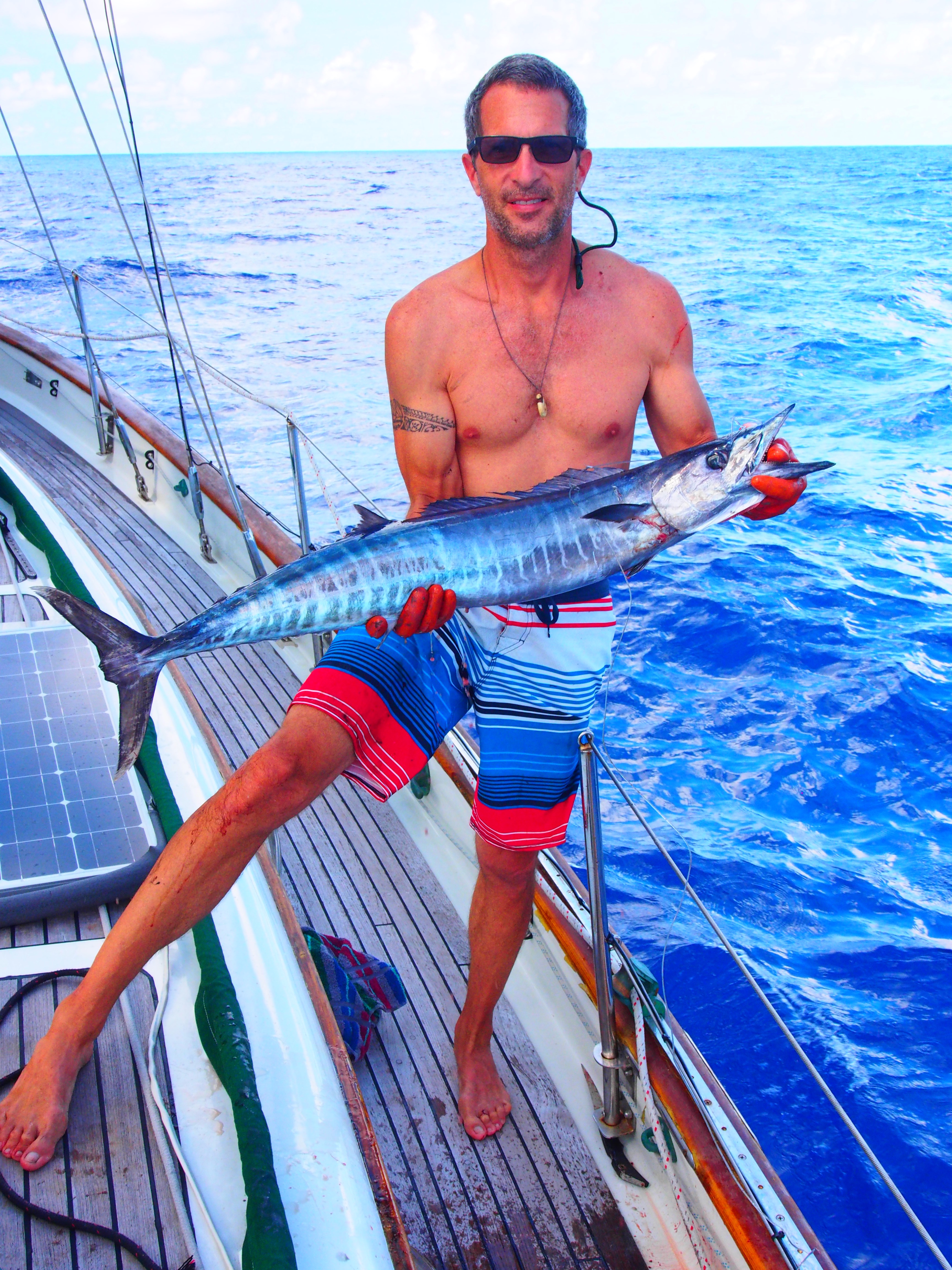
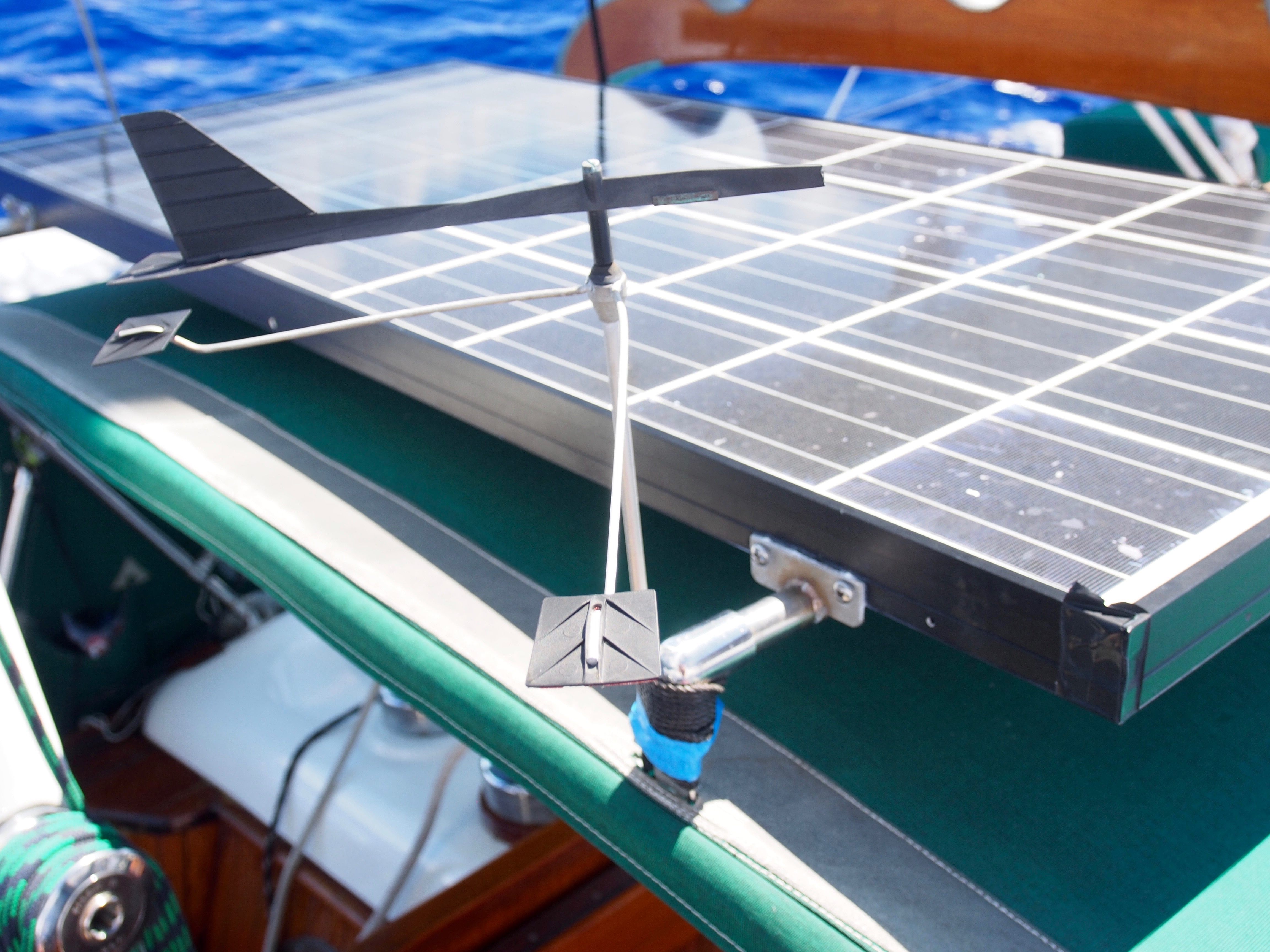
Today begins our 5th day at sea on the Christmas Island to Hawaii passage. We’ve seen everything from doldrums to squalls, but light air the majority of the time. And no sea-sickness among the crew for a change! Justin and Andi are doing great at picking up all the things required for passagemaking–sail trim & reefing, weather watching, boat maintenance, etc. They are also amazing in the galley and are avid “birders”, so I’m learning a lot about the different sea birds flying around us. We pulled in a large Wahoo on our 2nd day out and just finished eating it yesterday. It had some large upper teeth (like a small dog) and mostly small, sharp lowers, so we were careful handling it! The Hawaiian name for Wahoo is Ono, which means “delicious”. I think we drug it on the handline awhile since it was tired when we finally pulled it on deck. Justin and Andi made fish tacos, seared fish with couscous, and seared Mediterranean-style. We covered about 210 nm of easting during the first 4 days to set us up with a straight-line route into Hilo. If things change, we could check in at Maui or even Honolulu. We expect to reach the half-way point sometime tomorrow. Fuel is always a concern on long passages and so far we used up 48 out of 130 gallons. There was some remaining issues with bottom of the tank dirt clogging up the diesel filters, but seems to be better now after numerous filter bowl cleanings and filter changes. We pass time during the day with crossword puzzles, fishing, bird watching, eating, and resting. We have a special treat at Captains Hour when time allows and we’re not fighting squalls. We lost a critical part from Ian, the Fleming self-steering windvane. During the night, a 6 inch stainless steel rod that allows the vane to pivot on the servo arm disappeared into the deep, dark blue. I was surprised when I saw it since we count on Ian to keep us from hand-steering all the time. I was able to jury-rig a fix using a 10″ ss rod (fishing gear) that is slightly smaller in diameter. It’s held in place with 2 small set-screws, but for added insurance I used rescue tape on both ends to keep the pin from sliding out. So far it is working! After Samoa and especially Christmas Island, I’m really looking forward to landfall in Hawaii and being able to buy food and supplies just like in the rest of the states!
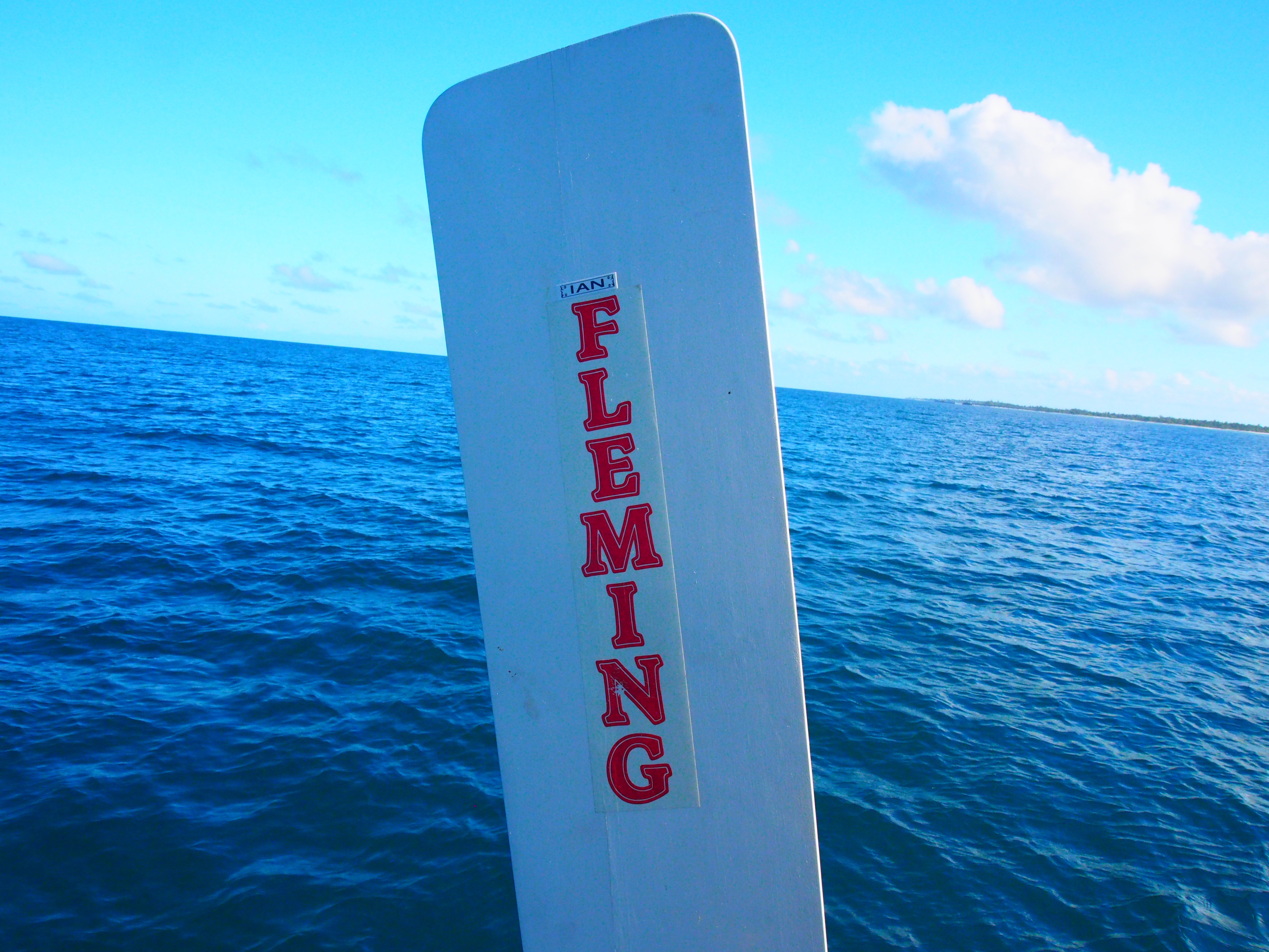
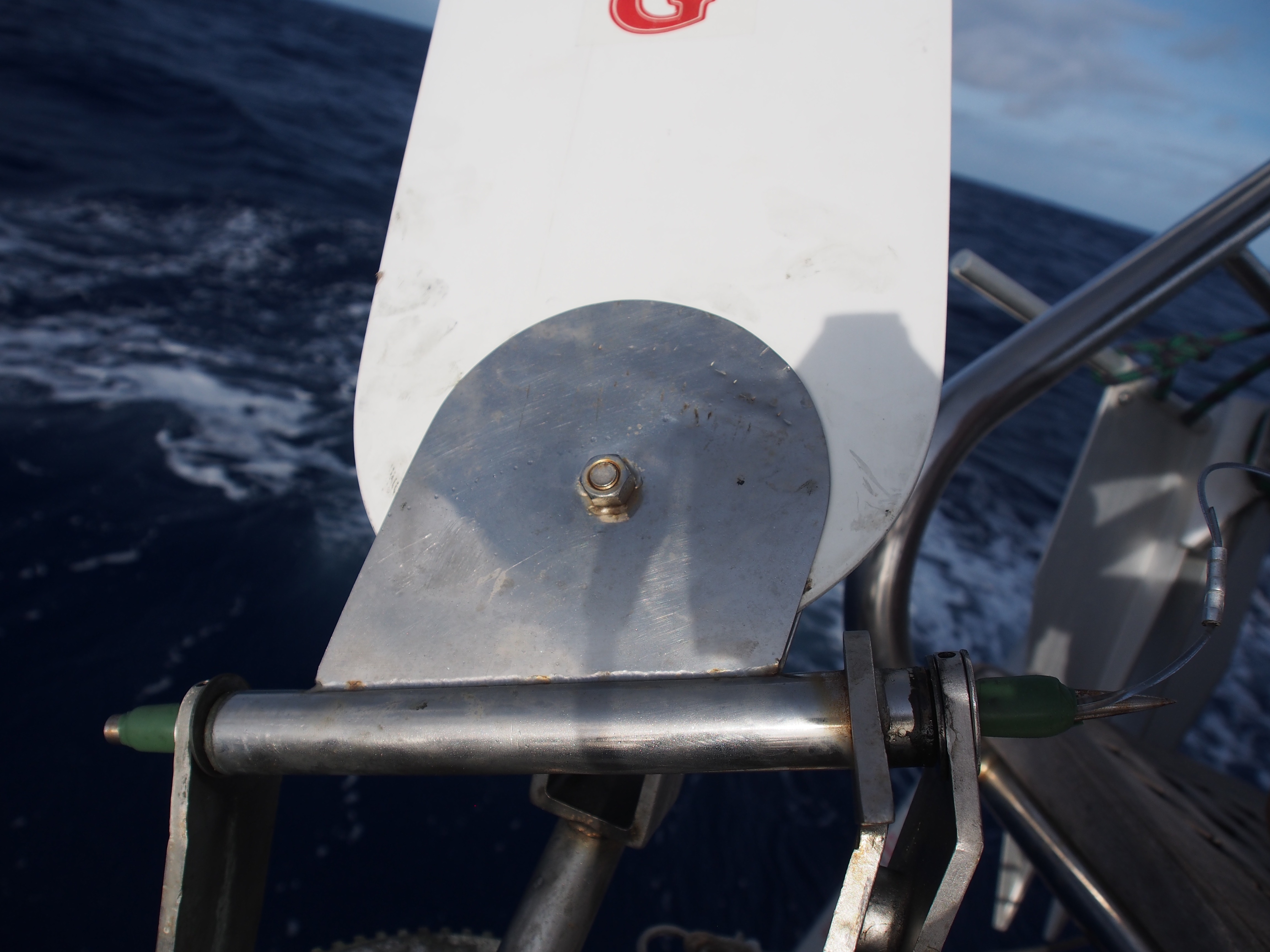
Update from Sea–8deg28min N, 154deg01min W
Today we are in day 9 of the passage from Christmas Island to Hawaii. We’re currently 260nm from Honolulu. We decided not to go to Hilo for check-in to make it easier and quicker for the Justin and Andi to get to Maui for their flight back to Seattle. Another unexpected and unfortunate thing happened to Ian, our self-steering wind vane. After loosing the pivot pin a few days ago, a more serious break happened–the wind vane rudder vanished into the deep, dark blue! It looks like a weld broke and a tether, whose purpose was to pull and pivot the rudder up and out of the water when not in use, was no match for dragging something that big in the water at 6 knots. This rendered the wind vane completely useless, so good thing we were only about 4 days from landfall. We used a combination of hand-steering and balancing the boat via the 4 sails so she would steer herself on a constant course. I contacted the wind vane manufacturer (Fleming from Australia) and will have a new rudder shipped to Hawaii. Brian, who is crewing from Hawaii to Seattle, is machining a pin to match the one that fell out, so Ian should be back to working condition when we depart from Hawaii. After getting through the doldrums and a huge, half-day rain storm, we finally broke out into the trade winds. We’ve now been sailing for the past 6 days covering 24-hour distances of 109, 94, 119, 116, 140, and 143nm. With 2 days left, we should pull into Honolulu with almost 3/4ths of the fuel still in the tanks. The past few nights have been moonless so the stars have been amazing. We finally spotted Ursa Minor about 2 nights ago and Polaris has been rising higher by about 2 degrees (angular height above the horizon) each night, since we cover about 2 deg of latitude (120nm) daily. We are on a 0 deg. true heading, so Polaris is straight ahead and we can still see the Southern Cross at 180 deg. getting lower and lower. Last night we used an iPad app. to identify Mars, Saturn, Jupiter, and bright stars and constellations in the dark sky. Another repair at sea involved the steering system after I noticed there was about a 1″ play in the wheel. I had visions of the wheel coming completely off the binnacle. To gain access to the upper steering connection, we had to remove the compass and mounting board. Then it was obvious that all that was needed was to tighten the large nut threaded onto the steering axle.
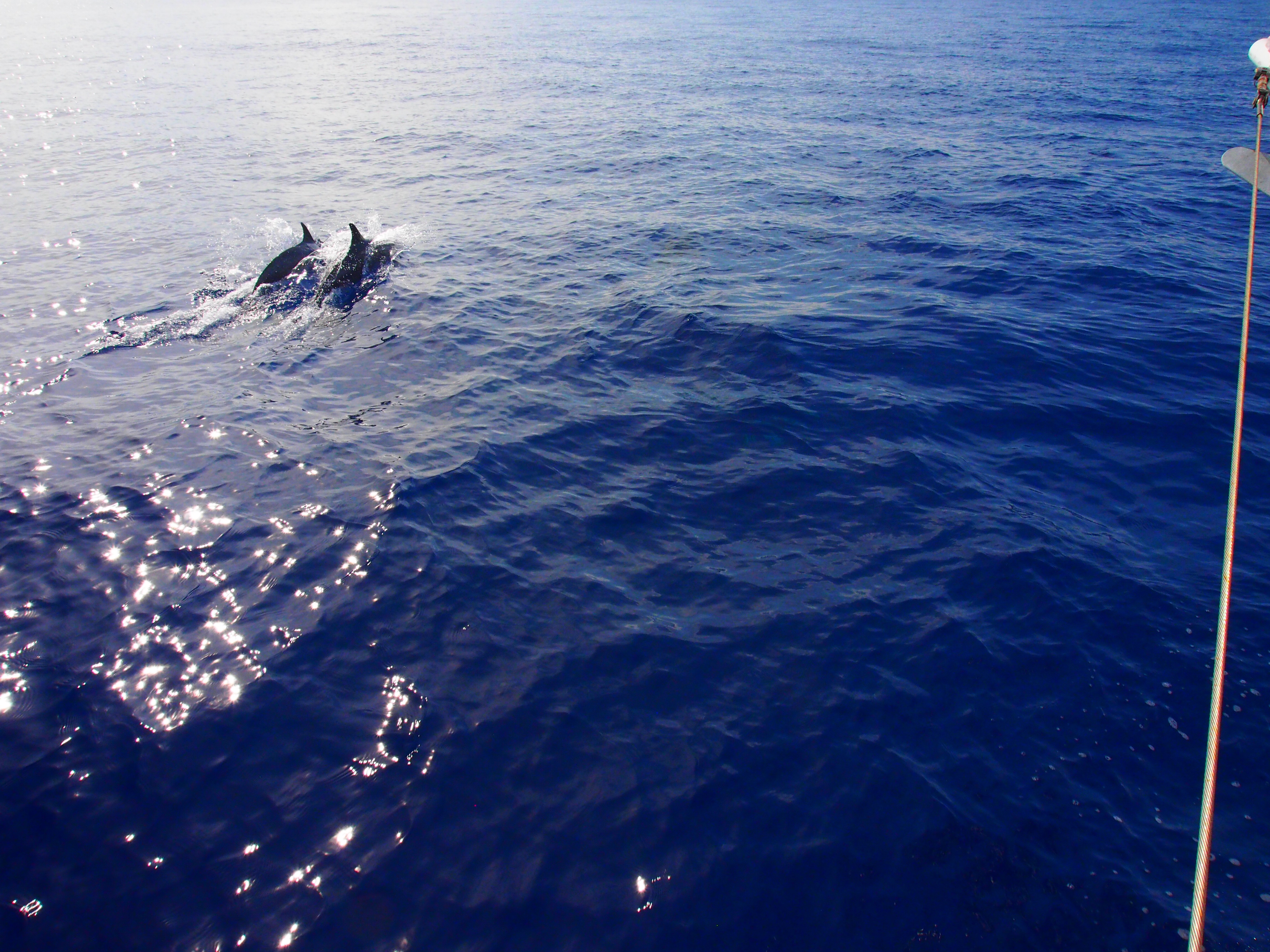
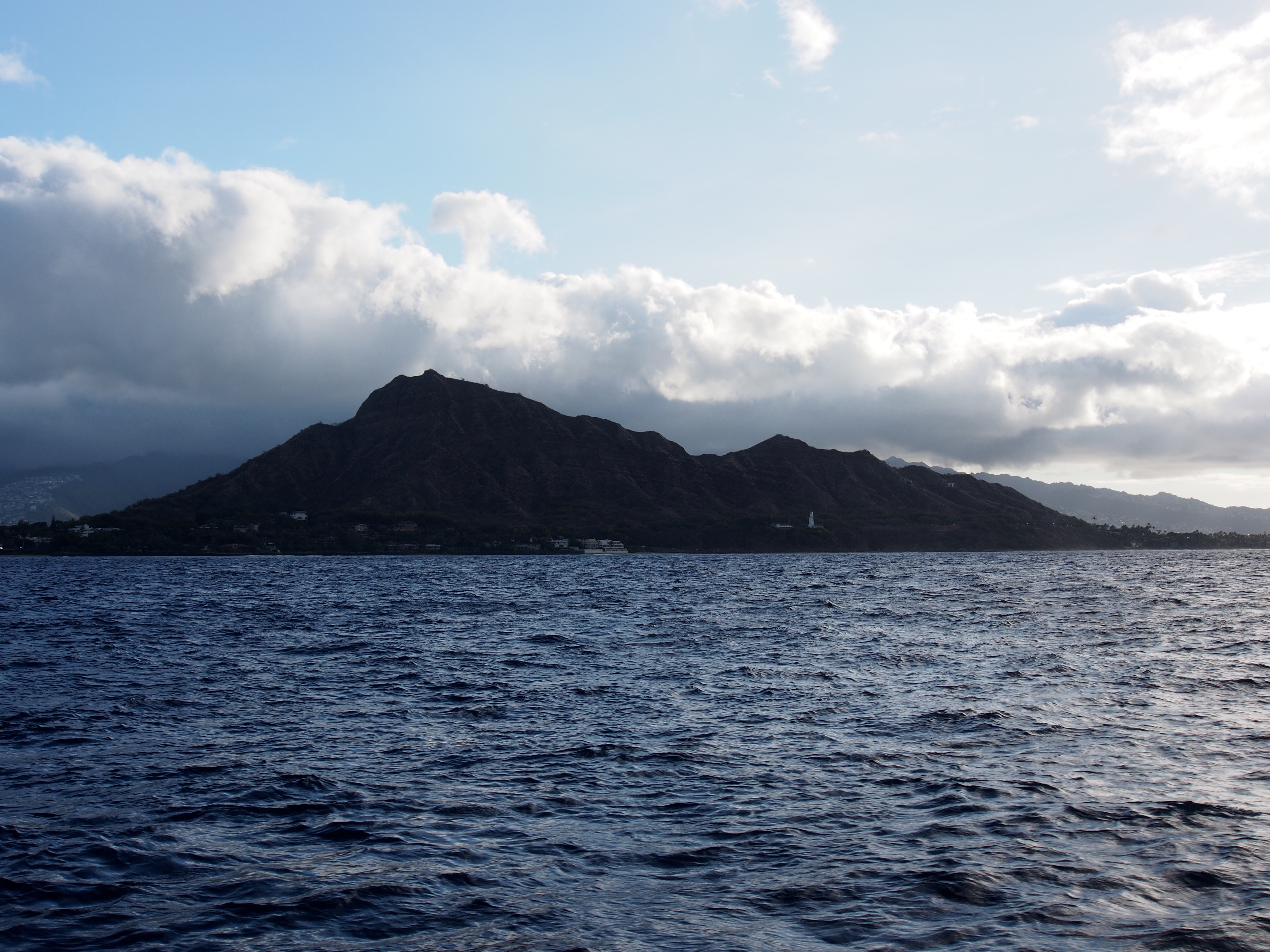
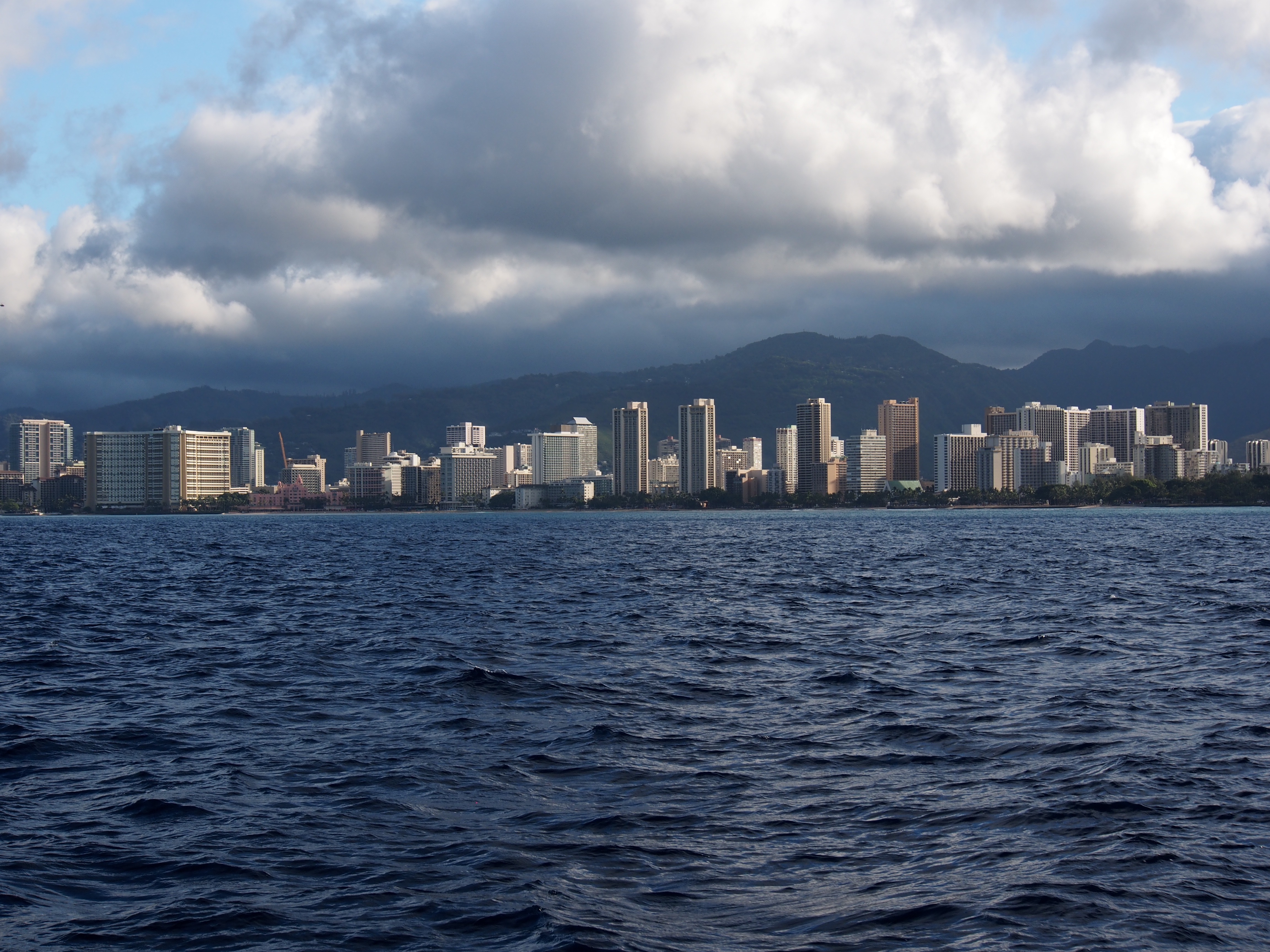
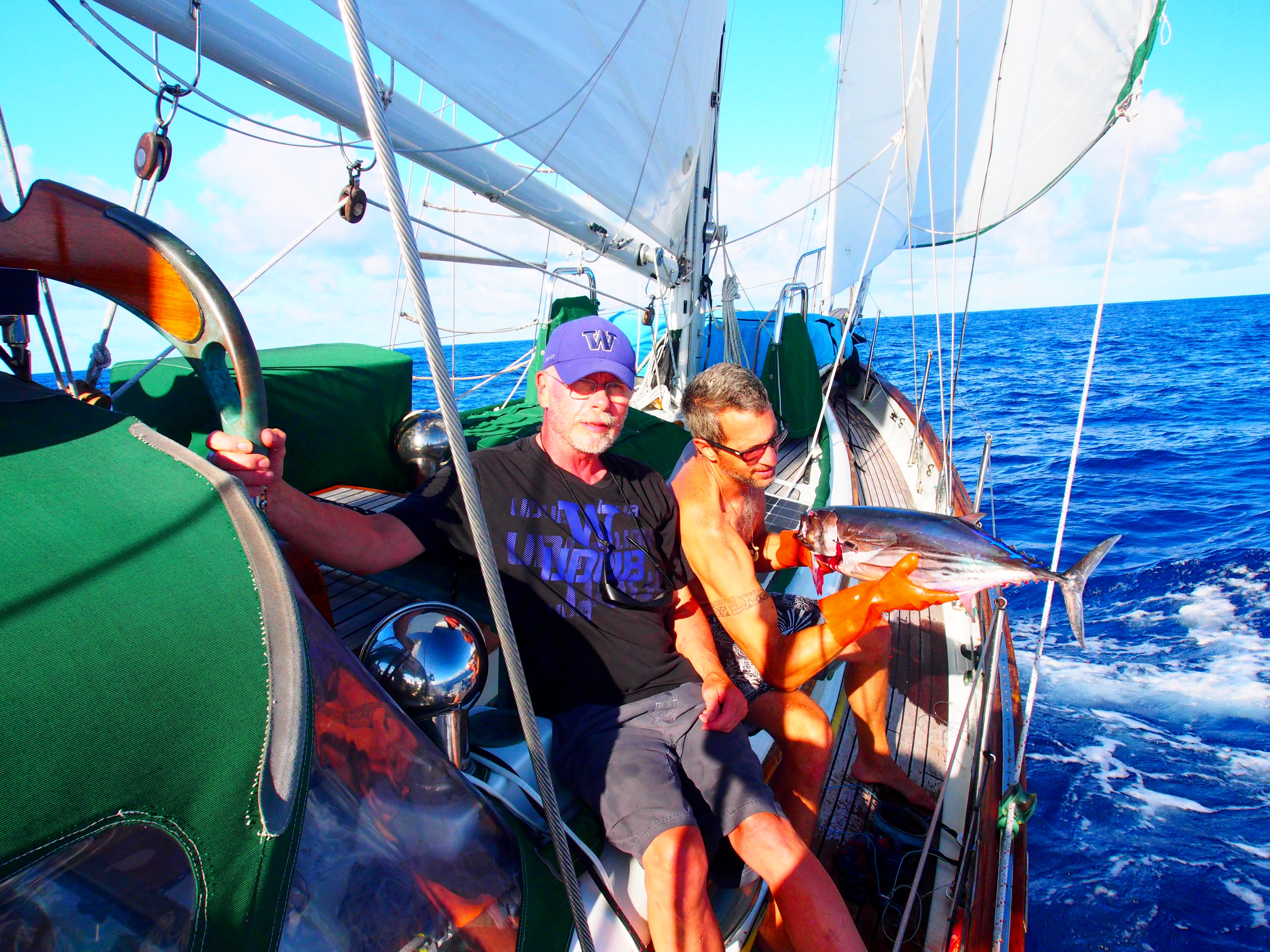
In the final day and a half, we saw both extremes of wind. Once we got in the lee of the big island of Hawaii with its tall volcanoes, there was no wind at all and we motored for about 12 hours. I never realized how big the island was until we had to motor along it. From tip to tip, it stretches about 80 miles, the same distance from Seattle to the Canadian border! At the closest, we were just 40 miles off the south-west coast, yet we never once spotted it due to the haze. We finally broke out of the wind shadow as we got closer to Maui, which was the first land we spotted. From there to Oahu, we had plenty of wind and had to reduce sail to keep the boat from heeling so much. We pulled in a small bluefin tuna as the hotels of Honolulu and Waikiki got closer. Right after that a group of about 20 dolphins swam beside us, giving us a fantastic show. Some were obviously showing off as they lept completely out of the water. Our arrival after dark forced us to hove-to (with stays’l and main) until dawn, since we would be tying Tahitian-style to a dock and mooring buoy at the Ala Wai marina. When I got up at 5am, I pulled out the genoa and sailed east past Waikiki and Diamond Head for some photos.
Savu Savu, Fiji to Apia, Samoa:
Apia, Samoa to Christmas Island, Kiribati:
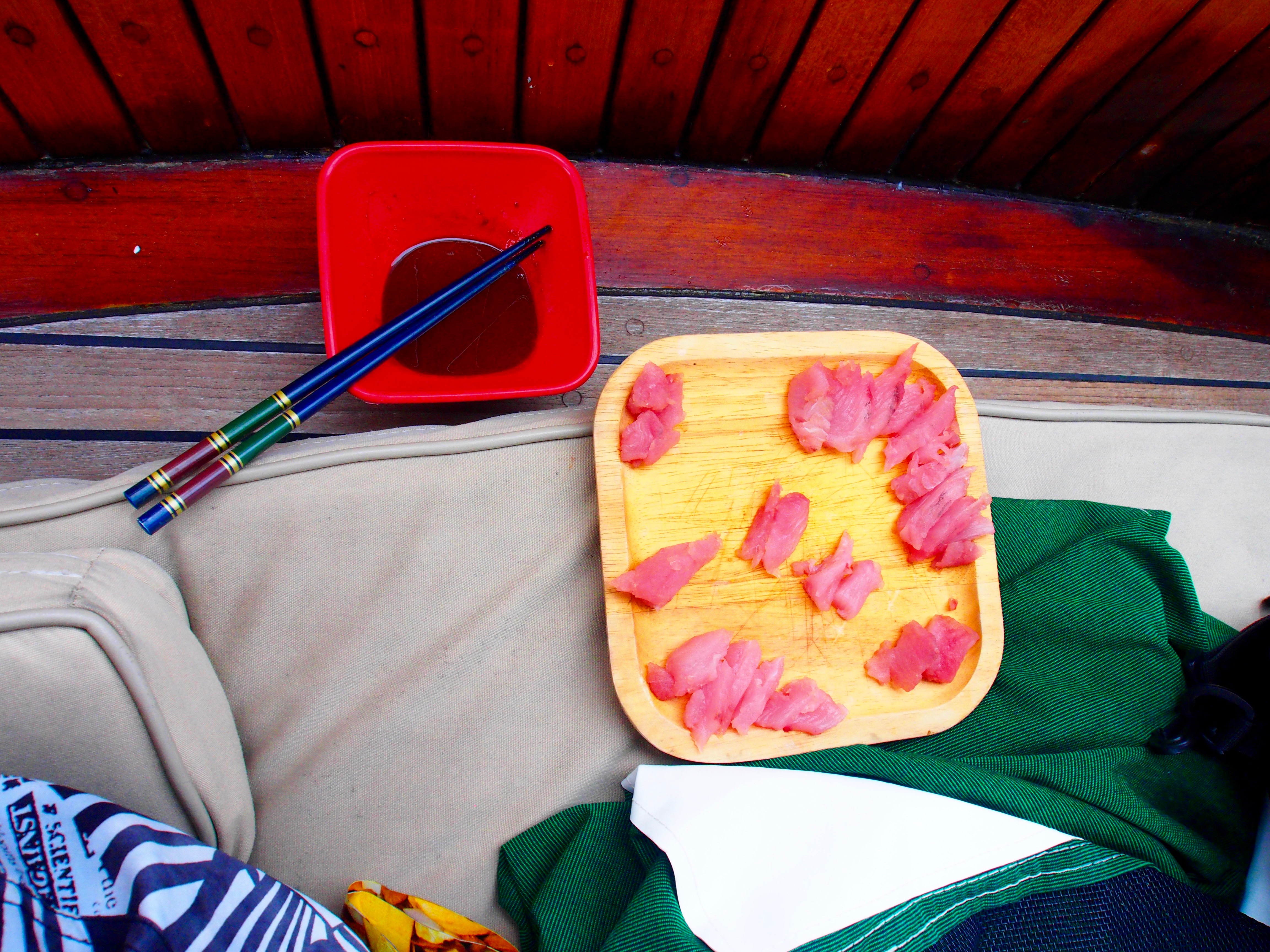
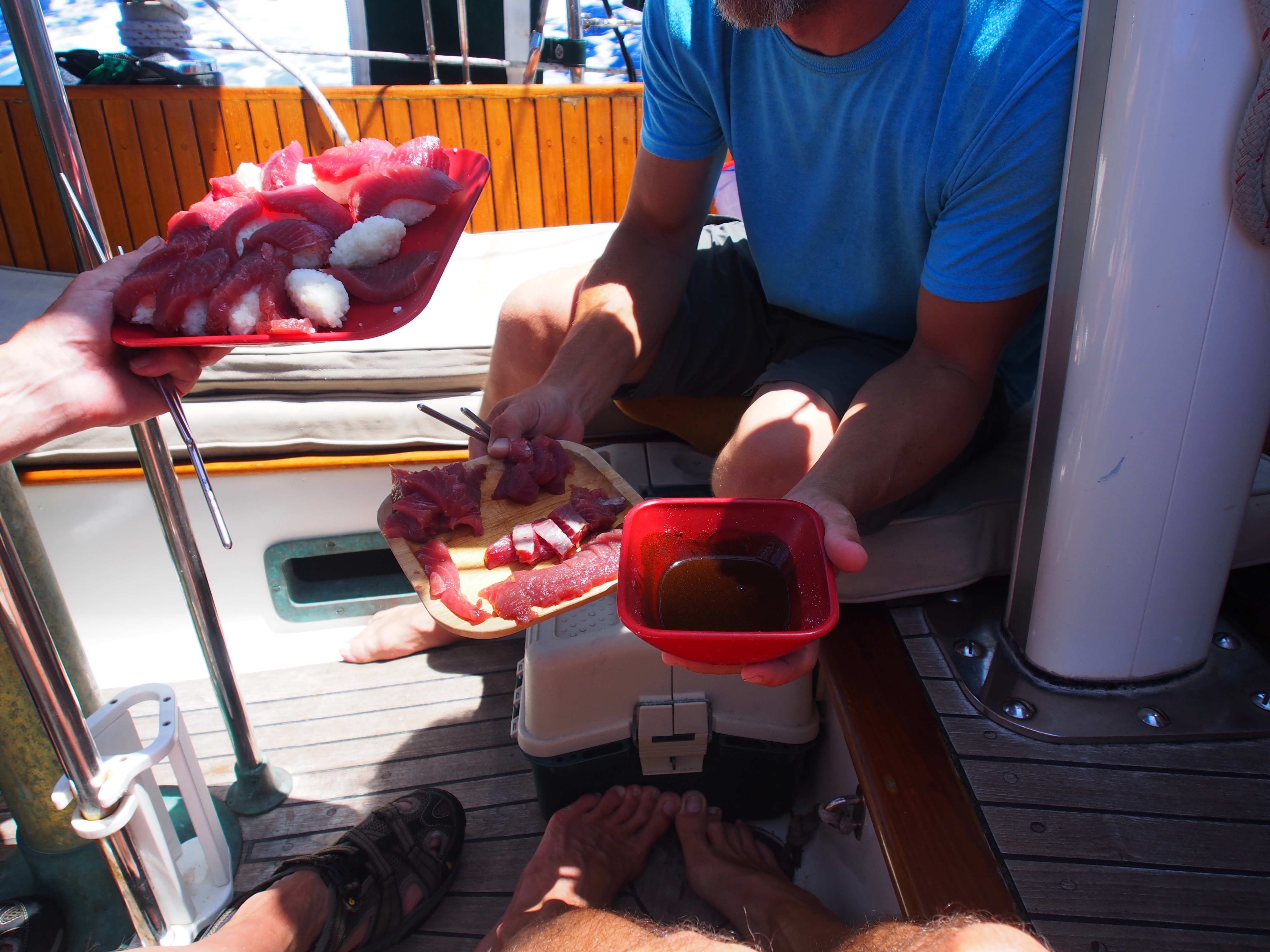
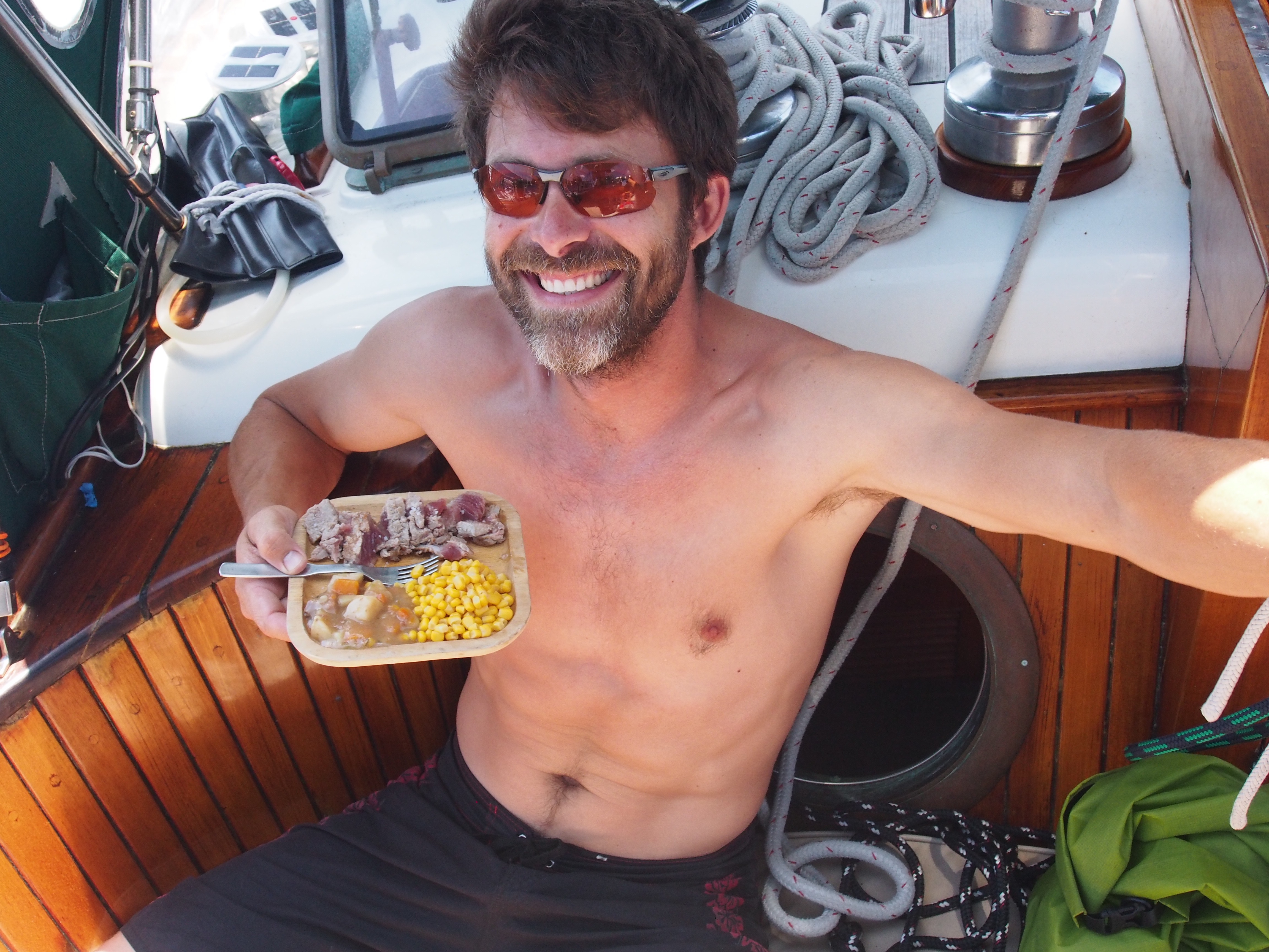
We arrived in Kiritimati (Christmas Island), Kiribati after 14 days and 5 hours. We found some nice NE trade winds over the past 3 days, sailing about 400nm on a due-north course. We pulled into the anchorage with about half of the fuel we left Samoa with. Sailing to motoring ratio was roughly 5:1, not bad for a difficult upwind passage. Yesterday we pulled in another large Blue Fin Tuna and today we finished up the other Blue Fin we caught a few days ago. For a change from sashimi, Adam lightly seared the tuna and served it with sea salt, a can of Irish Stew, and corn. We’ll be back on fresh sashimi tomorrow!
Equator Crossing
Having 2 pollywogs aboard, I had some fun creating an equator crossing ceremony. It started with a little hazing and ended with a champagne toast to Neptune. About 2 miles south of the equator, I had the pollywogs strip down and don womens clothes! Next they had to look up at the half moon and howl for 30 seconds. Thirdly, they had to consume a half-cup concoction of sea water, oatmeal, mustard, crackers, and hot sauce. They were good sports with it all and by the time that was done, we were about 5 minutes from the equator, so I popped a bottle of champagne, filled our glasses, then we all poured out half to the sea on the south side of the equator for King Neptune, and drank the other half on the north side of the equator. Doug and Adam are now and forever more Shellbacks. Pictures will be added when I find internet access!!
Landfall
We spotted the low-lying atoll of Kiritimati about 5 miles out, as coconut trees and radio towers are the tallest things on the island. We anchored in the late afternoon just off London, the small town on the west side. We’re flying the Q-flag and will have to wait until morning to contact customs, immigration, and bio-security officials. There is no dock here, so I will have to take the dinghy in to pick them up and bring them to the boat for the required inspection and clearance. Tonight we’re using the last of the vegetables, limes, sausages, etc since they would be confiscated tomorrow. The anchorage is calm and we’re all relaxing in the cockpit listening to music and enjoying the cool breeze. Also looking forward to a full night’s sleep tonight!
