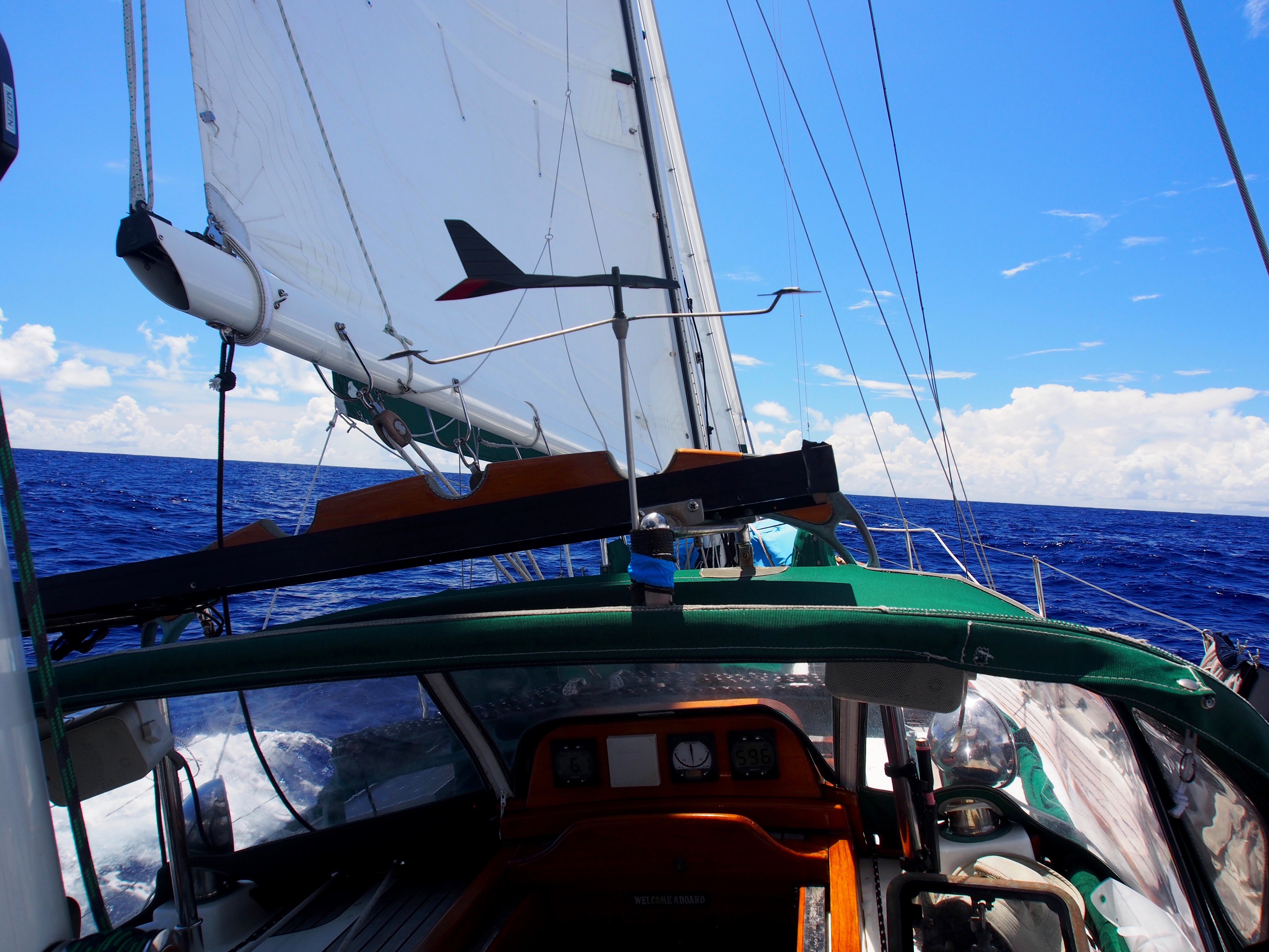
The 60nm passage from Port Angeles to Seattle began with a careful study of the tides and currents. Timing is important and can shave hours off this passage if done right. In the summer, this passage almost always requires motoring, and after 20 days of mostly sailing from Hawaii, I looked forward to relaxing with the autopilot doing the steering. We departed at 09:30 so that we would hit Dungeness Spit around slack, and Admiralty Inlet at mid-flood. This meant departing against an ebb tide, but by staying close to shore between Port Angeles and Dungeness, we actually had a slight positive current from back-eddies. We were also helped by a light westerly wind that gave us an extra half-knot by motor sailing with the Genoa. We passed Dungeness Spit moving at 8 knots, and were going 8-10 knots through Admiralty Inlet.
It had been 2 years since Apropos was in the Salish Sea. As we motored-sailed south towards Seattle, it was great seeing all the familiar landmarks–Dungeness Lighthouse, Port Townsend, Point No Point Lighthouse, the Edmonds-Kingston ferries, the cruise ships headed to Alaska, and finally, the Seattle skyline and Shilshole marina. Our trip to the South Pacific was amazing, but some of the best cruising grounds anywhere are in the Pacific Northwest.
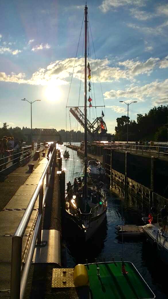
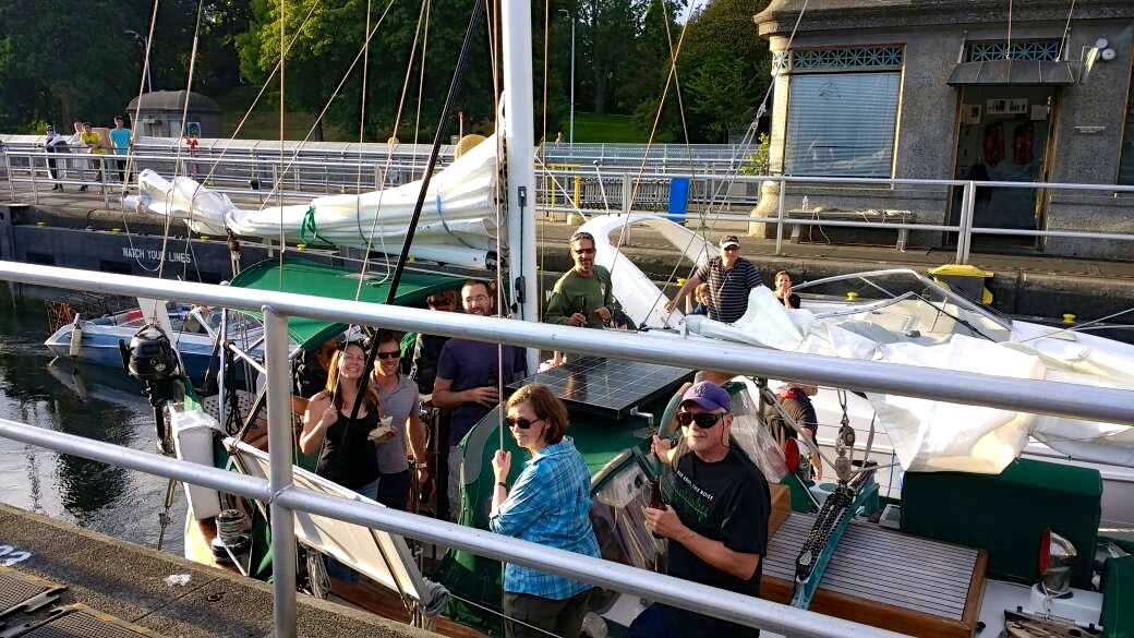
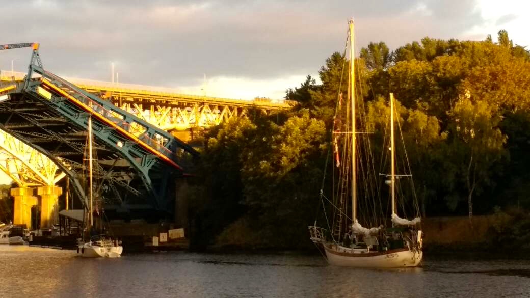
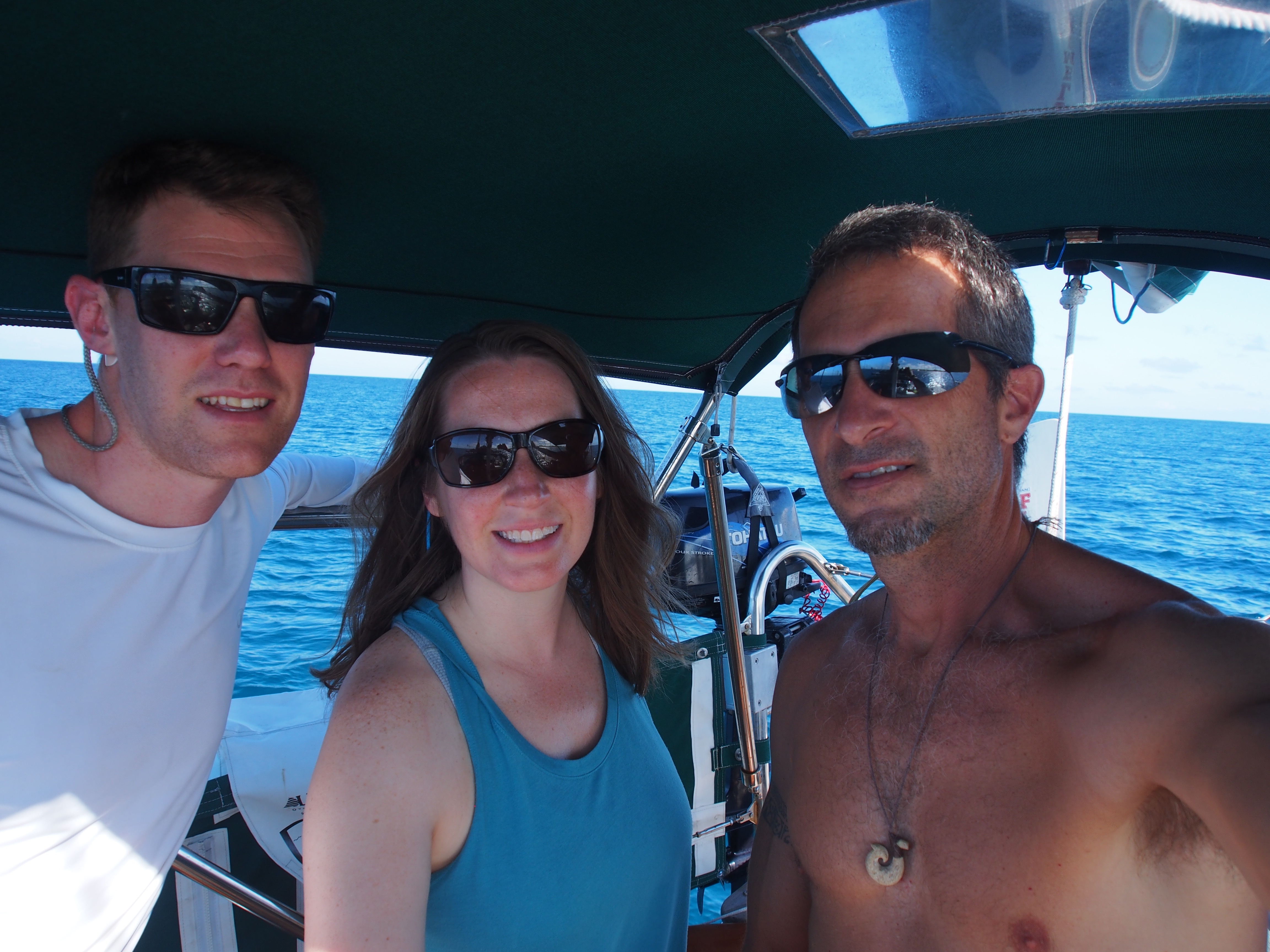
Anna Maria, who we hung out with when we were in Zihuatanejo, Mexico, joined us in Port Angeles for the final passage to Seattle. We reached Seattle by 7pm and pulled into Shilshole marina to pick up some of the crew from the Fiji, Samoa, and Christmas Island passages for the final 3 miles to Lake Union. Doug, Dave, Denise, Justin, and Adrea came aboard and we motored to the Ballard Locks, then through the canal to Lake Union. This completed a nearly 2-year, 16,000 nautical mile Pacific Ocean voyage with stops in 8 countries–Mexico, French Polynesia, Cook Islands, Nuie, Tonga, Fiji, Samoa, and Kiribati.
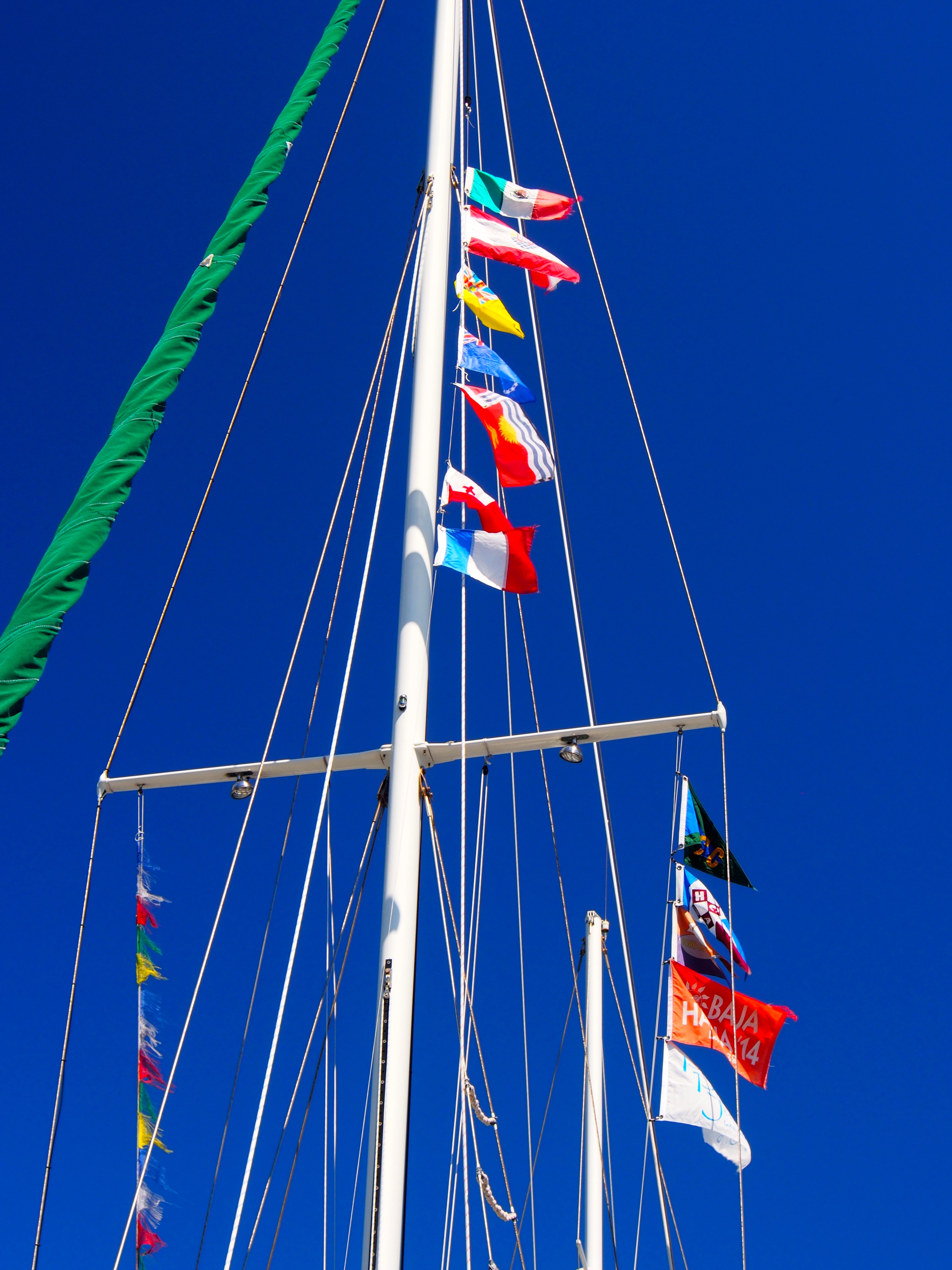
Country Courtesy Flags (top), Rally Flags (right), and what’s left of the Tibetan Prayer Flags (left)Inside the Ballard LocksSome of the crew joined us for the last 3 miles to Lake UnionFremont Drawbridge to Lake Union
Christmas Island to Hilo, Hawaii is a 1080nm passage (direct line) on a 9 degree heading. The predominant wind is NE, making it another close-hauled slog. Our plan was to sail 2-1/2 degrees of longitude (150nm) further east from the direct path in the first half of the passage to set us up for the stronger NE trades further north. We figured that we could always make landfall in Maui or Oahu if the wind shifted more north. In the end, we decided on Oahu due to the schedule and convenience of flights for crew. Since we went went so far east earlier, this added about 300 miles to the direct path to Honolulu.
Justin, Andi, and Cap’n
Here are 2 blog updates from sea on day 5 and day 9:
Update from Sea–17deg N, 156deg W
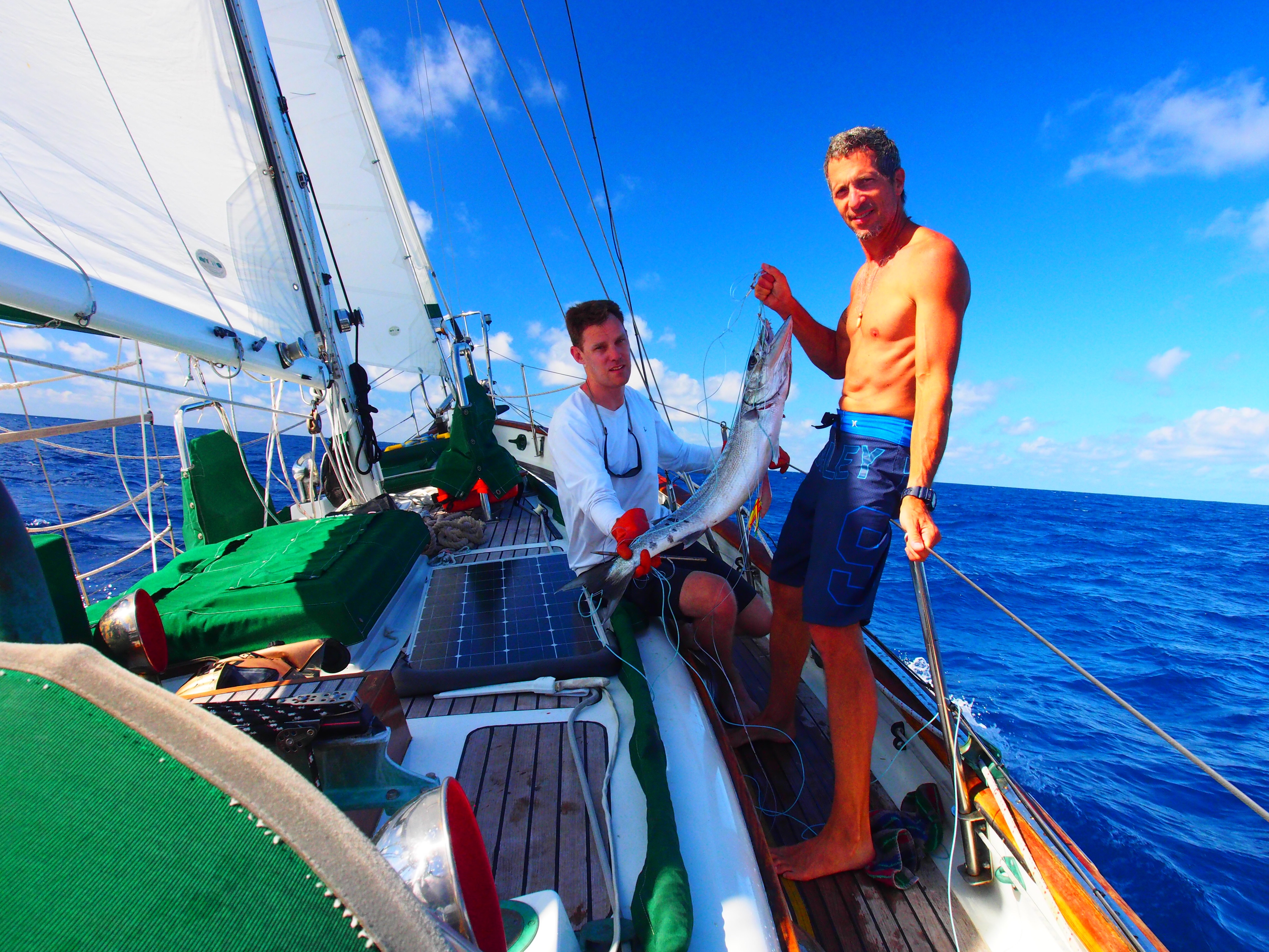
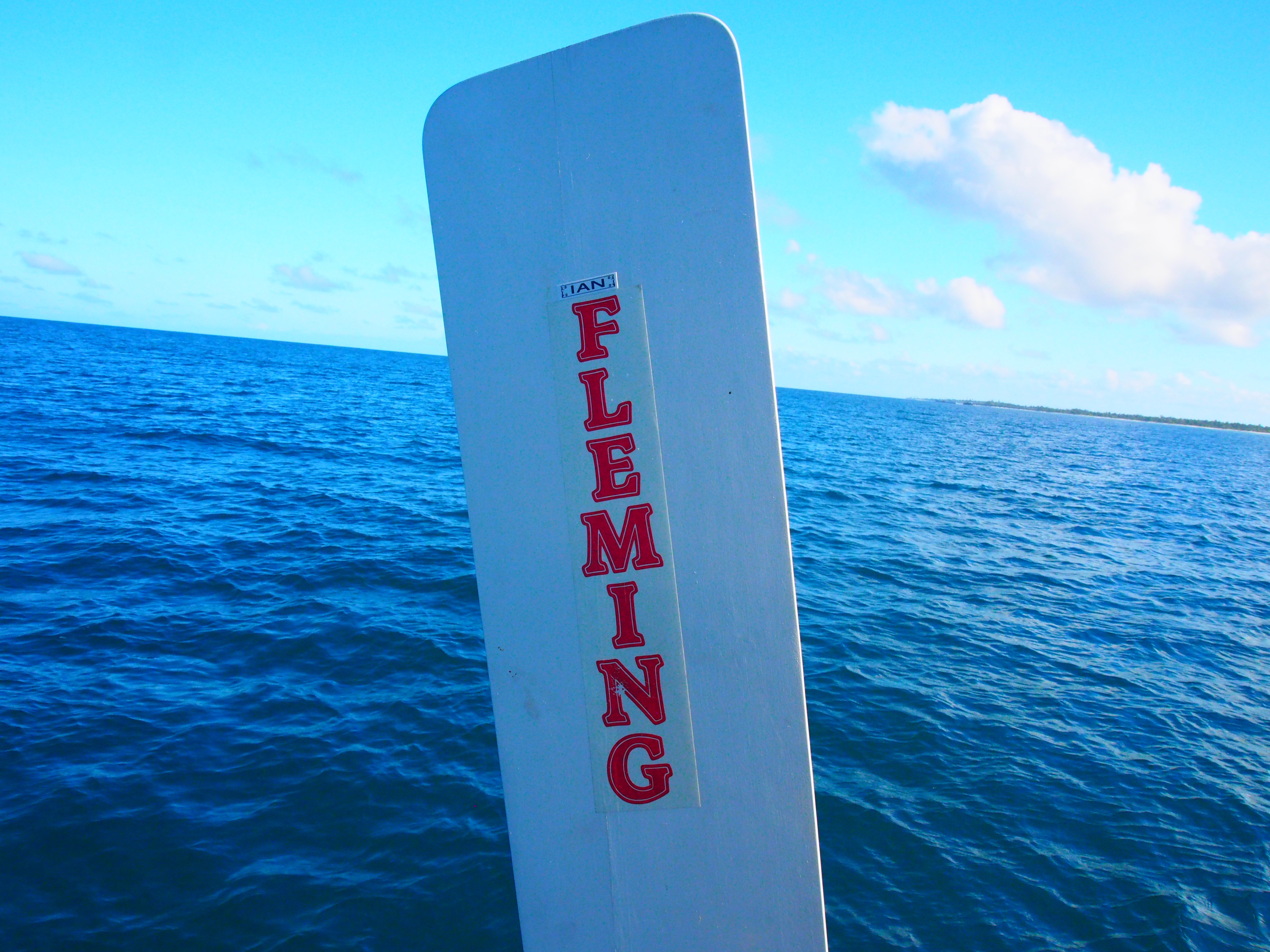
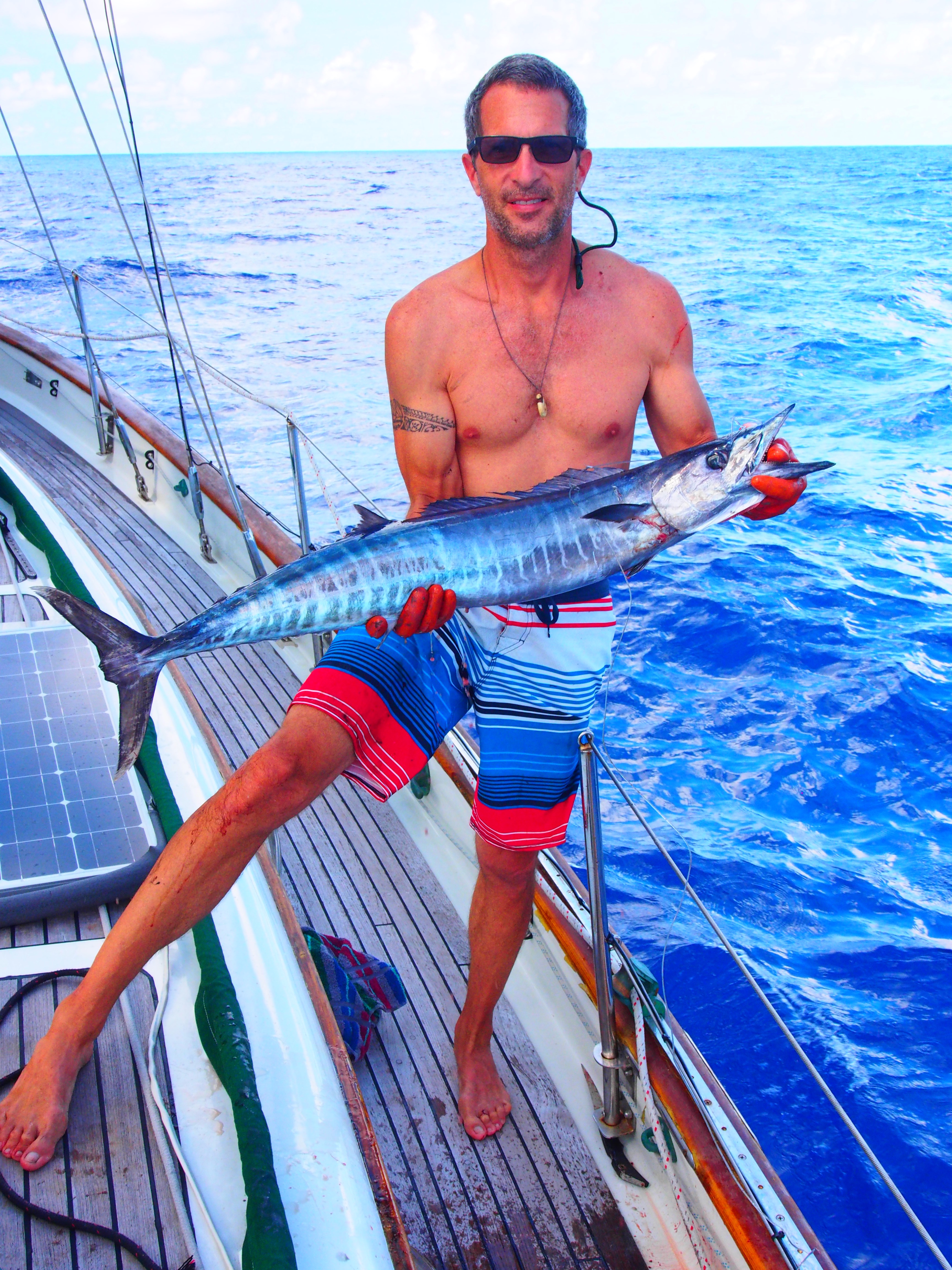
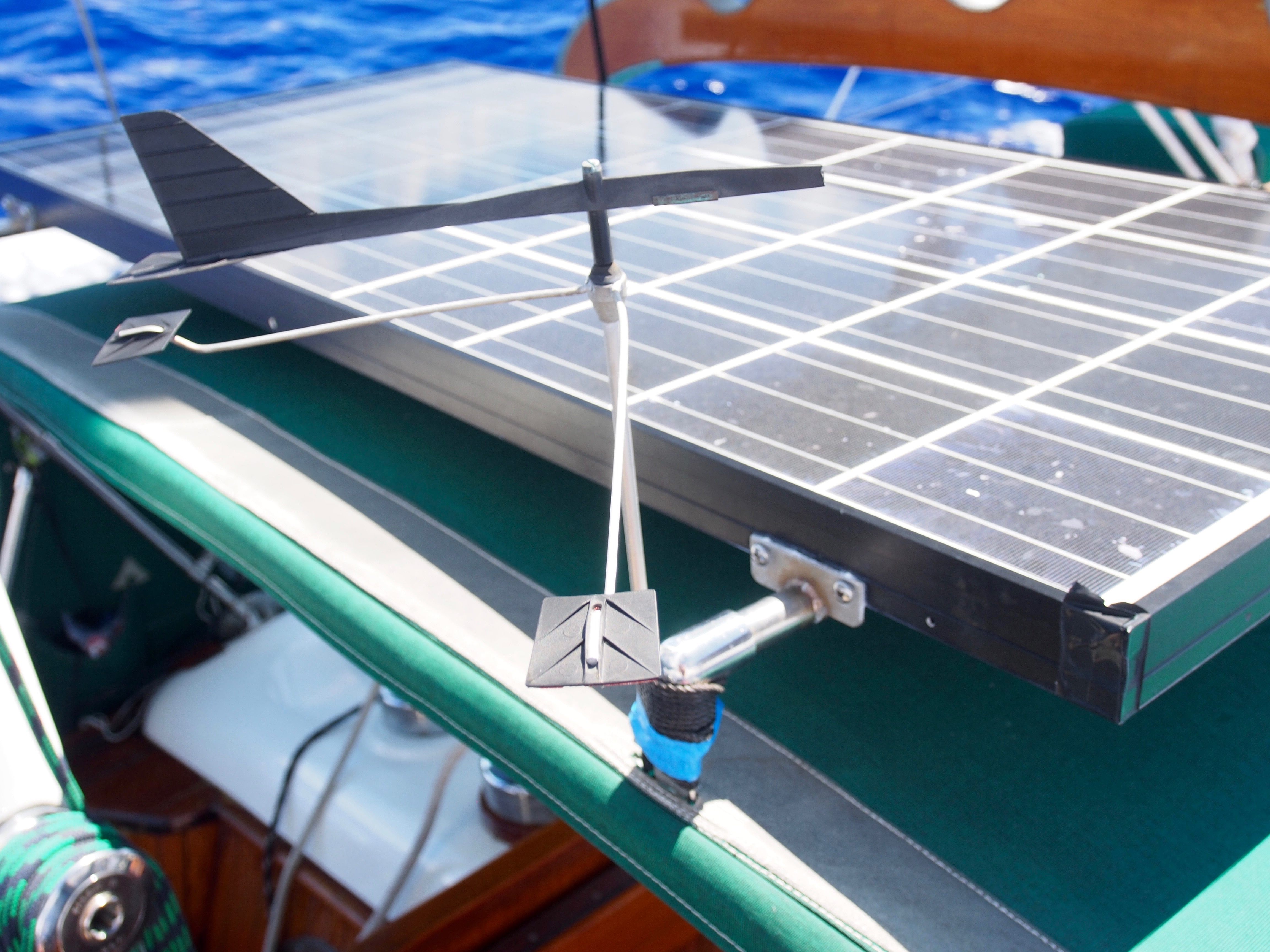
Today begins our 5th day at sea on the Christmas Island to Hawaii passage. We’ve seen everything from doldrums to squalls, but light air the majority of the time. And no sea-sickness among the crew for a change! Justin and Andi are doing great at picking up all the things required for passagemaking–sail trim & reefing, weather watching, boat maintenance, etc. They are also amazing in the galley and are avid “birders”, so I’m learning a lot about the different sea birds flying around us. We pulled in a large Wahoo on our 2nd day out and just finished eating it yesterday. It had some large upper teeth (like a small dog) and mostly small, sharp lowers, so we were careful handling it! The Hawaiian name for Wahoo is Ono, which means “delicious”. I think we drug it on the handline awhile since it was tired when we finally pulled it on deck. Justin and Andi made fish tacos, seared fish with couscous, and seared Mediterranean-style. We covered about 210 nm of easting during the first 4 days to set us up with a straight-line route into Hilo. If things change, we could check in at Maui or even Honolulu. We expect to reach the half-way point sometime tomorrow. Fuel is always a concern on long passages and so far we used up 48 out of 130 gallons. There was some remaining issues with bottom of the tank dirt clogging up the diesel filters, but seems to be better now after numerous filter bowl cleanings and filter changes. We pass time during the day with crossword puzzles, fishing, bird watching, eating, and resting. We have a special treat at Captains Hour when time allows and we’re not fighting squalls. We lost a critical part from Ian, the Fleming self-steering windvane. During the night, a 6 inch stainless steel rod that allows the vane to pivot on the servo arm disappeared into the deep, dark blue. I was surprised when I saw it since we count on Ian to keep us from hand-steering all the time. I was able to jury-rig a fix using a 10″ ss rod (fishing gear) that is slightly smaller in diameter. It’s held in place with 2 small set-screws, but for added insurance I used rescue tape on both ends to keep the pin from sliding out. So far it is working! After Samoa and especially Christmas Island, I’m really looking forward to landfall in Hawaii and being able to buy food and supplies just like in the rest of the states!
Wahoo caught on day 2Ian finally got his name put on the vaneThe fix that kept Ian working (pin with green tape on ends)
Update from Sea–8deg28min N, 154deg01min W
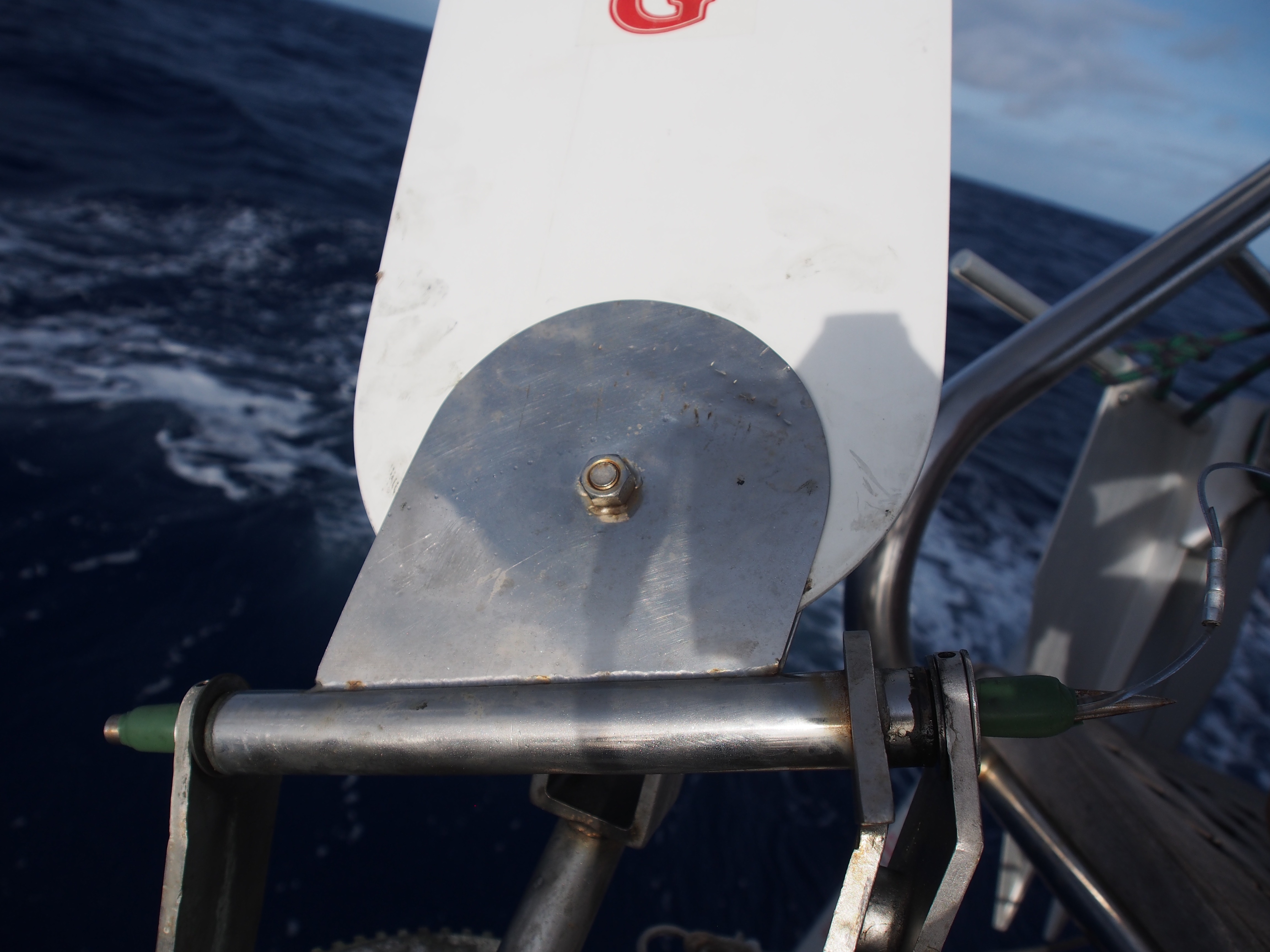
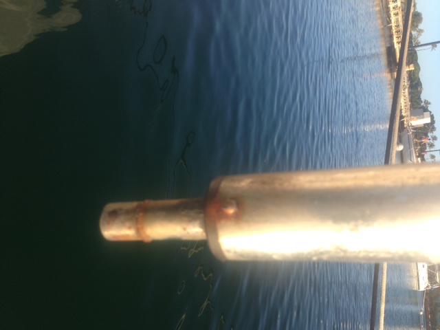
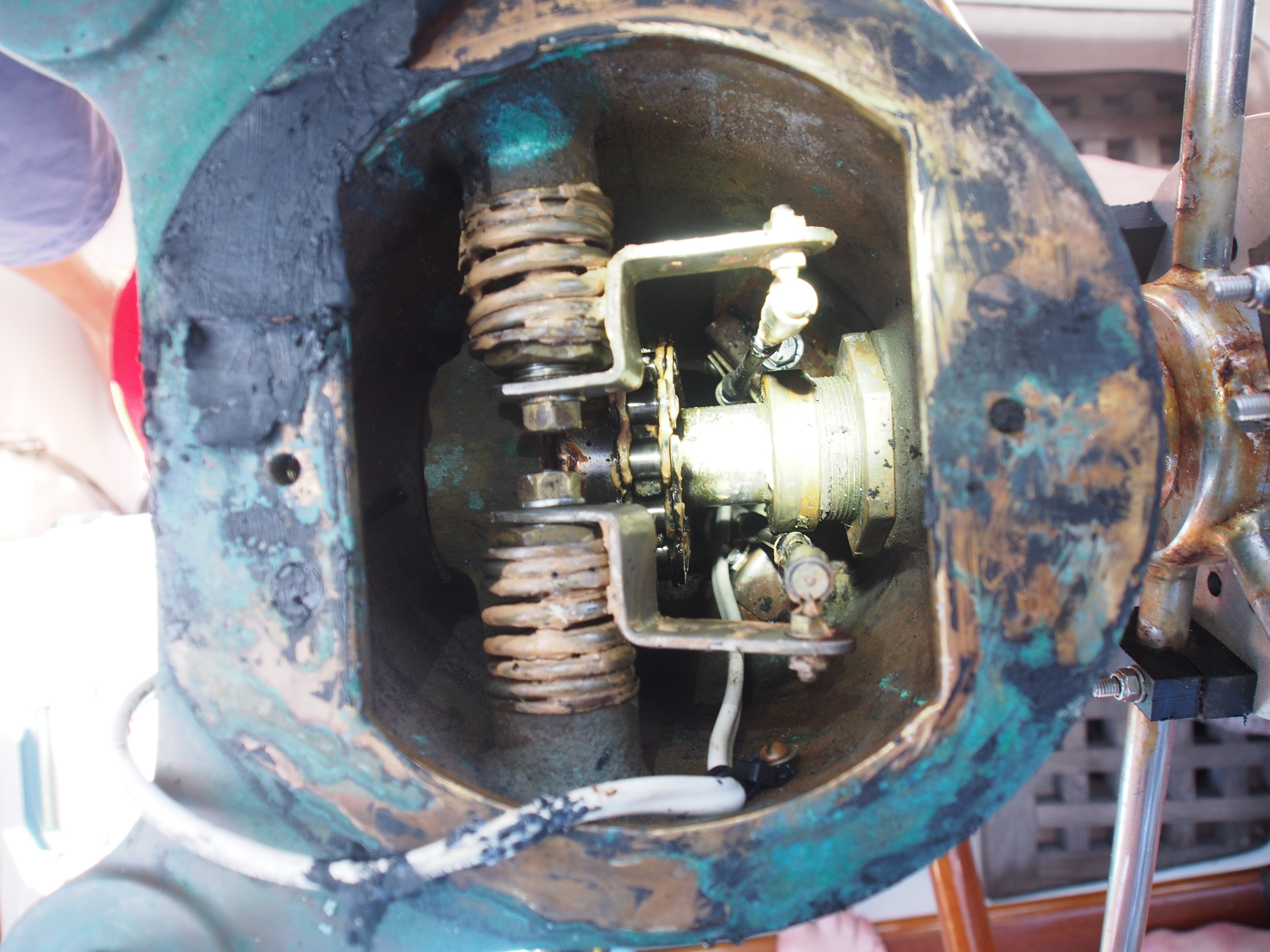
Today we are in day 9 of the passage from Christmas Island to Hawaii. We’re currently 260nm from Honolulu. We decided not to go to Hilo for check-in to make it easier and quicker for the Justin and Andi to get to Maui for their flight back to Seattle. Another unexpected and unfortunate thing happened to Ian, our self-steering wind vane. After loosing the pivot pin a few days ago, a more serious break happened–the wind vane rudder vanished into the deep, dark blue! It looks like a weld broke and a tether, whose purpose was to pull and pivot the rudder up and out of the water when not in use, was no match for dragging something that big in the water at 6 knots. This rendered the wind vane completely useless, so good thing we were only about 4 days from landfall. We used a combination of hand-steering and balancing the boat via the 4 sails so she would steer herself on a constant course. I contacted the wind vane manufacturer (Fleming from Australia) and will have a new rudder shipped to Hawaii. Brian, who is crewing from Hawaii to Seattle, is machining a pin to match the one that fell out, so Ian should be back to working condition when we depart from Hawaii. After getting through the doldrums and a huge, half-day rain storm, we finally broke out into the trade winds. We’ve now been sailing for the past 6 days covering 24-hour distances of 109, 94, 119, 116, 140, and 143nm. With 2 days left, we should pull into Honolulu with almost 3/4ths of the fuel still in the tanks. The past few nights have been moonless so the stars have been amazing. We finally spotted Ursa Minor about 2 nights ago and Polaris has been rising higher by about 2 degrees (angular height above the horizon) each night, since we cover about 2 deg of latitude (120nm) daily. We are on a 0 deg. true heading, so Polaris is straight ahead and we can still see the Southern Cross at 180 deg. getting lower and lower. Last night we used an iPad app. to identify Mars, Saturn, Jupiter, and bright stars and constellations in the dark sky. Another repair at sea involved the steering system after I noticed there was about a 1″ play in the wheel. I had visions of the wheel coming completely off the binnacle. To gain access to the upper steering connection, we had to remove the compass and mounting board. Then it was obvious that all that was needed was to tighten the large nut threaded onto the steering axle.
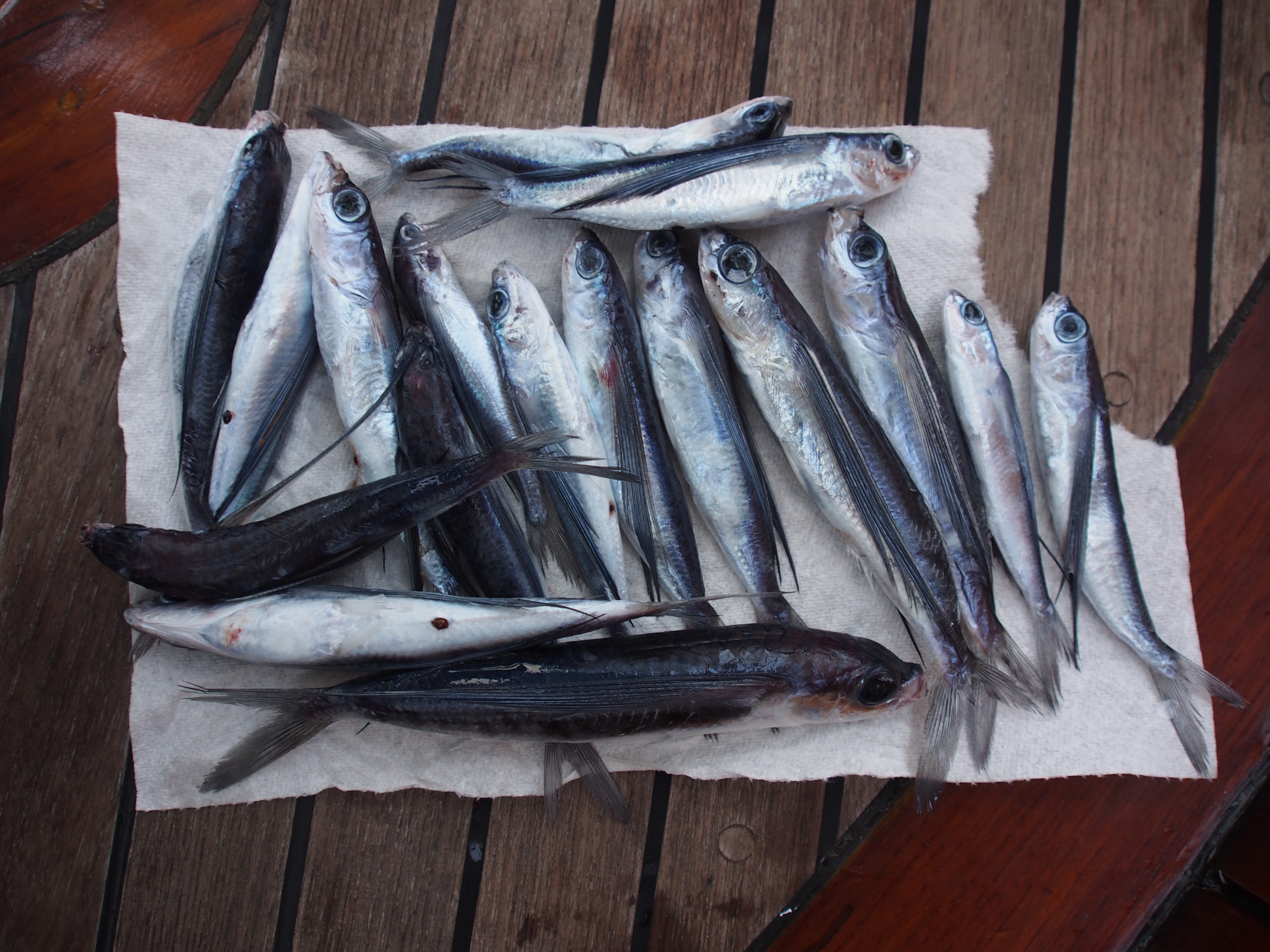
17 Flying Fish landed on deck overnightWind vane shaft showing where rudder broke offLooking down at the binnacle with compass removed to show throttle, gear, and steering chain (the bronze nut to the right was loose)
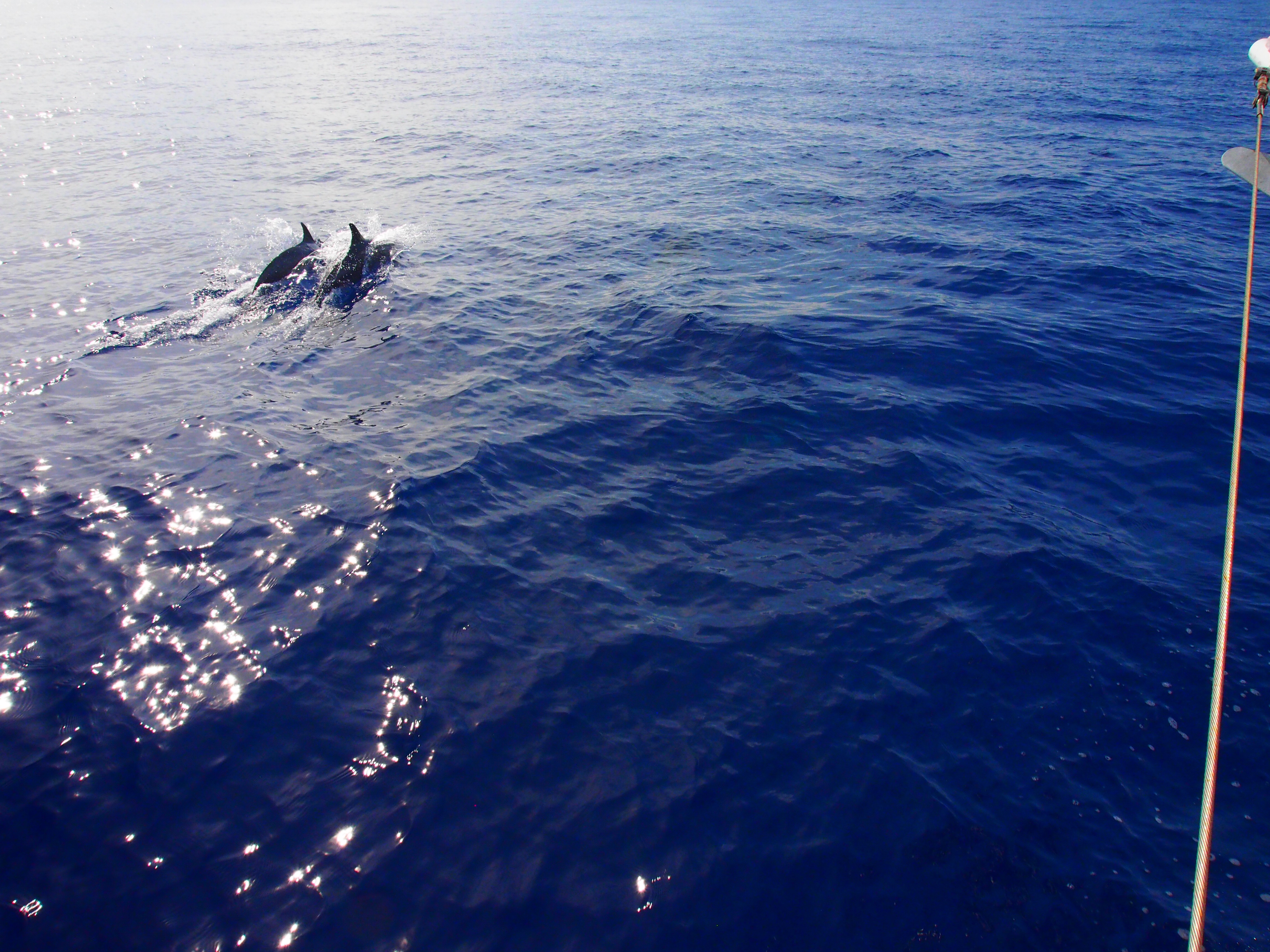
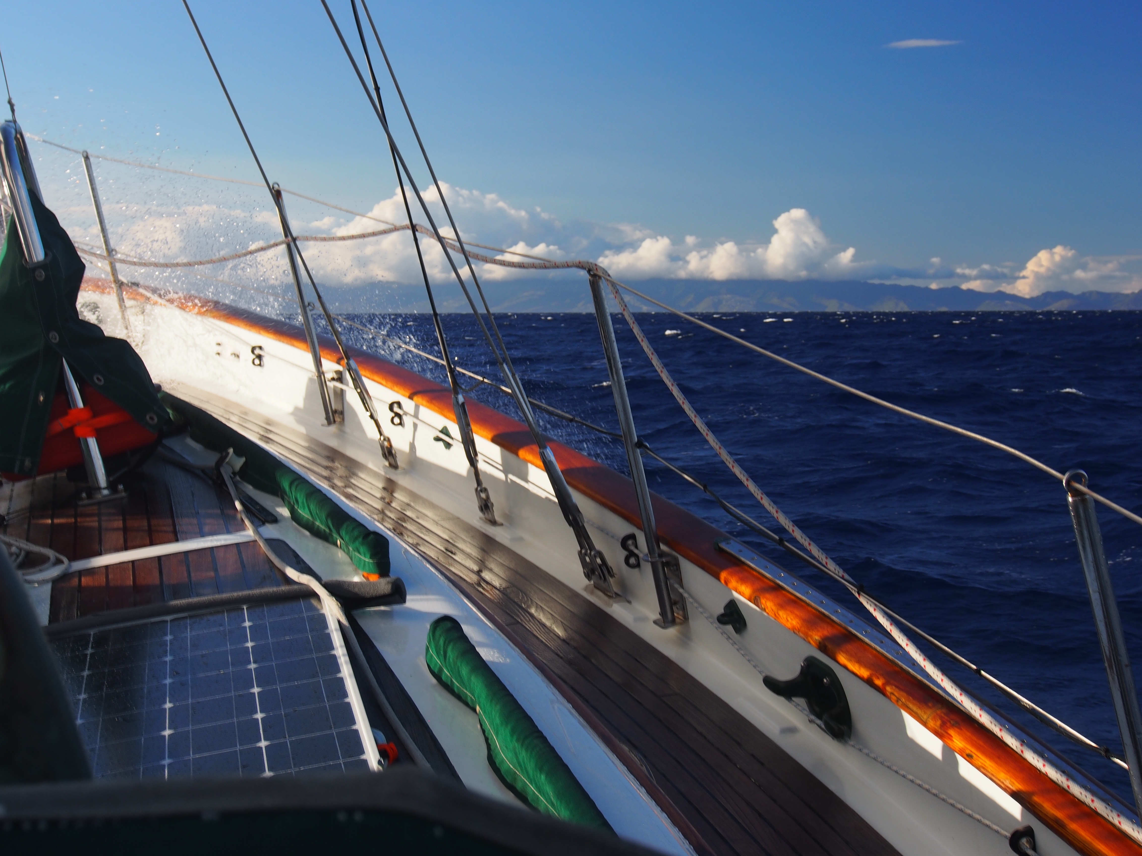
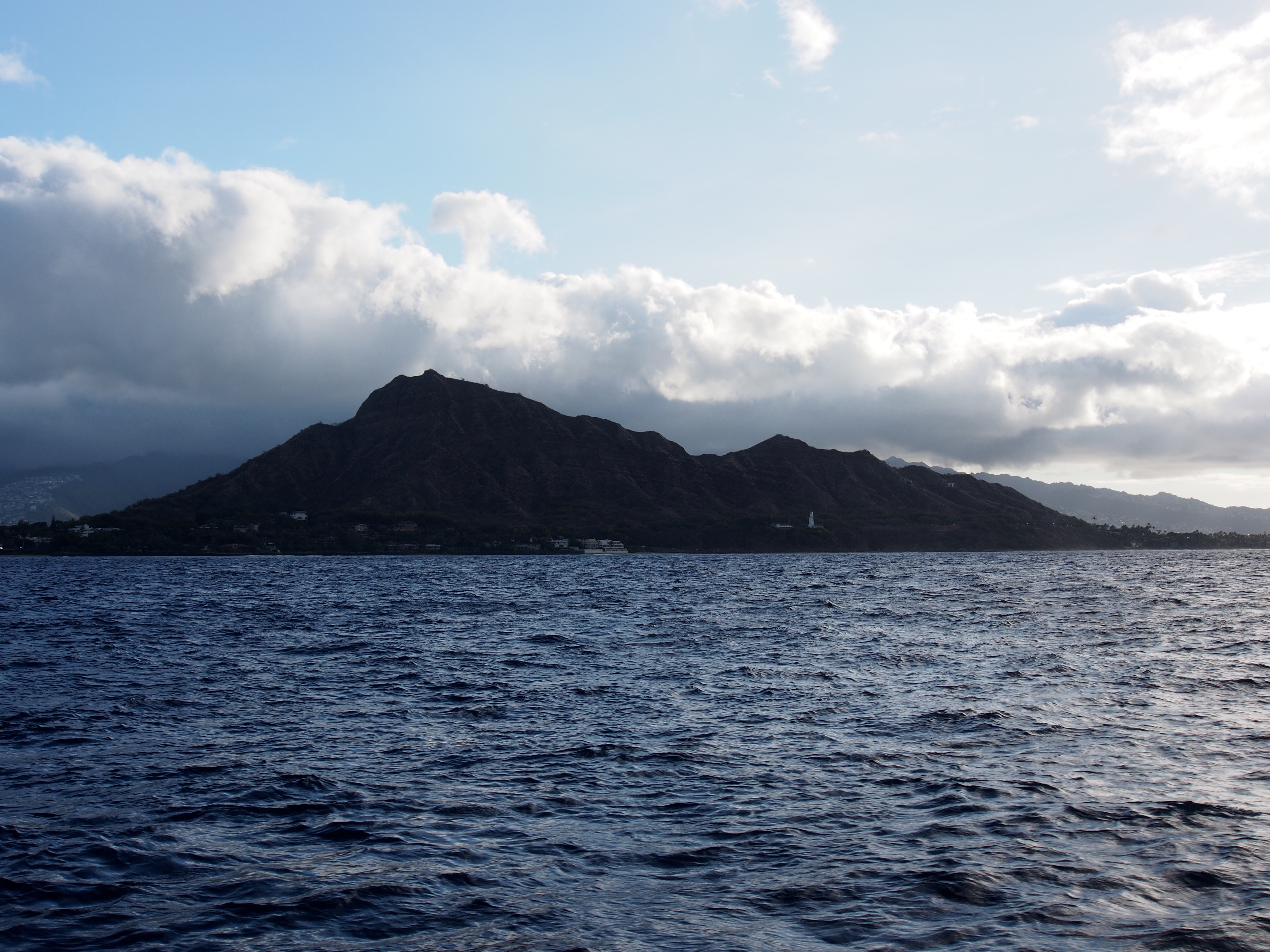
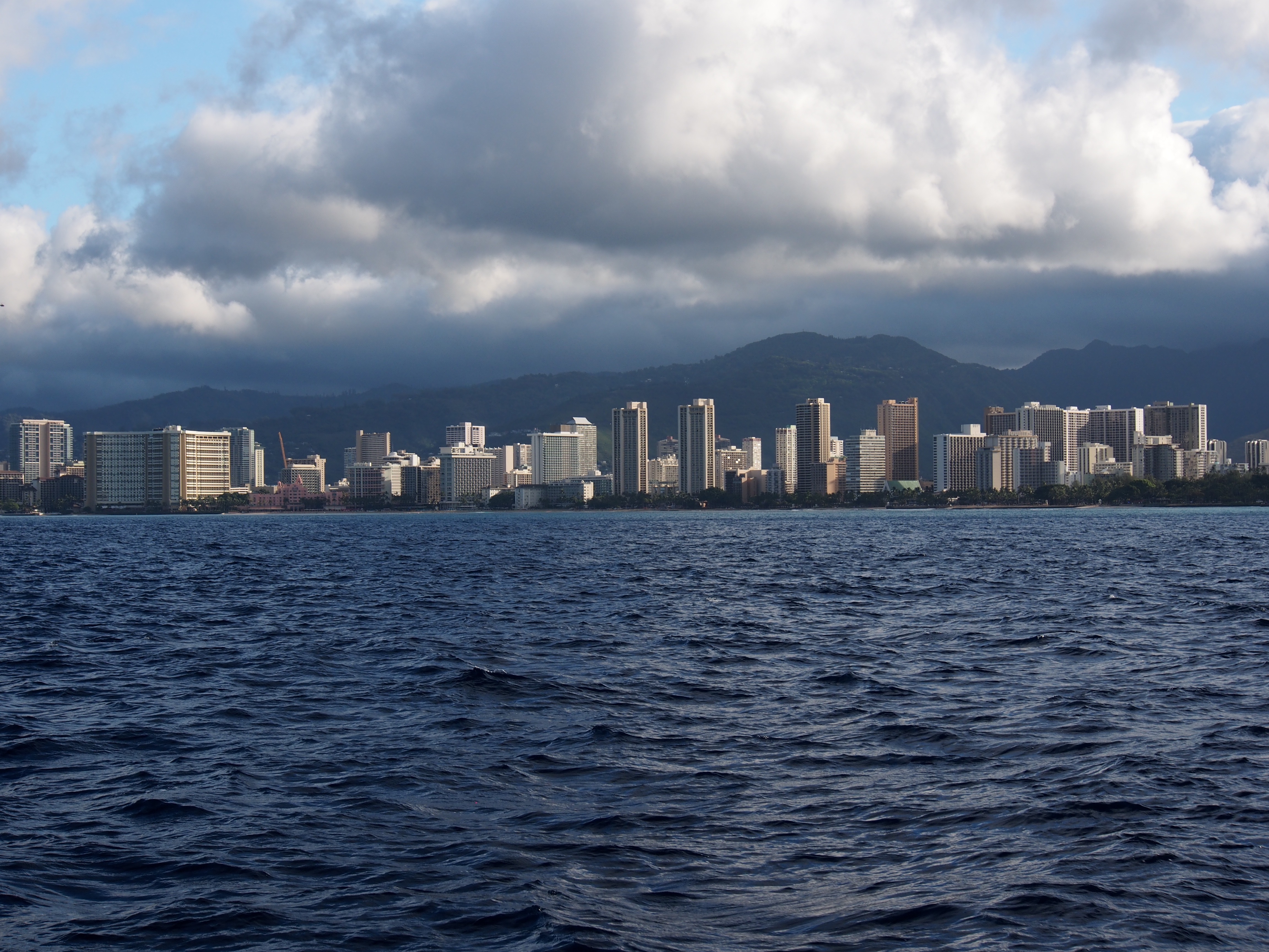
In the final day and a half, we saw both extremes of wind. Once we got in the lee of the big island of Hawaii with its tall volcanoes, there was no wind at all and we motored for about 12 hours. I never realized how big the island was until we had to motor along it. From tip to tip, it stretches about 80 miles, the same distance from Seattle to the Canadian border! At the closest, we were just 40 miles off the south-west coast, yet we never once spotted it due to the haze. We finally broke out of the wind shadow as we got closer to Maui, which was the first land we spotted. From there to Oahu, we had plenty of wind and had to reduce sail to keep the boat from heeling so much. We pulled in a small bluefin tuna as the hotels of Honolulu and Waikiki got closer. Right after that a group of about 20 dolphins swam beside us, giving us a fantastic show. Some were obviously showing off as they lept completely out of the water. Our arrival after dark forced us to hove-to (with stays’l and main) until dawn, since we would be tying Tahitian-style to a dock and mooring buoy at the Ala Wai marina. When I got up at 5am, I pulled out the genoa and sailed east past Waikiki and Diamond Head for some photos.
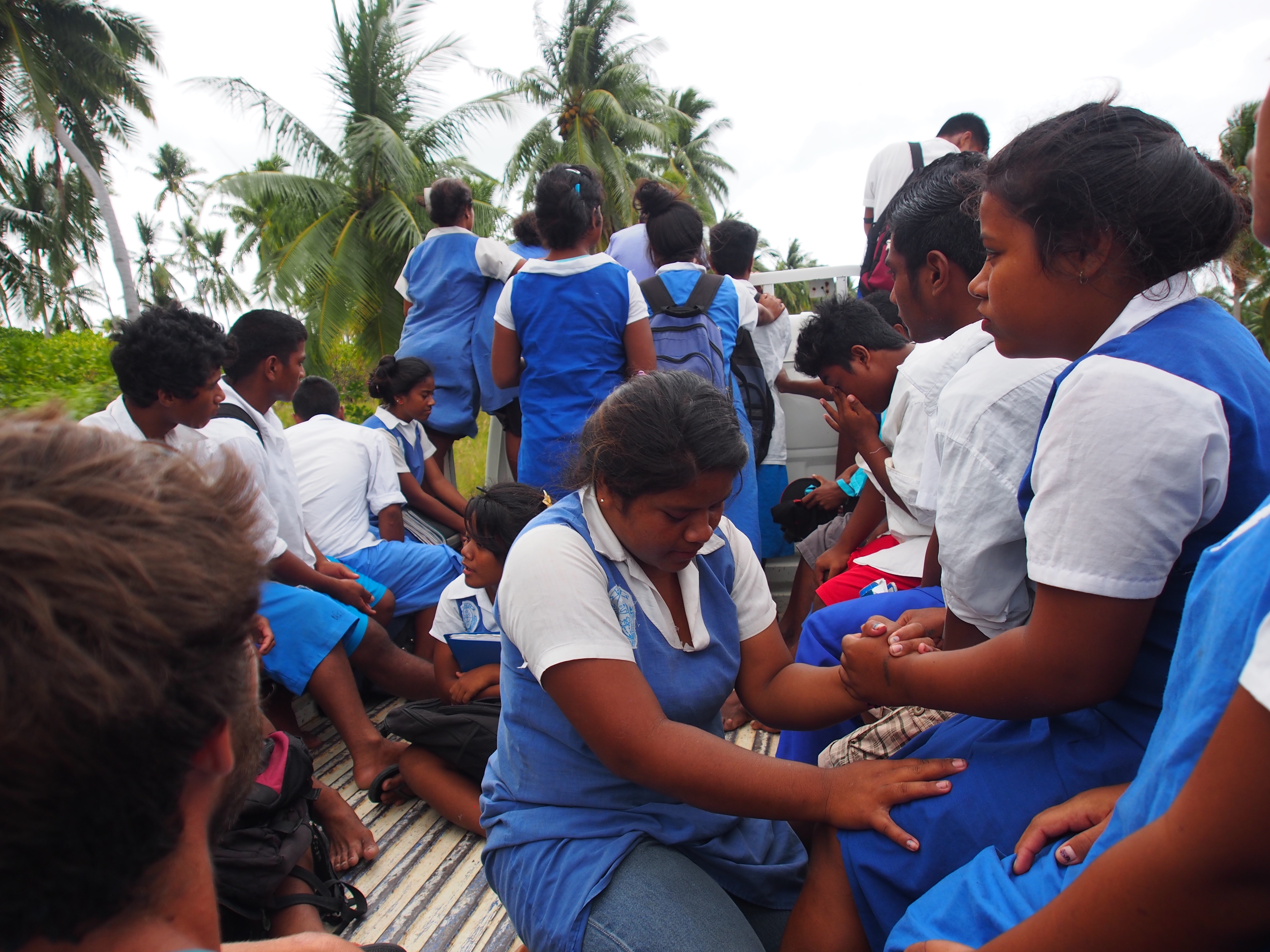
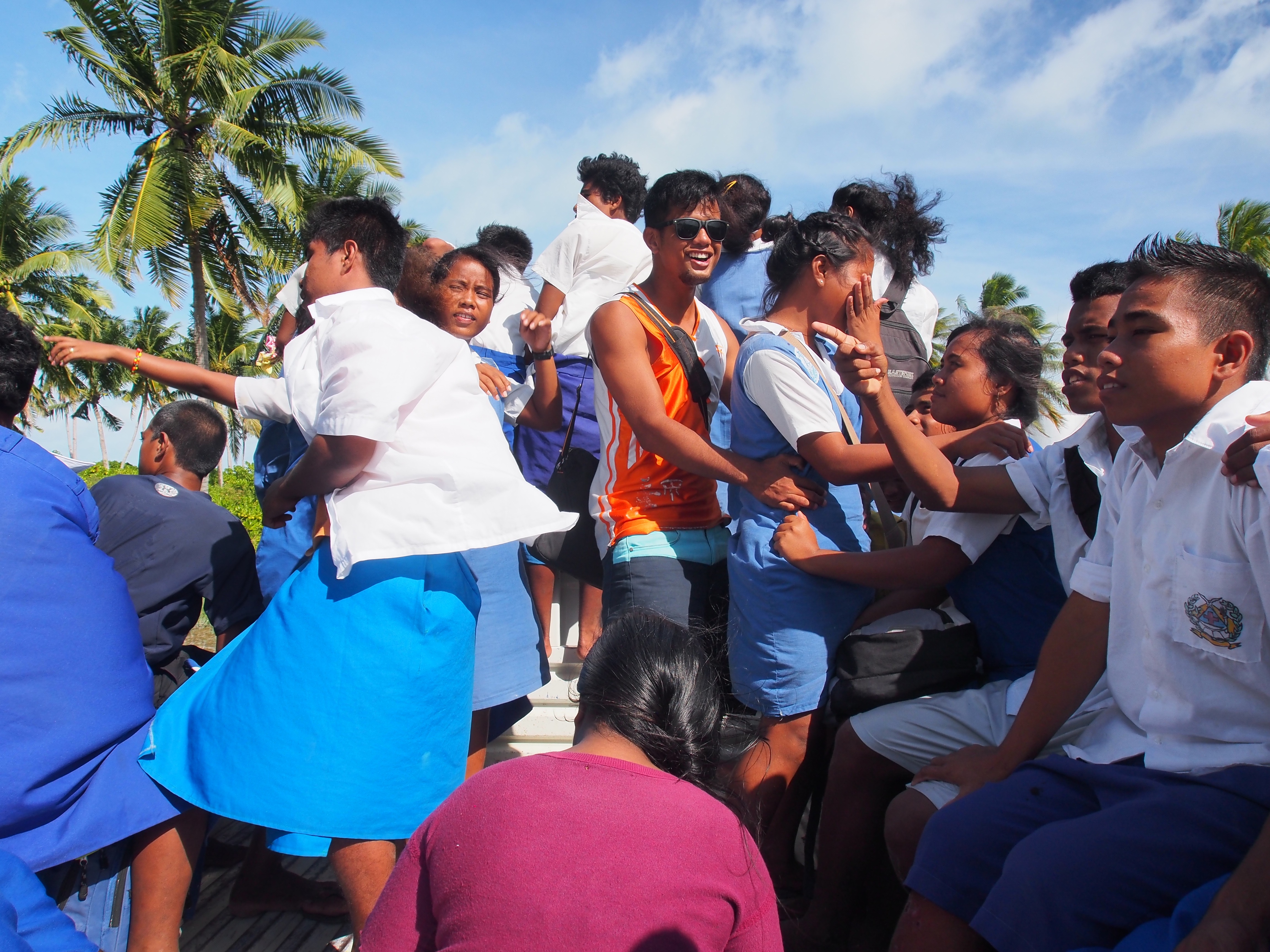
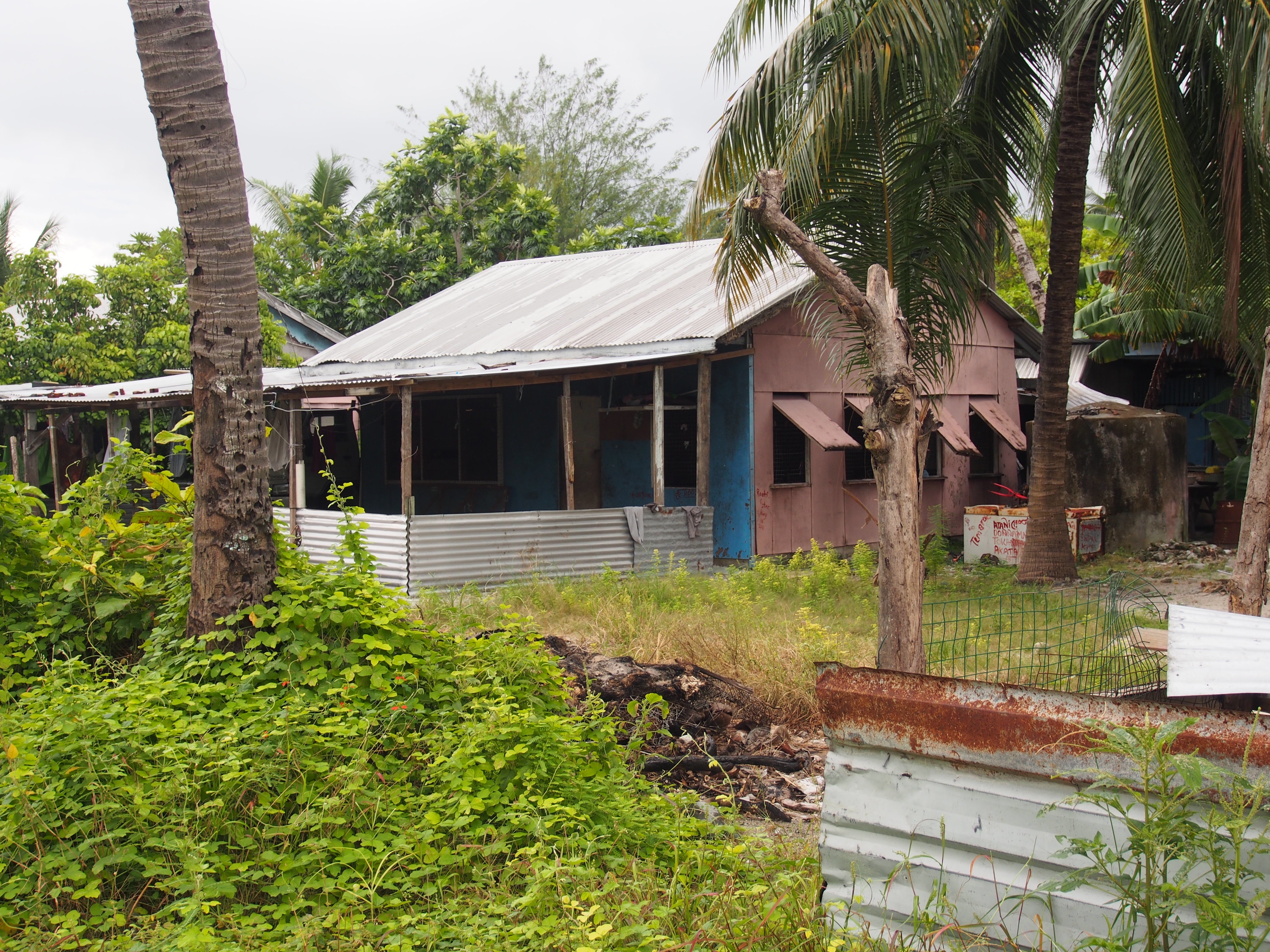
We spent 10 days of Christmas Island (Kiritimati Island) while waiting for new crew to fly in. We arrived on a Monday and flights only come in once a week on Wednesdays, but we had to wait for the following week for the crew exchange (Doug and Adam flew out the same day Andi and Justin flew in). London is the main village on the island and consists of a few small grocery stores (with very limited food), 2 gas stations, a bank, a school, and not much more. At 2 degrees north of the equator, it was very hot and mostly dry. Here are some pictures taken during our stay:
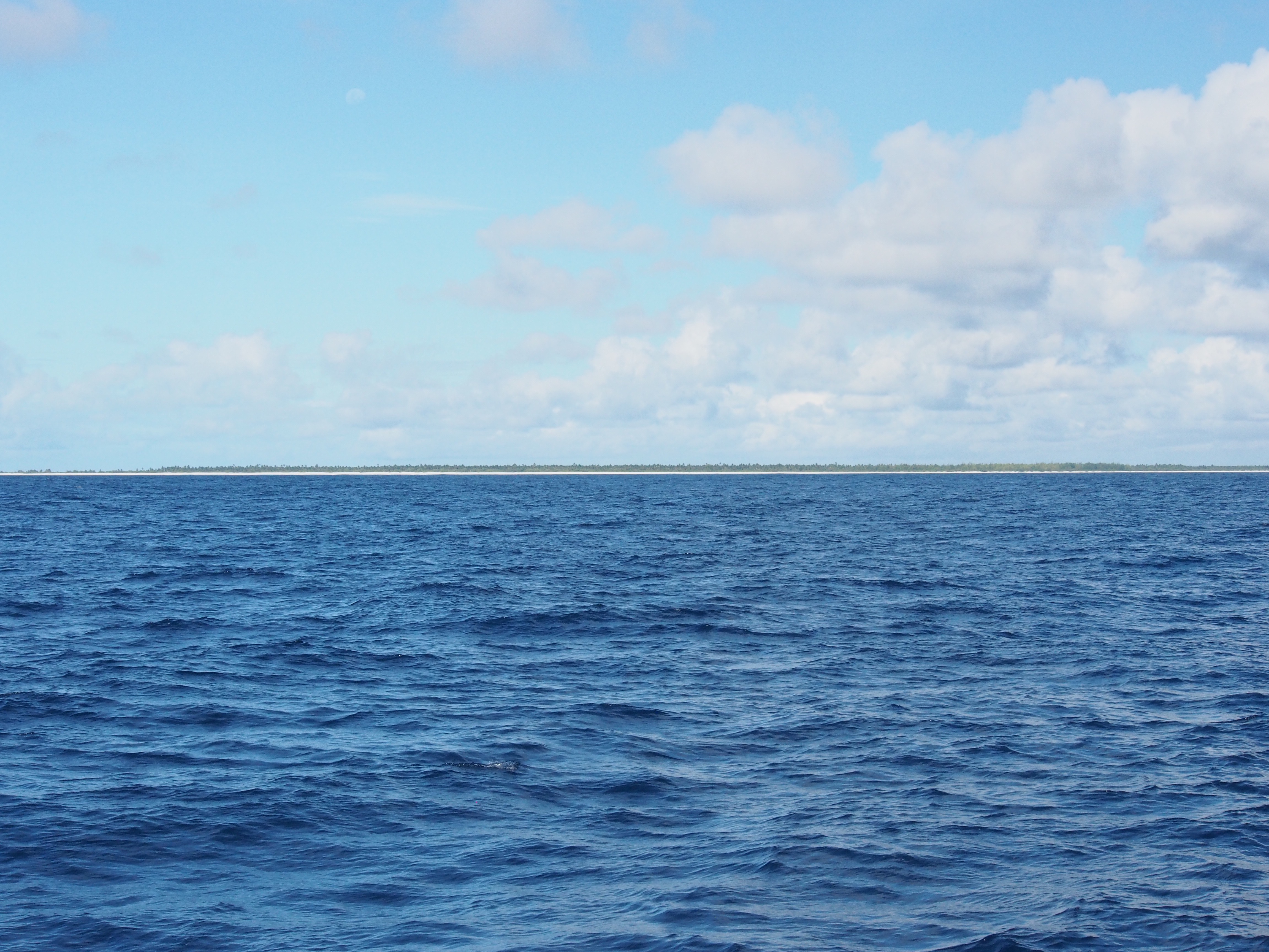
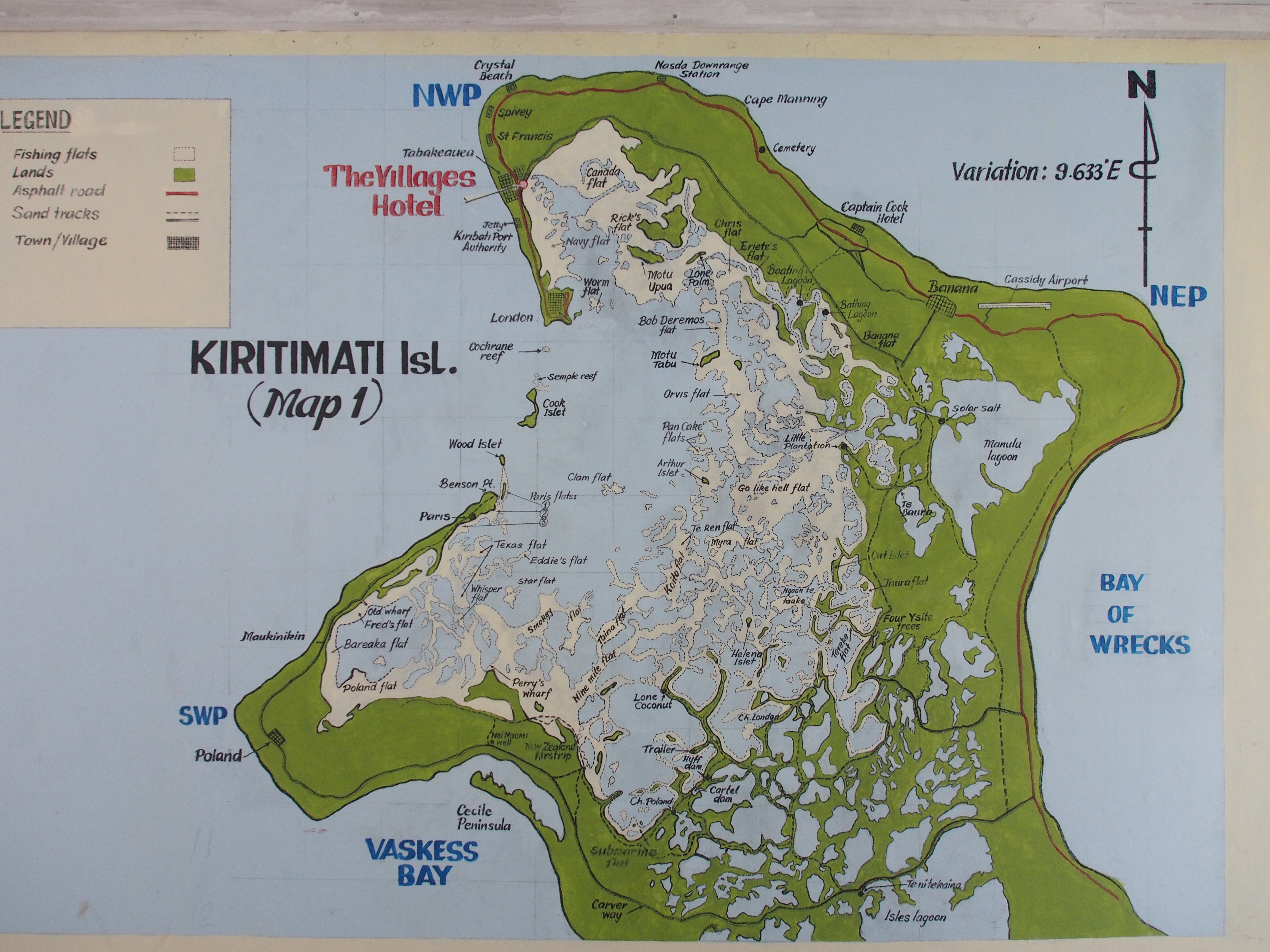
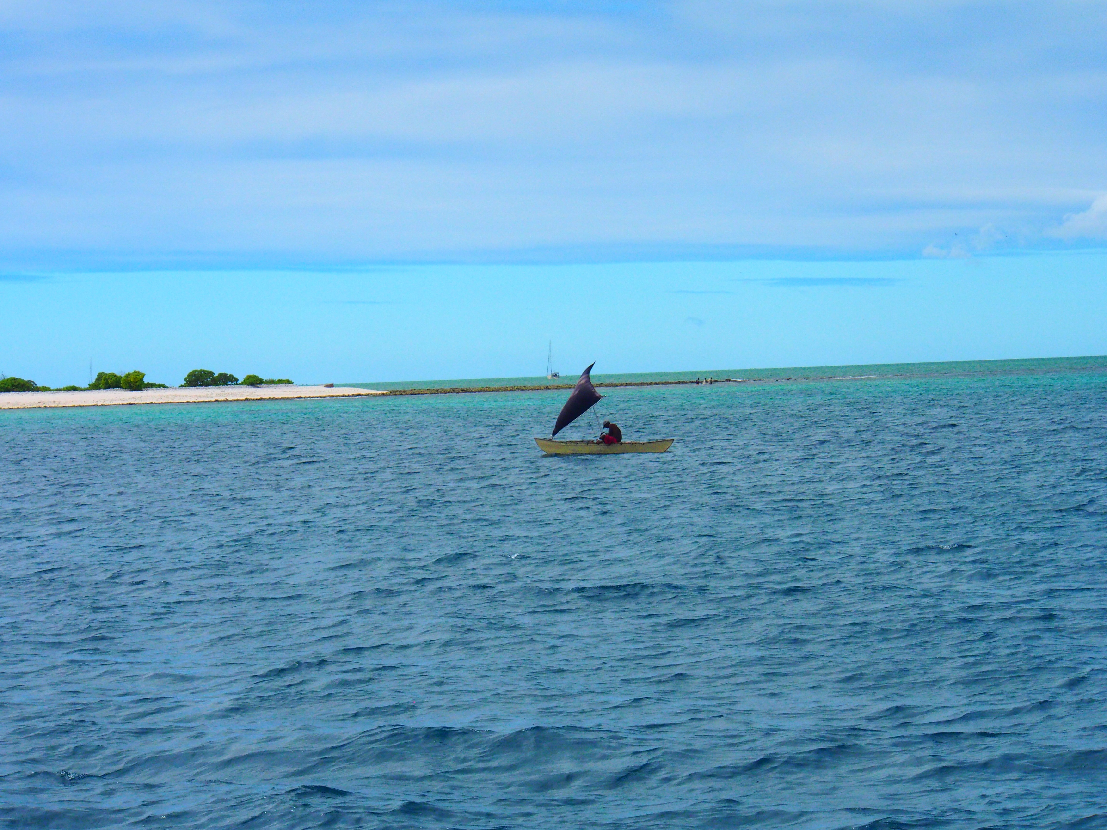
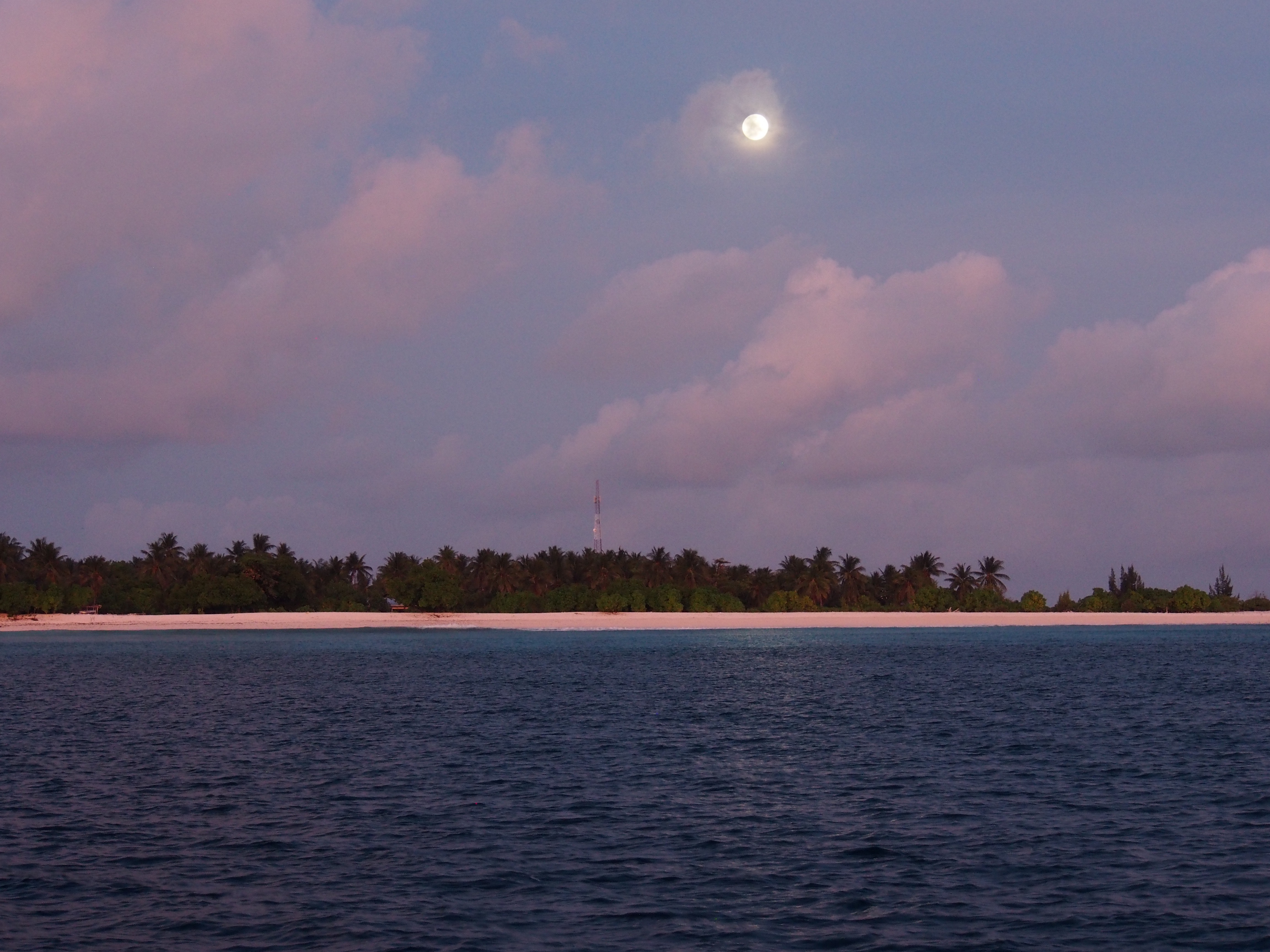
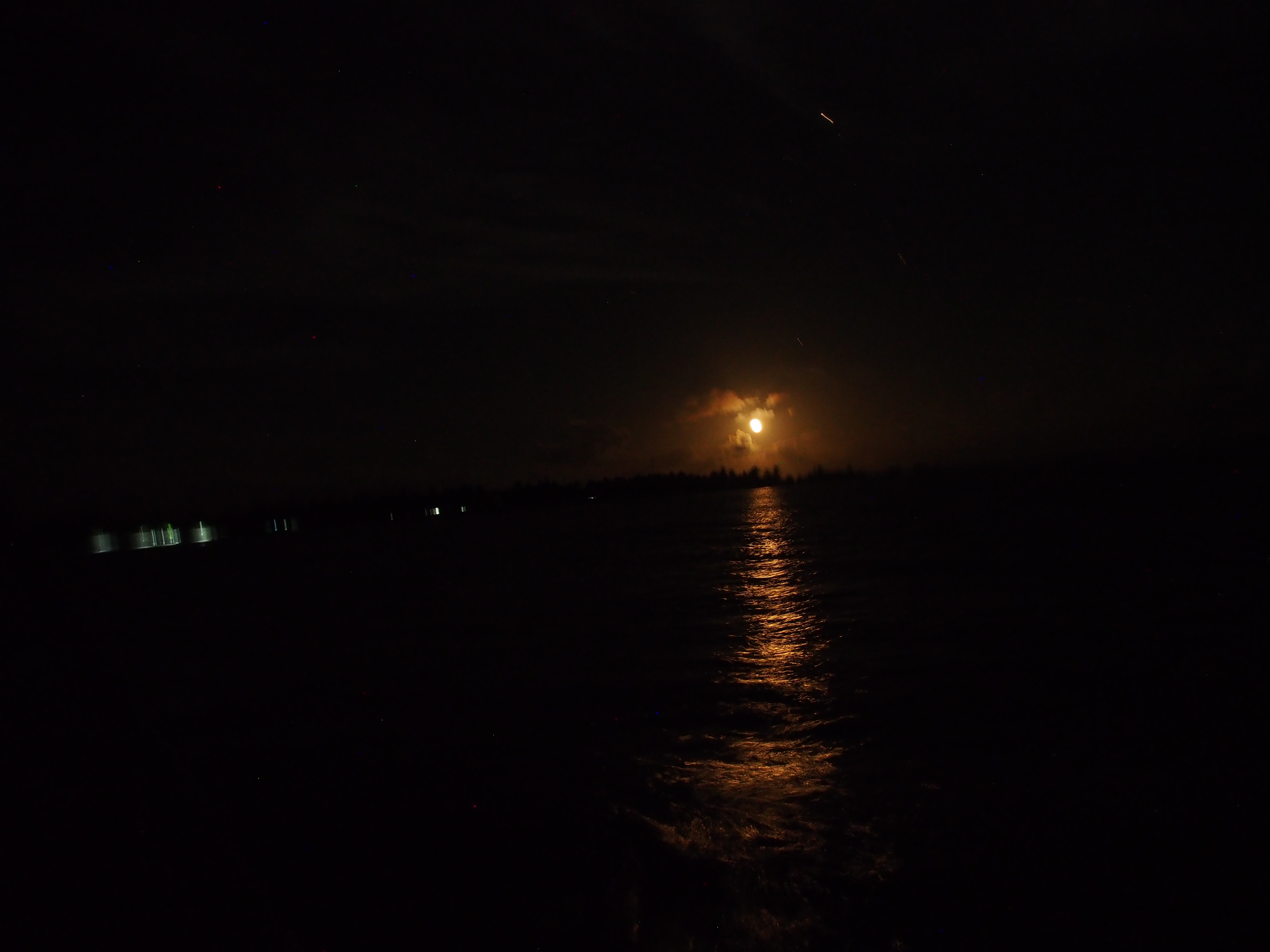
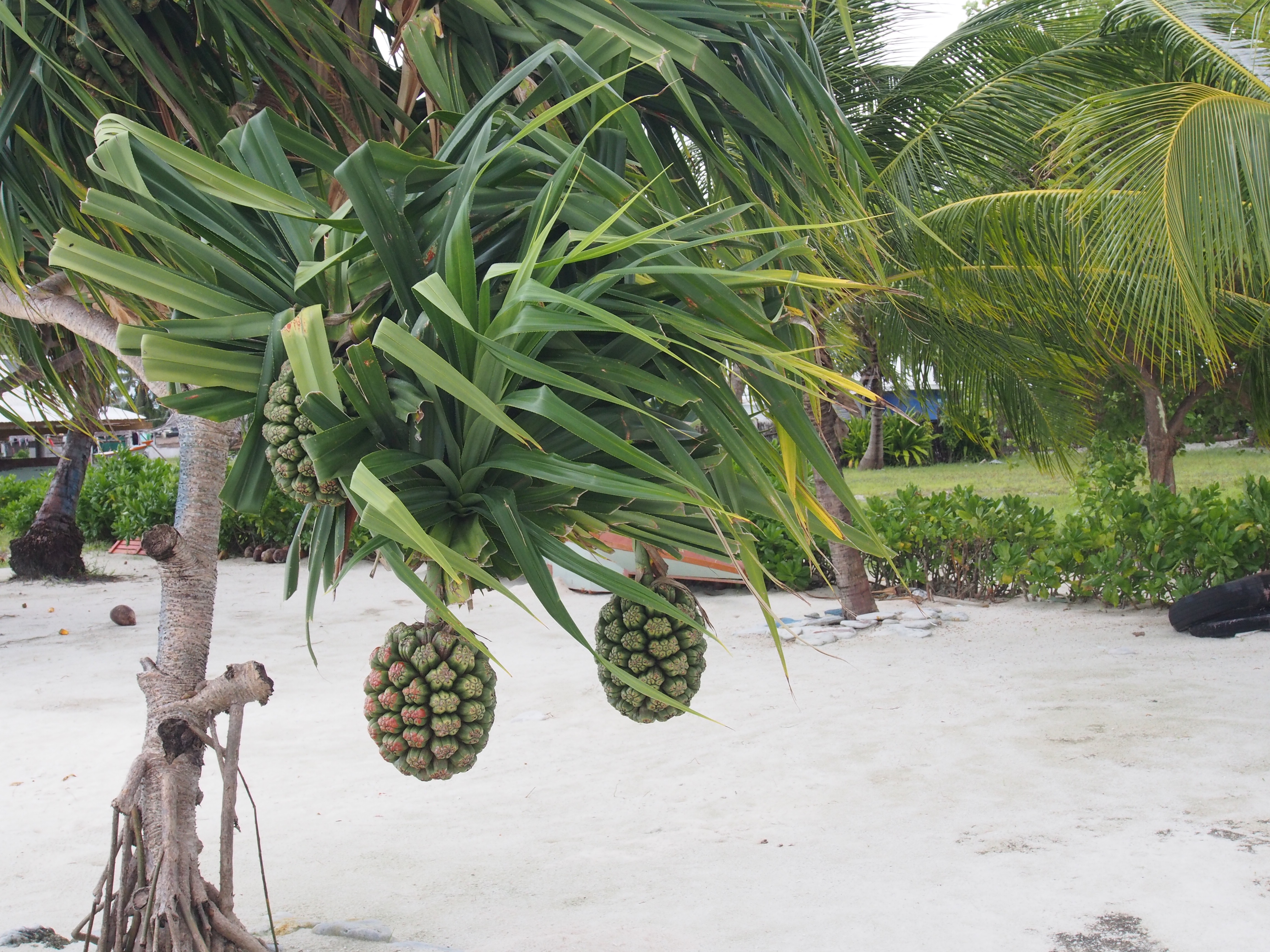
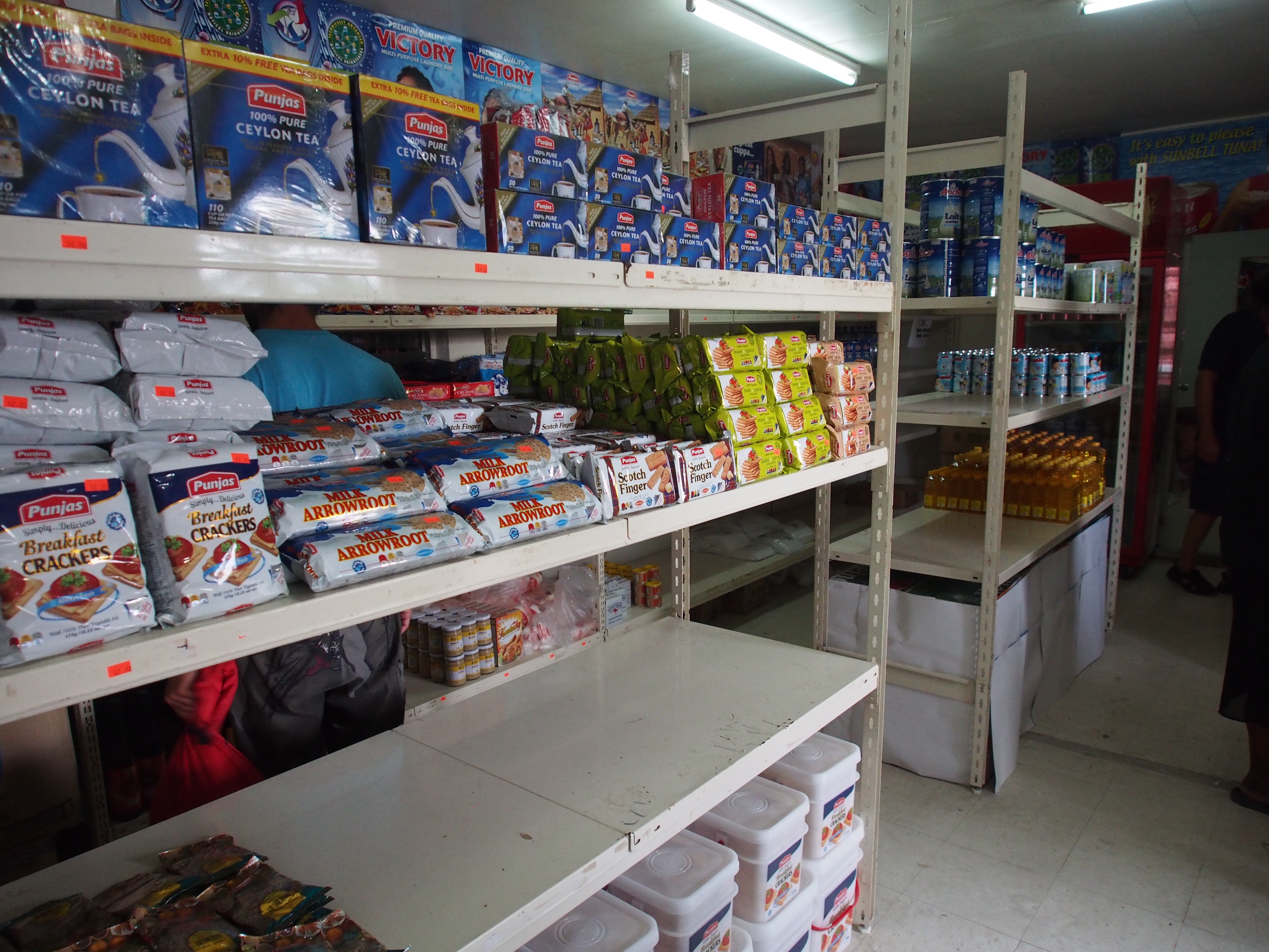
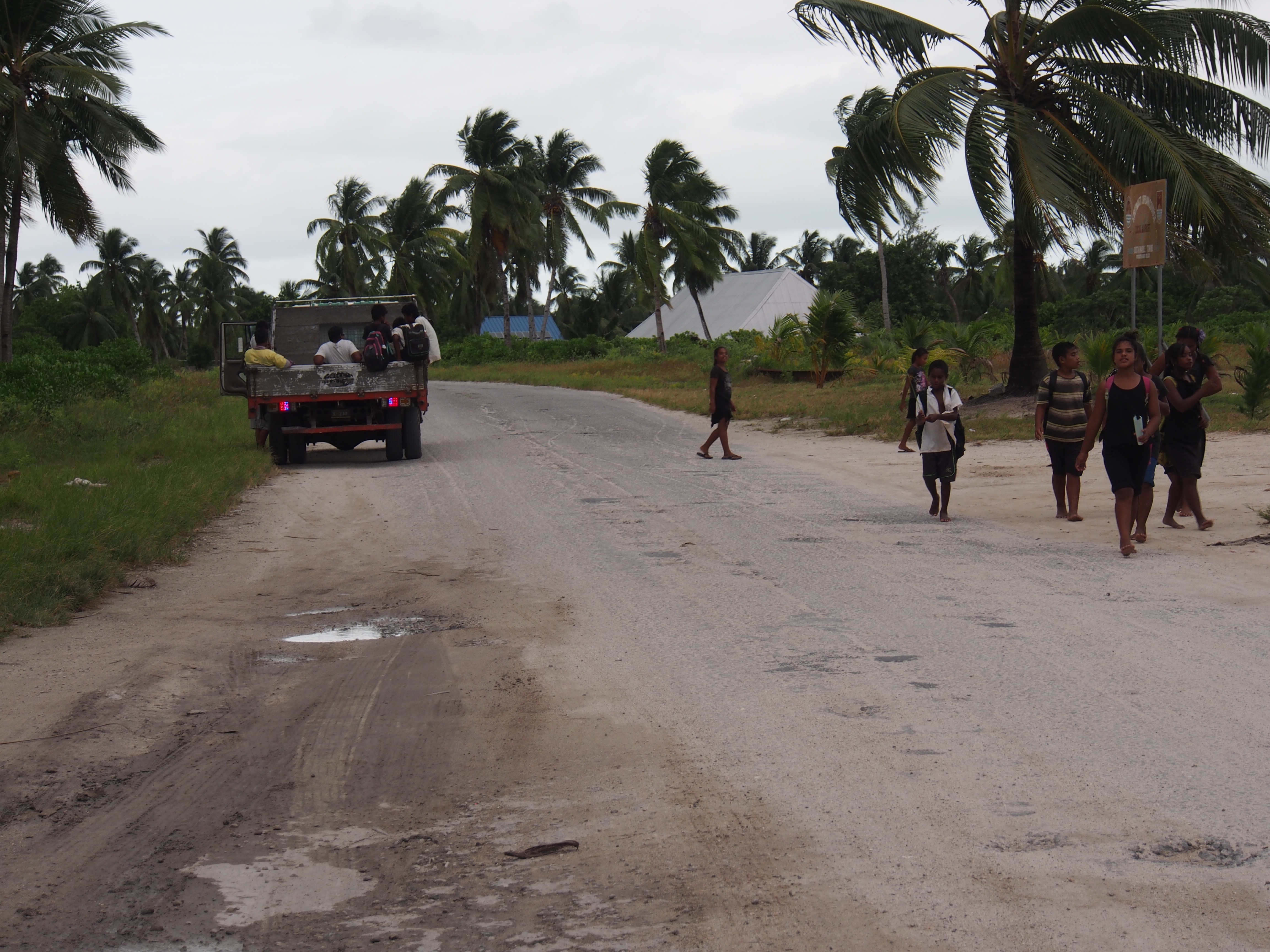
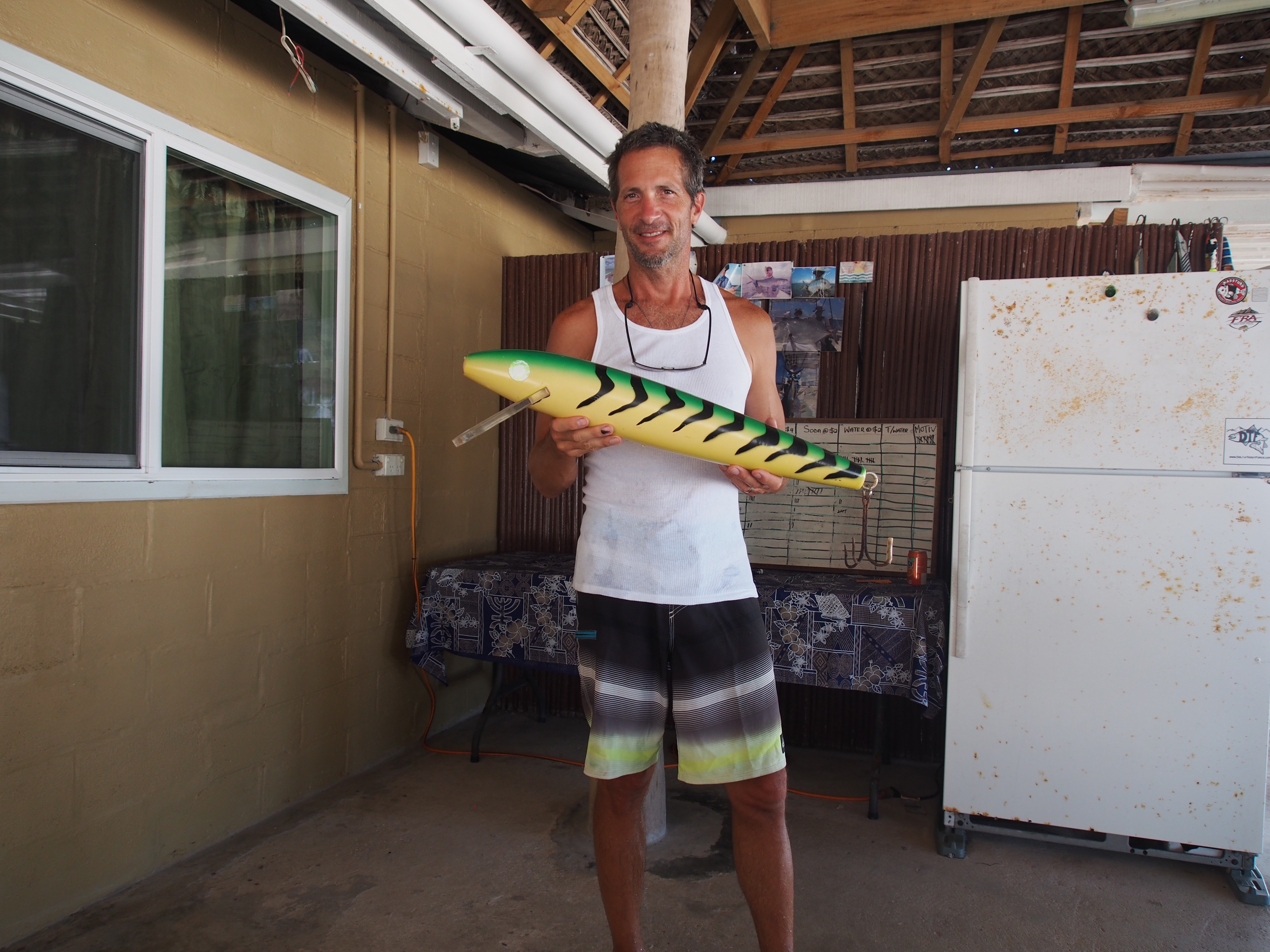
Spotting Christmas Island atoll from a few miles outKiritimati Island (Christmas Island) mapLocal fisherman in a sailing dinghy near our anchorageMoonrise at anchorageMoonrise at anchorage (a week later)Taken in London (village on Christmas Island)Local plant (not sure what it is)Typical store in London villageKids walking home from schoolWe hitched rides from trucks carrying students from schoolAnother “school bus” ride to get back to London villageTypical house on Christmas IslandCelebrating our 2 week passage to Kiritimati IslandThis lure is as big as the fish we catch!
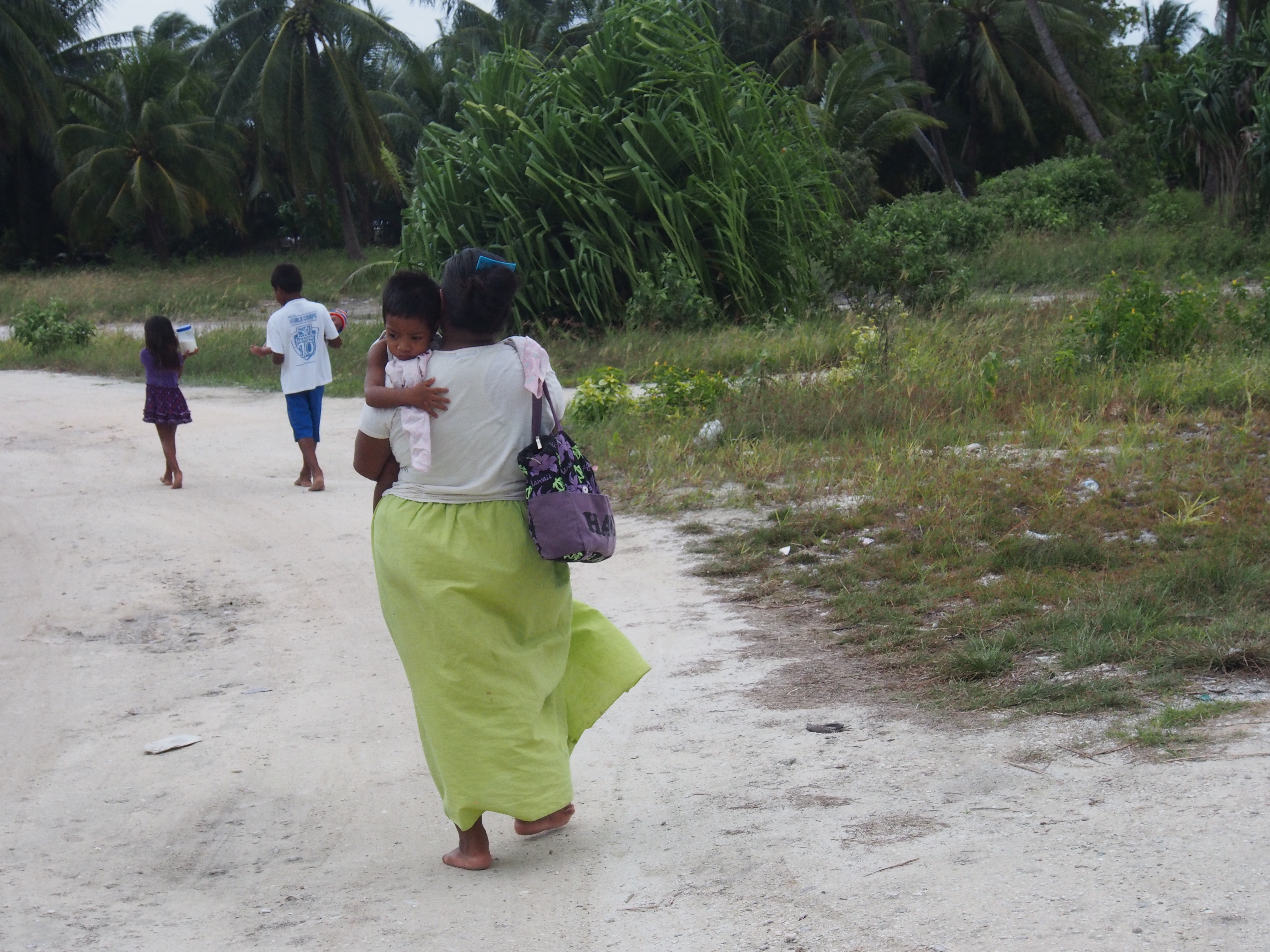
Kiritimati (‘ti’ is pronounced as an ‘s’ so it sounds like Christmas) is one of the largest atolls in the world and has a population of about 4000. It’s part of the Line Islands in the country of Kiribati. Fishing and very limited tourism, mostly from sports-fishermen, are the main sources of income. We anchored in 35′ of water just off the village of London, on the north-west side of Kiritimati. The entrance to the lagoon is too shallow for Apropos to safely transit, but the anchorage has been calm for the past 7 days. A nice breeze and frequent dips in the water helps with the intense heat at 2 degrees north of the equator. A 15 minute dinghy ride takes us to a central location in London that’s within walking distance to a few small stores, a bank with an ATM, a gas station with diesel, and the customs & immigration offices. The stores have limited groceries such as rice, canned goods (vegetables, soup, spam), limited snacks, beer, soda, and produce such as potatoes, oranges, apples, onions, and garlic. We hitchhiked most of the time to get to where we were going. Several times we jumped in the back of a big flatbed truck that was transporting kids home from school. The kids seemed amused at 3 white men hanging on for the bumpy ride along the partially paved roads. There are no restaurants in London, but a hotel about 4 miles north has a limited menu with cheap and tasty fish and chicken dishes. We hitchhiked there several times.
We made 6 trips over the course of 3 days to the gas station to re-fuel the boat (65 gallons). An option was to have a 200 liter barrel delivered to the commercial pier, but organizing the barrel delivery, transferring it to jerry cans, lowering it down 40 feet into the dinghy, then ferrying it to the boat seemed like too much trouble. Both tanks are now full with an additional 10 gallons in jerry cans, so that should be more than enough to get us through the windless days between here and Hawaii.
I found most of the adults on the island to be polite but not overly-friendly like they were in Samoa, Tonga, and Fiji. Only a few sailboats stop here each year so they are probably not accustomed to yachties. Most are very limited with English, so communicating is difficult. We radioed customs the morning after our arrival and were told to stand by for boarding instructions, then they didn’t respond until the following day. I was then instructed to pick up 7 officials in my dinghy and transport them back to the boat. In the end, only 3 officials returned with me to the boat, and nobody even went below deck to inspect before clearing us in! I think some decided not to come because of the long dinghy ride in the rain! The only other boat here has been anchored for 3 months and is in trouble for bringing pot into Kiritimati (the Portugeese owners are in Hawaii preparing for their legal case).
Getting anything done here has been difficult. I wanted to top off the propane tank and after asking several people, we were told that the KOIL (Kiribati Oil Co) could do it. We ferried the propane tank in the dinghy to shore, then tried to hitch a ride since it was a couple of miles away and the tank was heavy. A motorcycle offered to take me and the tank, so I hopped on the back and held on for dear life. When we got there, it was 1pm and they were closed for lunch until 1:30. By then, Doug and Adam arrived and soon the workers returned. Actually, they were there all the time but closed the door to the office. When they opened, there were 10 people sitting on the floor playing something that looked like bingo but there seemed to be betting involved. They didn’t move when they saw me and had me wait until the end of the round, then told me they only exchange tanks, no refills! I then decided we would have enough propane to get to Hawaii since we have a reserve tank that lasts a few weeks.
Doug and Adam checked into the only hotel in London for their final night since their flight leaves early in the morning, and the airport is on the north side of the atoll. The hotel hosts mostly fishermen and transports them to the airport on Wednesdays, the only day flights arrive and depart from Kiritimati. We found out they have a big farewell dinner and party for the fishermen on Tuesday nights, so I joined Doug and Adam at the hotel. We enjoyed a leisurely day at the hotel/beach overlooking Captain Cook’s Island. The sports-fishermen arrived in the late afternoon with stories of their catch of Wahoo, Grouper, Tuna, Bonefish, Travalli, etc. The dinner was quite the feast–salad, potatoes, fresh Wahoo, lobster, ceviche, and dessert. Entertainment included a girl dancing and a group of about 20 men and women singing. They placed a flowered headband on everyone’s head prior to the meal as a way of welcoming us to their feast. Afterwards I said goodbye to my Samoa to Kiritimati crew and dinghy’d back to the boat in the dark. Getting the engine and dinghy on deck is normally a 2-person job, but I had prepared a 4:1 block & tackle to hoist the engine, and a halyard to raise the dinghy, so all went well.
Tomorrow my new crew flies in from Hawaii and lands at 3:15pm. They’ll be on the same airplane that my old crew takes to Hawaii, so maybe they will see each other at the airport.
Only 1 flight per week comes to Kiritimati (Andi and Justin were on this flight)
Wahoo catch on passage to Christmas IslandBlue Fin TunaFresh SashimiFresh SushiAdam cooked up another fabulous meal of seared tunaHalyard swing in doldrumsHalyard swing in doldrumsAdam giving it a tryDoug relaxingAdam at helmOur only source of wind direction (the mount broke from masthead so we lashed it atop the dodger)Broken windex lashed to dodgerThis is what the chartplotter track looks like when you get hit with 2 squalls within 15 minutes at night!Making good use of cup-holders!
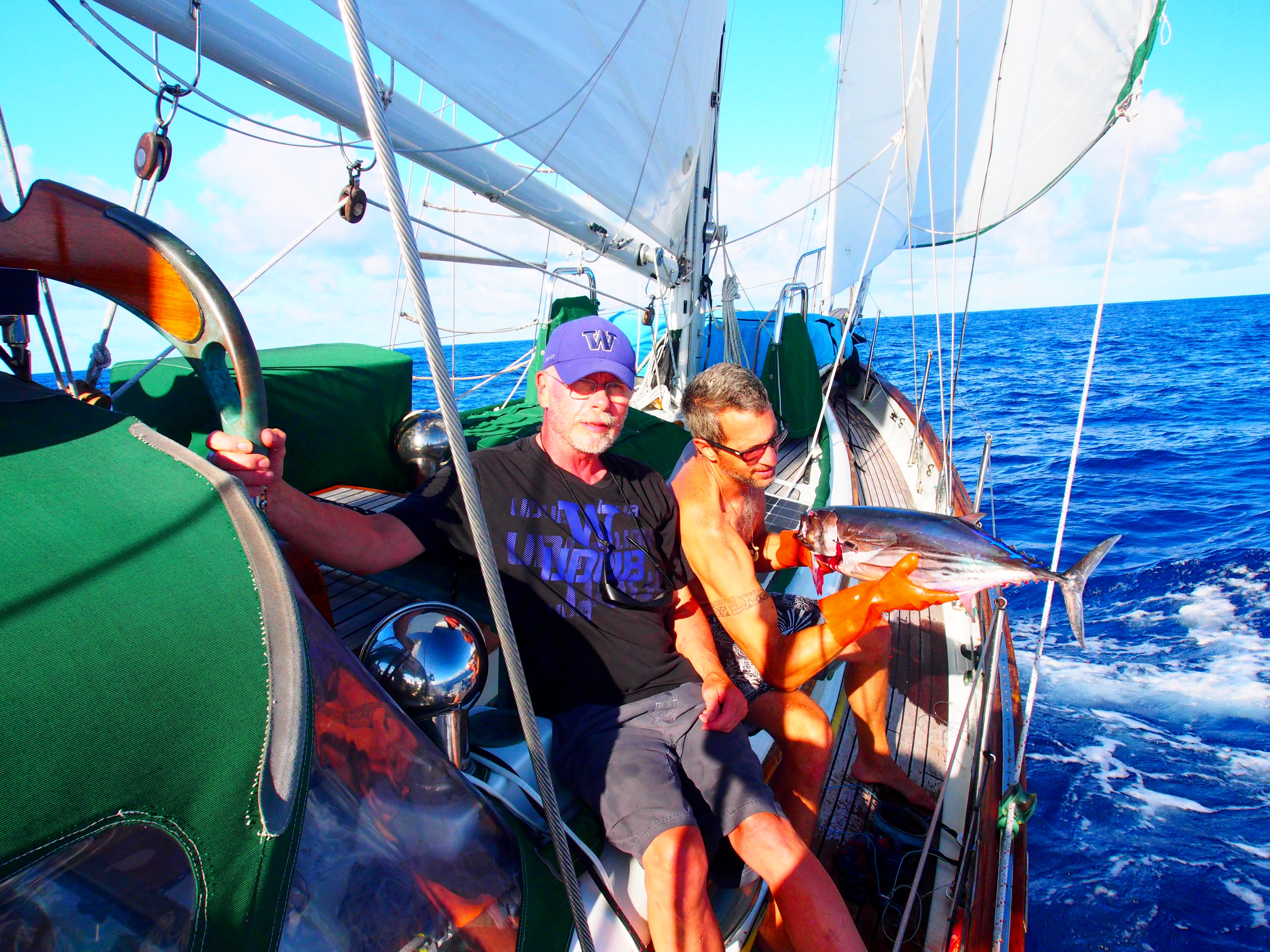
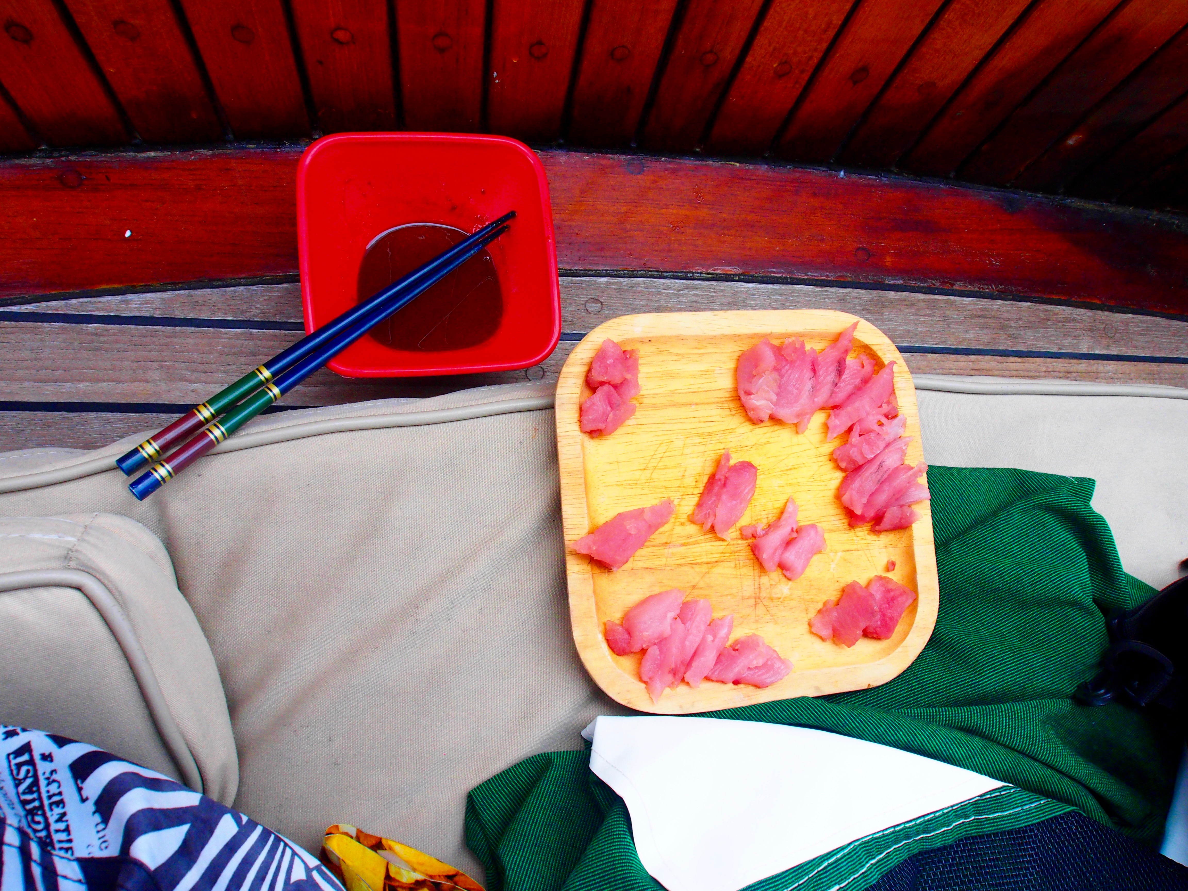
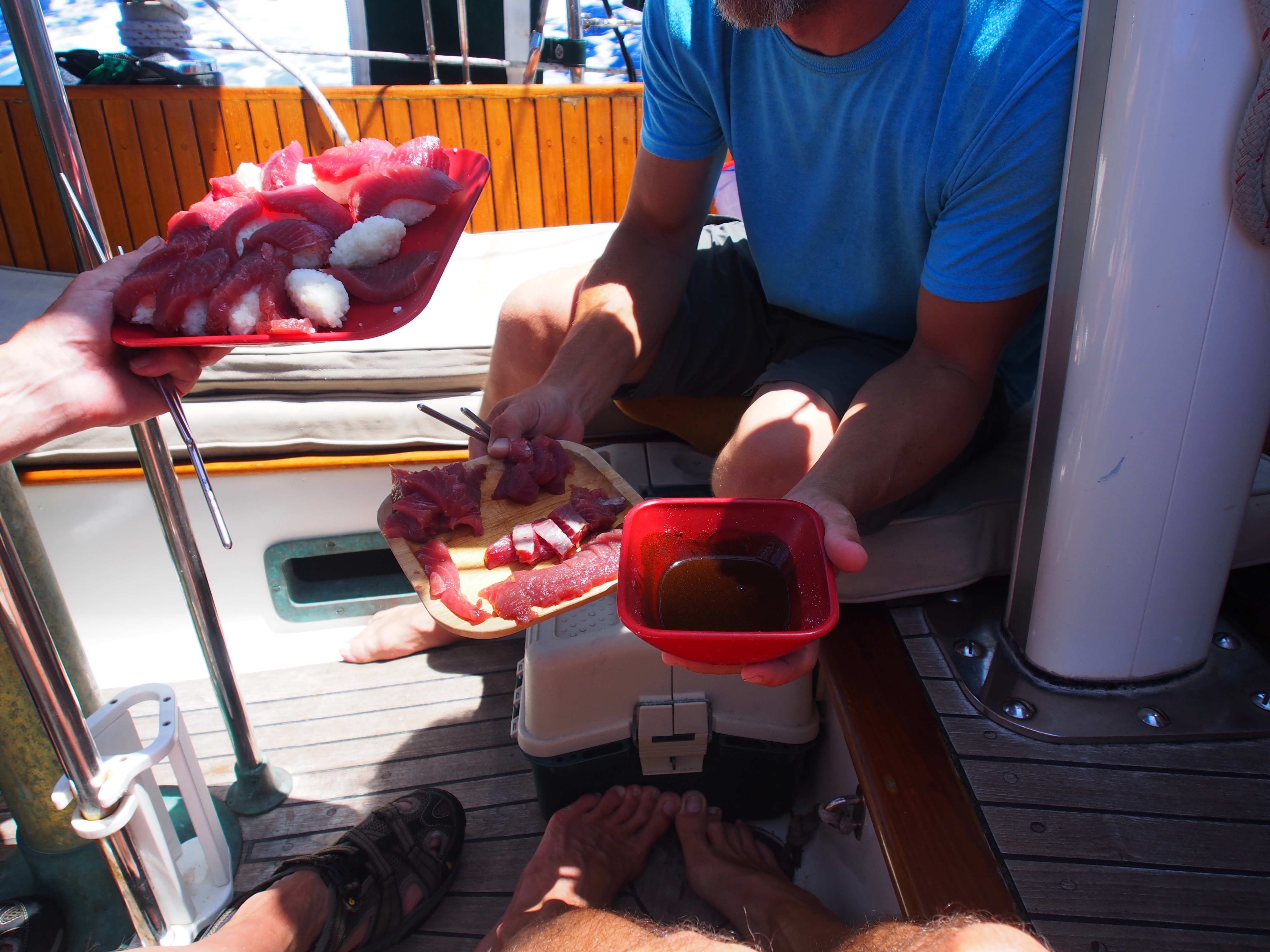
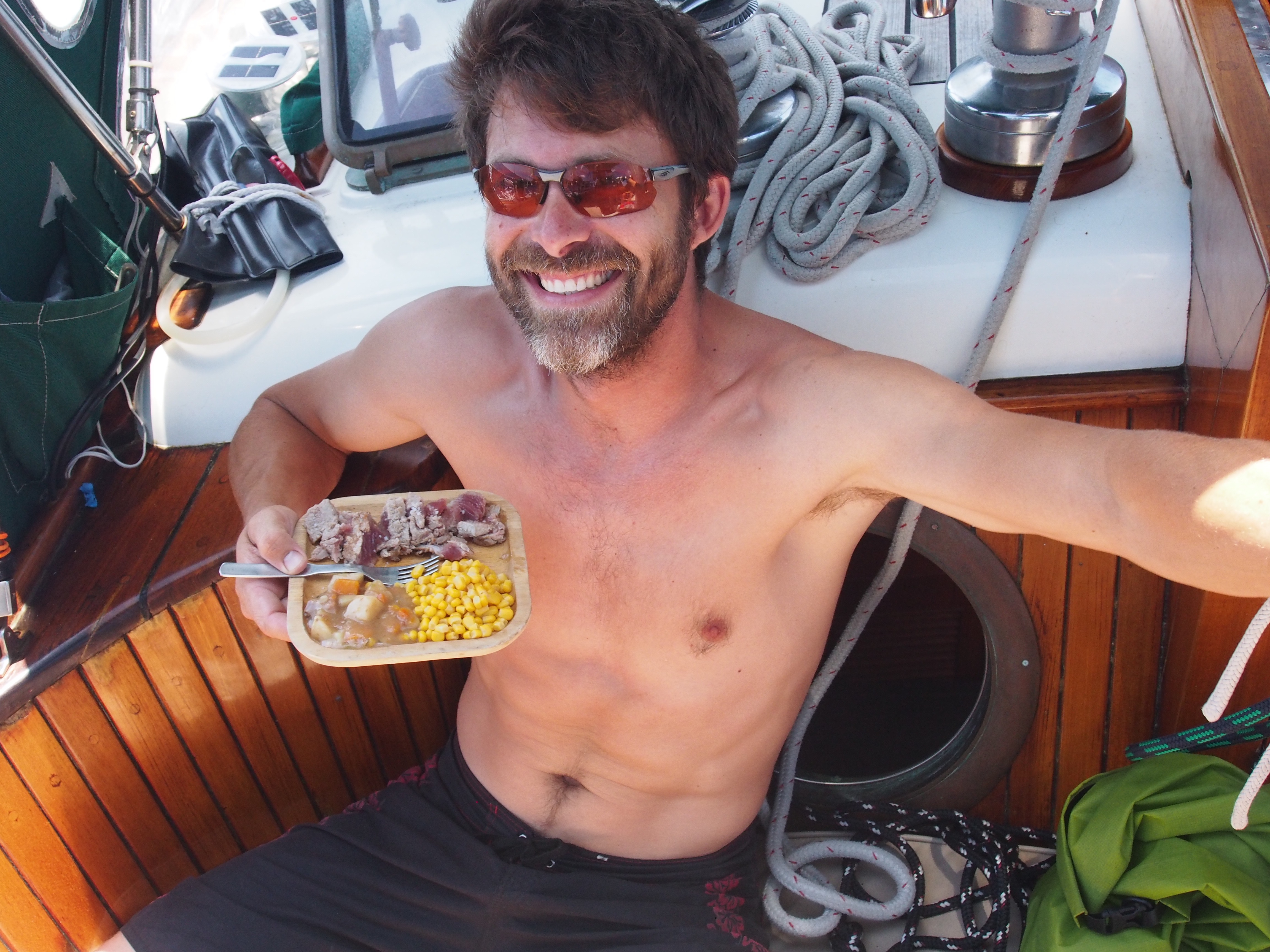
We arrived in Kiritimati (Christmas Island), Kiribati after 14 days and 5 hours. We found some nice NE trade winds over the past 3 days, sailing about 400nm on a due-north course. We pulled into the anchorage with about half of the fuel we left Samoa with. Sailing to motoring ratio was roughly 5:1, not bad for a difficult upwind passage. Yesterday we pulled in another large Blue Fin Tuna and today we finished up the other Blue Fin we caught a few days ago. For a change from sashimi, Adam lightly seared the tuna and served it with sea salt, a can of Irish Stew, and corn. We’ll be back on fresh sashimi tomorrow!
Equator Crossing
Having 2 pollywogs aboard, I had some fun creating an equator crossing ceremony. It started with a little hazing and ended with a champagne toast to Neptune. About 2 miles south of the equator, I had the pollywogs strip down and don womens clothes! Next they had to look up at the half moon and howl for 30 seconds. Thirdly, they had to consume a half-cup concoction of sea water, oatmeal, mustard, crackers, and hot sauce. They were good sports with it all and by the time that was done, we were about 5 minutes from the equator, so I popped a bottle of champagne, filled our glasses, then we all poured out half to the sea on the south side of the equator for King Neptune, and drank the other half on the north side of the equator. Doug and Adam are now and forever more Shellbacks. Pictures will be added when I find internet access!!
Landfall
We spotted the low-lying atoll of Kiritimati about 5 miles out, as coconut trees and radio towers are the tallest things on the island. We anchored in the late afternoon just off London, the small town on the west side. We’re flying the Q-flag and will have to wait until morning to contact customs, immigration, and bio-security officials. There is no dock here, so I will have to take the dinghy in to pick them up and bring them to the boat for the required inspection and clearance. Tonight we’re using the last of the vegetables, limes, sausages, etc since they would be confiscated tomorrow. The anchorage is calm and we’re all relaxing in the cockpit listening to music and enjoying the cool breeze. Also looking forward to a full night’s sleep tonight!
Today begins day 14 since departing from Samoa. We are less than 180nm from Kiritimati and close-hauled pointing direct. Boat speed has been a fast 6 knots for past 48 hours with Ian doing all of the steering. Apropos is well balanced with a partially furled genoa, full staysail, full main, and full mizzen. We are heeled 15 degrees and bounce around a lot but mostly glide over the swell and plow through the chop. Two days ago we pulled in a nice Blue Fin Tuna on the hand line, making it the 3rd catch on this passage. Adam worked his galley magic making his version of sticky rice for sushi and selecting the best cuts for sashimi. We will eat the same again today. Last night was a perfect night at sea. During Captains Hour we played music in the cockpit and as darkness approached, saw the outlines of dolphins swimming alongside the boat in our bow wave. We are closing in on the equator at about 1deg S. Ursa Major is getting higher in the sky but still can’t quite see Polaris, which is down 5x the distance from Ursa Majors pointers. Hoping to see the North Star and the Southern Cross at the same time once we get north of the equator. When the Southern Cross is sitting in the sky vertical, it points due south. Speaking of the equator, I have 2 polliwogs aboard and need to think of a good ceremony for the equator crossing, which will happen tonight around 7pm!
We got in 3 full days of sailing in a N-NE direction covering about 350nm. We used a combination of hand-steering and wind vane steering to maximize the distance-made-good since we were close-hauled all the way. When we approached 5 deg. S. latitude, we pointed due east and motor-sailed for 10 hours until the wind picked up and were able to sail. On this long of an upwind passage, fuel is a major concern. We carry 130 gallons of diesel and based on a conservative fuel burn-rate of 1 gal/hour, we have a range of about 650nm. The direct line distance between Samoa and Kiritimati (Christmas Island) is 1277nm and our meandering distance is more like 1400nm, so we clearly have to sail the majority of time. We have 68 gallons of fuel remaining and have a good northerly wind now so will keep sailing east for a few days. Our landlubber contact (Karen) tells us the wind will shift to an easterly in a few days, then our plan is to point north directly to Kiritimati. Will see how it plays out. Just before dark we brought in the fishing hand-lines and pulled in a small Yellow Fin Tuna. We filleted it on deck using a headlamp for light, then put it in the refrigerator. Today we had an awesome sashimi complete with soy sauce and wasabi. Nothing better than eating fresh fish during passages. Not all night watches are peaceful, star-gazing events. Last night I awoke for my 10pm-2am shift and it was pouring down rain. Doug was hand-steering and we were motor-sailing and he was drenched. I put up the canvas panel that connects the dodger to the bimini to shield most of the rain and things were much better. The wind picked up at midnight so I awoke Adam and we got the genoa sail out and shut down the motor and Ian (windvane) steered us throughout the night in stormy, wet conditions. After daybreak we shook out the reef in the main and unfurled the rest of the genoa and sailed along between 4.5-5.5 knots.
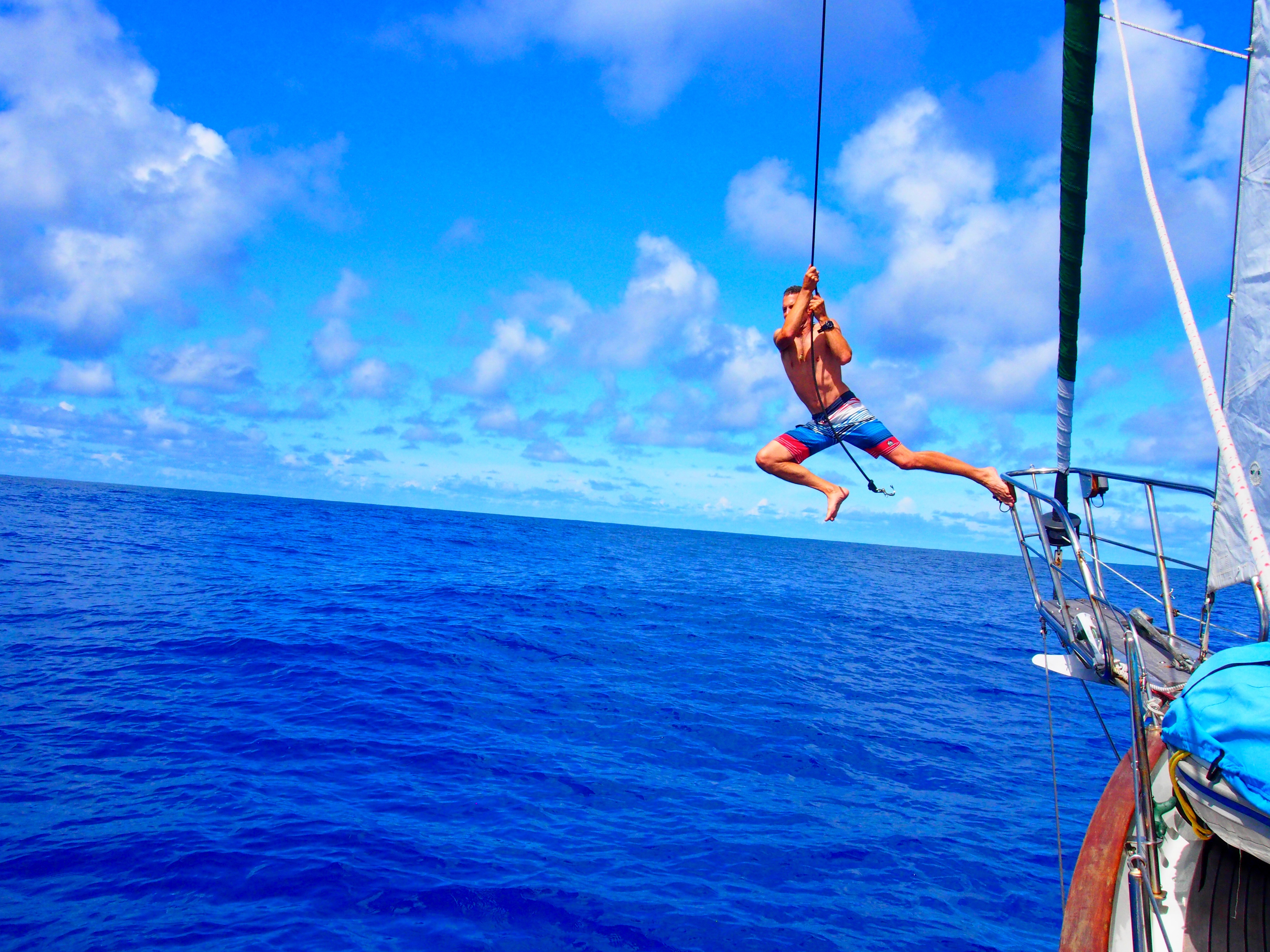
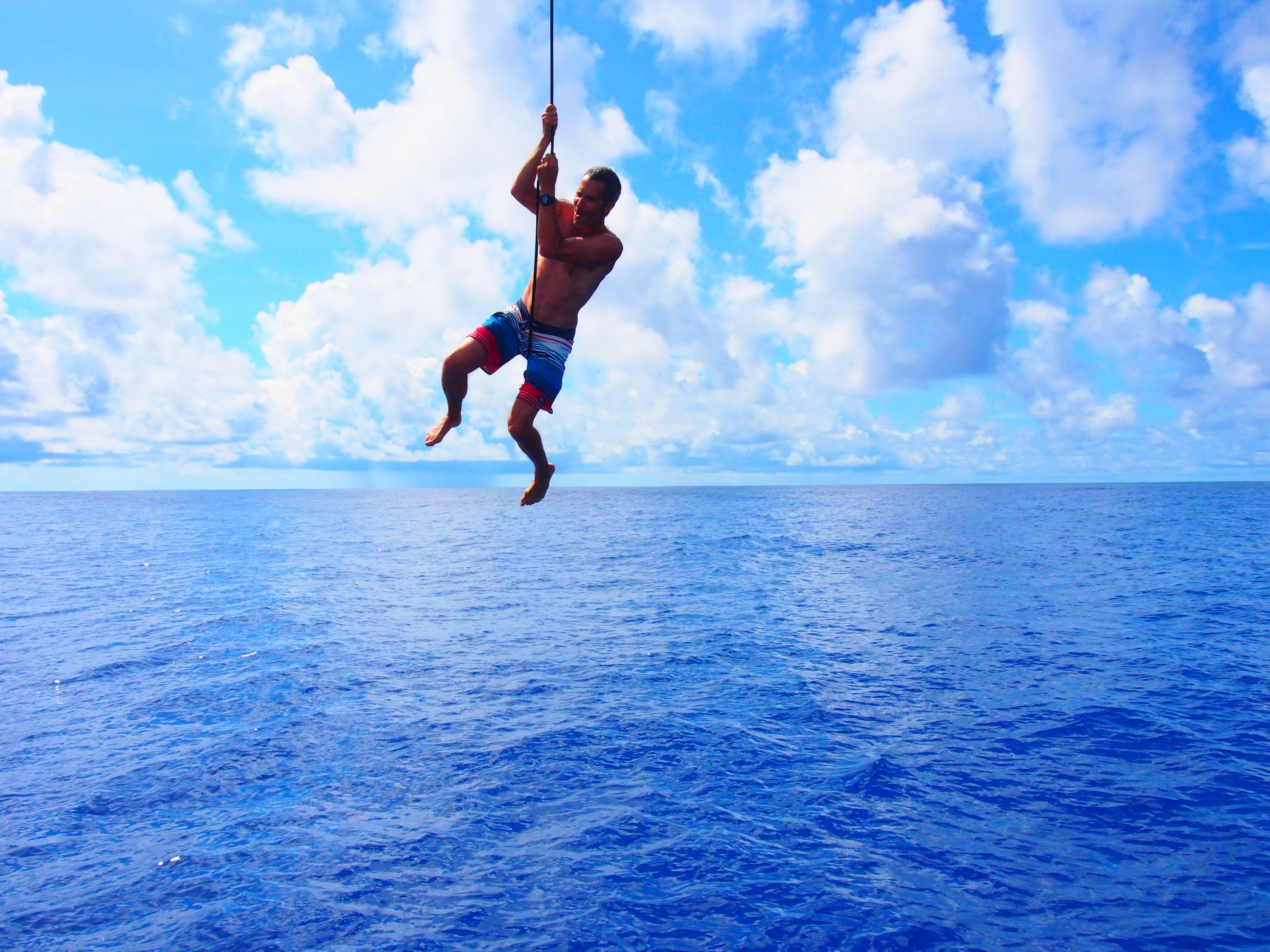
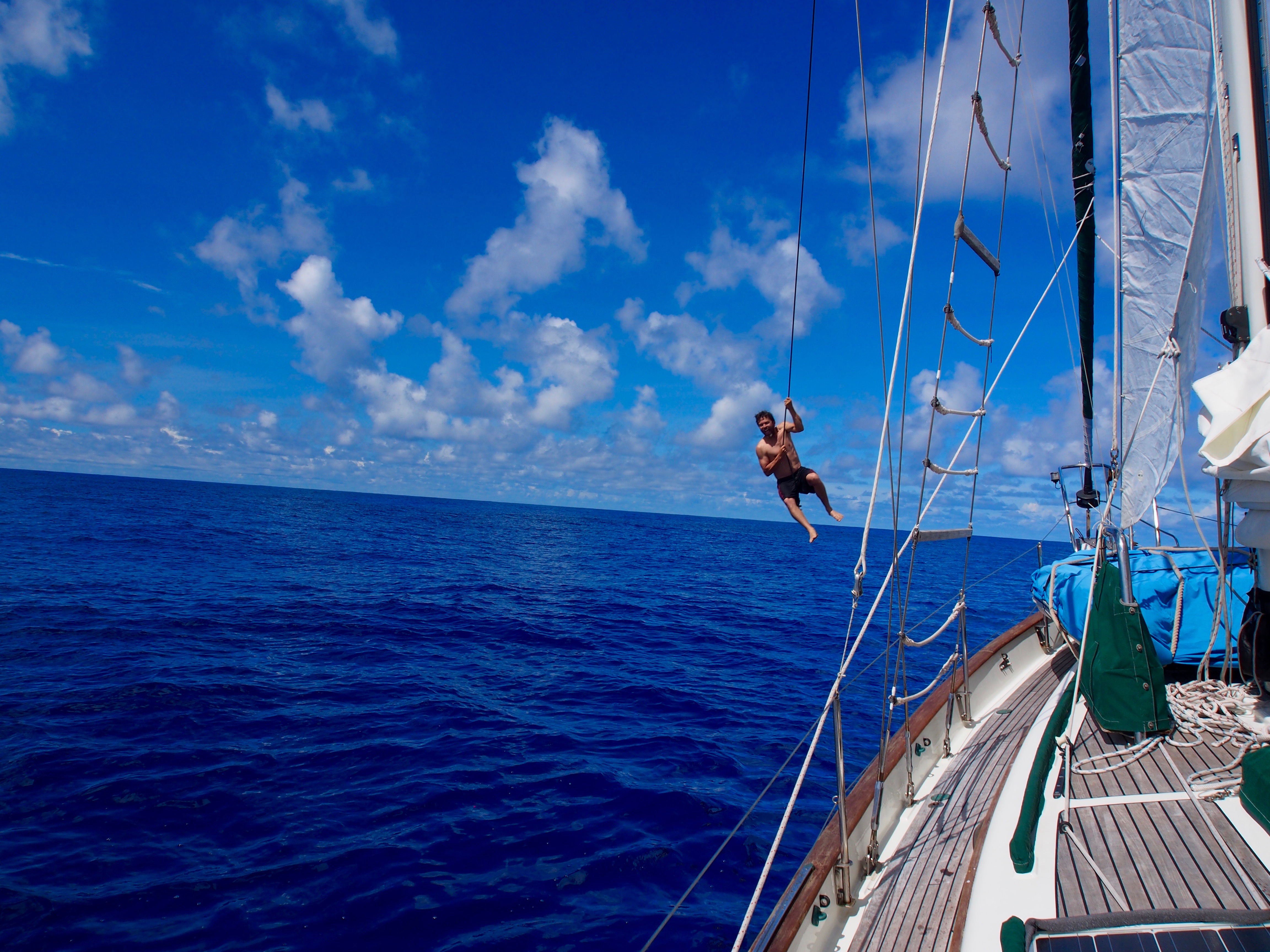
On day 6 from Samoa to Kiribati we found ourselves in the doldrumsflat seas, no wind, and clear skies. We took down all sails to keep them from banging with every swell and decided to go for a swim. On all my prior ocean passages weve never had such calm water so this was my first mid-ocean swim. The water was about 16,000 feet deep and we took turns jumping overboard with snorkel and mask and swimming around the boat. We even stood on the bowsprit and swung on a halyard, landing 40 feet away at the stern of the boatdiscovering that by timing the start just as the boat rolled over an ocean swell, you could swing in a wider arc and have a longer ride! After a few hours, we finally gave in and started the motor to continue moving east. Day 7 was the perfect day at sea. After motoring all night (and getting more concerned about fuel consumption), the wind began picking up at 5am and allowed us to sail in a northerly direction. We sailed throughout the day and eventually the wind clocked around to the east, putting us on a NE heading pointing to Kiribati. Adam cooked up an awesome lunch of potatoes, sausage, cheese, and onion & garlic. In the early afternoon we pulled in our first fish a 3 ft long Wahoo. I filleted it on deck and we threw it in the refrigerator for the next day. We continued hand steering most of the day and then turned the helm over to Ian (our self-steering wind vane) for the evening watches. We watched a wonderful sunset, followed by Captains Hour an evening celebration with a Samoan beer, Tim-Tams, and music by Jimmy Buffet.